We use cookies to distinguish you from other users and to provide you with a better experience on our websites. Close this message to accept cookies or find out how to manage your cookie settings.
To save content items to your account,
please confirm that you agree to abide by our usage policies.
If this is the first time you use this feature, you will be asked to authorise Cambridge Core to connect with your account.
Find out more about saving content to .
To save content items to your Kindle, first ensure coreplatform@cambridge.org
is added to your Approved Personal Document E-mail List under your Personal Document Settings
on the Manage Your Content and Devices page of your Amazon account. Then enter the ‘name’ part
of your Kindle email address below.
Find out more about saving to your Kindle.
Note you can select to save to either the @free.kindle.com or @kindle.com variations.
‘@free.kindle.com’ emails are free but can only be saved to your device when it is connected to wi-fi.
‘@kindle.com’ emails can be delivered even when you are not connected to wi-fi, but note that service fees apply.
The impact of hurricane-related flooding on infectious diseases in the US is not well understood. Using geocoded electronic health records for 62,762 veterans living in North Carolina counties impacted by Hurricane Matthew coupled with flood maps, we explore the impact of hurricane and flood exposure on infectious outcomes in outpatient settings and emergency departments as well as antimicrobial prescribing. Declines in outpatient visits and antimicrobial prescribing are observed in weeks 0-2 following the hurricane as compared with the baseline period and the year prior, while increases in antimicrobial prescribing are observed 3+ weeks following the hurricane. Taken together, hurricane and flood exposure appear to have had minor impacts on infectious outcomes in North Carolina veterans, not resulting in large increases in infections or antimicrobial prescribing
Indoor mold after flooding poses health risks including rare but serious invasive mold infections. The purpose of this study was to evaluate use of International Classification of Diseases, Tenth Revision, Clinical Modification (ICD-10-CM) diagnosis codes for mold infection and mold exposure in Houston, Texas during the year before and the year after Hurricane Harvey.
Methods:
This study used data from MarketScan, a large health insurance claims database.
Results:
The incidence of invasive mold infections remained unchanged in the year after Hurricane Harvey; however, the incidence of diagnosis codes for mold exposure nearly doubled compared with the year before the hurricane (6.3 vs. 11.0 per 100,000 enrollees, rate ratio: 1.7, 95% confidence interval 1.0–3.1).
Conclusions:
Diagnosis codes alone may not be sufficiently sensitive to detect changes in invasive mold infection rates within this population and timeframe, demonstrating the need for more comprehensive studies.
Wilfried Brutsaert (2022 Stockholm Water Prize Laureate) has revised and updated his classic textbook to take into account recent developments, while retaining the rigor and structure of the previous edition to introduce the fundamental principles of hydrology. New topics include the response of the global water cycle to climate change, the land surface energy budget closure, snow melt, groundwater trends and statistical surface variability with disturbed atmospheric boundary layers. Hydrologic phenomena are dealt with at the spatial and temporal scales at which they occur in nature. The physics and mathematics necessary to describe these phenomena are introduced and developed: readers will require a working knowledge of calculus and basic fluid mechanics. This classroom-tested textbook – based on the author's long-running course at Cornell - is invaluable for entry-level courses in hydrology directed at advanced undergraduate and graduate students in physical science and engineering. In addition, it is also a great reference text for practising scientists and engineers.
This article uses historical-ecological insights for a re-reading of two little-known mid-twentieth-century Australian plays, Oriel Gray’s The Torrents and Eunice Hanger’s Flood, which highlight developments relevant to the environmental disasters of today. In particular, the article focuses on the significance of key cultural assumptions embedded in the texts – and a revival of The Torrents in 2019 – including those to do with land use in a period of accelerating development. This approach offers new insights into the dominance of mining, irrigation, and dam-building activities within the Australian ethos, landscape, and economy. One of these insights is the framing of development as progressive. The article thus also examines how development projected as progressive takes place amid the continuing denial of prior occupation of the land by First Nations peoples and of knowledge systems developed over thousands of years. The intersectional settler-colonialist-ecocritical approach here seeks to capture the compounding ecosystem that is modern Australian theatre and its critique. The intention is not to apply revisionist critiques of 1950s plays but to explore the historical relationship between humans, colonialism, and the physical environment over time. Denise Varney is Professor of Theatre Studies in the School of Culture and Communication at the University of Melbourne. Her research is in modern and contemporary theatre and performance, with published work in the areas of ecocriticism, feminism, and Australian theatre. Her most recent book is Patrick White’s Theatre: Australian Modernism on Stage 1960–2018 (Sydney University Press, 2021).
This study aimed to evaluate a risk of flooding and landslides among home-care patients, to reveal an extent to which patients require support for evacuation, and to determine whether risk was accurately perceived among the patients.
Methods:
This is a cross-sectional study targeting the patients who were actively treated at the home-care clinic in Fukui Prefecture, Japan. We collected data on the patients’ sociodemographic and clinical characteristics. Additionally, we collected data on their risk of flooding and landslides through hazard maps and distributed a questionnaire to these patients regarding their risk awareness of flooding and landslides.
Results:
Of the 199 eligible home-care patients, 84.9% (169 of 199) were at risk of flooding and/or landslides, and 58.6% (99 of 169) of them needs support during evacuation. Furthermore, of those who were at risk of flooding and/or landslides, 46.0% (45 of 99) had accurate risk assessments. Factors that resulted in inadequate risk awareness of flooding and landslides included: not placing importance on evacuation, not using medical equipment, and living on the first floor.
Conclusions:
There was limited risk awareness of flooding and/or landslides among the home-care patients. The information of the risk factors regarding inadequate risk awareness of flooding and landslides should be used to sophisticate flooding and landslides evacuation strategy.
This chapter addresses insuring natural catastrophes in America. It provides an overview of the existing lines of insurance for natural catastrophe losses, such as homeowners insurance, commercial property insurance (including business interruption insurance), the National Flood Insurance Program, and earthquake insurance (including the California Earthquake Authority). Currently, most natural catastrophe losses are uninsured in America as a result of consumer ignorance regarding risk and private insurers’ general treatment of natural catastrophes as uninsurable correlated risks. Consequently, this chapter also includes a discussion of ways more natural catastrophe losses could be insured in America by considering the ways other developed countries throughout the world insure natural catastrophe losses.
Article 7.1 of the Paris Agreement establishes that parties should aim at enhancing adaptive capacity, strengthening resilience, and reducing vulnerability to climate change. While many climate hazards and vulnerabilities are beyond territorial control, a readiness to withstand and recover from them must be delivered locally. This chapter discusses climate-related vulnerability, adaptation, and resilience of the Greater Bay Area of China (GBA), an area that has been identified by the Chinese government as an engine of economic development but which has historically been vulnerable to flooding. After providing a contextual introduction to the GBA project, the chapter reviews key studies on past, current, and future climate trends focusing on meteorological, climatological, hydrological, and geophysical hazards. It then surveys adaptation policies and plans already implemented in GBA cities to assess what works and what does not and where the gaps are. Finally, the discussion focuses on the drivers and barriers for the uptake of technology for flood prevention and for the deployment of emergency responses. The aim of this discussion is to identify the opportunities and risks of technology in building future-ready local skills and citizen engagement for climate resilience. Given the ambitious plans for the GBA to contribute to the economic development of China, existing and projected vulnerabilities to climate hazards and their potential impact on the developed environment and physical infrastructure, business and industry, energy supply, financial services, human health, water resources, and biodiversity may not only hamper GBA plans but also put its businesses and citizens at risk. Technological innovation diminishes this vulnerability, but drivers and barriers to its uptake must be either identified and enhanced or removed accordingly.
At the beginning of the new millennium, Australia's cities and their peri-urban and rural hinterlands were in the midst of a worsening drought. Having developed in the mid-1990s, the Millennium Drought finally broke in 2010, at least in south-eastern Australia. It was the most severe drought experienced in southern Australia since instrumental records began in the early twentieth century, thanks to a combination of natural variability and anthropogenic climate change. The urgency of water restrictions and supply augmentation that had characterised the drought years gave way to more pressing matters of the electoral cycle. As Australian cities continue to grow, it remains be seen as to whether plans to shape the urban form as a water catchment of its own materialise beyond model suburbs and local initiatives and what their implementation might mean for the water infrastructure and cultures of the past.
Description: Beside pandemics and famines, humans have also suffered from the impact of other kinds of disasters, which at times were very destructive of lives and property. Among these natural disasters there were earthquakes, volcanic eruptions, major floods, hurricanes and tornadoes, and tsunamis. While some of these were clearly Acts of God, increasingly some had some human contribution, because of the growing impact that humans had started to have on nature. This human impact was growing with the passing of time. The increase in the standard of living of humans was increasingly coming at a high natural cost. The chapter provides information on some of the major disasters.
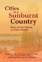
As Australian cities face uncertain water futures, what insights can the history of Aboriginal and settler relationships with water yield? Residents have come to expect reliable, safe, and cheap water, but natural limits and the costs of maintaining and expanding water networks are at odds with forms and cultures of urban water use. Cities in a Sunburnt Country is the first comparative study of the provision, use, and social impact of water and water infrastructure in Australia's five largest cities. Drawing on environmental, urban, and economic history, this co-authored book challenges widely held assumptions, both in Australia and around the world, about water management, consumption, and sustainability. From the 'living water' of Aboriginal cultures to the rise of networked water infrastructure, the book invites us to take a long view of how water has shaped our cities, and how urban water systems and cultures might weather a warming world.
In the wake of the ‘golden age’ of economic growth in the early 1970s, public provision of urban infrastructure came under the close scrutiny of governments seeking to reduce the size of their bureaucracies in the face of expanding budgets, rising prices, and increasing unemployment. Australian governments and water utilities followed the UK and USA by introducing price mechanisms to attain more efficient water use. This coincided with severe droughts that affected urban water supplies and led state governments to impose residential water restrictions, save for Brisbane, where catastrophic floods in 1974 reminded residents of their vulnerability to the elements. Growing concern for the environment, as well as the implications of environmental degradation for human health, meant that the sights, smells, and sounds of the Australian suburbs were on the eve of change. The use of suburban waterways as drains for industrial and domestic waste would no longer be tolerated, as local residents campaigned to protect built and natural environments from pollution and development projects. Such health and ecological concerns collided with the neoliberal reform agenda of the 1990s, when newly restructured water utilities faced a series of crises in their provision of water and disposal of wastes.
The Salinas del Bebedero occupies an isolated basin in the foreland of central Argentina at 33°S and was flooded repeatedly over past 25 ka. Isotopic evidence demonstrates that this flooding was due to overflow of the nearby Río Desaguadero with waters derived from the distant (≥300 km) central Andes between 28–34°S. Stratigraphic and shoreline evidence shows that floods occurred most frequently from 14.3 to 11.4 ka, followed by lesser events between 14.3 to 11.4 ka, and during the late Holocene from 2.6 to ca. 0.2 ka. Hydraulic modeling (2D HEC-RAS) shows that these floods could have originated from repeated subglacial drainage or sudden outbursts with a volume of >100 × 106 m3 and a peak discharge of >1,000 m3 s-1 each. The absence of flood deposits from 11 to 3 ka points to exceptionally dry and virtually ice-free conditions in the Andes between 28–34°S. The floods were probably caused by major rainfall or dammed-lake outbursts clustered largely during wet pluvial periods in the otherwise moisture-limited central Andes and Atacama Desert, such as when the Intertropical Convergence Zone was shifted southward. These include Central Andean pluvial events (CAPE) I (17–14.5 ka) and II (12.5–9 ka), and the Neoglacial/Formative archeological period 2500 ka to near-present.
The Uttarakhand State, known for its Himalayan Mountains, is a territory in Northern India that is extremely vulnerable to earthquakes, landslides, and floods. Currently, due to the COVID-19 outbreak, India is facing the dual challenge of containing a pandemic and responding to natural disasters. This situation can have a negative impact on the health and the economic development of the region, leading to a long-lasting humanitarian crisis that can disrupt even more, the already overburdened health service. In addition, it can pose serious threats to the wellbeing of the population as it complicates physical distancing and other COVID-19 prevention measures. It is of utmost importance to analyse the impact of floods, landslides, and COVID-19 pandemic on the health system of the Uttarakhand State, and how these crises interact with each other.
The objective of this study was to identify group-level health outcomes associated with the 2013 Calgary flood on Calgary participants (45–85 years of age) in the Canadian Longitudinal Study on Aging (CLSA). We compared baseline CLSA data collected on Calgary participants during the 6 months prior to and following the flood. Logistic regression models were created to explore whether select psychological outcomes were associated with the flood for participants categorized by evacuation status. Participants living in evacuated communities pre-flood had significantly lower levels of a diagnosed anxiety disorder than non-evacuated communities, which disappeared post-flood. Participants with higher household income were less likely to have post-traumatic stress disorder symptoms, worse self-rated mental health, and lower life satisfaction post-flood. Living alone reduced and female gender increased levels of perceived functional social support post-flood. Although natural disasters can shape research findings, the scope of the data being collected and the representativeness of impacted groups may challenge the ability to detect subtle impacts.
This chapter shows that theories of natural catastrophes in Greek and Roman literature in general presuppose the repetition of devastating events rather than their singularity, but that the ancient evaluations of natural catastrophes differ widely. Long shows that Plato and Aristotle tend to be detached and dispassionate in their accounts of such natural catastrophes by treating them simply as inevitable phases in the natural world’s cyclical history. By contrast, the Epicurean Lucretius and the Stoic Seneca clearly acknowledge human fragility in the face of catastrophes. Both philosophers register the dangers of presuming mastery over the natural environment and are sensitive to the human toll that nature can extort from exceeding such limits.
Typhoon Hagibis struck Japan on October 12, 2019. This study documents and characterizes deaths caused by Hagibis and helps identify strategies to reduce mortality in future disasters.
Methods:
Japanese residents, who were killed by Typhoon Hagibis, as reported by Japan’s Fire and Disaster Management Agency, were considered for the study. Details were collected from mainstream Japanese media, and flooding data from hazard maps published by local municipalities.
Results:
Out of the 99 total fatalities, 65 (73.0%) were aged 65 years or above. Among those who drowned indoors (20), 18 (90.0%) lived in high-risk areas of flooding, and their bodies were found on the first floor of their residences. A total of 10 (55.6%) out of the 18 fatalities lived in homes with 2 or more floors, indicating that they could have moved upstairs to avoid the floodwater. However, 6 (33.3%) could not do so due to existing health issues.
Conclusions:
Relatively elderly people, particularly those in areas at high risk of flooding, were most affected. Seeking higher ground is a standard safety measure in times of flooding, but this may not be possible for everyone depending on their health status, structure of their residence, and the depth of floodwaters.
Beginning in northwestern Kenya with the story of Eregae and Aita Nakali, this chapter introduces the new science of climate extremes and extreme event attribution. Between 2015 and 2019, the “fingerprints” of climate change slapped hundreds of millions of people. Extreme heat waves, floods, droughts, and wildfires exacted a terrible toll on developed and developing nations alike. These catastrophes affected hundreds of millions of people and resulted in hundreds of billions of dollars in losses. Fire-afflicted movie stars in California and ranchers in Australia; drought-stricken South Africans; poor flooded fisher-folk in Bangladesh; Houston's middle-class families riven by flood: these are just some of the people who felt the crushing blow of more extreme climate. While humans have always faced the perils of natural disasters, the data suggest that the human and economic cost of climate and weather extremes is increasing rapidly as our population and economies expand and our planet warms rapidly. Since the early 1980s, the number of large catastrophes has quadrupled, inflicting billions of dollars in losses and impacting vulnerable populations on every continent. Understanding the link between extremes and warming is both a moral and an existential imperative.
Little is known about how flood risk of health-care facilities (HCFs) is evaluated by emergency preparedness professionals and HCFs administrators. This study assessed knowledge of emergency preparedness and HCF management professionals regarding locations of floodplains in relation to HCFs. A Web-based interactive map of floodplains and HCF was developed and users of the map were asked to evaluate it.
Methods:
An online survey was completed by administrators of HCFs and public health emergency preparedness professionals in Illinois, before and after an interactive online map of floodplains and HCFs was provided.
Results:
Forty Illinois HCFs located in floodplains were identified, including 12 long-term care facilities. Preparedness professionals have limited knowledge of whether local HCFs were in floodplains, and few reported availability of geographic information system (GIS) resources at baseline. Respondents intended to use the interactive map for planning and stakeholder communications.
Conclusions:
Given that HCFs are located in floodplains, this first assessment of using interactive maps of floodplains and HCFs may promote a shift to reliable data sources of floodplain locations in relation to HCFs. Similar approaches may be useful in other settings.