

This book summarizes the current archaeological and ethnographic knowledge regarding the indigenous people who inhabited the South American Southern Cone since the end of the Pleistocene (Figure 1.1). This land, roughly between 32° and 56° S latitude, comprises the Pampas and Patagonia. Since the beginning of the European conquest in the sixteenth century, both regions have attracted the attention of conquerors and explorers even though there were no precious rocks or metals within them, nor were they inhabited by indigenous populations who could be easily exploited or subjugated to slavery or encomiendas. This is not to say that there were no fabulations – notably, the legend of the Ciudad de Los Césares, or Trapalanda, where supposedly fabulous riches could be found. This legend originated around the sixteenth century when stories after the inland trip by Francisco César, a captain from the Sebastian Gaboto expedition, began to circulate. Also, the castaways from the shipwreck of one of Francisco Camargo’s expeditions fueled these legends. The sad reality was that no evidence existed about the fate of those castaways.

Figure 1.1 Map showing the regions of the Southern Cone of South America.
Except for the societies living in the Lower Paraná and Uruguay Rivers (Guaraní, Chaná, Timbú, etc.), all the others were nomadic foragers who hunted terrestrial mammals such as guanacos and Pampas deer and fished and collected mollusks on the Patagonian coast. Societies in Tierra del Fuego and the southern archipelagos hunted sea mammals, fished, and collected mollusks. Conversely, the Pampas and Patagonia have been a fascinating location not only for the study of past hunter-gatherers but also for theoretical reflection on the evolutionary scheme that anthropology and archaeology have used to define them. The Selk’nam and Yámana of Tierra del Fuego, considered to be “archetypically” “primitive” hunter-gatherers (Gamble 1992; Martinic 1995; Steward 1955; Vidal 1999), were seen in the dawn of anthropology as the prototype of primitive society.
Needless to say, nomadic foragers held little appeal for the economic ambition of European conquerors first and Hispanic-criollo people later. Only in the nineteenth century, with the industrial expansion of Europe and the subsequent need for raw material and new lands, were these vast territories effectively annexed to the national political control and introduced into the global market. The indigenous people who lived in these territories had a fascinating history of 14,000 years, which archaeology has uncovered mainly during the last decades. How did these people live? How did they explore and occupy new environments? What was the temporal and spatial variability of their basic foraging life throughout the millennia? How did some of these groups incorporate horticulture, and how did some adapt to live in the very harsh environment of the southern channels? How did they significantly change their mode of life since the Late Pleistocene times? This book aims to answer these questions.
The Pampas and Patagonia are among the main regions in South America. The former is an extensive grassland plain located in the eastern part of the South American Southern Cone, roughly between 32° and 39° S, comprising over 700,000 km2 (Figure 1.1). Although several limits have been proposed based on different criteria, in this book we will consider the Pampas as the extended plains that border the Atlantic coast and the La Plata and Uruguay Rivers to the east; the Basaltic Plateau, the Salado-Desaguadero Rivers, and the foothills of the Central Hills to the west; and the Colorado River (including its paleo delta) to the south; and that has a diffuse border with the Chaco-Santiagueña Plains, marked by the xerophytic forest (the Spinal phytogeographic province, sensu Cabrera 1971) to the north. In Uruguay and southeastern Brazil, these prairies are called Campos or Uruguayan Pampas; to the north, they border the Brazilian Planalto at approximately 28° S.
The Pampas, a Quechua word that means plains or flatness, is a gentle, widespread prairie developed on loess deposits. Forests were limited, and the great majority of the land was treeless. However, nowadays, patches of foreign trees can be seen here and there. The climate varies from dry-tempered to sub-humid, with warm summers and rainfall distributed throughout the year. This vast prairie is interrupted, in the southern sector, by two major hill systems, Tandilia and Ventania, and smaller hilly ranges (Choique Mahuida, Lihué Calel, Calencó), as well as by several isolated hills, low rocky plateaus (e.g., El Fresco Plateau), and ridges with scattered rugged rock outcrops (especially in the southwest). The Pampas have traditionally been divided into two sub-regions, based on the 600 isohyets (although it has been moved to the west in the last decades): Humid Pampa to the east (with average rainfalls that reach 1,200 mm in the northeast) and Dry Pampa to the west (with a rainfall average of 400 mm in the southwest). To the south, the Pampas border the Colorado River, beyond which extends semi-arid Northeast Patagonia.
Patagonia’s name originates with the identification of the Aónikenk with the giant Patagon from Spanish chivalry tales (Duviols 1997; Vidal de Battini 1975). Patagonia and Tierra del Fuego extend over more than 1 million square kilometers in Chile and Argentina in the southern extreme of South America. This large territory comprises a variety of environments that go from the foot of the Andes through dissected basaltic plateaus to the coasts of the Atlantic. As we will see, there are many ways of dividing this area, none of which is perfect.
Despite the long tradition of archaeological research in these regions, the knowledge of its prehistoric past is still uneven, providing an incomplete perspective on the indigenous historical trajectories. Therefore, the coverage of this book, in some ways, reflects this unevenness. Although it is focused on the Argentine Pampas and the whole of Patagonia, including Argentina and Chile, there are some references to the Campos of Uruguay, which integrates the same macro-region. Some cultural processes (the Late Pleistocene occupation, the cerritos phenomenon, the expansion of the Guaraní Indians, etc.) were shared by both regions.
In order to follow the international consensus, we set the subdivision of the Holocene defined based on physical and chemical markers (Walker et al. Reference Walker, Head, Berkelhammer, Björck, Cheng and Cwynar2018). These reflect abrupt climatic events at the onset of the Holocene at ~ 11.7 cal BP, and later at ~ 8.2 cal BP and ~ 4.2 cal BP. Therefore, we will use these dates for the limits between the Late Pleistocene and Early Holocene, as well as for the boundaries between the Early and Middle Holocene, and the Middle and Late Holocene. We will also use BP for uncalibrated radiocarbon years before present, cal. BP for calibrated radiocarbon years before present, and kyr for thousands of years. All radiocarbon dates in the text will be cited without the statistical error, laboratory code, and type of sample dated. This information is detailed in the Supplementary Tables 1–6, found online (www.cambridge.org/politisborrero_tables1-6).
Present and Past Environments
The primary environment of the Pampas grasslands is a plain with a temperate climate, without a marked dry season, and covered the entire year by a gramineous carpet (Daus 1968). This plain has a gentle slope toward the east- southeast, and its horizontality is interrupted only by the reliefs of the Ventania and Tandilia systems in the eastern Pampa, and the Mahuidas hills and El Fresco Plateau in the western Pampa. The palynological record indicates that grasslands and xerophytic shrubs have been the typical vegetation of the region since at least the Late Pleistocene and all along the Holocene (Mancini et al. 2005; Messineo et al. 2019; Tonello and Prieto 2010; Vilanova et al. 2006).
The Lower Paraná Delta constitutes a specific environment within the Pampean. This delta presents a high environmental heterogeneity represented by rich and abundant biota of both subtropical and temperate origin (Blanco and Méndez 2010; Bó and Malvárez 1999; Malvárez 1999). Its landscape is mainly characterized by islands produced by the accumulation of sediments supplied by major Paraná River tributaries (e.g., Bermejo, Paraguay, Pilcomayo). The lower Uruguay River contributes to the delta but has a more narrow alluvial plain and much fewer islands. The vegetation in the lower Paraná and Uruguay Rivers has been characterized as an “azonal” ecoregion. Biogeographically, it is an extension of the subtropical gallery forest (Figure 1.2), which penetrates within a template zone of the Pampean grasslands as a moderator effect of the climate produced by the rivers.

Figure 1.2 View of the gallery forest in the Paraná River Delta.
Toward the southern Pampa, there is an ecotonal environment (Abraham de Vázquez et al. Reference Abraham de Vazquez, Garleff, Liebricht, Regairaz, Schäbitz, Squeo, Stingl, Veitz and Villagrán2000; Morello 1958) dominated by the so-called Arid Diagonal, characterized by warm and dry steppe arid climate, with a mean annual rainfall of 466 mm (Sánchez et al. 1998). The dominant vegetation belongs to the Caldén District, although vegetal communities of the Monte phytogeographic province can also be observed in the area (Morello 1958). Thus, this arid to semi-arid sandy area presents a shrub-steppe, an open vegetal formation composed of short xeric trees mixed with hardy and scarce herbaceous grasses (Martínez et al. 2009; Villamil and Scoffield 2003).
In Patagonia, the climate is influenced by the seasonally shifting Pacific westerlies, which produce strong summer winds in South Patagonia. Continental climates are characteristic of most of Patagonia, while in Tierra del Fuego and the western archipelagos, climates are moderated by the ocean masses (Tonello et al. 2009). Temperatures fluctuate between −10°C and 32°C in the north, with very cold winters and hot summers. In the south, temperatures can reach −20°C or lower in winter, and summers are also cold, particularly because of the chilling effect of the wind (Papadakis 1974). The Andean range and two large continental ice fields constitute an effective barrier between the eastern steppes and the Pacific between 46° and 52° S (Figure 1.3). The result is a dramatic contrast between both sides of the Andes. An intricate maze of archipelagos with very high precipitation that reaches above 4,000 mm/year characterizes the west side. On the eastern steppes, precipitation diminishes to around 200 mm/year. As a result of the rainshadow effect produced by the Andes intercepting the humid air masses transported by the westerlies, a narrow belt of forests can be found at the foot of the eastern side of the mountains. In contrast, the western side, particularly the islands, was fully covered by forest during the Holocene (Figure 1.4). In the fjords, these forests are usually dominated by Nothofagus, Weinmannia, and conifers (Villagrán 1988). Extensive peat bogs cover many of the islands, particularly near Cape Horn. Some sectors were described as Magellanic tundra, a habitat with a very cold and humid climate that was not particularly attractive to humans. Sphagnum magellanicum dominates bogs, and sometimes they have attached patches of Pilgerodendron uviferus (Pisano 1973). South of 45° S coastal peatlands of Donatia and Oreobolus predominate (Luebert and Pliscoff 2006). Precipitation of up to 5,000 mm/year or more is recorded at some islands, which even present ice fields (Schimpf et al. 2011).

Figure 1.3 South Ice Field is located between the fjords on the Pacific coast and the eastern Patagonian steppes.

Figure 1.4 View of Yalac Island, Refugio Channel, Chonos Archipelago, Chile.
There is a long history of glacial advances and retreats in Patagonia that starts with the Greatest Patagonian Glaciation about 1 million years ago or before. This was the only glaciation that reached the coasts of the Atlantic Ocean, near the mouth of the Gallegos River (Coronato and Rabassa 2011). The succession of advances and retreats of the ice was studied in detail at several localities, particularly in the Chilean Lakes Region at ca. 41° S (Denton et al. 1999) and the Strait of Magellan at ca. 52° S (Sugden et al. 2005). Even when differences in timing were noted, the movement of ice masses was more or less in sync. At any rate, it was suggested that only in the southern extreme was there an influence from the Antarctic (McCulloch et al. 2005).
The Last Glacial Maximum (LGM) occurred sometime around 24,000–20,000 BP, during which the ice extended beyond the Andes. The retreat of the Pleistocene glaciers, which started sometime before 15,000 BP, was not a linear process, but punctuated with short, cold pulses around 11,000 BP in North Patagonia, perhaps correlated with the Younger Dryas (Ariztegui et al. 1997), and around 12,300 BP or before in South Patagonia and Tierra del Fuego in synchrony with the Antarctic Cold Reversal (Jouzel et al. 2001; McCulloch et al. 2005). It must be recalled that the human exploration and colonization of Fuego-Patagonia at large began sometime before 12,000 BP (Borrero and Franco 1997; Miotti 1996). What this means is that the process of initial human dispersal into Patagonia basically occurred under cold conditions. Nevertheless, the process of deglaciation was marked by a warmer trend, during which floral and faunal communities expanded from unknown Pleistocene refugia into locations near the Cordillera. As a result of all these recent changes, it was indicated that most near Andean environments are still unstable (Pisano 1975).
Palynological studies have a long tradition in Patagonia, starting with the work of Vaino Auer in the 1930s (Auer 1974). Several pollen columns were analyzed that cover the Holocene and the end of the Pleistocene (Heusser 2003; Mancini et al. 2012; Markgraf 1993; McCulloch et al. 2005; Villa-Martinez and Moreno 2007). Most of this research took place near the Andean range, where the most extensive peat bogs are located. A few localities away from the Andes were intensively interrogated. Among them, the Cardiel Lake (Ariztegui et al. 2009; Stine and Stine 1990) and the Potrok Aike Lake (Zolitschka et al. 2013) must be mentioned. The variation observed between both extra-Andean records is notable, and one conclusion is that local sequences are needed to assess the interaction between humans and climate.
The extent of glaciation during these later times was limited, with calving glaciers reaching the Pacific coast on the west, but is mostly confined to Andean valleys on the east. The latter formed proglacial lakes dammed by ice walls. Several of these lakes had high stands at the end of the Pleistocene, which was the time when humans were dispersing into Patagonia. However, there is also a variation, with some lakes showing high stands during the Holocene (Horta et al. 2011). Well-studied examples of proglacial lakes are those of the Consuelo or Tehuelche paleolake in Última Esperanza (García et al. 2014; Stern et al. 2011) or the Strait of Magellan west of the first narrow (McCulloch et al. 2005). Their importance to understanding the process of human colonization of South Patagonia rests on the fact that these paleolakes concentrated megafauna and large mammals that are well represented in the nearest paleontological sequences (Martin et al. Reference Martin2013; Stern et al. 2011).
The postglacial warming period favored the expansion of prairies and forests in the west and steppes in the east. There was not much floristic variation during the Holocene (Mancini 1998), except during minor climatic punctuations, like the Medieval Climatic Anomaly (Stine and Stine 1990) or the Little Ice Age (Masiokas et al. 2008). However, at each of these events, there were fluctuations in the character and eastern limit of the forest. Environmental conditions in extra-Andean Fuego-Patagonia near the end of the Pleistocene were unstable, and foraging resources were not necessarily abundant (Clapperton 1993; Markgraf 1988; Pisano 1975). The environmental conditions were cold but not extreme, but probably adequate for human dispersal during transition times from their low demography enclaves. During the Early Holocene, not only were more habitats available, but the flux of people from the north probably increased.
Tierra del Fuego is today separated from continental Patagonia by the Strait of Magellan, but in Late Pleistocene times, it was still part of the continent. After the successive late-glacial advances documented at the Strait of Magellan began, a large proglacial lake dammed by the ice was formed west of Primera Angostura. Land bridges existed around 13,100 BP and between 10,300 and 8300–7500 BP (McCulloch and Morello 2009). Ice and water barriers occurred before and after that time, respectively, constituting important obstacles for the dispersal of humans and animals. The Strait of Magellan opened only in the Early Holocene, around 9000–8000 BP, after the deglaciation and discharge of the west paleolake (McCulloch et al. 2005). In sum, at the end of the Pleistocene, the connection with Tierra del Fuego was interrupted several times, but circulation was intermittently possible (Coronato et al. 1999; McCulloch et al. 1997). The available early subsistence and technological evidence for Tierra del Fuego indicates a terrestrial crossing into the island.
The Holocene environment was characterized by the opening of the connection between the Pacific and the Atlantic through the Strait of Magellan, as well as its connection with the Otway and Skyring interior seas. As mentioned, at the beginning of the Holocene warmer conditions returned that prompted an expansion of the forests from the Andes (Moreno et al. 2012) (Figure 1.5). The sea level was rising up until ca. 6000 BP, and later progressively retreated, shaping the actual coastal landforms (Isla and Bujalesky 2008). The mentioned Holocene warm trend was shortly interrupted by Neoglacial advances that were confined to the Andes.

Figure 1.5 View of Perito Moreno Glacier, Argentina.
The Pampas and Patagonia as Geographical Units for Archaeological Analysis
The Pampas
Until the beginning of the twentieth century, the discussion about the archaeological remains of the Pampas and Patagonia was centered, one way or another, on the topic of the antiquity of humans in both regions (Podgorny 1999a). For the most part, this debate in the Pampas region originated with Florentino Ameghino (1880–1881), with his postulation of the Pampean-Patagonian origin of humanity (see Chapter 2). At that time, Ameghino referred to a vaguely defined region he dubbed “El Plata” (hence the title of his famous book, La antigüedad del hombre en el Plata), which included the Pampas of Argentina and Uruguay. However, from the beginning of the twentieth century, an alternative was developed for the organization of past and present indigenous peoples: the combination of temporal and geographical division (Podgorny 1999a). Outes and Bruch (Reference Outes and Bruch1910) introduced a new concept in the definition of the spatial units since they organized the archaeological material based on the European units: Paleolithic, Neolithic, and Bronze Age. However, the historical indigenous peoples were grouped within “geo-ethnical provinces” and thus described through various associated features. This new concept was later utilized by Torres (Reference Torres and Carbía1917), who grouped cultural series for each physical region of the country (Podgorny 1999a). In a new edition and enhancement of the original work, Torres (1935) modified the 1917 map and defined the “four natural regions of the Argentine territory,” including what we today define as the Pampas region and another as Patagonia.
During this period, the Pampas, along with the indigenous people who had lived within it, were considered to be an ecological and cultural unity with little internal variation. However, there are various precedents for the identification of differences within the region. One was set by Lothrop (1932), who proposed three different cultures in the delta of the Paraná River. Another was Howard and Willey (Reference Howard and Willey1948), who proposed several areas within this region, although they included some which at the time and now are considered to be beyond the Pampas region. A significant contribution was that of Madrazo (Reference Madrazo1973, Reference Madrazo1979), who identified physiographic – and to him, cultural, too – differences within the region and proposed the existence of “aspects” and “foci.” Although these two categories were imperfectly defined and were not very operational, they captured to some extent the intra-regional variation, which up until that point had barely been taken into consideration.
Until the 1980s, the idea of the Pampas as a great, relatively homogeneous, cultural region was prevalent (e.g., Austral Reference Austral1971; Menghin and Bórmida Reference Menghín and Bórmida1950). Likewise, in his synthesis of Argentine archaeology, Fernández (Reference Fernández1982) referred to the Argentine territory’s areas and expressed that, besides the southern Andean area (to him the best defined), the remainder of the territory “should no doubt be the object of more exact divisions in the future” (Fernández Reference Fernández1982).
In the 1980s, Politis (Reference Politis1984) formalized the region’s internal differences and defined seven areas for the eastern sector, or the Humid Pampa subregion: North, Salado River Depression (Depresión del Río Salado), West, Tandilia, Ventania, Interserrana, and South. In physiographic and ecological terms, this proposal was based on the classic geographical research of Daus (1968, 1969) and contributions from geology (Rolleri 1975). Subsequently, and following similar criteria, the Dry Pampa subregion was also divided into four areas: Close Basins (Bajos sin Salida), Basaltic Plateau (Meseta Basáltica), Caldenar, and Salado-Chadileuvú-Curacó (Berón and Politis 1997). In both cases, the differentiation of areas was mainly based on ecological features, although the archaeological record was taken also into account. However, these differences were not attributed to cultural distinctions, and it was, in fact, proposed that the same societies could occupy different areas and leave diverse archaeological records depending on the exploited resources, the technology utilized, and the type of settlement (this was specifically discussed for the differences between the Interserrana and Tandilia areas). Consequently, it could be concluded that the areas defined by Politis first and by Berón and Politis later were based primarily on ecological criteria and secondarily on archaeological. Therefore, under these terms, the Pampas region is not assignable to a “cultural area” in the classical sense of the concept (Steward 1955), but archaeological features intervened in its definition (see discussion in Politis and Barros 2006).
Although there were some exceptions (e.g., Orquera 1987), most of the authors who have researched in the region considered these spatial units of analysis, which is reflected in the regional or areal synthesis (Berón Reference Berón2006; Carrera Aizpitarte Reference Carrera Aizpitarte2014; Martínez and Gutiérrez Reference Martínez, Gutiérrez and Mengoni Goñalons2004; Martínez et al. Reference Martínez, Prates, Flensborg, Stoessel, Alcaraz and Bayala2015; Mazzanti Reference Mazzanti, Mandrini and Reguera1993; Politis and Madrid 2001; Salemme Reference Salemme1987; among many others). In this way, by customary use and not by an explicit agreement, the proposed areas were transformed into operational and relatively consensual spatial units of analysis.
The area that encompasses the lower Paraná and Uruguay Rivers, located in Northeast Pampa, belongs to another tradition of investigation: the one of the Argentine Northeast or Littoral (Aparicio Reference Aparicio and Steward1948; Caggiano Reference Caggiano1984; Ceruti Reference Ceruti2003; González Reference González1977; González and Pérez 1966; Lafon Reference Lafon1971, Reference Lafon1972; Serrano Reference Serrano1972). In this sense, the synthesis of the Pampas and Patagonia’s archaeology made by Orquera (1987) defined a sharp separation at the Salado River of the Buenos Aires province, noting the integration existing between the indigenous peoples who lived to the north of this river during the Late Holocene and the cultural tradition of the Argentine Northwest.
In summary, considering the advances of the last years and the ecological and archaeological spatial variations, the Pampas region is susceptible to being divided into twelve areas (Figure 1.6).

Figure 1.6 Map showing the areas of the Pampas region.
1. Northeast or Mesopotamic Pampa. This includes the alluvial plains of the lower courses of the Paraná and Uruguay Rivers and the intermediate plains. The Lower Paraná River forms an extensive delta that is considered a complex estuarine delta influenced by the rising of the Paraná and Uruguay Rivers and the La Plata River’s freshwater tides (Kandus et al. 2011). It covers over 17,000 km2 and is formed over a Middle Holocene marine littoral complex that started to define its current morphology after the last transgressive event at ~ 6000 BP (Cavallotto et al. 2004, 2005; Codignotto 2004; Iriondo and Kröhling 2008).
Between the Paraná and Uruguay Rivers, to the south of ~ 32° S, there is a low grassland plain, as well as three rivers that cross it from north to south: Nogoyá, Gualeguay, and Gualeguaychú. This plain is bordered to the south by the tidal flat of the Paraná River Delta (Cavallotto et al. 2005) and contrasts with the undulated (which forms the so-called cuchillas) and forested (the Spinal District) relief that develops toward the north and constitutes the limit of the Pampas region.
2. Rolling Pampa. This is formed by rolling plains that are located to the west of the Paraná River, up to the Central Pampean Dunefields and the Salado River Depression areas and the transition toward the Chaco-Santiagueña Plains. This northern border is also the end of the grasslands and the beginning of the xerophytic forest (the Spinal District). This is a grassland plain with no outcropping of hard rocks. Toward the southeast, this area reaches the river and the estuary of La Plata River, and through the length of this riverside, a dense gallery forest of subtropical stock has developed, which goes toward the south and is known as the tala forests. These forests, formed mainly by tala (Celtis tala), molle (Schinus longifolius), and coronillo (Scutia buxifolia), extend parallel to the river and have developed over shell deposits (Cerro de la Gloria Member from the Las Escobas Formation, Fidalgo et al. 1973), a product of the regressive stages of the last Holocene marine ingression.
3. Central Pampas Dunefield (CPD). This area, previously called West (Politis Reference Politis1984; Politis and Barros 2006), has recently been redefined by Messineo et al. (Reference Messineo, González, Álvarez and Pal2018) based on geomorphological characteristics. The CPD is an eolian system of the central Pampean region formed by linear dunes of eolian origin, 100–130 km long and 2–3 km wide (Messineo et al. 2019; Zárate and Tripaldi 2012). The dune landscape produces an irregular relief, about 2–5 m high, where the depressions between the sand ridges commonly have numerous temporary or permanent shallow lakes. Through periods of drought, the number of lakes in the area decreased and the salinity of the water increased (Quiroz et al. 2003). However, a few permanent lake systems occurred in the area: Las Encadenadas (which comprises the Alsina, Cochicó, del Monte del Venado, La Paraguaya, and Epecuén lakes) and Hinojo-Las Tunas. Although most of these dunes are fixed nowadays, during dry periods in the Late Pleistocene and the Holocene, they lost grass coverage and became active dunes.
4. Tandilia. This area is formed by a discontinuous range of low hills, their foothills, and intermediate valleys. The hill system is an elongated range of 340 km in length with a maximum width of 60 km, which runs southeast by northwest, from Cabo Corrientes on the Atlantic coast to the last Quillalauquen hills in the northwestern end (Figure 1.7). This is a treeless environment where grasses and shrub communities of currumamuel (Colletia paradoxa) predominate (Cabrera 1971). This area is one of the main sources of toolstones, and these raw materials are found in almost all areas of the Pampas region (see Chapter 3).

Figure 1.7 View of Cerro Curicó, in the northwestern sector of the Tandilia Hill Range.
5. Ventania. This system is a continuous mountain range approximately 180 km long in a southeast-northwest direction and 60 km wide in the central part, with heights of over 1,000 m (Figure 1.8). It is composed of Paleozoic sedimentary rocks, with a predominance of quartzite, and a lower proportion of granite and rhyolite of Precambrian age. It has also been one of the main sources of toolstones not only in the outcrops of the hills but also in secondary deposits transported by the creeks. Specific grass communities, adapted to higher and colder environments, predominate. On the banks of rivers and creeks that were born in the hill (e.g., Sauce Grande, Sauce Chico, Las Mostazas, Chasicó) some Humboldt’s willow (Salix humboldtiana) forests have developed.

Figure 1.8 Guanaco in the Ventania Hill Range.
6. South. This area is formed by a flat land that extends from the southwestern foothills of Ventania up to the paleochannel system of the Colorado River. It borders the Atlantic seashore to the east, and to the west, it is transitional to the Close Basins. The Colorado River is one of its main features (Figure 1.9a). It flows northwest to southeast across the area and forms an alluvial plain that ends in an ancient delta (Spaletti and Isla 2003). Abundant recent channels, paleochannels, abandoned meanders, levees, and saltpans characterize this alluvial plain. The area is dominated by the Spinal phytogeographical province (Cabrera 1971, 1976).
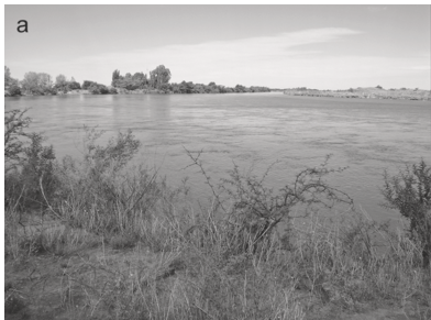
(a) Lower course of the Colorado River;
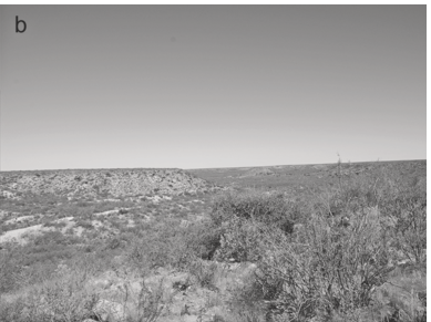
(b) Salado-Chadileuvú-Curacó area;
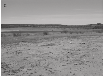
(c) Close Basins;
(d) Transversal Valleys.
7. Interserrana. This is a treeless plain with soft undulations, basically loess slopes that were deposited on the Plio-Pleistocene relief that extends between the hill systems of Tandilia and Ventania. To the south, it borders the Atlantic seashore, and to the north, the CPD. This area is limited by the south area at the southeast, the Napostá Grande creek being the approximate limit. The Gramineae of genera Stipa, Piptochaetium, Poa, Hordeum, and Melita dominate these grasslands. This zone’s basins are drained by rivers or streams whose headwaters can be found in the hills (e.g., Quequén Grande River, Sauce Grande River), although other courses originate in the plains themselves (e.g., Claromecó basin). There are only small and isolated outcrops of hard rock (Lumb, Gonzáles Chaves, etc.)
Within the area, there is a zone with its own very strong distinguishing characteristics, which is the Atlantic seashore. It comprises a chain of mobile dunes of variable width that can reach 5 km and beaches with rounded cobble deposits. In some sectors, there are coasts of abrasions with pronounced ravines, while in others, the coast is lower with wide beaches that continue on the chain of dunes.
8. The Salado River Depression. This area is characterized by a large depression, with the main course, the Salado River, flowing northwest to southeast and emptying into the estuary of the La Plata River. It has been divided into two parts: the eastern one, lower (<30 masl) in which lakes are abundant and the drainage is deficient, and the western one, higher (>30 masl), with a greater slope and better drainage (although still deficient). The lowlands are covered by hydrophilic species (Stipa formicarum and Stipa bavioensis). On the border of the abundant lakes, there are dense communities of reed beds (Scirpus ruparius) accompanied by waxy leaf nightshade (Solanum glaucum) and totora (Typha sp.). Elongated forests of tala, molle, and coronillo extend along the shores of the estuary. Active dunes develop along the seashore in the southeastern strip.
9. Salado-Chadileuvú-Curacó. This area is heterogeneous and consists of several environments. To the west, it borders the Basaltic Plateau, and to the east, the Transversal Valleys and the Close Basins. To the south, it is limited by the Colorado River Valley. It is a flat area with an axis formed by the Salado-Chadileuvú-Curacó fluvial system, which flows northwest to southeast (Figure 1.9b). It is dominated by the Monte Province, made up of open xerophytic shrubs, mainly jarilla, although, in the eastern sector, caldén forests develop. The area has a great diversity of toolstones, among which stand out the siliceous chert from the El Fresco Plateau and the variety of cobbles that form the northern strip of the Patagonian Shingle Mantle.
10. Close Basins. This is an area formed by plateaus and a system of valleys (of 100–300 km in length) arranged in the shape of hand fans. The width among the plateaus is 15–20 km, and among the valleys is varies between 5 and 15 km. These geoforms are composed of dune cords, the lateral plain sectors that constitute the transversal valleys, and the chaining of very salty lakes on the borders of the dune cords (Figure 1.9c). The area is characterized by a semi-arid climate with 400 mm/year precipitation and by the presence of sandy and stony soils. It is predominated by the caldén forest with grasslands, low gramineous grasslands with shrubs, jarilla shrubland, and the halophilic vegetation (Carrera Aizpitarte Reference Carrera Aizpitarte2014).
In this environment of plateaus and valleys, the Cerro de Los Viejos stands out: a granite massif with an elliptical shape of 1.5 km × 1 km that reaches 216 masl, making it the highest elevation of the zone. This geoform gives particular characteristics to this area’s environment (Lucero et al. 2020; Piana Reference Piana1981).
11. Transversal Valleys. This area corresponds to the topography of plateaus and transversal valleys, which run in an east-west direction (Figure 1.9d). Besides the Argentino-Utracan valley, which is the biggest, other valleys are also found in the area: Hucal, Maracó Grande, Chapalcó, Quehué, Nerecó, and Daza-Chillén. It stands as a structural plain with low isolated hills covered by a calcareous crust; some plateau relicts that have resisted the hydric activity that shaped the plains can also be observed (Carrera Aizpitarte Reference Carrera Aizpitarte2014). The Spinal Province dominates it. However, in the east, grasslands are well developed. The area lacks toolstones, except for a few highly localized outcrops of good quality chert and quartzite such as Valle Daza and El Carancho lake (Berón and Curtoni 2002; see Chapter 3).
12. Northwest. This area is not well defined and coincides in part with the Caldenar area (Berón and Politis 1997) and with the Western Pampas Dunefields (Zárate and Tripaldi 2012: 403). The landscape is a very softly undulated uniform plain with a regional slope in a southwest-northeast direction and a micro-relief comprised of small hills with depressions and dispersed salty lakes. It has an ecotonal biogeographic position between the Pampas, Spinal, and Monte phytogeographical provinces (Cabrera 1971, 1976). From east to west, this transitional area combines grassland from the Humid Pampa, caldén xerophytic forest from the Spinal District, and grassland and shrubs from Monte province (Heider and Demichelis 2015). In the northeast portion of the area, extended active dunes can be observed. There are a very few toolstone outcrops, such as a particular type of chalcedony in the Loma de Los Pedernales (Heider and Demichelis 2015) and an isolated granite hill known as Lonco Vaca (Heider Reference Heider2015).
Micro-regions have also been recognized within some of these areas, which have some ecological particularities and have served as spatial units of analysis for some research teams. Among these can be found: (1) a strip of land that runs north to south, more or less on the 62° meridian and between 33° and 39° S, which has been named “Pampean Ecotonal Humid-Dry Area” (Oliva Reference Oliva2006), and (2) a sector of the alluvial plains of the western shore of the Lower Paraná River, which has been named Bajíos Rivereños Meridionales (Southern Coastal Shoals) by Lafon (Reference Lafon1971) and is currently in use by Acosta (Reference Acosta2005), Loponte (Reference Loponte2008), and collaborators. Last, in the west of the La Pampa province are the Basaltic Plateau, the Chicalcó Plains, and the lower course of the Atuel River, which in some syntheses has been included in the Pampas region (Berón and Politis 1997; Politis and Barros 2006) but which we will not address in this book because it is ecologically and culturally related to southern Cuyo (Aguerre 1987a; see below).
Patagonia
One way of segmenting Patagonia is the simple separation into North Patagonia, which would extend between 39° S, location of the Colorado River, and 50° S, the approximate latitude of the Santa Cruz River; South Patagonia, which goes from 50° S to the Strait of Magellan (~ 52° S); and the southwestern archipelagos that extend in a long arc from the island of Chiloé to Cape Horn, at 56° S.
Diversity of environments exist in Patagonia, with important differences in extension. Several subdivisions can be made based on primary productivity, availability of water, and other important variables for human adaptation. However, all this variability can be reduced to four basic environments: the steppes, the forested foothills, the Atlantic coast, and the southwestern archipelagos. These four environments present sufficient individuality to make them significant units to characterize the habitats of Patagonian hunter-gatherers.
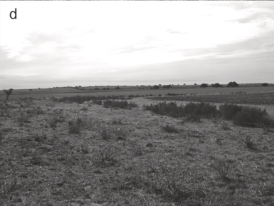
Most of the archaeological information was obtained in the steppe, which for some specialists can be distinguished from the Monte of South Cuyo and Northeast Patagonia (Parodi 1945) (Figure 1.10). They basically constitute extensive plains with a limited cover of grass and shrubs, sometimes interrupted by low-altitude plateaus. Information from the other areas is slowly growing, particularly from the Atlantic coast. Only during the last few decades has the archaeological exploration of the forests and the western archipelagos begun to offer consistent results.

Figure 1.10 View of Monte environment near Huenul Cave, Northwest Patagonia, Argentina.
The history of research in Patagonia also reflects an implicit assumption of widespread homogeneity (Vignati 1939), even when the existence of a huge variety of environments within which many significant subdivisions were possible was recognized. Importantly, studies were not coordinated across this vast and largely disconnected region, making it difficult to find agreement concerning the most relevant limits for culturally significant areas. As a result, the ghost of homogeneity is still flying over Patagonia.
The important synthesis made by Junius Bird for the Handbook of South American Indians recognized – extending a characterization by Cooper (1917) – what he called “two cultural areas … now occupied by the canoe Indians … and that of the foot Indians” (Bird 1946: 18). These areas corresponded to the obvious contrast between the steppes in the east and the southwestern archipelagos and planted a dichotomy that is still affecting our interpretation. More recently, Carlos Gradin (1980) presented units with clear physical limits as a framework for Patagonian archaeology. His way of segmenting the space was based on recognizing two transitional areas, one with the Andean lands in Northwest Patagonia and the other with the Pampas, and subsuming all the rest – including Tierra del Fuego and other islands – as the proper Patagonia land. These three areas were determined on the basis of cultural criteria, separating regions with substantial differences in human adaptation. In turn, Gradin’s ample category “Patagonia” was subdivided into four units: North Patagonia between the Negro and Chubut basins, Central Patagonia between the Chubut and Santa Cruz basins (in turn subdivided in two by the Deseado River), and South Patagonia between the Santa Cruz basin and the Strait of Magellan; he also identified Tierra del Fuego as another unit (Gradin 1980). This was a geographic characterization probably selected in order to facilitate the management of the existent information. The available evidence from each of the proposed units was variable, to the point that only very preliminary work was done in some cases.
Luis A. Orquera organized his discussion of Patagonian archaeology in “units of convenience,” recognizing three major subdivisions within the steppes. He also distinguished the Lower Negro River Valley and North Patagonian Coast as an area that “displays a strong cultural individuality,” the Limay and Negro Basins and North Tierra del Fuego (Orquera 1987: 337). He was justifiably more detailed in his analysis of the archipelagos, considering the Beagle Channel, the area where most of his research took place, the Western Magellan Strait, and the Magellan-Fuegian Channels and Islands as units with cultural individuality.
Having at our disposal a richer archaeological record, the pragmatic decision of changing the defining criteria was made. At this time, we opted to emphasize geographic but anthropologically relevant characteristics for the segmentation of the steppes. Accordingly, we organized the archaeological information from that vast area using the hydrological basins as our main focus since the limited availability of drinking water makes them powerful attractors for human populations (Pérez et al. 2016). This decision makes sense in a land where precipitations barely average 200 mm/year. The island of Tierra del Fuego and the southwestern archipelagos constitute additional areas in our discussion of Patagonian archaeology.
The Colorado Basin is considered the limit between the Pampas and Patagonia, a demarcation that responds more to political purposes and research traditions than to significant ecological differences. For example, the Grande River in the headwaters of this hydrographic system connects with northwest of the Province of Neuquén and South Cuyo. The latter is considered to be part of Patagonia on the basis of both cultural and environmental evidence (Borrero Reference Borrero, Martin, Barberena, Whallon, Lovis and Hitchcock2011).
The Neuquén-Limay-Negro Basin was a major waterway between the Andes and the Atlantic that, in historical times, was characterized by relatively high human demography. However, the archaeological evidence suggests relative autonomy between units using both extremes of the hydrographic system.
The Chubut Basin has offered substantial human occupations since the Middle Holocene. There is no evidence of Late Pleistocene occupations, but the important research area of Aisén, Chile, located between the headwaters of the Chubut and Deseado basins, is basic for our understanding of the process of human exploration of the western fringes of the steppes.
The Deseado hydrographic system is not comparable in flow with the rest of the Patagonian rivers, but this was not necessarily the case in the past. This system originally drained Lago Buenos Aires-General Carrera, the second largest lake of South America, but the North Patagonian Ice Field’s shrinking, in combination with terminal moraines and basaltic lava deposits, changed it all. Effectively, when the Baker River captured the drainage of both basins toward the Pacific Ocean, the hydrological landscape of that zone of Patagonia changed drastically (Isla et al. 2014).
It must be mentioned that the Deseado system is related to some of the most significant archaeological expressions of central Patagonia. The Deseado Massif, which constituted the most important node of early human occupation in Patagonia, is located south of this system. Also, near its headwaters is located the Pinturas River, where some of the more studied archaeological sequences of Patagonia were recorded. Cueva de las Manos is just one of those sites (Gradin et al. Reference Gradin, Aschero and Aguerre1976). Also, high-altitude archaeological localities are found north and south of the Pueyrredón-General Carreras Lake (Aschero et al. 2005). Importantly, at the beginning of the deglaciation, “the Deseado and Pinturas rivers [had] a maximum discharge capacity of eroding their present canyons” (Isla et al. 2014: 6), which was followed by a Holocene diminution in the discharge of the river that may have affected human settlement.
The Santa Cruz basin is the most important hydrographic system of Patagonia, given its large flow and significance for hunter-gatherer populations. It was an important frontier for historical societies that were already using European horses, but before that time, it was less a limit than an attractor for human populations (Belardi et al. 1992). The crossing of the river was difficult but viable, as proved by the peopling of South Patagonia.
The Coyle basin is particularly rich given its complex net of branches, availability of lithic raw materials, and extensive wetlands at the lower Coyle. For these reasons, it attracted intense human activity that showed regular use of the basin without any major organizational changes through time (Belardi et al. Reference Belardi, Carballo Marina and Espinosa2006; Espinosa et al. 2020).
The Gallegos basin, with its southern affluents, Rubens, Penitentes, and Chico, encompasses the Pali Aike Volcanic Field (PAVF) (Figure 1.11). This field resulted from the contact between three tectonic plaques. Abundant volcanic formations resulted during three volcanic cycles: the Basal Lava Plateaus, 3.8 my old; the Older Cones and Lava Flows, with maares, cones, and tuff rings formed ca. 200,000 BP; and the Younger Cones and Lava Flows, restricted to a small area near the center of the volcanic field and formed during the Late Pleistocene (D’Orazio et al. 2000). Its importance derives from the fact that some of the older evidence for the human installation in Patagonia was found at this volcanic field. Near the Pacific Ocean, and not too far away from the headwaters of the Gallegos River, is located Última Esperanza, one of the few known nodes of early human occupation in Patagonia (Figure 1.12). It was recently claimed that the early occupations at Última Esperanza were connected with those at the PAVF through the Gallegos basin (Martin and Borrero Reference Martin and Borrero2017). An additional reason to highlight the significance of this hydrological system is that the south affluents connect with the more productive zones of the Strait of Magellan.

Figure 1.11 View of the Chico River, Pali Aike Volcanic Field, Chile.

Figure 1.12 Map showing early occupational nodes in Patagonia and geographic features mentioned in the text. Nodes: (A) Northwest Patagonia; (B) Meseta Somuncurá; (C) Aisén; (D) Deseado Massif; (E) Pali Aike Volcanic Field; (F) Última Esperanza Sound; (G) Cerro de los Onas. Geographic features: (1) Seno Reloncaví; (2) Chiloé; (3) Guayaneco Archipelago; (4) Limay Basin; (5) Negro Basin; (6) San Matías Gulf; (7) Piedra Parada Valley; (8) Cisnes Valley; (9) Hudson volcano; (10) Lakes Cochrane/Posadas/Pueyrredón; (11) Perito Moreno Park; (12) Pampa del Asador, Cerro Pampa; (13) Oso Marino Bay; (14) Strobel Plateau; (15) Cardiel Lake; (16) Peninsula Maipú, San Martín Lake; (17) Viedma Lake; (18) Argentino Lake; (19) Reclus volcano; (20) Baguales Range; (21) Cancha Carrera; (22) Oriental Range; (23) Cordillera Chica; (24) Llanuras de Diana; (25) Zurdo Basin; (26) Gallegos River; (27) Chico River; (28) Otway Sound; (29) Brunswick Peninsula; (30) Strait of Magellan; (31) Cabo Vírgenes; (32) Bahía Inútil; (33) Bahía San Sebastián; (34) Fagnano Lake; (35) Península Mitre; (36) Hoste Island; (37) Picton Island.
The classic subdivision of Tierra del Fuego between the northern plains and the southern mountains and forests makes sense in terms of human use of the environment. It is in the northern plains that the isthmus between Bahía Inútil and Bahía San Sebastián is located. This is where the Tres Arroyos site, the only Late Pleistocene evidence of human occupation on Tierra del Fuego, is located. That area was already a treeless habitat with a relatively rich fauna available (Massone Reference Massone2004).
Finally, the western archipelagos, extending from Chiloé to the Beagle Channel – and responding to some of the already mentioned climatic and phytogeographic characteristics – present a variety of peculiar habitats. The northern archipelagos even offer the possibility of important plant resources at Chiloé (Reyes et al. 2020). Except for a few islands, like Chiloé, where pudu populations exist, and Wellington, where living populations of huemul were reported (Curry 1991; Emperaire 1963), the southwestern archipelagos have practically no land vertebrates of any economic importance. In some places, like Madre de Dios (Jaillet et al. 2010), huemul remains were recovered at archaeological sites, perhaps suggesting their local presence. However, it is not always clear if they were acquired locally. The main subsistence resource in the Western archipelagos consists of birds, fish, mollusks, and marine mammals that concentrate on a narrow fringe of the Pacific Ocean (Reyes Reference Reyes2021).
Supra-Regional Significance of the Archaeology of the Pampas and Patagonia
There are several reasons to defend the supra-regional significance of the archaeology of the Southern Cone of the continent. In practical terms, not only does this area, excepting Antarctica, reflect the geographical end of the colonization of the continental landmasses, but there are also interesting implications of the initial results obtained in that area.
Since the earliest archaeological explorations of the Pampas and Patagonia, important implications for the Americas, in general, were evident. Ameghino’s efforts at the end of the nineteenth century trying to substantiate his thesis about the South American origin of humankind offers an extreme example (Ameghino Reference Ameghino and e Igon hermanos1880–1881). Needless to say, this thesis generated heated discussions with researchers from North America (Hrdlička Reference Hrdlička1912) and from Europe (see review in Orquera Reference Orquera1971). This debate, which will be summarized in Chapter 2, colored the archaeology of the first half of the twentieth century. In the end, Ameghino’s thesis was proved inadequate to accommodate the available facts, and the idea of a late peopling was dominant for some time. It was necessary to wait for the results of Bird’s excavations in Patagonia and Madrazo’s discoveries of Fishtail projectile points at Cerro El Sombrero in the Pampas to reopen the possibility of Late Pleistocene human occupations in the Southern Cone.
Significantly, the results of the 1930s excavations of Junius Bird in South Patagonia produced archaeological evidence – basically Fishtail projectile points in association with extinct Pleistocene fauna (Bird 1938, 1946) – which was to play a crucial role in the debate concerning the antiquity of peopling of the Americas, a debate that is still developing. This evidence – particularly the similarity of Fishtail projectile points from the Pampas and Patagonia to Clovis points from the Great Plains – was many times used to substantiate a very fast model of peopling of the Americas, in which basically similar adaptations were described for the north and south of the continent (Morrow and Morrow 1999).
As mentioned, the contrast between the Pampas and Patagonia is not marked: gradual ecological changes can be observed, and, basically, the same fauna was available everywhere. Without any doubt, the guanaco (Lama guanicoe) was the key prey in both regions all along the Holocene. More relevant, no important barriers separate both regions, and evidence of intense ethnographic and archaeological interaction is well recorded. The presence of long-term hunter-gatherer adaptations since the end of the Pleistocene up to historical times is another important commonality as well as the adoption of horses very early during the first phase of the Spanish Conquest. The similarity of the geographic and ecological settings, basically open plains, suggested a common type of hunter-gatherer organizational adaptation strategy (Steward 1955) in comparison with other zones across the continent. As a result, for decades the archaeology of the North American Great Plains was taken as a model for the earliest occupations in the south of the continent. This way of thinking is not accepted today. This is not only on the basis of chronology (Chapter 4), but because there are important differences when we compare the earliest forager adaptations from the Pampas-Patagonia and the Great Plains. Fishtails have been a chronological marker for Late Pleistocene sites in South America, but important differences with the Clovis projectile points have been pointed out many times (Hermo and Terranova 2012; Politis Reference Politis, Bonnichsen and Turnmine1991; Suárez Reference Suárez, Stanford and Stanger2014). Also, the importance of extinct fauna at the earliest recognized sites from the Northern Plains was not replicated in the Southern Cone, where at best it constitutes a complementary resource (see Chapter 4). The question of specialized versus generalist adaptations is at stake here, with the South American evidence for wide-spectrum diets contrasting with the presumed specialization on megafauna and large mammals in the Clovis sites. This difference is endorsed by the absence of kill sites in the southern archaeological record, which differs substantially from the North American Plains sites. Given that a large component of the southern archaeological record – in particular, in Patagonia – consists of caves, this can easily be a taphonomic artifact. However, this issue also highlights the under-utilization of caves by early foragers in the Great Plains, suggesting the possibility that we are dealing with important differences in human land use.
Site size suggests the existence of larger human groups in northern plains than in southern grasslands, while the varied quality of the usual local rocks selected to make projectile points in the Pampas and Patagonia differs from the careful selection of high-quality, usually exotic rocks in the Plains. Finally, lithic projectile points are less frequent and less diverse in the Pampas and Patagonia compared with the Plains. Part of the explanation could be the popularity of the bola stones, which in Pampas are abundant and probably reflect their effectiveness to hunt in open grasslands. Bola stones surely complemented spears, atlatl, and arrows in the hunting technology along the Holocene. When comparing both regions, it seems that the Plains had denser demography since the Late Pleistocene, although sampling biases cannot be ruled out, since there were much more intense surveys and excavations in the Plains than in the Pampas and Patagonia.
Summing up, a model of human colonization not necessarily centered on large mammal hunting can be defended for the Pampas and Patagonia. Beyond the demonstrated importance of medium-sized mammals in both regions, this opens the door to the potentiality of small-package lower-return resources, including plants, in early human adaptations and all along the Holocene. The analyses of plant remains at sites in the Pampas and Patagonia are only beginning (Belmar Reference Belmar2019; Belmar et al. 2017; Bernal et al. 2007; Brea et al. 2014; López et al. Reference López Mazz and López Cabral2020; Mazzanti and Bonnat Reference Mazzanti and Bonnat2013; Paleo and Perez Meroni 2004), but the importance of plants as seasonally complementary resources is clear. Although bola stones were recorded in other regions of America, it was in the Pampas and Patagonia where they probably became the main hunting weapon. If we look at the earliest record and the Holocene developments of the different regions of South America, this is exactly what is shown, a situation that provides strong support to the existence of several divergent cultural trajectories in the continent.


