Hostname: page-component-8448b6f56d-xtgtn Total loading time: 0 Render date: 2024-04-23T19:17:06.672Z Has data issue: false hasContentIssue false

Introduction

Published online by Cambridge University Press:  04 January 2016

Abstract

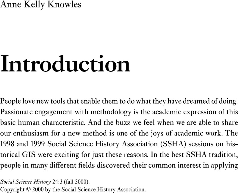
Image of the first page of this content. For PDF version, please use the ‘Save PDF’ preceeding this image.'
Type
Special Issue: Historical GIS: The Spatial Turn in Social Science History
Copyright
Copyright © Social Science History Association 2000 

Access options

Get access to the full version of this content by using one of the access options below. (Log in options will check for institutional or personal access. Content may require purchase if you do not have access.)

Footnotes

a1

Anne Kelly Knowles received her master’s and Ph.D. in geography at the University of Wisconsin–Madison. She taught at the University of Wales, Aberystwyth, and Wellesley College, where she was Mellon Fellow in Geography and resident scholar on a research fellowship from the American Council of Learned Societies. Her first book, Calvinists Incorporated: Welsh Immigrants on Ohio’s Industrial Frontier (Chicago, 1997), examined the influence of immigrants’ traditions and social values on their economic behavior. She is now writing a book about the role of skilled ironworkers in the transfer of technology in the U.S. iron industry.

References

Abbott, Andrew (1992) “From causesto events: Notes on narrative positivism.” Sociological Methods and Research 20(4): 4255.Google Scholar
Abbott, Andrew (1995) “Sequence analysis: New methods for old ideas.” Annual Review of Sociology 21: 93113.Google Scholar
Abbott, Andrew (1998) “Temporality and process in social life,” in Engelstad, F. and Kalleberg, R. (eds.) Social Time and Social Change. Oslo: Scandinavian University Press: 2861.Google Scholar
Abler, Ronald F. (1993) “Everything in its place: GPS, GIS, and geography in the 1990s.” Professional Geographer 45(2): 131–39.Google Scholar
Bailey, T. C. (1995) “A review of statistical spatial analysis in geographical information systems,” in Fotheringham, S. and Rogerson, P. (eds.) Spatial Analysis and GIS. London: Taylor & Francis: 1344.Google Scholar
Bogue, Allan G. (1987) “Great expectations and secular depreciation: The first ten years of the Social Science History Association.” Social Science History 11 (3): 329–42.Google Scholar
Boonstra, O. (1994) “Mapping the Netherlands, 1830-1994: The use of NLKAART,” in Goerke, M. (ed.) Coordinates for Historical Maps. Göttingen, Germany: Max-Planck Institute: 156–61.Google Scholar
Chrisman, Nicholas R. (1997) Exploring Geographic Information Systems. New York: Wiley.Google Scholar
Cobb, David (1999) Interview by author at the Harvard Map Collection, Cambridge, MA, 7 July.Google Scholar
Conzen, Michael P., ed. (1990) The Making of the American Landscape. London: Harper-Collins.Google Scholar
Coppock, J. T., and Rhind, D. W. (1991)“The history of GIS,” in Maguire, David J., Goodchild, Michael F., and Rhind, David W. (eds.) Geographical Information Systems: Principles and Applications. Vol. 1. New York: Longman: 2143.Google Scholar
Dennis, Richard (1991) “History, geography, and historical geography.” Social Science History 15 (2): 265–88.Google Scholar
Dobson, Jerome E. (1993) “The geographic revolution: A retrospective on the age of automated geography.”Professional Geographer 45(4): 431–39.Google Scholar
Earle, Carville (1992) Geographical Inquiry and American Historical Problems. Stanford, CA: Stanford University Press.Google Scholar
Earle, Carville (2000) Personal communication to author, 8 February.Google Scholar
Egenhoffer, Max J., and Golledge, Reginald G., eds. (1998) Spatial and Temporal Reasoning in Geographic Information Systems. New York: Oxford University Press.Google Scholar
ECAI (Electronic Cultural Atlas Initiative) (1999) Web page describing the ECAI project. Retrieved 11 July 2000 from the World Wide Web: www.ias.berkeley.edu/ecai/.Google Scholar
Fontana, Dominic, Collier, Peter, and Inkpen, Robert (1999) “Constructing and using an historical GIS for the Tower of London.” Paper presented at the Social Science History Association conference, Fort Worth, TX, 13 November.Google Scholar
GIS: Tool or science?” (1997)Forum in Annals of the Association of American Geographers 87 (2): 346–73.Google Scholar
Gould, Peter (1993) The Slow Plague: A Geography of the AIDS Epidemic. Cambridge, MA: Blackwell.Google Scholar
Gregory, Derek (1994) “Geography and the cartographic anxiety,” in Geographical Imaginations. London: Blackwell: 70205.Google Scholar
Gregory, Ian, and Southall, Humphrey R. (1998)“Putting the past in its place: The Great Britain Historical GIS,” in Carver, S. (ed.) Innovations in GIS 5. London: Taylor& Francis: 210–21.Google Scholar
Hägerstrand, Torsten (1967) Innovation Diffusion as a Spatial Process. Trans. and post-script by Pred, Allan. Chicago: University of Chicago Press.Google Scholar
Hall, Stephen S. (1992) Mapping the Next Millenium: How Computer-Driven Cartography Is Revolutionizing the Face of Science. New York: Vintage Books.Google Scholar
Hochstadt, Steve (1999) “Outdated geographical models of migration.” Paper presented at the Social Science History Association conference, Fort Worth, TX, 13 November.Google Scholar
Knowles, Anne Kelly (2000) “Geographic visualization without GIS: Simple ways to prompt profound visual thinking.” Cartographic Perspectives 36: 2437.Google Scholar
Knox, Paul L., and Marston, Sallie A. (1998)Places and Regions in Global Context: Human Geography. Upper Saddle River, NJ: Prentice-Hall.Google Scholar
Kousser, J. Morgan (1984) “The revivalism of narrative: A response to recent criticisms of quantitative history.”Social Science History 8(2): 133–49.Google Scholar
Krygier, John (1995) “Visualization, geography, and landscape: Visual methods and the study of landscape dereliction as a process.” Ph.D. diss., Pennsylvania State University.Google Scholar
Krygier, John (1997) “Envisioning the American West: Maps, the representational barrage of nineteenth-century expedition reports, and the production of scientific knowledge.” Cartography and Geographic Information Systems 24(1): 2750.Google Scholar
Ladurie, Emmanuel LeRoy (1977) “Motionless history.” Social Science History 1 (2): 115–36. Translated by John Day from Inaugural Lecture at the Collège de France, 30 November 1973.Google Scholar
Langran, Gail E. (1991) Time in Geographic Information Systems. London: Taylor & Francis.Google Scholar
Lewis, Ronald L. (1999) Personal communication to author, 3 September.Google Scholar
Long, John H. (1998) “The Atlas of Historical County Boundaries and GIS.” Paper presented at the Social Science History Association conference, Chicago, 21 November.Google Scholar
Long, John H., and members of the Atlas of Historical County Boundaries project (1999) Discussion at the Newberry Library, Chicago, 10 May.Google Scholar
MacEachren, Alan M. (1994) “Time as a cartographic variable,” in Hearnshaw, Hilary M. and Unwin, David J. (eds.) Visualization in Geographic Information Systems. Chichester, U.K.: John Wiley: 115–30.Google Scholar
Maguire, David J. (1991) “An overview and definition of GIS,” in Maguire, David J., Goodchild, Michael F., and Rhind, David W. (eds.) Geographical Information Systems: Principles and Applications. Vol. 1. New York: Longman: 920.Google Scholar
Maguire, David J., Goodchild, Michael F., and Rhind, David W. (1991) Geographical Information Systems: Principles and Applications. 2 vols. New York: Longman.Google Scholar
Maynard, Patrick (1997) The Engine of Visualization: Thinking through Photographs. Ithaca, NY: Cornell University Press.Google Scholar
Miller, David W. (1999a) Comments on papers presented in the panel, “Spatial history: Testing the reality of regional divides,” Social Science History Association conference, Fort Worth, TX, 12 November.Google Scholar
Miller, David W. (1999b) Interview by author in Fort Worth, TX, 13 November.Google Scholar
Miller, David W., and Modell, John (1988)“ Teaching United States history with the Great American History Machine.” Historical Methods 21: 121–34.Google Scholar
Moch, Leslie Page (1999) “Overcoming immobility: Source, method, and ideology in the study of French migration.” Paper presented at the Social Science History Association conference, Fort Worth, TX, 13 November.Google Scholar
NCGIA (National Center for Geographic Information and Analysis) (1998) “Initiative 19: GIS and society—The social implications of how people, space, and environment are represented in GIS.” National Science Foundation report. Retrieved 7 February 2000 from the World Wide Web: http://www.geo.wvu.edu/i19.Google Scholar
Openshaw, Stan (1991) “Developing appropriate spatial analysis methods for GIS,” in Maguire, David J., Goodchild, Michael F., and Rhind, David W. (eds.) Geographical Information Systems: Principles and Applications. Vol1. New York: Longman: 389–402.Google Scholar
Openshaw, Stan (1995) “Developing spatial analysis functions relevant to GIS environments,” in Fischer, M., Scholten, H., and Unwin, D. (eds.) Spatial Analysis and GIS. London: Taylor & Francis: 2138.Google Scholar
Peuquet, Donna J. (1994) “It’s about time: A conceptual framework for the representation of temporal dynamics in geographic information systems.” Annals of the Association of American Geographers 84(3): 441–61.Google Scholar
Peuquet, Donna, and Qian, Liujin (1997)“An integrated database design for temporal GIS,” in Kraak, Menno-Jan, Molenaar, Martien, and Fendel, Elfriede M. (eds.) Advances in GIS Research II: Proceedings of the Seventh International Symposium on Spatial Data Handling. London: Taylor & Francis: 2131.Google Scholar
Pickles, John, ed. (1995) Ground Truth: The Social Implications of Geographic Information Systems. New York: Guilford Press.Google Scholar
Pred, Allan R. (1966) The Spatial Dynamics of U.S. Urban-Industrial Growth, 1800-1914: Interpretive and Theoretical Essays. Cambridge: MIT Press.Google Scholar
Proctor, James D., and Smith, David M. (1999) Geography and Ethics: Journeys in a Moral Terrain. London: Routledge.Google Scholar
Robinson, Arthur H., Sale, Randall D., Morrison, Joel L., and Muehrcke, Phillip C. (1984) The Elements of Cartography. 5th ed. New York: John Wiley & Sons.Google Scholar
Schwartz, Robert (1999) Course Web site with historical exercises using GIS. Retrieved 14 February 2000 from the World Wide Web: www.mtholyoke.edu/courses/rschwart/rail/intro_hist_gis.htm.Google Scholar
Sheppard, Eric (1995a) “Dissenting from spatial analysis.” Urban Geography 16(4): 283303.Google Scholar
Sheppard, Eric (1995b) “GIS and society: Towards a research agenda.” Cartography and Geographic Information Systems 22(1): 516.Google Scholar
Skinner, G. William (2000) Personal communication to author, 10 February.Google Scholar
Taylor, Peter J., and Johnston, Ronald J. (1995)“Geographic information systems and geography,” in Pickles, John (ed.) Ground Truth: The Social Implications of Geographic Information Systems. New York: Guilford Press: 51–67.Google Scholar
Tufte, Edward R. (1983) The Visual Display of Quantitative Information. Cheshire, CT: Graphics Press.Google Scholar
Vanhaute, E. (1994) “The quantitative database of Belgian municipalities (19th/20th centuries): From diachronic worksheets to historical maps,” in Goerke, M. (ed.) Coordinates for Historical Maps. Göttingen, Germany: Max-Planck Institute: 162–75.Google Scholar
Yapa, Lakshman (1996) “Innovation diffusion and paradigms of development,” in Earle, Carville, Mathewson, Kent, and Kenzer, Martin S. (eds.) Concepts of Human Geography. London: Rowman & Littlefield: 231–70.Google Scholar