


Introduction
During their sojourn in Manchuria, the poet-couple Yosano Akiko 与謝野晶子 (1878–1942) and Yosano Tekkan 与謝野鉄幹 (1873–1935) noticed how different its roads were from Japan’s. One late spring night, following a dull and lacklustre gathering with local tanka fans, they rented a horse cart and aimlessly traversed the city of Dalian to seek better entertainment. Enveloped in the brisk wind of early May, they both felt relaxed and joyful; listening to the sound of horse hoofs on the stone paving, they would later describe this atmosphere as typically Chinese.Footnote 1
For the Yosanos, the clopping of hoofs on stone paving was a fresh aural element that had almost vanished from the soundscape of Japan’s home islands by the 1920s. From the 1880s, the use of horses as transportation gradually faded from the streets of Japanese cities.Footnote 2 As the twentieth century progressed, urban traffic increasingly comprised trolleys, railroads, and automobiles, which were powered by steam, electricity, and oil. Roads paved with crushed stones in the style known as macadam gave way to asphalt paving in the late Meiji era.Footnote 3 To the couple’s ears, the crisp rhythm of hoofs on flagstones thus sounded foreign, special, and romantic: a distinctive feature of the Asian continent.Footnote 4
Despite the Yosanos’ assumption that stone paving was particular to continental Asia, the macadam paving they travelled on in Dalian had in fact been designed and implemented by Japanese engineers after the establishment of Mantetsu (the South Manchuria Railway Company; JP: Minami Manshū tetsudō gaisha) in 1906. The soundscape of hoofs striking stone paving documented a history of constant coordination and negotiation between Japanese engineers and Manchuria’s environment. This environment was social as well as natural: focusing on the construction of roads sheds light on little-explored negotiations between Japanese imperial engineers and local communities, showing how imperialism works with and within environments and how it expands its influence through infrastructure projects. Anthropologists of infrastructure have argued that ‘infrastructure is a terrain of power and contestations’, a techno-political sphere jockeyed over by power brokers that is also a site for negotiations between state actors and unevenly governed populations.Footnote 5
Representative of ‘mundane material structures’,Footnote 6 roads are part of everyday infrastructure whose functionality relies on both the producers—civil engineers and state planners—and on the users of various transportation methods. This distinguishes roads, together with other mundane infrastructure, from large technical projects such as dams and railways. Such projects are usually overseen by state or corporate capital, which gives users far less control over the system.Footnote 7 In the context of imperialism, dynamic interactions between colonial regimes and indigenous societies manifested in the usage of everyday structures. Such interactions provide a lens through which to examine the social history of technology. Instead of seeing technology as the fruit of innovation, mundane infrastructure such as roads shifts our focus to the negotiations between engineers and users.Footnote 8
When considering the implementation of infrastructure projects, focusing on the materiality of paving deepens our understanding of the formation of technical expertise and the influence of users. Current scholarship, particularly contemporary studies of Japan’s empire, on Japanese infrastructure projects does not fully address the question of materiality.Footnote 9 Few studies consider how the supply of local labourers, a colony’s natural environment, or the users of mundane infrastructure influenced how imperial engineers designed, imagined, and constructed physical infrastructure. It is true that studying the role of colonized peoples in imperial projects requires particular care. Yet shifting our perspective from colonial exploitation to how the colonized influenced empire neither negates the historical responsibility of Japanese imperialism nor diminishes how imperial domination, which destroyed lives and environments, brought suffering to local societies.Footnote 10
Neglecting the impact of local communities and environments on the contours of imperial infrastructure projects produces one-sided historical depictions of imperialism and imperial engineers. This results in dichotomies being drawn between engineers’ expertise and vernacular knowledge, modernity, and tradition, as well as almighty empires and resistant subjects. In this vein, much previous research depicts imperial engineers as embodiments of metropole-trained knowledge, of modernity, and of progressiveness, who held utterly different visions from indigenous residents and workers.Footnote 11 But more recent scholarship, with which this article is aligned, demonstrates that the technical expertise of imperial engineers was a hybrid phenomenon built on absorbing and coordinating other place-specific knowledges.Footnote 12
The materiality of roads registers the influence of their users on Japanese engineers’ blueprints. Users gave new meanings and significance to infrastructure projects not found in the imaginaries of engineers.Footnote 13 People’s travel on roads not only endowed these artefacts with new social interpretations but also influenced their design. To build roads in Manchuria, for example, Japanese engineers were compelled to employ river gravel, along with granite and basalt flagstones, to enable horse cart’s traffic.
In particular, the presence of horse carts on Japanese-designed roads reflected how Japanese engineers had to accommodate environmental conditions in Manchuria. Long used for transportation in the region, the physical structures of horse carts manifested the influence of the natural environment: their wheels were big in size and narrow in width so they could travel on muddy dirt surfaces. Drivers of horse cars also limited their long-distance travel to the winter months in order to take advantage of frozen surfaces. In adapting their roads for horse cart usage, Mantetsu engineers had thus familiarized themselves with how to build in the specific conditions of Manchuria’s environment.Footnote 14
The choice of certain materials created distinct dynamics between engineers and the labourers they hired. The use of macadam, a standardized paving method in Britain, allowed the state to implement more detailed supervision and to employ unskilled workers for road construction.Footnote 15 Conversely, the use of flagstones in the railway zone in northeast China highlighted the importance of local stonemasons, as carving flagstone pieces required more skill than sorting gravel. This led quarries in that area to retain experienced Chinese stonemasons, whose skills were needed for Japanese engineers to succeed in paving thoroughfares.
Even in Manchukuo, a client state built on the military support of the Kwantung Army, local knowledge played a major role in informing Japanese technical engineers of where and how to build new roads, from choosing highway courses to drawing up road plans for the new capital, Xinjing or Shinkyō (currently Changchun).Footnote 16 Yet the active incorporation of local communities’ vernacular knowledge accompanied a growing push to overhaul the transportation system as a whole to better serve the interests of Japanese businesses and the military. Previously, Japanese technocrats worked both by the bottom-up absorption of local practices and the top-down installation of imperial design. But over time, Japanese engineers in Manchukuo began to pave highways with concrete for the use of automobiles, which prohibited the use of horse carts. Even today, this hybrid landscape of roads—ones built to accommodate local practices and others that reflect imperial designs—still marks the built environment in this region.
Despite a voluminous body of research on railroads in Manchuria,Footnote 17 studies on roads are scant. Yet without connective roads, Manchuria’s railway system could not have functioned. Roads in the railway zone, an urban corridor along Mantetsu’s railways,Footnote 18 increasingly linked Japanese-administered regions to Chinese inner cities and villages, redirected and facilitated flows of commodities and people from pre-existing watercourses to the steel tracks of railroads, and consolidated Japan’s economic domination over the entire region. And, in contrast to railroads, which usually run outside of older urban areas, road construction often results in revolutionizing the socio-political dynamics of urban landscapes and lifestyles.Footnote 19 As capillaries that connected Japanese railroads with Chinese-administrated regions in Manchuria from 1906 to 1932, the roads in Mantetsu’s railway zone extended Japan’s reach far beyond the physical borders of its administrative territory (Figure 1).Footnote 20

Figure 1. Major railway auxiliary zone.
In the railway zone, which bordered other Chinese-administrated areas, Mantetsu used road construction to cement a certain type of relationship between itself and Chinese locals such as merchants, horse cart drivers, and residents of neighbouring regions.Footnote 21 Mantetsu aimed to expand its presence in the economic and social life in the area outside its administration, and it succeeded to some extent in the districts on its borders, where it managed to normalize the use of flagstone paving and restrictive policies on horse carts.Footnote 22
To unveil the complex relationships compressed into the materiality of roads, linking Japanese engineers with workers, communities, and natural environments in Manchuria, I adopt a bilingual, multi-archival, and multidisciplinary approach to cross-examine a combination of technical reports by Japanese engineers, Mantetsu research reports, governmental reports by the Ministry of Foreign Affairs, and Chinese newspaper journalism. This methodology has unavoidable limitations: newspapers in Chinese written by Chinese reporters relied on Japanese colonial institutions for financial support, which subjected them to the latter’s political influence. The domestic political situation in mainland China today also limits researchers’ access to archival materials, allowing only a partial presentation of Chinese voices in this article.Footnote 23 Even so, my approach of reading materiality as an archive and cross-examining multiple archival materials shed light on the interactions that have often been glossed over in official records.
The analysis below starts by discussing Japanese civil engineers’ grand vision for roads, after which it turns to investigate how Mantetsu engineers started paving with flagstones, and how the choice of this material reflected their interactions with Manchuria’s social and natural environment. Paving with flagstones also affected the power dynamics between engineers and skilled workers, since the former relied on the latter to access flagstones. Subsequently, I discuss the influence of paving with flagstones in the railway zone on other Chinese-administered regions. The last section discusses how changing the materials for paving in the Manchukuo era also reflected a change in relations between Japanese technocrats and local communities.
Visions of progress (1906–1925)
Roads were among the very first infrastructural artefacts that Mantetsu built in the railway zone. Japanese officials and company engineers considered roads to be symbols of civilization, modernity, and progress. Their debates over the size, width, and functionality of roads reflected a diverse array of visions for the future of Japan’s empire-building in Manchuria.Footnote 24
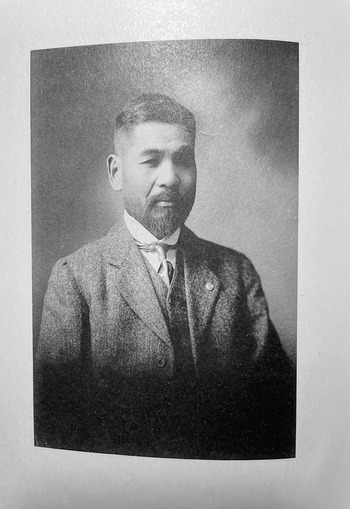
Katō Yonokichi 加藤与之吉 (1867–1935), the first civil engineer hired by Mantetsu, drafted a blueprint for roads in the railway zone in 1907 (Figure 2). For Katō, roads were vessels to facilitate the transportation of goods and people from former commercial centres, namely neighbouring Chinese cities and river ports, to the railway stations and ports under Mantetsu’s administration. This redirection of traffic would not only bring Mantetsu commercial opportunities and economic benefits but also enhance Japan’s political leverage in Manchuria. That building in the railway zone would lead to the wholesale colonization of Manchuria ‘was more obvious than looking at the sun’, Katō wrote.Footnote 25

Figure 2. Katō Yonosuke (1867–1935).
Without connecting routes such as roads and light rail, not even Mantetsu’s extensive system of railroads could compete effectively with pre-existing transportation systems. Seki Tokizō 関時蔵 (n.d.), a Mantetsu officer in Tieling, observed that only one-third of the approximately 10,000,000 soybeans shipped out of Tieling was transported by railroad, with the remaining two-thirds shipped via the Liao River. For many Chinese merchants, shipping via watercourses was cheaper and took a more familiar route compared to automobiles and railways. Only after Mantetsu purchased the light rail that connected the Chinese hinterlands to the company’s Tieling station and reduced their fare for soybean transportation were more Chinese merchants incentivized to use railroad shipping.Footnote 26
Katō took pride in his contributions to road construction. ‘I was a trailblazer in the railway zone,’ he wrote. ‘From surveying to urban planning, I did it all. We carried out construction and now splendid streets have appeared everywhere.’Footnote 27 To Katō, transforming the earth from deserted wilderness (kōbaku taru genya)Footnote 28 to paved surface was a mark of his success as a civil engineer and the progress of Japanese imperial rule. In his view, paved roads were material advocates for Japan’s imperial domination. As the Japanese Settler Association of Andong argued, paving embodied ‘an idea of progressiveness’. The Association believed that constructing roads in Japanese residential areas would encourage Chinese and Korean communities to ‘learn from the Japanese’ and discard their older, ‘uncivilized habits’ such as travelling on dirt roads.Footnote 29
Another proponent of paved roads was Gotō Shinpei 後藤新平 (1857–1929), the first chairman of Mantetsu. Katō and Gotō’s debates around 1907 over the ideal form of road reflected their respective visions of a civilized future in Manchuria. Katō saw Manchuria as a peripheral colony in an empire whose hierarchy centred on Tokyo. In contrast, Gotō imagined Manchuria as a continental centre within the empire. How they placed Manchuria and how they foresaw the future of Japan’s empire led them to conceive of different ways forward.
Katō took Tokyo as his principal model in drafting plans for roads in Manchuria. As the widest road in the Japanese metropole was about 27 metres, Katō considered that a 27-metre width would be a more than adequate standard for roads in the colony, and his survey of Russian-built roads in Dalian only confirmed his calculations. He further anticipated that Dalian, which housed Mantetsu’s headquarters and was the most developed city in southern Manchuria, would remain the most prosperous place along the Mantetsu railroad. Thus, he concluded, ‘There was no need to equate the railway zone with Tokyo.’Footnote 30
In contrast, Gotō considered Manchuria as a potential continental base for Japanese nationals.Footnote 31 He believed that this would allow Japanese settlers to put down roots, mingle with other ethnic groups,Footnote 32 and spread their people and culture across the whole continent. Mantetsu, in this scenario, would be the new axis in constructing Manchuria as such a base on the Asian continent within Japan’s empire. For Gotō, railroads and roads in the railway zone were tools to realize this vision of transforming Manchuria into a continental centre.Footnote 33 Instead of copying Tokyo’s urban plans, he urged Katō to design wider roads for Manchurian streets, similar to those found in European capitals such as Paris and Berlin. Only these bigger roads, he insisted, reached civilized standards.Footnote 34 Gotō’s focus on building a continental centre also made him more tolerant of Chinese culture and practices. Instead of limiting horse cart traffic to certain areas, as specified in Katō’s plan, Gotō advocated learning from road regulations in Beijing, where the roads were wide enough to accommodate all traffic, including giant horse carts.Footnote 35
The disagreements between Katō and Gotō reveal the divergent civilizing imaginaries they projected onto Manchuria, with each man proclaiming his own vision of a desirable future for Japan’s newly obtained colonial space. Katō saw Japan’s empire in northeast Asia as a monocentral enterprise whose metropole was the zenith of civilization. Against this view, Gotō viewed Japan’s empire as comprising multiple centres and cherished European models as standard-setters for continental civilization, a vision shared by many Japanese settlers and Mantetsu officials who sought to create a distinct culture in Manchuria.Footnote 36 Even so, these differing visions of civilization only confirmed Katō and Gotō’s shared perception that infrastructure projects had political and ideological functions. For all their differences, they both saw paved roads as physically imprinting Japanese influence onto Manchuria’s landscape.
Realities of negotiations (1906–1931)
In Katō and Gotō’s debates over the width of roads in the railway zone, neither of them was especially concerned with what paving material should be used for said roads. Yet choosing the appropriate material and paving methods became the most urgent task that confronted Katō and his Mantetsu colleagues. Unlike pristine blueprints with neat lines and numbers, paving was a laborious process of negotiation, failure, and adaptation. Mantetsu engineers, as represented by Katō, had to accommodate Manchuria’s social and natural environment by locating a material that would survive drastic temperature changes and bear the weight of horse cart traffic.
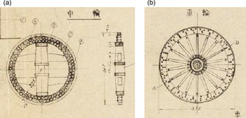
Paved roads were relatively new to the landscape of northeast China. For a long time, roads were made of dirt, and transportation tools such as horse carts were adapted for smooth travel on such roads. Over the decades, horse carts in Manchuria had adopted narrower and bigger wheels to facilitate travelling in all seasons. Chinese drivers and merchants relied primarily on two types of carts—‘big carts’ (CH: dache; JP: daisha) and ‘mixed carts’ (CH: huaguluche; JP: heisha)Footnote 37—to transfer agricultural products from the hinterland to river ports, and to ship commodities in the opposite direction.Footnote 38 To produce one big cart usually took 15 carpenters and six blacksmiths, who used about 500 pieces of wood and various metal parts to make its wheels and body. Horse cart wheels in Manchuria were made of solid wood, and wood parts from the Yalu River region were preferred for their high quality. A big cart’s wheel included two parallel spokes and a horizontal spoke that connected these sections in a structure reminiscent of the ‘ki’ character in Japanese katakana (キ). In contrast, a mixed cart’s wheel resembled contemporary wheels in its composition of a hub and radiating spokes. Big carts were driven by three to 12 horses, while mixed carts used fewer horses; both types had cart bodies of a similar size (Figure 3).Footnote 39

Figure 3. Wheel shapes. The left illustration shows the wheel of big carts and the right, that of mixed carts.
These horse cart wheels showed traces of their adaptation to Manchuria’s natural environment. The wheel width in big carts ranged from 11.9 to 16.5 centimetres with a diameter of between 96 to 102 centimetres.Footnote 40 Mixed carts, widely used in urban areas in Manchuria, were essentially big carts with smaller wheels, whose width could be as narrow as 9.9 centimetres.Footnote 41 Mantetsu researchers at the Temporary Economic Research Bureau (TERB, JP: Rinji keizai chōsakai) described the narrow wheel as ‘a result born out of nature itself’.Footnote 42 In the summer monsoon seasons, these horse carts travelled well on muddy dirt roads, as wheels with a narrower width caught less dirt and facilitated their operation (Figure 4). The TERB also found that horse cart wheels with bigger diameters caused less friction and hence required less tractive power. On Manchuria’s uneven and unpaved dirt roads, ‘it was wise to opt for bigger wheels’.Footnote 43

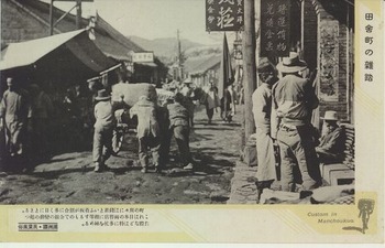
Figure 4. Inaka machi no zattō. ‘The crowd in rural villages’, a typical example of Japanese impressions of Chinese streets. Note the unpaved roads and narrowness of the streets.
Horse carts thus suited the natural environment in Manchuria and became a major tool that connected agricultural production sites, especially for soybeans, with export routes via railroads or waterways. Compared to shipping via railroads, in Mantetsu’s early days, using horse carts proved cheaper and sometimes even faster (Figure 5). According to a 1907 report by Shibata Yōjirō 柴田要治郎 (n.d.), the Japanese consul in Changchun, horse carts travelled smoothly on frozen dirt surfaces in the winter and took just 14 days to ship seven tonnes of products from Changchun to a neighbouring town for a total amount of 105 yen. In comparison, travelling the same distance with railroads would cost over 150 yen and take more than 20 days.Footnote 44

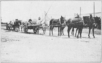
Figure 5. Five-horse big wheel cart.
To replace dirt roads with paved ones, Mantetsu engineers had to find an appropriate means of laying their vision for a hard and durable surface onto Manchuria’s environment, in its natural and social dimensions, without incurring high maintenance costs. Searching for a material that would best survive Manchuria’s seasonal patterns, the engineers first tested wood blocks and red brick, both used as paving materials in Japan’s home islands.Footnote 45 But they discovered that both wood-paved roads and brick-built gutters easily decayed and collapsed when they were exposed to the local weather.Footnote 46
Nature, in Manchuria, worked through water. Rainfall soaked the wood blocks in the summer, making them swell. Water remained in the wood, accumulating between the blocks and their concrete base; in the winter, it froze and knocked the blocks out of place. Similarly, water in gutters expanded as it froze and displaced brick structures.Footnote 47 The continued use of wood and red brick would increase the cost of building and maintaining roads even as these same materials potentially undermined Japanese rule. Swollen and decaying wood not only hindered roads from functioning properly, but also marred the image of a perfect civilization that Mantestu, and by extension the empire, aspired to project. Ultimately, wood and red brick made for flimsy roads in Manchuria and made the ideals of imperial engineers crumble in the face of reality.
After these failures, Mantetsu engineers gradually settled on using stone and concrete to pave in Manchuria. As the Meiji government (1868–1912) prioritized railway construction over road renovation, only a few roads in Japan’s home islands were paved even in 1911, and these used all kinds of materials, including cement, wood, and asphalt, in their builders’ efforts to figure out the best style of paving.Footnote 48 Meiji-era engineers in Tokyo preferred pebbles and macadam for the Ginza Bricktown, as these were convenient to install and produced an adequately hard surface.Footnote 49 Both materials—pebbles and concrete—were tested in Manchuria, where Mantetsu engineers eventually adopted macadam to pave many roads. The results proved capable of surviving the drastic climate, encouraging Mantetsu engineers to repave most roads and gutters in the railway zone with pebbles or concrete.Footnote 50
Yet Mantetsu engineers found that macadam-paved roads in the railway zone were far less durable than those in Tokyo. The intense traffic of horse carts on such surfaces easily wrecked the roads, as these vehicles were ruinous for macadam surfaces: a three-horse big cart could carry as much as seven tonnes,Footnote 51 and a one-horse mixed cart could hold anywhere between 750 to 2,000 kilograms.Footnote 52 Katō called these vehicles ‘organs of road destruction’ (dōro hakai kikan) and considered them ‘extremely uncivilized’. He likened the effect of horse carts on paved roads to mortars (yagen) that pulverized paved surfaces in the way druggists ground herbs for medicine.Footnote 53 Horse carts hindered traffic and left deep ruts when they travelled on paved surfaces, raising the costs of maintenance. In one case, their use decommissioned a road paved by the Chinese warlord, Wu Junsheng 吴俊升 (1863–1928), within a year of construction. TERB researchers even described the multiple varieties of damage that carts caused as ‘state-ruining’ (bōkokuteki).Footnote 54
Travelling on horse carts in urban areas was also described as an exhausting experience, for horse carts destroyed lightly paved and ground stone paved roads into a storm of white sand. In areas with rudimentary paving, Yosano Akiko noted how deeply horse carts dented these surfaces.Footnote 55 And when the novelist Natsume Sōseki 夏目漱石 (1867–1916) visited Manchuria in 1909, he likened riding in a horse-driven passenger wagon to ‘dancing on top of the cart’, which strained the nerves of every passenger.Footnote 56 The combination of rough roads and jerky carriages erased any illusions of horse cart travel as a comfortable and romantic experience.
In 1924, given the damage that horse carts caused to macadam streets and the ensuing high cost of maintenance, Japanese officials enacted policies to limit the passage of narrow-wheel horse carts in Dalian and Lüshun, the two cities in the Kwantung Leasehold (Kantō soshakuchi) where the Kwantung Government-General (Kantōshū) operated as a colonial government. They did so to encourage the transformation of Chinese mixed carts into four-wheel ones with smaller diameters but wider thickness (JP: shirinsha), similar to carts in Japan’s home islands. By 1928, only four-wheel carts were allowed to operate within both cities.Footnote 57 The wheel diameter of such carts was limited to a maximum of 9.9 centimetres.Footnote 58
Compared to cities in the Leasehold, the railway zone was more directly connected to its neighbouring cities and the hinterland. As Mantetsu had no administrative rights over horse carts registered in these Chinese cities, it could not force big carts to change to four-wheel carts even if they travelled in its zone. Moreover, Mantetsu relied on horse carts to connect its railway zone to the hinterland, a relationship that a TERB researcher described as one of mutual dependence:
It goes without saying that railroads benefited enormously from horse carts, for the latter was a key means of collecting and distributing goods. Although in the beginning some treated horse carts as unimportant because they were auxiliary means to railroads, one wonders whether there is any other transportation [method] that can match them. As a transportation tool, the horse cart is the most economical and holds the greatest influence. If there was no horse cart, but only vehicles like ox carts and packhorse carts, railroads would clearly lack a remarkable record. Behold! The freight of railroads completely relies on horse carts to collect and distribute [goods]. The transportation capacity of horse carts is unlimited. There is no place in Manchuria and Mongolia they cannot reach. Surely, we can [therefore] say that the key to exploiting the rich resources of Manchuria and Mongolia single-handedly lies in horse carts… Although it is possible that railroads would cause the unavoidable decline of horse carts as transportation, the completion of the former would [actually] promote the latter’s development… The opening of railroads is meant to tap the rich resources in unexploited areas… with the settlement of migrant farmers in Manchuria, the number of horse carts will also increase.Footnote 59
Imposing harsh regulations akin to those in Dalian and Lüshun in the railway zone would have been likely to produce a decline in Chinese-registered horse carts, which would in turn have decreased railroad traffic. Limited by its political jurisdiction and its reliance on the economic function of horse carts, Mantetsu ended up implementing a more lenient approach. From 1926, the company stipulated that two-wheel mixed carts with a wheel width of over 12 centimetres and four-wheel carts with a wheel width of over 10 centimetres could travel through its zone.Footnote 60 However, such regulations were not always carried out in reality. In Yingkou, for instance, some four-wheel carts with a width of six centimetres travelled freely in that section of the railway zone.Footnote 61
The inability to fully regulate and limit the traffic of horse carts led Mantetsu to seek ways of paving roads that could both withstand horse carts and cost less to maintain. Mantetsu engineers tested and adopted two new methods using Telford paving and flagstones to replace the simpler form of macadam paving. Katō and his colleagues also implemented a special design for ‘horse cart exclusive roads’ (nibasha senyō dōro); these limited big carts to the one street in each railway zone that connected soybean warehouses with the railway station.
Where macadam paving used a single layer of gravel, the Telford method required three layers and intensive compression by applying stone-made rollers after setting each layer. Roads paved in this way could be as bulky as 33.33 centimetres compared to macadam paving’s 23.1-centimetre thickness. The additional step of using a two-tonne stone roller to finish paving also increased the weight capacity of these roads.Footnote 62 Even so, Mantetsu engineers soon noticed that this enhanced paving could not survive the heavy use of horse carts in the railway zone due to the high volume of traffic there.Footnote 63 In Fengtian, about 1,900 carts travelled daily through Mantetsu’s station during the summer, and the number rose to 4,300 in the winter. In Changchun’s winter season, around 8,000 carts travelled through its part of the zone per day.Footnote 64
The accelerating destruction of Telford roads challenged Mantetsu engineers to devise a more durable paving method for horse cart traffic in Manchuria. Their solution involved using a hybrid of flagstones, concrete, and gravel to pave roads for cart use. Limitations in historical records make it hard to tell how Katō and his colleagues arrived at this method. One source of inspiration may have been pedestrian roads in Dalian, some of which the Russian administration there had paved with flagstones prior to 1905.Footnote 65 In Japan’s home islands, some pedestrian roads were also made of flagstones.Footnote 66 Although flagstones were not used for traffic roads in either example, these precedents are likely to have motivated Mantetsu engineers to consider flagstones as a potential paving material. In 1917, they built their first experimental flagstone paving in Dalian, which included three layers each of gravel, concrete, and mortar, topped with a final layer of granite flagstones. They further used heavier rollers, which weighed over ten tonnes, to level each layer, and added mortar to prevent the penetration of rainwater into deeper layers between the seams of the granite flagstones.
This hybrid use of gravel and granite stone blocks proved to excel in resisting damage from horse carts, remaining perfectly usable even after ten years of heavy traffic.Footnote 67 This experiment boosted Mantetsu engineers’ confidence in this paving method and gradually led them to repave all horse cart exclusive roads in the railway zone in the same manner over the course of the 1920s, sometimes even omitting the layers of concrete.Footnote 68 In regions with no accessible granite, they used flagstones made of other solid materials for paving, such as basalt in Changchun.Footnote 69
Flagstone paving in the Mantetsu railway zone emerged out of Japanese engineers’ adaptation of their metropolitan-trained expertise to Manchuria’s natural environment, and, more importantly, to local forms of transportation. Mantetsu’s efforts to build a civilized empire through paving solid surfaces engendered multiple endeavours to negotiate with and adapt to this location-specific practice of travelling with horse carts. This birthed an amalgamated knowledge system that fused metropolitan visions with a consideration of place-specific practices. Flagstone paving documented how the users of roads, as well as the natural environment, played important roles in shaping the corporeality of roads in Manchuria’s colonial space.
From stone to paving
The use of granite or basalt flagstones and river gravel of various kinds not only connected Japanese engineers’ vision of paving to the producers of these materials, but it also shaped relations between the engineers and the Chinese workers they employed, whether manual or skilled. As the main institution in charge of road construction, Mantetsu employed Chinese and Japanese workers on both permanent and temporary bases to pave and maintain roads in the railway zone. It hired from both groups for operators of steam rollers, and employed Chinese as stokers and assistants. In 1921, the company hired 20 Japanese and 113 Chinese as assistant employees (koin) and another 106,873 Chinese as temporary employees to oversee the maintenance of roads in the railway zone.Footnote 70 The function of a paved and hard road relied on both the engineers’ designs and the skills of these lower-ranked employees and temporary labourers. Mantetsu’s choice of flagstones and gravel for paving further created a wider network of relations between engineers and larger adjacent communities that comprised manual labourers, producers, and skilled workers. As Susan Naquin points out, researching history through the lens of materiality shows the central position that previously marginalized historical actors such as artisans and craftsmen occupied in the production of any regional culture.Footnote 71
In Dalian, paving with gravel connected the city’s construction sites with the shores of the Liaodong Peninsula. Instead of excavating and shipping gravel in-house, Mantetsu and the Kwantung Government-General outsourced these tasks to Japanese construction companies (ukioisha) that further hired Chinese boat-owners (senshu) to acquire and transport gravel. These Chinese owners proceeded to employ Chinese heads (sentō) to manage the details of shipment and acquisition, who then hired Chinese foremen to carry out the physical processes of extraction, which they did by hiring manual labourers.Footnote 72 In this way, the supply of gravel in the form of crushed stones for road construction in Dalian came from manual labourers on the coast of the peninsula, together with foremen, boat-heads, and Japanese construction companies.
Similarly, gravel used by other parts of the railway zone came from quarries worked by manual labourers. Crushed stone did not require much effort to shape, and quarries would occasionally outsource the entire process of gravel excavation to local workers. In the Quantou Quarry near Changchun, the Japanese owner Onitake Ritsuzō 鬼武律蔵 (n.d.) hired Chinese foremen to oversee excavating and transporting. Onitake paid his foremen for each task and put them in charge of all work-related expenses (for example, transportation and fuel costs). These foremen were responsible for hiring, managing, and paying the manual labourers under their supervision.Footnote 73 Onitake may also have hired other foremen to oversee the shipping of excavated gravel to construction sites.
Aside from relying on the physical strength and the intricate social networks woven by labourers, foremen, and their associates, Mantetsu also depended on the skills of Chinese stonemasons to produce flagstones. Unlike gravel, granite and basalt needed trimming and cutting before being used in paving. The Chinese Eastern Railway Company, which had used stone in Manchuria since 1896, had attracted skilled Chinese workers to the region, where they settled.Footnote 74 After the Russo-Japanese War, some Russian-managed quarries passed into Japanese army hands before being handed over to the management of Japanese companies.Footnote 75 This earlier history of Chinese and Russian companies’ use of stone thus allowed Mantetsu to access skilled labour along with raw materials.
Making granite into flagstones was a labour-intensive and delicate process. Japanese quarry owners tasked stonemasons with the three crucial steps of excavating (yamawari), crude refining (aragiri), and polishing (shiage). Depending on the type of stones required, quarries also hired specialized masons to make more sophisticated refinements: cutting the stone into smaller sizes (irihogagiri), creating a pattern with slight dents (kotadaki) on the surface of the cut stone (kiriishi), or trimming one side into a narrower shape (hosonomi) for stonewalls (kenchiishi).Footnote 76 In the hands of these masons, granite and basalt transformed into different types of building stones.
Many stonemasons were Chinese. According to Toheda Fumikichi 藤平田文吉 (n.d.), a Mantetsu researcher, Japanese quarries hired Chinese masons because they could pay these skilled workers a lower salary. Tada Workshop (Tada kōmusho), a granite quarry in the neighbourhood of Dalian, hired over 200 Chinese masons who had migrated from North China and settled in Manchuria in the previous decades. To secure this workforce, Tada offered them higher pay, but even this increased remuneration was around two-thirds the average salary of Japanese masons.Footnote 77
Toheda’s report also showed how Mantetsu absorbed the vernacular skills of these skilled workers, turning them into knowledge for circulating among its engineers and Japanese engineers in the empire at large. In drafting his report, Toheda interviewed Chinese stonemasons working in quarries across Manchuria, diligently noting details on types of stone, the qualities of each type, and how they processed stones with diverse material characteristics. Yet, in his final report, Toheda gave no credit to the workers he interviewed, and he presented his findings as a record of knowledge shared by both Chinese and Japanese skilled workers and engineers.Footnote 78 By translating the practices of cutting granite and basalt into flagstones into Mantetsu’s intellectual property, Toheda buried the labour of skilled stonemasons in his dryly written engineers’ reports. Tracing the origin of flagstones and the manifold efforts needed to turn stone into paving materials shows how imperial engineers exploited the physical strength of local workers, and further proves that they appropriated and erased the latter’s skills and contributions. By presenting infrastructure projects as the ultimate product of Japanese technical expertise and vision, these engineers reinforced a dichotomy between a technologically savvy empire and a backward colony waiting to be civilized.
Roads for economic and political control
Paving roads further extended Japanese influence over the physical boundaries of the railway zone. Constructing flagstone-paved roads there changed how Mantetsu interacted with horse cart drivers as the primary users of such roads, as well as with Chinese administrations in neighbouring regions. Over the years, Chinese merchants gradually became reliant on railroads to export agricultural products and import commodities. Flagstone roads in the zone grew into major channels of traffic, connecting merchants to railroad stations and Manchuria to external markets.Footnote 79 Having ascertained the importance of flagstone roads to Chinese merchants, Mantetsu officials strove for greater power over this constituency. Political control in Manchuria had been territory-based, permitting Mantetsu to administer only residents within its zone. In the 1920s, however, the company challenged this system of administration by seeking administrative rights over the political and economic activities of Chinese merchants residing outside its territory.
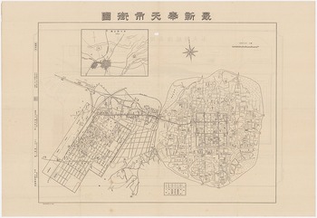
In 1926, the most contentious debate over the control of traffic took place in Fengtian (JP: Hōten) (Figure 6). Fengtian comprised three separate regions, each with their own administrative system. Its railway zone, under Mantetsu’s control, bordered the treaty port zone (shangbuqu). In 1906, the Qing government designated an area of 667 hectares as a treaty port that allowed foreign citizens to settle and conduct business.Footnote 80 On the east side of the treaty port zone lay the Chinese inner city (chengnei), which in 1916 became the political base of Zhang Zuolin, the regional warlord.Footnote 81 These divisions of territorial space reflected the complicated politics of governing Fengtian, where Mantetsu oversaw the civil administration of the railway zone and Zhang’s government administered the areas beyond. Chinese merchants in Fengtian were also divided into two groups, one registered with Mantetsu and the other with the Zhang regime.Footnote 82 Foreign merchants in the treaty port zone registered with a separate Chinese authority—the Bureau of Treaty Ports (Shangbuju).Footnote 83 In 1928, 1,555 horse carts were registered with the inner city, 2,238 with the treaty port, and a mere 35 with the railway zone.Footnote 84

Figure 6. Map of Fengtian (1925). From left to right: railway zone, treaty port area, and Chinese inner city.
These separate administrations exerted control over horse carts through registration systems. Horse cart drivers paid tax to the institution with which they were registered to receive its official protection. The registration allowed the government to regulate their routes of travel. Since most horse carts in Fengtian were registered with the Zhang government, Zhang enjoyed a greater flow of tax income in comparison to Mantetsu, which oversaw only a fraction of registered carts. In 1927, Mantetsu estimated that about one-third of the horse carts not registered with them—about 1,000—travelled daily in the Fengtian railway zone.Footnote 85 Regardless of the institution with which horse cart drivers were registered, their vehicles were permitted to travel freely across all three administrative areas.
The low number of carts registered with Mantetsu meant that the company received little tax income from horse cart traffic. Yet the railway zone bore a high volume of this traffic as the main area for horse carts to travel to and from railway stations, which accelerated the damage to its roads and the maintenance costs thereof. In 1926, in order to increase Mantetsu’s revenue for road maintenance, Hirano Masamoto 平野正朝 (n.d.), chair of the company’s Fengtian office, proposed charging a scaled toll for all vehicles travelling through the railway zone. Hirano suggested that this charge be based on potential damage to the road inflicted by different vehicles: a rickshaw, which caused relatively low damage, would pay 70 sen, while a far more destructive horse cart would command one yen.Footnote 86 The imposition of scaled tolls would thus not only help Mantetsu pay for the maintenance of roads in the zone but also increase its control over local traffic.
Unsurprisingly, this proposal encountered severe resistance from both vehicle owners and Chinese authorities. The former, especially horse cart drivers, protested against the double burden of paying taxes for registration and using roads.Footnote 87 Meanwhile, the Zhang government feared that the new tax would lead more drivers to register with Mantetsu to avoid dual taxation, or refuse to pay registration fees at all, either of which would reduce the regime’s income and authority. Mantetsu stayed its course by adding economic pressure. For three days, from 6 May to 9 May 1926, it prohibited horse carts not registered with the company from entering its railway zone in Fengtian. The Zhang government adopted the same strategy and banned all Mantetsu-registered horse carts from entering the area it administered. This tussle hurt both parties, since the cessation of traffic between the railway zone and Chinese areas cut merchants off from business and starved residents of food supplies. Eventually the warring sides reached a compromise: Mantetsu dropped the proposal of a scaled toll, and the Zhang government agreed to pay Mantetsu 5,000 yen annually for maintaining roads in its Fengtian zone.Footnote 88
Although Mantetsu did not fully succeed in controlling traffic flow through tolls, it nonetheless gained financially from this standoff against the Zhang regime. With the completion of flagstone roads and other facilities such as grain warehouses in the railway zone, the company made its physical infrastructure essential for Chinese merchants. As in Fengtian, Japanese officials in other railway zones also used road maintenance as a reason to propose imposing tolls on Chinese vehicles.Footnote 89 Local dependence on roads in the railway zone thus allowed Mantetsu to compete with Chinese authorities for political and economic control beyond the zone’s territorial boundary.
Paving for connectivity
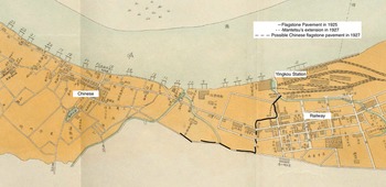
Mantetsu’s construction of hybrid flagstone roads for the exclusive use of horse carts also influenced how Chinese administrators in bordering regions carried out or conceptualized road paving. Some reached out directly to Mantetsu, seeking assistance to extend its flagstone-paved horse cart roads through inner cities to facilitate transportation and reduce maintenance costs on the Chinese side. In the Yingkou railway zone, Mantetsu paved the road that connected its railway station to the thoroughfare with flagstones in 1925, covering a total area of about 2,000 square metres. This installation of a horse cart exclusive road in the zone led more drivers from Yingkou to travel on a certain path in the Chinese region on its borders, causing severe damage to these roads. To stop the deterioration of its own roads, the Yingkou government thus imitated Mantetsu’s paving methods, even negotiating with the company to connect the paved horse cart road in its inner city with the one Mantetsu had installed two years ago. Mantetsu agreed to extend the current flagstone road southwards towards the border of the railway zone, from where the local administration took over and constructed a connective paved road through the Chinese part of the city in 1927 (Figure 7).Footnote 90 The building of this connected road system further decreased the spatial distance between Yingkou’s Chinese and Japanese regions, and provides a clear example of how Chinese inner cities grew to rely on Mantetsu’s railway system and infrastructure network.

Figure 7. Flagstone paving and its extension to Chinese streets.
Indeed, it is likely that Mantetsu’s flagstone paving broadly influenced how Chinese officials in northeastern territories considered the relationship between roads and transportation, as well as the choice of materials for paving. Roads in Chinese-administered areas increasingly resembled the appearance and structure of roads in the railway zone. Officials drafting road plans in Chinese areas not only delineated exclusive-use roads to limit horse cart travel in urban spaces, they also adopted flagstone paving to reduce the damage these vehicles caused. All this strongly suggests that Mantetsu’s infrastructure building influenced what materials Chinese governments chose for paving and how they regulated horse carts in the areas they administered.
While macadam paving had been representative of modern urban structures in China from the late Qing era, the horse cart exclusive roads and flagstone paving introduced by Mantetsu were uncommon in most areas of the country. In many mainland Chinese cities with paved roads, such as Beijing, flagstone paving was rare and horse carts were mostly allowed to travel freely on macadam.Footnote 91 Yet Chinese officials in the northeast used both macadam and flagstones as paving styles. A notable instance of this occurred in Fengtian, where Zhang Zuolin’s government embarked on a programme of urban renovation from 1923. Zhang’s officials purchased a six-ton stone roller from an American seller for macadam paving, which they termed shizilu 石子路.Footnote 92 However, when paving roads to withstand heavy traffic, they adopted the Mantetsu-designed flagstone paving, which they called as shikuai lu 石块路 or shikuai qizhu lu 石块砌筑路.Footnote 93 Furthermore, Andong banned narrow-wheel big horse carts in 1919,Footnote 94 and Fengtian followed suit in 1925.Footnote 95 The adoption of Mantetsu-style flagstone paving and the regulation of horse carts build a persuasive case that Mantetsu’s practices changed Chinese officials’ conception of modern roads and even made flagstone paving the norm in northeastern Chinese cities.
The case study of Jilin, a city that served as the military and political centre of Jilin province, further reveals that Mantetsu’s construction of flagstone roads and imposition of horse cart restrictions not only influenced towns adjacent to its railway zone but also areas further away.Footnote 96 Unlike Fengtian’s Chinese-administered area, which shared a border with the railway zone, Jilin was not on Mantetsu’s primary trunk line. Yet despite Jilin’s geographical and political distance from the railway zone, its officials nevertheless reformed it in the zone’s image. From 1929 to 1931, the Jilin provincial government established a Preparatory Municipal Bureau (shizheng choubei ting 市政筹备厅) to modernize the city. Officials in this Bureau adopted stone as a major paving material and purchased polished stones, most likely granite, to construct several streets.Footnote 97 They further limited big carts to the winter and urged two-wheel mixed carts to use wider wheels or a four-wheel setup.Footnote 98 And where Mantetsu failed to charge a scaled toll for various vehicles in Fengtian, Chinese officials in Jilin succeeded in adopting a similar toll-based tax system for traffic inside the city. According to this new system, narrow-wheel mixed carts had to pay three dayang per month, which dropped to 2.2 and 0.4 dayang respectively for wide-range mixed carts and rickshaws.Footnote 99
At the same time, it is important to note that Chinese cities did not fully mirror Mantetsu’s model. Besides adopting its strategies in urban construction, Chinese officials also drew on practices from other regions, both domestically and internationally. In Fengtian, besides macadam and flagstones, the Zhang regime also paved with asphalt, a material that Japanese engineers in Manchuria did not test until much later during the Manchukuo era.Footnote 100 Jilin officials used concrete as a major paving material but did not top it with gravel, flagstones, or coal tar.Footnote 101 Northeastern Chinese cities in the 1920s clearly showed the influence of other paving methods unrelated to those used by Mantetsu in the railway zone. Nonetheless, their adoption of various types of flagstones and the installation of horse cart regulations demonstrated Mantetsu’s significant influence on Chinese urban construction. Once built, flagstone roads in the railway zone fixed the routes that horse carts took within the zone and beyond. They further engendered a new spatial constitution and social relations in northeast China at large between Chinese and Japanese officials, as well as between horse cart drivers and local authorities. Flagstone paving in the railway zone thus transformed the physical landscape of Manchuria and defined the ontology of modern roads in northeast China.
Concrete highways: Transforming local practice (1932–1945)
Compared to the Mantetsu era, road construction in the Manchukuo era stood out as a way for the Kwantung Army to consolidate military control over Manchuria and promote Japanese business interests. Manchukuo technocrats drafted road plans with less consideration for local practices and increased ambition to use infrastructure projects to transform social and natural environments in Manchuria. During Manchukuo’s early days, these technocrats still absorbed local knowledge when configuring efficient plans to build military highways; gradually, however, they built roads that transformed local practices while erasing their reliance on local knowledge as part of their technical expertise.
This new regime saw drastic personnel changes among those responsible for road building. During the Manchukuo era, Japanese civil engineers, such as Miyamoto Takenosuke 宮本武之輔 (1892–1947) and Naoki Rintarō 直木倫太郎 (1876–1943), who had trained and worked primarily in Japan’s home islands, arrived in Manchuria. These new arrivals took advantage of building in Manchukuo to promote their own social status in the home islands.Footnote 102 Compared to Mantetsu engineers, Manchukuo engineers assumed key bureaucratic positions in central and local governments and ruled Japan’s client state as technocrats.Footnote 103 The educational and employment backgrounds of these Manchukuo technocrats also differed from their Mantetsu counterparts, as they were better educated—42.2 per cent had graduated from imperial universities—and 51 per cent of them had previously worked in the Japanese home islands. Moreover, a mere 19 per cent of these men had worked in Manchuria before 1932. In contrast, only 25 per cent of Mantetsu engineers had worked in the home islands before coming to Manchuria, and about 23 per cent of them had trained in Mantetsu-sponsored schools.Footnote 104
These Japanese technocrats in Manchukuo worked closely with the Kwantung Army. As Naoki Rintarō argued, working with the army served the Japanese nation, since Japan as a nation-state and an empire needed to prepare for total war and build up a system of ‘high national defence’ (kōdo kokubō kokka).Footnote 105 In September 1932, Nakamura Sadasuke (中村貞輔) (1885–?), an engineer hired by the Kwantung Army, worked with former Mantetsu officialsFootnote 106 and Manchukuo technocrats to draft an ‘Outline of National Road Construction in Manchukuo’(Manshū kokka dōro kensetsu ni kansuru yōkō). This plan fully represented the military’s interests in building roads. Fujine Hisayoshi 藤根寿吉 (1876–?), one of its authors, frankly stated that ‘the most important concern [for building roads] is the military use’.Footnote 107 They planned to extend roads to territories that the Kwantung Army deemed major military targets, especially areas ‘pestered’ by Korean and Chinese guerrilla fighters.Footnote 108 Roads became channels to transport soldiers and military necessities.Footnote 109 As they were also designed for immediate use, most were built with dirt and simple drainage systems. Moreover, to deprive anti-Japanese military forces of hiding places, the plan dictated that all tall plants along these roads, such as sorghum grass, had to be cut down. They also banned all farming activities within a 100-metre radius along roads of the first and second rank.Footnote 110
Japanese engineers absorbed local practices in the process of constructing these military roads. Rather than conducting surveys and drafting maps, they found it more convenient to build roads along the ruts left by horse carts, while paving old trails for civilian use. Doing so significantly reduced the time and cost of finding appropriate routes across the whole of Manchuria, whose geography and landscape remained unfamiliar to the officials of this new state. Furthermore, paving horse cart trails allowed imperial engineers to separate the traffic of horse carts from that of military automobiles with ease, as only the latter were allowed to use the new dirt roads.Footnote 111
In the early Manchukuo period, Japanese technocrats still gave weight to the frequent traffic of horse carts in their urban plans. In 1933, led by Kondō Yasukichi 近藤安吉 (1887–?), who oversaw road construction in Shinkyō, these technocrats agreed on the importance of designating certain channels for horse cart use. Kondō considered that horse carts were well suited to Manchuria’s agricultural production needs and its current road system, which mainly comprised unpaved dirt roads. Therefore, he wrote, ‘when deciding on the structure of roads in the capital, we must consider horse carts in their current forms [with big and narrow wheels]’. To accommodate these vehicles, Kondō and his colleagues continued to use flagstones in building roads, though they replaced big stone blocks with smaller ones (koshikiishi hosō 小鋪石舗装) to reduce costs.Footnote 112
Building highways
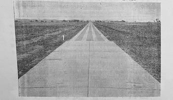
As the Manchukuo government gradually solidified its political control, it embarked on the further construction of highways for military expansion and industrial development. Japanese technocrats tightened regulations over horse carts on these newly paved roads and eventually sought to replace them with automobiles.Footnote 113 The earliest highway in Manchukuo, built from July 1933 to June 1935, connected Xinjing to Jilin and shrank the travel time between these cities to a mere three hours, roughly the same time if travelling on the railroad (Figure 8). Manchukuo engineers, particularly Yoneda Masafumi 米田正文 (1904–?) and Haraguchi Tadajirō 原口忠次郎 (1889–?), experimented with different paving methods by dividing this highway into 17 sections, each paved in a different style and to varying thicknesses, including macadam covered by coal tar, concrete, and simple macadam. As a national road of the first rank, it is highly likely that the use of horse carts was prohibited on this road, which is also borne out by the absence of flagstones in the paving materials used.Footnote 114 Similarly, when designing other highways in the later Manchukuo era, such as the Harbin-Dalian Highway and the Andong-Dadong Port Highway, Manchukuo technocrats paved such roads with concrete to facilitate automobile traffic and cordoned them off for the exclusive use of these vehicles.Footnote 115

Figure 8. Concrete paving in the Xinjing-Jilin Highway.
These newly built trans-urban highways constituted arteries of control. By banning horse carts from using them, Manchukuo technocrats forced Chinese subjects to abandon their familiar transportation methods by shrinking the spaces that horse cart drivers could access and forcing merchants to use new systems comprising automobiles and railways. Before 1932, Mantetsu had tolerated horse carts as relics of an earlier system that were needed to divert people and goods from watercourses to railways. The concentration of political control in the Manchukuo government gave Japanese technocrats more freedom to further shape the landscape of transportation and allowed them to gradually replace Chinese horse carts with automobiles. Promoting automobiles in turn enabled Japanese officials to develop imperial capitalist interests by setting up special Japanese-operated companies to replace pre-existing Chinese ones, thereby turning the operation of automobiles into an industry monopolized by Japanese agents.Footnote 116 In short, highways became sites where the agendas of Japanese capital overpowered local Chinese preferences and concerns.
Erasing traces of local knowledge
Japanese technocrats not only marginalized Chinese business interests, they also neglected to acknowledge their absorption of local knowledge and skills from various contexts. Their discourses on technical expertise identified nature as the main (if not the only) fount of their expertise. In a speech to Japanese civil engineers in Manchuria, Hirayama Fukujirō 平山復二郎 (1888–1962), then chair of the Association of Manchurian Civil Engineering (Manshū doboku gakkai), depicted civil engineers as those who worked with nature and whose technical knowledge originated from natural phenomena. Engineers, he asserted, stood separate from political influence or social practices; they only worked with nature-tested facts:
Nature is really honest. As long as the possible reasons and preconditions are provided, all phenomena and movements will unfailingly take place, either simultaneously or sequentially. Yet, no matter how great an individual, it is impossible for him to perceive the full scope of every connection that occurs between all phenomena. Moreover, because we each have our limitations, chances are that we will follow a thought against facts, or fail to consider certain matters.
In summary, as civil engineers, our job is to actively work on nature in order to produce artefacts. From the point of view mentioned above, rather than considering our own ideas in humble yet self-conceited fashion, I believe we must strive to always test our ideas through practices and to clarify whether these ideas are right or wrong. Then, if the results of our practices do show that our previous ideas are wrong, we must have the courage to revise those ideas. Regardless, in doing a job where nature is the other party, none of the following [ills], whether power, or threat, or deception, could ever affect [our work]. Without doubt, any lie would ultimately come to light.Footnote 117
In his writing, Hirayama chose not to acknowledge the social aspects of engineers’ work, especially how they learned from local practices and absorbed vernacular skills. Instead, he celebrated engineers as working with nature to transform and manage society.Footnote 118 Similarly, concrete highways left little space for horse carts; Manchukuo technocrats also aspired to remove themselves from their social context and to portray their knowledge as universal instead of place-specific. Hirayama’s identification of engineers as those who worked with ‘honest’ nature emphasized his belief that technocrats differed from other politicians. He presented the former as a more rational group better suited to rule society because their opinions and ideas were not swayed by political or social bias but underwent testing and correction by nature. In omitting to mention engineers’ relations with local knowledge, he helped to advocate the rule of experts.Footnote 119
From flagstone paving to concrete highways, the rising number of paved roads in Manchuria documented the evolution of Japanese colonial institutions’ attitudes towards local society. After 1932, Japanese engineers built roads to transform, rather than to accommodate, the pre-existing transportation system that had been woven together by horse carts. By hastening the transition from horse carts to automobiles, they aimed to facilitate the traffic of military vehicles, promote Japanese business interests, and increase Japan’s control over Manchukuo.
Conclusion
Paving materials embodied the influence of local knowledges and practices on Japanese infrastructure projects. Users of roads in the railway zone, especially drivers of horse carts, not only redefined the meaning of the roads they travelled on—more importantly, they also shaped the contours and forms of these transportation routes. Relying on horse carts to ferry soybeans from Manchuria’s hinterland to railway stations, Mantetsu built roads with materials such as granite flagstones to reduce maintenance costs and smooth the passage of carts. When building flagstone roads, the company also directly or indirectly relied on the skills of stonemasons, mostly Chinese, and the physical strength of manual labourers. Local knowledge held by skilled workers and users was grafted onto the technical expertise of Mantetsu engineers to form a hybridity that birthed Manchuria’s landscape of flagstone roads, so distinct from those in Japan’s home islands or cities in other parts of China.
In the Manchukuo era, the switch from paving with flagstones to concrete shows a significant shift in Japanese engineers’ relationship with local practices. Concrete highways for automobiles that excluded horse carts testified to the ever-tightening grip of Japanese technocrats and the Kwantung Army over Manchuria, as these roads aimed to serve the needs of the military and Japanese capital. Moreover, Japanese technocrats intentionally neglected the importance of local knowledge in enabling their work. Instead of seeing their expertise as the product of interacting and negotiating with local environments, technocrats such as Hirayama Fukujirō depicted engineers as representatives of nature whose knowledge stemmed from interactions with an abstract physical environment that was rational, universal, and placeless. As a consequence, Manchukuo technocrats left little space, both practical and discursive, for recognizing the influence of local practices.
Infrastructure projects allowed Mantetsu engineers and Manchukuo technocrats to shape Manchuria’s landscape. Building flagstone roads extended Mantetsu’s economic influence over its neighbouring regions, since paved roads and railway stations as their destinations became necessities for Chinese merchants and local residents. The increasing traffic of horse carts in railway zones further enabled Mantetsu officials to extend their economic and political control over a larger community of merchants beyond the company’s territorial boundaries. Furthermore, Mantetsu’s flagstone paving is likely to have influenced Chinese administrations’ urban planning, leading them to adopt and adapt flagstone roads as a standard of a city’s modernity.
Even today, one may easily detect the traces of Japan’s imperial influence in northeast China by walking the streets of the former railway zone. Despite the region’s accelerating urbanization since the 1980s, the contours of many streets installed by Mantetsu and, later, Manchukuo remain the same. With a 1935 map of Shinkyō, for instance, visitors would still be able to navigate contemporary Changchun. Even though streets previously named by Japanese officials were renamed by Chinese governments after 1945, with some parts repaved or paved over with asphalt to accommodate newer generations of automobiles, the shape of most roads rarely changed. This demonstrates the lasting influence of infrastructure projects in creating social and spatial relations. It is easy to see Chinese roads as the mere physical materialization of Japanese political intentions, but, as examined above, the history of road paving in the first half of the twentieth century in fact illustrates that roads are better viewed as both spaces of hybrid knowledge and tools for imperial interference. While the meanings they hold may not be set in stone, the various materials used to pave streets in contemporary northeast China still document a complex historical process of negotiation, accommodation, appropriation, and erasure.
Acknowledgements
Yuting Dong is currently working at the University of Chicago. She is grateful for the generous comments and support offered by the reviewers and editors of Modern Asian Studies.
Competing interests
None.

 Open access