

Crossref Citations
This article has been cited by the following publications. This list is generated based on data provided by Crossref.
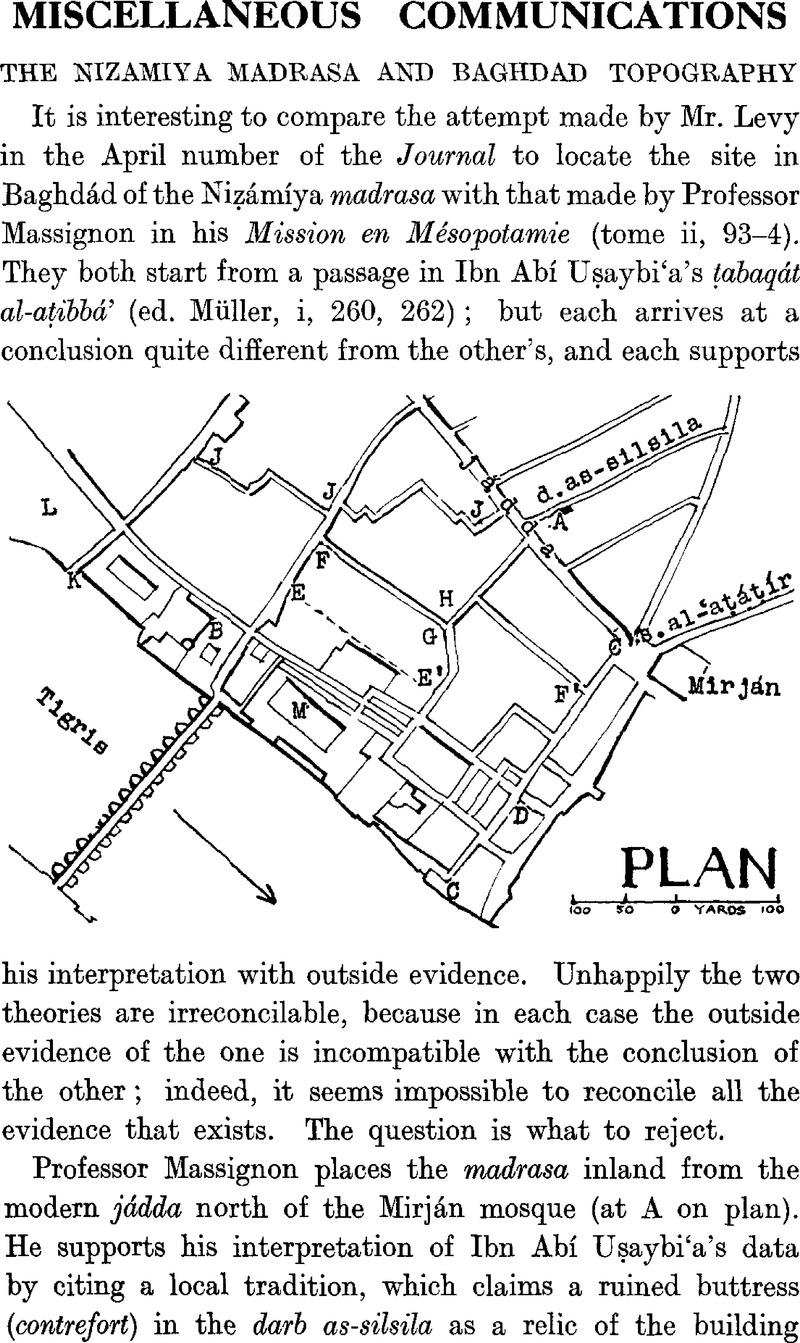
Makdisi, George
1961.
Muslim institutions of learning in eleventh-century Baghdad.
Bulletin of the School of Oriental and African Studies,
Vol. 24,
Issue. 1,
p.
1.