


Introduction
The British Ruwenzori Expedition, 1952, was led by Professor W. Q. Kennedy, of Leeds University, and collaborated with a Belgian expedition which was visiting Ruwenzori at the same time. Its main object was geological. As glaciologist of the expedition I remained for six weeks in the high parts of the mountain massif, studying in particular the recent glaciation there. I examined the glaciers both on the Congo side (in company with Dr. J. de Heinzelin, of Brussels) and—in more detail—on the Uganda side, with the help of Mr. I. R. Menzies, of Luanshya, Northern Rhodesia.
For a short distance Ruwenzori is the natural boundary between Uganda and the Belgian Congo (Fig. 1, p. 471). The mountain chain is about 120 km. long, lying in a north-north-east to south-south-west direction, and 50 km. wide at the southern end where it reaches the Equator. It rises very steeply from the savannas and equatorial forests of the lowlands to purely alpine regions. The highest peak is Margherita, 5119 m. (Fig. 2, p. 468).

Fig. 1. Equatorial East Africa. Ruwenzori, orientated NNE., forms, for a short distance, the boundary between Uganda and the Belgian Congo. The mountain chain is about 120 km. long and reaches the Equator at its southern end. The latest information gives’ the height of Margherita as 5119 m.

Fig. 2 Margherita (5119 m.), the highest peak of Ruwenzori. In the, foreground, the Stanley Plateau
Ruwenzori is built mainly of pre-Cambrian gneisses, migmatites, metamorphic shales and amphibolites with a complex geological history. (By contrast, the other two glacier-covered mountains in Africa—Kenya and Kilimanjaro—are both volcanoes.) Opinions differ as to when uplift began.Reference Johnson and McConnell 1 Judging by the terraces and ledges in the valleys, it seems to have been intermittent, and is probably still proceeding.
Pleistocene Glaciation
The sharp sculpture in the peak regions of Ruwenzori and the profiles of many of its valleys are largely due to earlier glacierziations. The climate and vegetation make the finding and analysis of glacial deposits very difficult. At the foot of Ruwenzori great deposits of glaciofluvial material (containing boulders up to
Our present knowledge of Ruwenzori’s Quaternary geology only allows the plotting of very approximate boundaries of the Ice Age glaciation (Fig. 3, p. 471). This is supplemented by aerial photographs, on which a few formations are discernible; by the numerous glacially eroded “rock basin” lakes marked on the available maps; and by the level at which the Ice Age glaciers built up their terminal moraines (about 2000 m. above sea level on the Uganda side compared with 4400 m. above sea level where the present glaciers end). Boulders measuring more than

Fig. 3. Map of the central area of Ruwenzori showing the present glaciers (dotted lines) and the approximate boundary of the maximum Ice Age glaciation. The Ice Age glaciers generally consisted of networks of ice streams, and the area within the boundary line was accordingly not all covered by ice
On the Congo side, no traces of moraines have been found below about 3800 m. above sea level, though most of the valleys at lower levels remain to be examined. The general impression, however, is that glacier cover was not as extensive as on the eastern flank of Ruwenzori.
The extant moraine walls show that the retreat of the glaciers was not uninterrupted. Recession from the outermost terminal moraines appears to have been slow at first, and was broken by two—or possibly three—halts resulting in the formation of moraines. Later it was more rapid, and the glaciers withdrew until, judging by their terminal moraines, they cannot have been much larger, and were probably even smaller, than at present (Fig. 4, p. 468). At some later date, the climate changed, the glaciers advanced and more moraines were formed. There are at least four, possibly five, Pleistocene terminal moraine belts, of which some at least include minor halts or re-advances.

Fig. 4 The melt area of the Stanley Glacier in 1932. In 1952 the front part of the glacier was hidden by the cliff in the foreground. Successive white lines indicate from the left: the last ontal moraine built Moraine; up by the Pleistocene glacier probably before this thawed completely; the Late-glacial the maximum post-glacial extension of the recent glacier tongue; the outermost but one of the recent terminal moraines; the position of the glacier front in about 1900
The relative distances between the several moraine belts and their respective altitudes above the sea vary much in different parts of the mountain chain. One reason for this is the unequal accumulation areas from which the glacier tongues flow. The probable difference in the extent of glaciation on the eastern and western flanks of Ruwenzori could be due to the same cause. On the steep Congo side the topography does not favour the formation of any really large ice stream systems.
The Present Glaciers
The very steep slopes of the highest parts of Ruwenzori, and the altitude of the present glacierization limit there (about 4600 m.), thus preclude the possibility of any more comprehensive recent glacierization. (At lower levels the topographical conditions would be more favourable for glacier formation.) There are to-day some forty glaciers in the massif. All are small, and together hardly cover more than 10 km.2. From the available maps, the present extent of ice-cover can only be roughly estimated.
There are glaciers on the six highest peak complexes: Mt. Stanley, 5119 m., Mt. Speke, 4914 m., Mt. Baker, 4873 m., Mt. Emin, 4802 m., Mt. Gessi, 4769 m., and Mt. Luigi di Savoia, 4665 m. (Fig. 3). The first two have the largest accumulation of ice and firn, in the form of relatively large ice caps which are the accumulation areas of steeply dropping glacier tongues (Fig. 5a and 5b, p. 468). The Ruwenzori glaciers are almost all either valley glaciers or transitional between valley and hanging glaciers.

Fig. 5a Mt. Speke from the west

Fig. 5b The eastern glacier tongues of the Stanley Plateau. Margherita in the background
Circumstances compelled us to restrict our investigations mainly to Mt. Stanley. Here there are about ten glaciers. The firn areas of seven of them are on or in contact with the Stanley Plateau, which lies immediately to the south of the highest peak, Margherita (Fig. 2). This relatively large firn area, the western part of which is nearly 4800 m. above sea level, slopes steeply to the east, and divides at about 4650 m. into three separate glacier tongues. The firn areas of the other outlet glaciers from the Stanley Plateau—the Elena, Mobius, South-West and West Stanley Glaciers—are not on the plateau and they may be regarded as isolated units. Of these, the West Stanley Glacier (on the Congo side) and the Elena Glacier (on the Uganda side) were studied for evidence of fluctuation.
Our main sources of information regarding the variations in size of the glaciers during their most recent history have been the records of expeditions since the Duke of the Abruzzi’s expedition of 1906 first succeeded in reaching the high parts of Ruwenzori.Reference Filippi 3, Reference Humphreys 4a, Reference Humphreys b, Reference Gnmne 5 These comprise somewhat general descriptions of the glaciers, accompanied by more or less diagrammatic maps, and photographs. The latter were particularly useful for our purpose.
Post-Glacial Fluctuations
(a) The lake site evidence
Following Nilsson’s conclusionReference Nilsson 2 that variations in glacier size and in lake levels are synchronous changes, we studied shore lines and sections at three lake sites (one of which is still a lake) at about 4000 m. above sea level. Pits dug at the lake sites revealed stratification, sand and partly varved clay alternating with layers of vegetation made up of fragments of tree trunks, branches and leaves. The sequence of these layers was on the whole the same at the three sites.
At the still existing lake we found, 70 cm. below the present water level, a well marked vegetation layer about 45 cm. thick, containing tree-trunk fragments (notably Senecio and Alchemilletum). Below this we found only clay to a depth of at least 75 cm., but above it were six more vegetation layers with intercalated beds of clay, varying from 10 to 20 cm. in thickness. On the lake side we found four shore lines, one very prominent at 80 cm. above present water level and three weakly developed at 55, 40 and 10 cm. respectively above present water level.
These facts give some indication of the development of the climate since the Ice Age, and may be interpreted as follows. The thick layer of clay at the bottom of the pit was formed during a long period when the lake had an ample water supply. A period of intense drought followed, reducing the surface of the lake to at least 115 cm. below its present level. At this time the 45 cm. layer was formed, in conditions substantially different from what they are now. This layer probably represents the extreme of the climatic change which terminated the Pleistocene glaciation. Subsequently dry and humid stages alternated relatively rapidly up to more recent times, when a markedly humid period supervened, represented by the 80 cm. shore line. The water level has since been falling, as indicated by the 55 and 40 cm. shore lines. The weakly developed 10-cm. shore line probably indicates the present high-water level.
The shore lines are not very old for they can be identified on boulders along the shore by three zones representing the different periods afforded for the immigration of lichens. Within these zones, lichens have not yet had time to form a close vegetation cover such as is found above the 80-cm. shore line.
From these facts we drew some tentative conclusions regarding the history of the Ruwenzori glaciers. Considering the small extent of the late-glacial ice masses, as shown by their terminal moraines (Fig. 4), it seems likely that they melted completely under the glacially unfavourable conditions apparently prevailing during the optimum phase of the climatic change which terminated the Pleistocene glaciation. If so, the present glaciers would be new formations resulting from a succeeding change of climate.
The upper strata at the lake-side pits suggest that, prior to their maximum post-glacial extension (represented by the 80-cm. shore line), the glaciers oscillated at least six times. Their present recession has been interrupted by two halts or brief advances marked by the 55-cm. and 40-cm. shore lines.
(b) The moraine evidence
With the means available it was impossible to find direct evidence of glacier fluctuation before the time of the maximum post-glacial extension. Our principal data on the variations in size of the glaciers since their maximum extension were the moraines, the state of the lichen cover on the rocks, and photographs.
The glacier tongues to-day terminate at about the 4400-m. level, but their moraines show that they formerly reached lower (Figs. 4 and 6, p. 468). That this was in the not distant past is shown by the stages of progressive colonization by lichens (mainly species of Umbilicaria and Rhizocarpon) of the areas freed of ice, which is still continuing. Four different zones can be distinguished in front of the Ruwenzori glaciers, their outer boundaries marking the limits of halts or major advances (Fig. 7, p. 471), and also bounded by moraines wherever the topography has permitted moraines to form. These lichen zones were studied on rock faces and on boulders and stones, since finer materials seemed to offer different conditions for immigration, and even variations in the nature of the rock in the melt area may apparently modify the growth of lichens.

Fig. 6 The western Stanley Glacier from Camp Lac Gris (4300 m.). Below the ice a light-coloured zone is seen in which no lichens are yet macroscopically visible; its outer boundary marks the position of the glacier about 1930

Fig. 7. Diagrammatic sketch showing the formation of lichen zones in front of a glacier. The dark outermost zone marks the area that has probably never been covered by recent glaciers. The innermost zone represents that part of the melt area in which no lichens have yet become macroscopically visible; cf Fig. 6, p. 468
The first direct evidence of the age of this zonation is from photographs taken on the Uganda side of Ruwenzori by the Duke of the Abruzzi’s 1906 expedition,Reference Filippi 3 and on the Congo side by the 1932 Belgian expedition.Reference Gnmne 5 From detailed examination of these it appears that in 1906 the Uganda glaciers were almost touching the outer boundary of the innermost zone but one, and in 1932 the Congo glaciers were close to the outer boundary of the innermost zone. As the zones have the same appearance on both sides of Ruwenzori, they may be correlated with reasonable certainty. It is probable, then, that the two inner moraines—and the outer boundaries of the two innermost zones—show how far the glaciers extended about the years 1900 and 1930 respectively.
The two outer moraines and zones cannot be definitely dated, but a comparison with similar investigations in Norway and Sweden suggests that these extreme positions were occupied a little later in Ruwenzori. This is inferred from the fact that lichens immigrate and establish themselves more rapidly in Ruwenzori than in northern countries. In Sweden, the formation of the innermost zone of lichen colonization was initiated about 1900; thus the 1930 position is not a zone boundary, although in some places it is marked by a moraine. Here two major advances occurred about 1740 and 1800.
The comparison with Norwegian and Swedish glaciers discloses another difference: that the recession of the glacier fronts has been greatest since 1900 in Scandinavia, but in Ruwenzori before that year.Reference Bergström 6 , Reference Bergström 7 The front of the Elena Glacier, 0.2 km.2 (Fig. 8, p. 471), has receded
| about | 50 m. | between the outermost moraine and the outermost-but-one |
| ” | 350 m. | from the outermost-but-one moraine to 1900 |
| ” | 100 m. | between two and 1920 |
| ” | 100 m. | since 1930. |

Fig. 8. The Elena Glacier showing the present ice margin and, to the right, the moraines
The last two values cannot be considered as typical, for since about 1900 the glacier tongue has been receding up a steep ravine. The retreat of other Ruwenzori glaciers has been less between 1900 and 1930 than since 1930.
The number of lichen zones found at the lake sites corresponds with that at the glaciers, except that the 1930 position could not be identified either as a shore line or as a distinctive zone boundary. The reason for this is probably that this halt (which is also comparatively faintly marked at the glaciers) did not last long enough for the water line to leave any permanent impression.
There are indications that some of the Ruwenzori glaciers have been advancing in the last few years. In small pools of water 5 m. in front of the Elena Glacier we found a large number of dead worms, whereas live worms were observed in pools 15 m. or 20 m. from the ice front. It is difficult to ascribe their death to any other cause than the advance of the ice altering their habitat. Observations made by Mr. H. A. Osmaston in August 1953 (using fixed points put out in 1952) indicated that the front of the Elena Glacier had advanced at least 2 m., while the eastern flank of the tongue had receded about 4 m.
The Economy of the Elena Glacier
As part of our study of the factors affecting the changes of volume of the glaciers, the material economy or “budget” of the Elena Glacier, on the eastern flank of Mt. Stanley, was computed, in conjunction with meteorological observations from 20 July to 14 August 1952 recorded below. It was found to be negative up to the beginning of August, and then positive until the end of the observation period. This may indicate that ablation was giving way to accumulation about the time our observations were made. In June and July ablation predominated, as indicated by a layer of dirt about 2 cm. thick on the glacier surface.
Several similar dirt layers were observed in crevasses (Fig. 9, p. 468). To make a more detailed examination of these, and of the firn in general, we dug four pits at different levels in the firn area. These showed that the firn was stratified; besides the dirt layers, which were alternately thick and thin, there were ice crusts and layers of firn of varying grain size (Fig. 10, p. 475). The sequence was practically the same in all the pits. The layers of dirt, coarse-grained firn and ice indicated melts, while the intermediate fine-grained firn was relatively unaffected by ablation.

Fig. 9 Crevasse with two well-marked dirt bands representing June-July ablation periods. The firn between them is one year’s accumulation surplus. Just below the upper dirt band is one less distinctly marked which represents the comparatively weak ablation period probably occurring in January and February

Fig. 10. Firn profile in a pit in the Elena Glacier showing the specific gravities
A rain gauge at about 4000 m. above sea level has recorded low precipitation values in January and February (no information is available for December) and in June and July.Reference Osmaston 8 This is borne out by the records of permanent meteorological stations in the immediate vicinity of Ruwenzori. 9 The two maxima and two minima characterizing this periodicity readily fit the observed firn profiles on the Elena Glacier, the thick dirt layers being formed in June and July and the less marked layers in January and February and possibly also in December. It must be remembered that snowfalls have been recorded in the upper parts of Ruwenzori in every month of the year; melting probably also occurs every month. To speak of accumulation and ablation periods thus merely means that the budget is mainly positive in the one and negative in the other.
While our budget studies were too meagre for any general conclusions to be drawn, they possibly justify our pointing out some tendencies in the conditions governing ablation and accumulation.
In Fig. 11 (p. 475), Curve I is based on observations made by Mr. Menzies in December 1953. It clearly shows the accumulation increasing with altitude. In Fig. 12 (p. 475), Curve I (for the accumulation period 5–14 August 1952) shows no such increase with altitude, the precipitation being fairly evenly distributed. Though the period of observation is limited, the facts are consistent with the interpretation that the surplus accumulation tends to increase from 4450 m. up to 4650 m., and then to diminish at higher altitudes.

Fig. 11. Economy of the Elena Glacier
-
I. Accumulation surplus about August—early December 1953
-
II. Accumulation surplus in budget year 1951–52 (August–August)
-
III. Accumulation surplus in the first half of the budget year 1951–52
-
IV. Accumulation surplus in the second half of the budget year 1951–52

Fig. 12
-
Curve I. Accumulation surplus 5–14 August 1952
-
Curve II. Ablation 1–5 August 1952
-
Curve III. Ablation 22 July–5 August 1952
If we now consider the ablation curves in Fig. 12 (Curves II and III, covering the earlier part of our observation period) we find that ablation tends to diminish from the glacier tongue up to 4650 m., where it begins to increase. Thus ablation seems to be greatest at lower and at higher altitudes, which perhaps explains the decreasing surplus of accumulation above the 4650 m. level indicated by Curve I in Fig. 12. The view that ablation increases above 4650 m. is also supported by Curves II, III and IV in Fig. 11, showing accumulation surpluses for the budget year 1951–52. It should be remembered that normal ablation curves in higher latitudes show the ablation decreasing fairly rapidly with increasing altitude.Reference Ahlmann 10
We were unable to determine the relative values of meteorological factors and of radiation in ablation. However, with the possible exception of evaporation, the meteorological factors were obviously of small importance to the ablation, especially at higher altitudes, where everything pointed to radiation being the principal agent. This may explain the observed tendency for the ablation to increase above about 4650 m.
The run-off from the Ruwenzori glaciers is insignificant. Often we could only find small rills, and apparently very little melted firn and ice is drawn off. Most of it seems to freeze again, as we found re-frozen melt water both on the surface of and beneath the glaciers.
The time available in the field, and the physical difficulties of carrying out scientific study in such an environment, led to severe curtailment of the projected scope of our glaciological studies. It is hoped that enough has been accomplished to encourage further studies that will lead to closer long-distance correlation of climatic fluctuations.
A Note on the Meteorological Observations
Meteorological conditions on Ruwenzori are practically unrecorded except for a few rain gauges. The gauge at about 4000 m., mentioned above, records an annual precipitation of about 1700 mm.
The longest of our series of meteorological observations covers the period 20 July to 6 August 1952. The instruments were mounted at our camp, about 50 m. from the edge of the Elena Glacier, 4500 m. above sea level.
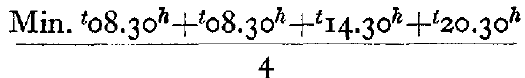
Temperatures were read on an Assmann psychrometer and on maximum and minimum thermometers. Observations were taken at 08.30, 14.30 and 20.30 hrs., local time. The mean diurnal temperature was calculated from the formula
Having no cage for our thermometers, they were suspended on a wooden cross 100 cm. above theground, and the maximum thermometer may therefore have been affected by direct solar radiation.
The warmest day of the period was 27 July, when the mean temperature was +0.1° C. The highest temperature reading was +9.7° C. on 3 August at 20.30 hrs., but that value is in all probability too high. The lowest temperature was −6.7° C. at 08.30 hrs. on 2 August (Fig. 13, p. 475). On one of the days between 8 and 12 August, however, the minimum thermometer registered −11° C.

Fig. 13. Maximum, minimum and mean temperatures in the period 20 July–6 August 1952

Fig. 14 Above: Cloudiness in tenths in the period 20 July–6 August 1952, and Below: Relation of daily mean cloudiness to incoming radiation in the period 24 July–6 August 1952
The relative humidity varied from 71 per Cent to 98 per cent.
On most days the cloudiness was between nine- and ten-tenths (Fig. 14, p. 475, top). Clouds of stratus type were most common.
The barometer readings were practically constant throughout our stay in Ruwenzori. Their maximum amplitude was 5 mm. Hg.
Easterly winds predomInated, but in the evenings and at night a westerly catabatic wind was blowing. The wind strength never exceeded 5 m./sec., however, and its mean value for the whole period was 0.9 m./sec.
At this altitude the precipitation, aggregating 31 mm. H2O in the period, was invariably in solid form. The precipitation-carrying clouds rose only exceptionally above 4300 m. However, 65 per cent of the observations had to be taken in dense fog. It may be mentioned that the snowfall from 7 to 14 August amounted to 32 mm. H2O.
Clear weather seemed more frequent in the upper parts of the Stanley massif, above about 4700 m., than at our camp. Sometimes we could see relatively strong local winds radiating from the firn surface of the Stanley Plateau. These winds appeared to dissolve or hold back the masses of cloud rising from the valleys, thus improving the weather conditions on the Plateau.
Incoming radiation was astonishingly low, an average of 172 cal./cm.2 per day being observed at our camp. The lowest value, 61 cal./cm.2, was observed on 28 July. The maximum was 338 cal./cm.2 per day. From Fig. 14 (bottom) it will be seen that the average cloudiness, in tenths, agrees well with the incoming radiation.


