Introduction
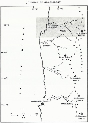
Until the late 1960s, Quaternary events in ihe sub-tropical Chilean Andes were mainly known through the accurate but scattered field observations reported in the pioneer works of Reference BruggenBruggen (1928,1950). Recently, more detailed data were collected by the authors in the upper basin of the Rio Elqui (Reference PaskoffPaskoff, 1970), located at the southern edge of the Atacama desert at lat. 30°S., and along the upper course of the Rio Aconcagua (Reference CaviedesCaviedes, 1972[a]) at the northern boundary of the Mediterranean strip of central Chile at lat. 33°S. (Fig, 1). The remarkable similarities presented by the glacial modelling of the two basins encouraged the authors to combine the results of their independent investigations and to propose a climaticgeomorphic model that would explain the extent and the character of the Quaternary glaciations in the Andes of north-central Chile.

The Physical Setting and the Present Glaciation
The Elqui Cordillera is about 60 km wide from east to west and occupies more than 6 000 km2. The summits rise up to 5000 m; the two highest points in this area even exceed 6000 m. The massive relief is interrupted only by a few valleys which generally run north-south or north-west-south-cast; they are wide and allow easy access to the foot of the impressive mountain wall which forms the divide between the main slopes of the Andes. There is no frontier pass to Argentina lower than 4000 m.
The massive nature of the Andes continues south to lat. 33°S., where the upper Aconcagua valley drains a compact mountain body which is not wider than 50km and which covers an area of about 1000 km2. The rather flat summits are arranged from east to west in different levels of decreasing altitude. Near the Argentine border, a chain of isolated peaks around 5000 m high rises above the rest of the Cordillera. The valleys are deep and display abundant evidence of recent glacial shaping.
Precipitation varies greatly from north to south; while there are only 200–300 mm of rainfall per year in the Elqui Cordillera (Reference SchneiderSchneider, 1969), up to 1000 mm can be registered in the uppermost part of the Aconcagua valley during exceptionally humid years. On the other hand, the irregularity of annual precipitation is strongly marked, as is the rule in a semiarid Mediterranean area. Precipitation occurs mainly in the form of snow during the winter periods of stormy weather (from May to August in the Elqui valley, and from April to October in the upper Aconcagua valley). These are caused by episodic depressions associated with northward advances of the polar front in the South Pacific (Reference WhittackerWhittackcr, 1943; Reference Caviedes and AguilaCavicdcs and Aguila, 1969; Reference SchneiderSchneider, 1971). In the dry air and under a generally strikingly blue sky, temperatures are closely related to solar radiation. As a consequence, diurnal temperatures have a range of 20 deg or more throughout the year, which results in almost daily alternations of freezing and thawing. This causes intense frost shattering of the exposed rocks, and so thick talus slopes have developed above 3000 m in the Elqui valley and above 2000 m in the Aconcagua valley. Good examples of stone pavements and patterned ground can also be found. Despite the effects of current periglacial processes related to present climatic conditions, the semi-arid Chilean Andes essentially exhibit a glacial type of modelling.
Throughout the high Andes of semi-arid Chile, cirques and U-shaped valleys represent the main erosional forms. Rock thresholds and valley widenings filled with outwash materials often characterize the uppermost reaches of the glacial troughs. There are all types of glacial accumulation: large lateral moraines which resemble long embankments at the foot of rockywalls, ablation moraines which produce the typical hummocky topography of the valley bottoms, and terminal moraines which sometimes display the classical crescentic loop shape.
In contrast to the widespread and distinctive alpine-type topography, the present glaciation has a very limited extent. In the Elqui Cordillera, near the Argentine border, there is only one small hanging residual glacier perched above the Rio Laguna valley (Fig. 2). The firn line lies between 5000 and 5500 m (Reference LiboutryLliboutry, 1956), and even névé patches exist only in south- and south-east-facing cirques. Nevertheless, rock glaciers are well developed above 4500 m; they are similar to those described from the Turkistan mountains (Reference KlebelsbergKlebelsberg, 1948–49), Alaska (Reference CoxWahrhaftig and Cox, 1959) and the western United States (Reference Outcalt and BenedictOutcalt and Benedict, 1965; Reference Blagbrough and FarkasBlagbrough and Farkas, 1968; Reference Shroder, Adams and HelleinerShroder, [c1972]). In the Aconcagua Andes, however, with the firn line at 4200 m, debris-free alpine glaciers, such as Juncal Norte and Río Plomo glaciers, descend to approximately 3000 m (Reference Wilgat and WojciechowskiWilgat and Wojciechowski, 1971). Rock and mud glaciers are normally found in the valley heads above 4000 m.

Fig. 2. The summit of El Tapado mountain (5124 m) with a hanging residual glacier and ablation moraines where the glacier ends.
The Former Glaciations
A. The upper Elqui valley
The Elqui Cordillera comprises the basin drained by the two main branches of the Rio Elqui: the Rio Turbio, formed by the confluence of the Rio Laguna and Rio Toro, and the Rio Claro, fed by an important tributary, the Rio Cochiguas (Fig. 3). At the present time, this part of the Chilean Andes is characterized by a periglacial morphogenesis typical of a dry high-mountain area. During the Quaternary, however, the Elqui Cordillera was considerably affected by the geomorphic action of ice, which left a widespread and conspicuous glacial topography marked by cirques, U-shaped valleys and morainic deposits (Reference BruggenBrüggen, 1928,1950; Reference MortensenMortensen, 1928; Reference PaskoffPaskoff, 1967[a],[b],1970,1972; Reference WeischelWeischet, 1969). In order to determine the number and character of the glaciations of the Elqui Cordillera, the Rio Laguna valley and its down-stream continuation, the Rio Turbio valley, were thoroughly surveyed.

Fig. 3. The Rio Elqui basin. The solid and hatched arrows show the extents of the last (Laguna) and penultimate (Tapado) glaciations, respectively. The Vicuña fault separates the upper and lower Elqui Cordillera.
The Laguna glaciation
At about 3 100 m, the Rio Laguna valley is dammed by a large and well-preserved end moraine (Fig. 4) in which two main arcuate walls are clearly marked; they are about 150 m high and separated from one another by a kame terrace. The matrix of the till is variegated; violet-brown is the dominant color. In the grain-size group between 300 and 500 μm, angular feldspars are the most abundant minerals. The matrix contains angular pebbles (median of Cailleux’s roundness index for a sample of 33 pebbles: 43) mainly of a volcanic origin. Exposures reveal an arrangement of polychromatic bundles which seem to be pushed one over the other, so that elongated or ribboned violet, yellowish or bluish streaks are shown. The deposit is loose and not chemically weathered. The youth of the morainic accumulation, already suggested by its well-preserved topographic forms, is confirmed by the analysis of heavy minerals in the grain-size interval between 50 and 500 μm, where fragile minerals, such as olivine, show no sign of alteration. Brown augite, green hornblende, epidote, garnet and quartz are also present.

Fig. 4. At La Laguna the river has cut a deep gorge through the morainic plug.
The weak stratification and poor sorting of the outwash materials suggest a sudden fluvio-glacial discharge during which the load was transported without selection and deposited in bulk. The river then began to cut through its own accumulation, thus creating a terrace. The present extended flood plain, which is strewn with disproportionately large boulders and characterized by braided systems, is the consequence of lateral erosion which is more effective than down-cutting at the present time.
Because of the distinctiveness of its forms and the youth of its deposits, the Laguna end moraine must be attributed to the latest major ice advance in the Southern Hemisphere. At that time, a glacier about 40 km long occupied the Rio Laguna valley which is a typical trough except for a short stretch just up-stream of its junction with the Quebrada Sin Fin. The characteristic U-shaped valley, which has scarcely been obliterated by the effects of current periglacial processes, displays many striking features of glacial modelling such as hanging tributary valleys, several short gorges cut into rock thresholds, a widening filled with outwash sediments and remnants of kame terraces. Many subsidiary glaciers from the high mountains converged to form the large glacier which occupied the Rio Laguna valley. In addition, the orientation of its upper course from north to south and then from east to west protected it from insolation and allowed it to descend down to 3 100 m, wasting shortly after the flow direction had turned northerly.
If it were assumed that the till accumulation found at the Laguna site was left by two short glaciers which flowed down the right wall of the valley, and that it was not built by a long glacier coming from up-stream, the Laguna moraine would be a barrier due to a supply of material from the valley side rather than an end moraine. However, there is much evidence supporting the assumption that the Laguna moraine was mainly accumulated by a longitudinal glacier. For instance, the above-mentioned glacial features of the valley up-stream of the Laguna site, as well as some granitic components in the till, suggest an allochthonous origin. Finally, if the valley was dammed by glacial material transported from the right wall, the breach would have occurred on the weaker left side where the barrier would have been lower, and not at the right side, as is the case. Hence we agree with Reference BruggenBrüggen (1928) in interpreting the Laguna moraine as a frontal accumulation from a main valley glacier.
The bulky end moraine of the Laguna site can be understood if it is assumed that the glacier snout was heavily loaded with materials as a consequence of an environment which was very conducive to effective frost-shattering. Since two separate arcuate walls are found in the Laguna accumulation, the terminal moraine was built up during the glacial maximum, which was probably marked by two stages. The ensuing warming-up period was undoubtedly fast. The outwash deposits point to a sudden melting caused by a rapid rise in temperature. During the Quaternary, volcanic activity was absent from the Rio Laguna basin. Thus the hypothesis of a catastrophic discharge linked with an eruptive episode must be excluded. In the continental and dry mountainous environment of the Aragon Pyrenees, Reference SeretSeret (1965) found a similar example of a sudden and powerful ice-melt flush which washed down morainic material from a glacial front. Another indication of rapid deglaciation may be found in the scarcity of till deposits up-stream of the Laguna terminal moraine.
The Tapado glaciation
At about 2 500 m, nearly 15km down-stream from the Laguna site, Reference BruggenBrüggen (1928) reported boulder clays plastered against the walls of the U-shaped Rio Laguna valley. They are exposed especially between the junction with the Quebrada Tapado and the confluence with the Rio Seco. The deposit was studied near the junction with the Quebrada Tapado tributary, on the left side of the Rio Laguna, where it formerly blocked the outlet of a small torrent. Field observations support the proposal by Brüggen that this deposit is of a glacial origin. The accumulation of boulder clay, almost 100 m in thickness, singularly recalls the polychromy and sedimentologic characteristics of the Laguna moraine, except for its much greater compactness. The heavy mineral content is also very similar to that of the sample from the Laguna site. However, alteration phenomena indicate that the Tapado accumulation is older. Fragile minerals such as pyroxenes have vanished and chemical decomposition has affected the amphiboles which are often chloritized. Weathered epidote and apatite as well as garnet are also present.
Just down-stream of the Tapado till exposure, remnants of an outwash terrace, partially concealed beneath talus slopes, appear at about 15 m above the younger terrace associated with the Laguna moraine; this is a further argument for the glacial origin of the boulder-clay formation.
The older glaciations
Along the Rio Turbio valley itself there is little evidence of ancient glaciations. For instance, a compact clastic formation occurs in the Quebrada Las Mercedes, an east-trending creek about 10km long which appears above the 3000 m level and joins the Rio Turbio 5km up-stream of Rivadavia. This deposit displays a glacial facies, but considering the latitude, its altitude of 1000 m seems too low for it to be considered a till. In a small tributary of the Rio Claro, just in front of Pisco Elqui, two exposures of poorly sorted and badly stratified sediments are noticeable at 1500 m and at 1700 m. Reference WeischelWeischet (1969) assumed that they were left by two separate ancient glaciations but we feel they are probably mud-flow products. Reference BruggenBrüggen (1950) described as glacial a Clastic formation in the Rio Turbio valley at 800 m, near Varillar, just up-stream of Rivadavia. However, the local origin of its constituents (they are composed of tonalite which crops out on the left wall of the valley) does not support this interpretation; the idea of a mud-flow deposit seems more appealing.
Finally, the best argument for older glaciations comes from indirect evidence gathered mainly to the west of the Elqui Cordillera, beyond the major north-trending Vicuña fault, where summits rarely exceed 3000 m. In this part of the Andes, the deterioration periods of the Quaternary climate were characterized by a fall in the average temperature and especially by an increase in precipitation which led to pluvial rather than to glacial morphoclimatic conditions. The lower relief features prevented permanent snow and ice formation. Consequently, during the spring ablation period, very active torrential processes occurred, favored both by the steepness of the slopes and by the fragility of fractured and weathered rocks. The counterpart of this erosion is found in the huge alluvial fans constructed by the steep tributary streams at their junctions with the main valleys, which were temporarily dammed up by the thick debris accumulations. Today, the alluvial fans are no longer active but are being deeply cut by periodic floods. The setting of different generations of alluvial fans, one constructed within another, indicates an alternation of pluvial periods (construction of fans)with arid periods (erosion of fans). The best example of this is found in the Rio Claro valley, between Mente Grande and Pisco Elqui, near the junction with the Rio Cochiguas. The successive alluvial fans are:
-
i The remnant of an ancient mud-flow accumulation, whose components are difficult to recognize because they are not well exposed.
-
ii A younger fan composed of tonalite pebbles and boulders mixed with coarse sand, also eroded, but still about 200 m high. Weathering is not noticeable.
-
iii A present fan perfectly preserved except for the entrenchment made by the current floods. Its constituents are very similar to those described above for its predecessor, although boulders are less numerous and coarse uncompacted sands are more abundant. Assuming that the construction of the recent fan is contemporaneous with the Laguna glaciation, and that the older fan can be correlated with the Tapado glaciation, then the oldest fan must have been built during an even earlier glaciation. What was the extent of this glaciation? Was it preceded by a still earlier glacial episode? All these questions need further investigation.
B. The upper Aconcagua valley
The location of the Aconcagua valley (Fig. 5) roughly coincides with the boundary between the semi-arid zone of the so-called “Norte Chico”, which may have periodic rains, and the temperate zone with heavy winter rainfall in the central part of the country. The mobility of the boundary between the semi-arid and sub-humid environments that prevailed during the Quaternary has been demonstrated not only by observing the features of the morphology but also by palaeobotanic discoveries (Reference PaskoffPaskoff, 1967[a]; Reference CaviedesCaviedes, 1972[b]; Reference PizarroPizarro, unpublished). Information about the glacial geomorphology of the valley was restricted to a few isolated remarks in the works of Reference BruggenBrüggen (1928,1946,1950) until Reference CaviedesCaviedes (1972[a]) carried out further detailed investigation in the valleys of the Juncalillo creek and the Aconcagua itself.

Fig. 5. The Rio Aconcagua basin. The arrows show the maximum extents of the pre-penullimale, penullimale and last glaciations. The Pocuro fault is east of Los Andes.
The Portillo glaciation
At Portillo, between 2900 and 2650 m, two glacial troughs converge and glacial deposits can be found at different levels in the valley bottom. Among them the most remarkable are two lateral moraines deposited on each side of the converging troughs, the exterior moraine being built of coarser and more cemented till than that of the interior one (Fig. 6). a closer look at the components of the lateral moraines reveals a layer of till in whose matrix pale biotite flakes, augite and slightly altered olivine crystals are present. The coarse material consists mainly of angular boulders of andesitic basalt, andesitic porphyry, tuff and breccia of a reddish color. Even though the mineralogy of the matrix and the debris contained in the till is similar for both lateral moraines, a greater amount of fine-grained particles in the matrix and the presence of a thin soil upon the exterior margin suggest that they belong to two different glacial episodes. Both lateral moraines are abruptly terminated at their down-stream ends; thus the remnants of the corresponding end moraines are completely lacking. It must be assumed that this occurred not only as a consequence of the post-glacial melting and erosion but also because of the rather violent increase in the steepness of the valley bottom down-stream of Portillo.

Fig. 6. The valley widening at Portillo (2850 m). The lateral moraines (I and II) and the boulder moraine (B M) which dams the Laguna del Inca are clearly visible. This view which was taken in spring shows the high snowfall received in this area under the present climatic conditions.
Other minor ice tongues were able to glide down the valley along the path determined by the lateral moraines. They left tiny morainic loops composed almost exclusively of unsorted angular boulders of andesite, basalt and red tuff, together with a small amount of fine material. The latter is composed mostly of montmorillonite clay with isolated inclusions of plagioclase, biotite, augite, olivine, alkali feldspar and quartz grains. Behind the small arcuate walls, the accumulation of outwash material and lacustrine deposits built up the flat surface of the llanos which appear repeatedly in the Portillo complex at 2900, 2 800 and 2650 m. Another remarkable form of the system is a sizeable boulder moraine at the level of the llano at 2 800 m, which dams the Laguna del Inca.
The Portillo system exhibits features that clearly belong to two distinct glacial phases. The huge lateral moraines were deposited during two major advances of the last glaciation, while the small arcuate loops, which are not compatible in size and sediments, are the testimony of minor glacial re-advances during the post-glacial period. a short but powerful advance deposited the huge boulder moraine that dammed the Laguna del Inca. Subsequently, glacio-fluvial material and lacustrine deposits filled the shallow pro-glacial lakes behind the loops, and the flat surfaces of the llanos appeared. 4 km down-stream of Portillo, at 2000 m, where the Ojos de Agua creek empties into the Rio Aconcagua, a hummocky feature damming an elongated llano occupies the valley bottom. Numerous exposures on the hummocks as well as in the llano itself reveal that both are composed of till which was covered either by glacio-fluvial sediments (as on the surface of the llano) or by a 15 cm deep soil overlying the hummocks. Beneath this thin soil cover, traces of cryoturbation and solifluction are very noticeable. These features, which were not found on top of any of the forms of the Portillo system, suggest that both the hummocky topography and the llano were built during a glacial phase previous to the Portillo glaciation.
The Guardia Vieja glaciation
16 km down-stream of Portillo, another group of forms caused by accumulation appears at Guardia Vieja (1 600 m). It consists of a broad arcuate wall rising about 135 m above the level of the Rio Aconcagua (Fig. 7); behind it, glacio-fluvial sands and gravels form the flat bottom of the llano of Guardia Vieja. The arcuate wall is definitely a terminal moraine composed of thick deposits of reddish till which contains grains of partially chloritized augite, altered olivine, weathered plagioclase, epidote and haematite particles. Small boulders and pebbles of andesite, andesitic porphyry, basalt or tuff, slightly smoothed, are irregularly distributed in this matrix. An alternation of silts, fine sands and pebbles on top of the till indicates several phases of glacio-fluvial outflow during deglaciation, while on the surface of the terminal moraine there is a mature organic soil without traces of solifluction or cryoturbation; this suggests that it was formed during the temperate climatic conditions of the Holocene. There is no terminal moraine of the dimensions and variety of components which characterize the Guardia Vieja complex elsewhere in the valley. The fluvio-glacial deposits and the presence of the soil, as well as the absence of periglacial traces, lead us to the conclusion that the main body of the Guardia Vieja arcuate loop was constructed by a maximal glacial stand notably older than those of Ojos de Agua and Portillo.

Fig. 7. The glacial trough of the upper Rio Aconcagua at Guardia Vieja (1 600 m). The river has incised itself deeply into the farmer morainic loop (arrows).
The Salto del Soldado glaciation
At Salto del Soldado (1 300 m), the Aconcagua valley narrows considerably. The rock ridge, through which the river has cut a sharp gorge, is nothing but the remnant of a still larger Riegel, which was dismantled by former phases of discharge and erosion. The fact that up-stream of here the valley is a perfect glacial trough, together with the discovery of glacial till in well-protected places behind the partially eroded former rock barrier, indicates that this was the final position of the oldest glacial advance down the upper Aconcagua valley.
The morainic material behind the rock barrier at Salto del Soldado consists of montmorillonite clays and fine silts, in which the commonest mineral grains are of quartz, plagioclase partially altered to sericite, completely chloritized pyroxene and haematite. The petrography of the boulders does not differ considerably from that of the Portillo lateral moraines or the terminal moraine of Guardia Vieja, suggesting that the material forming these moraines originated from the same area. The high degree of cohesiveness and the mineralogic alterations in some parts of the matrix indicate that these deposits are the oldest among those found in the upper Aconcagua. This is confirmed by the occurrence of the lowest pro-glacial outwash deposits in the valley, about 3km down-strearn of Salto del Soldado. They correspond to the Salto del Soldado glacial phase and are particularly noticeable in the form of fluvio-glacial sands, varves and fine gravels which crop out at Los Espinos.
Even though the lowest hints of glacial shaping and deposits occur only as far down-valley as Salto del Soldado, there is ample evidence below this locality for a cooler and more humid climate during the glacial advances. There are colluvial deposits at both sides of the valley bottom interspersed with flat and extended alluvial fans at places where a former subsidiary creek joined the valley. Both colluvial deposits and fans are totally indurated and erosion by the ephemeral swelling of the creeks during the periodic winter rains is the most important factor in their present morphogenesis.
A third form related to a more humid and cooler climate than the present one are the smooth slopes composed of layered scree that appear at about 1200 m in the upper Aconcagua valley. They are strikingly similar to those described by Reference WeischelWeischet (1969) from the Elqui valley and interpreted by him as evidence for periglacial modelling beyond the maximal extension of the Pleistocene glaciations.
Since slope colluvia, layered scree and flat alluvial fans require special conditions of soil humidity and slope wash during snow-melt periods for their formation, and because these forms are now indurated, we conclude that they were created in a periglacial environment under climatic conditions that were more humid than the present, probably during the cool moist periods affecting the Aconcagua Cordillera in the Quaternary.
The sequence of events during the Pleistocene
A survey of the traces left by the glaciations along the upper Aconcagua valley suggests that they descended to 1 300 m, following the deeply eroded valley of the Rio Aconcagua, and that they never extended beyond the outer limits of the Cordillera. Unlike other Andean valleys to the south, the Aconcagua valley was never affected by volcanic eruptions or by seismic-catastrophic events, so that each of the glacial accumulations in the valley can be attributed to a corresponding glacial episode without secondary alteration.
In the Juncalillo valley, the present forms of glaciation, small rock glaciers, mud-covered glaciers and dead-ice patches are located at about 4000 m, and deposits of the glaciation preceding the current episode occur at 2900 m in Portillo. Thus, the latter should be assigned to a glacial recurrence that took place just before the present. No chronological dating has ever been attempted for the north-central Chilean Cordillera; the only tentative way to date these forms is to fit the results of the geomorphological survey into the time-scale proposed by Reference HeusserHeusser (1966) and Reference MercerMercer (1972) for the Late and post-Glacial in southern Chile. Using palynological and l4C dating techniques, Heusser and Mercer established the existence of two main advances during the last glaciation: one at about 19000 years B.P. and the other at about 14 800 years B.P. We believe that these advances were responsible for the formation of the huge lateral moraines at Portillo. Three minor re-advances during the Holocene were responsible for the construction of the small arcuate loops, the boulder moraine and for the formation of the llanos. These stages have also been detected by Heusser and Mercer.
It follows that the glacial hills of Ojos de Agua, down-stream of Portillo, are testimony of a stadial phase of a glacier withdrawal from a maximal position at Guardia Vieja (1 600 m). Considering the Guardia Vieja system as being contemporaneous with the penultimate glaciation, the Ojos de Agua hills must be related to a stadial within the penultimate glaciation. Similarly, the traces of the glacial modelling and the sparse morainic deposits located in front of the Salto del Soldado barrier, at 1 300 m, are the remnants of the oldest glaciation that affected the upper Aconcagua valley.
The perfectly U-shaped valley and the polished trough walls that can be found from the valley head down to the Salto del Soldado site, together with the increasing proportion of fine weathered material in the till, lead us to believe that the earlier glaciations in the Aconcagua area were more powerful and the accompanying climate more humid than later. Similar characteristics of the younger glacial advances have been observed by Reference MercerMercer (1965,1970) in southern Argentina, and Reference KinzlKinzl (1968) and Reference ClappertonClapperton (1972) in the Andes of central Peru.
Main Results and Unsolved Problems
The solid evidence of Quaternary ice advances in the Andes of north-central Chile causes us to raise questions about (1) the morphogenetic effectiveness, (2) the climatic characteristics, and (3) the number of glaciations.
The morphogenetic effectiveness of glaciations
In the high Cordillera of semi-arid Chile there is a striking contrast between the limited extent of the present glaciation and the distinctiveness and scale of the glacial landforms which surround them. This contrast, which is especially conspicuous in this part of the Pacific side of the Andes, is explained by the latitudinal position (30–33°S.) of semi-arid Chile, which, during the cool humid periods of the Quaternary, was part of the rainy province of the territory. Therefore, the authors assume that ice streams—some tens of kilometers in length— appeared and deeply eroded the area. This powerful erosion was facilitated by structural conditions, as has already been stressed by Reference DollfusDollfus (unpublished) and Reference BordeBorde (1966); the predominant micro- and macro-fractured granitic and volcanic rocks lent themselves to effective glacial quarrying.
The climatic characteristics of the glaciations
The study of the meteorological conditions of particularly rainy years, such as 1963 and 1965, when the polar front shifted considerably farther north than normal, has proved to be very helpful in a reconstitution of the climatic pattern of this area during the cool humid periods of the Quaternary. In 1963 and 1965, heavy snow fell in the Cordillera and accumulated in cirques excavated by ice during earlier glaciations. In the Elqui mountains it remained until the end of spring and in the Aconcagua Cordillera it melted only on the arrival of summer. Very similar conditions probably prevailed during the Pleistocene cold periods. Preliminary studies conducted by Caviedes on humidity transport in different atmospheric layers show that, during the winter months, the amount of moisture carried from the sea towards the continent by the wind at levels of 850 mbar (±1500 m) and 700 mbar (±3 100 m is actually greater than below 1000 m. This is because the wind velocity in the upper layers of the atmosphere is usually between three and five times higher than that near the ground. Thus the summits of the coastal Cordillera above 1500 m receive a thick snow cover during the cyclonic-frontal disturbances in winter which may remain for weeks on the flat mountain tops, if the insolation rate is not excessive. Near the Rio Aconcagua valley, snowfields were observed on the summit of the Cerro Vizcachas (2043 m) and on the ridge of the Cordillera El Melón (2192 m) and these persisted until the beginning of spring in the especially rainy years of 1963 and 1965. All of these observations help us to understand the conditions of the increase in precipitation, mainly in the form of snow, associated with an equatorward shift of the polar front during the glaciations. Moreover, along the coastal fringe of semi-arid Chile, relict vegetation, for instance, the Fray Jorge forest at lat. 30° 15’ S., seems to indicate a marked migration of the Valdivian rain forest towards the tropics during the Quaternary. There are also rubified palaeosols very similar to the present red soils of humid Chile (Reference PaskoffPaskoff, 1970). The palaeontological discoveries of Reference HermHerm (1970) in the completely arid environment of northern Chile also suggest that the first cold period of the Quaternary was able to support at least a sparse vegetation cover.
These points strengthen the hypothesis that the Pleistocene glaciations in semi-arid Chile resulted in a northward shift of about 5–6 degrees of latitude of the austral polar front (Reference PaskoffPaskofF, 1967[a],[b]), combined with a displacement and also a weakening of the vast South Pacific anticyclonic cell. We can therefore account for the thermal cooling by the greater frequency of polar air flows which were able to affect sub-tropical latitudes because of the retreat of the tropical air. Related to this was an increase in precipitation, linked not only with more frequent disturbances but also with a more active cyclogenesis. The general observations of Reference HastenrathHastenrath (1967,1971 [a],[b]) on the Pleistocene snow-line depression in the Peruvian-Chilean Andes confirm this hypothesis, since they show that in the Pleistocene the boundary between middle-latitude westerlies and tropical easterlies was situated nearly 5 degrees equatorward from the present location of lat. 30°S. Consequently, during the Quaternary glaciations, the climate of semi-arid Chile was probably characterized by heavy precipitation, mainly in the form of snow above 1000 m, cold waves and reduced evaporation.
Finally, we must stress that in the high Cordillera of semi-arid Chile the Quaternary glaciations were linked with a decrease in temperature, but more significantly with a marked increase in precipitation which accounted for the ice extension. The reduced extent of the present glaciers is not due to thermal causes, since the altitude is sufficient to create a cold climate, but to a precipitation inadequate for the formation of ice. Under conditions of higher humidity, the glaciers would have expanded throughout the high Cordillera, whereas the middle Andean mountains to the west have been affected by a climatic regime of pluvionival type responsible for effective torrential erosion.
The number of glaciations
From the evidence mentioned above, we deduce that the high Cordillera of semi-arid Chile was undoubtedly affected by several glaciations during the Quaternary. The two youngest left distinct morainic forms and deposits as evidence of their former existence. Many other observations indicate that older glaciations also occurred, but their extent and number remain undetermined. These findings coincide with those of other geomorphologists who have recently surveyed the glacial features of central and south-central Chile (Reference WeischetWeischet, 1964; Reference BordeBorde, 1966; Reference LauerLauer, 1968; Reference HabbeHabbe, 1969; Reference LaugenieLaugénie, 1971).
The last glaciation was very likely contemporary with the Wisconsin-Würm glaciation of the Northern Hemisphere, if the research on absolute dating carried out in south-central Chile by Reference HeusserHeusser (1966) and Reference MercerMercer (1972) is taken into account. It was responsible for the Laguna end moraine at 3 100 m in the Elqui Cordillera, and also for the lateral moraines of the Portillo system in the Aconcagua valley. These moraines probably continued down-stream to a terminal accumulation which is assumed to have been constructed at the Llano de Juncal at 2200 m and then erased by post-glacial erosional processes. The two arcuate morainic walls at the Laguna site and the two lateral moraines near Portillo indicate the probability of two phases within the last major glaciation. Farther south, this last advance has also been clearly identified. In the Maipo River valley, a glacial tongue extended down to Los Queltehues at 1700 m (Reference BordeBorde, 1966) and in the Rio Cachapoal valley to El Manzanar at 1200 m, 40km down-stream of the present glacier front (Reference SantanaSantana, 1967). Near lat. 40°S., the last glaciation left terminal lobate loops, referred to by Reference WeischetWeischet (1964) as the “El Salto moraine”, which dammed the sub-Andean lakes. Radiocarbon dates obtained from wood samples found in this El Salto moraine near Lago Llanquihue, lat. 41°S., suggest that the last glacial maximum occurred between 1 6000 and 12000 years B.P. (Reference HeusserHeusser: 1966), although Reference MercerMercer (1972), in his more recent work, dated the main phase of the last glaciation at 19000 years B.P. and the second phase at 14800 years B.P.
The shrinkage of the ice from the final position reached during the second phase of the last glaciation was interrupted by a new advance of glaciers heavily loaded with coarse debris (“dark” glaciers and rock glaciers), probably related to a climatic oscillation mainly characterized by a decrease in temperatures. The long-dead rock glaciers in the mountains of the upper Elqui valley and the boulder accumulations in the Rio Aconcagua valley near Portillo at 2 800 m are evidence of a late glacial recurrence. In the Rio Maipo valley, Reference BordeBorde (1966) repotted the same event as the “Lo Valdés stage”, characterized by “glacio-solifluction flows” which have moved down short and steep tributary troughs and dammed the main valley. On the Argentine side of the central Andes, this late glacial advance has also been delected by Reference SalomanSalomon (1969).
Corresponding probably to the penultimate glaciation (Illinois-Riss) are the Tapado morainic accumulation at 2 500 m in the Elqui Cordillera and the Guardia Vieja moraine at 1 600 m in the Aconcagua valley; two stages may be distinguished in this glaciation from the occurrence of till remnants at Ojos de Agua (2000 m). The San Alfonso moraine at 1100–1200 m in the Rio Maipo valley (Reference BordeBorde, 1966) and the Río Negro moraine in the lakes region (Waschet, 1964), where ice lobes reached the center of the Chilean vale, are also evidence of the penultimate glaciation. The poorly preserved forms left by this glacial advance, the degree of compactness and the weathering of its deposits clearly indicate that this glaciation preceded the Laguna Portillo glaciation.
Finally, there is some evidence for an earlier glaciation mainly in the Rio Aconcagua valley where, at the Salto del Soldado site (1 300 m), a rocky barrier and morainic material are found. Elsewhere, the field data are too discontinuous and uncertain to allow the determination of the number and extent of possible glaciations which preceded the Tapado-Guardia Vieja glaciation. Even in the lakes region, where the latitudinal position and the topographic arrangement are especially suitable for the study of the ancient glaciations, some authors (Reference liliesillies, 1960; Reference LauerLauer, 1968; Reference LaugenieLaugénie, 1971) have argued that there is evidence of only three glaciations, whereas Reference WeischetWeischet (1964,1970) assumed that his penultimate glaciation, the Río Negro glaciation, was preceded by two earlier ice advances, the Rahué and Contaco glaciations (Table I).
Table I. Glacial advances in the Andes of central Chile, between lat. 30° and 41° S.

Our knowledge of the glacial morphology of the Chilean Andes between lat. 30° and 40°S. has improved greatly during the last decade. However, further research is still needed in the Atacama desert and in the fjord province, where only discontinuous and unreliable field data are available, before a more complete history of the Quaternary glaciations on the Pacific side of the Andes may be compiled.
Acknowledgements
The authors express their acknowledgement to Dr Alexander Paul, University of Saskatchewan, Regina Campus, and to Dr Norman Lasca, University of Wisconsin-Milwaukee, who revised this work and made valuable suggestions.