


Crossref Citations
This article has been cited by the following publications. This list is generated based on data provided by Crossref.
1983.
Proceedings of the Summer Meeting of the Royal Archaeological Institute at Weymouth in 1983.
Archaeological Journal,
Vol. 140,
Issue. 1,
p.
1.
Stewart, Dave
Cheetham, Paul
and
Russell, Miles
2020.
A Magnetometry Survey of the Second Augustan Legionary Fortress at Lake Farm, Dorset.
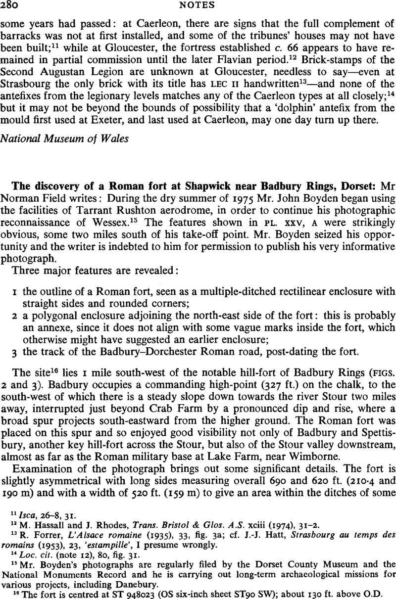
Britannia,
Vol. 51,
Issue. ,
p.
307.