


Introduction
The Northern Bald Ibis Geronticus eremita was present in Europe until the beginning of the seventeenth century (Schenker Reference Schenker1977, Böhm and Pegoraro Reference Böhm and Pegoraro2011). In the twentieth century, two separate populations existed, a largely non-migratory population in North Africa and a migratory population in the Near East (Collar and Stuart Reference Collar and Stuart1985, del Hoyo et al. Reference del Hoyo, Elliot and Sargatal1992). Currently, in West Asia, only a semi-wild population exists near Birecik, south-eastern Turkey (Kumerloeve Reference Kumerloeve1962, Hirsch Reference Hirsch1980, Akçakaya Reference Akçakaya1990, Hatipoglu Reference Hatipoglu, Boehm and Bowden2016). The small population of Northern Bald Ibis that was discovered in Syria in 2002 is probably extinct (Serra et al. Reference Serra, Abdallah, Assaed, Abdallah, al Qaim, Fayad and Williamson2004, Reference Serra, Peske, Abdallah, al Qaim and Kanani2009, Serra Reference Serra2017).
The only wild population of Northern Bald Ibis remains in North Africa in south-western Morocco (Hirsch Reference Hirsch1979, Thévenot et al. Reference Thévenot, Vernon and Bergier2003, Bowden et al. Reference Bowden, Smith, El Bekkay, Oubrou, Aghnaj and Jimenez-Armesto2008). Conservation activities, which began in the 1990s, have helped to stabilise and increase the population (El Bekkay et al. Reference El Bekkay, Oubrou, Ribi, Smith and Bowden2007, Bowden et al. Reference Bowden, Smith, El Bekkay, Oubrou, Aghnaj and Jimenez-Armesto2008); recently, this has led to a revision and down-listing of the Northern Bald Ibis from “Critically Endangered” to “Endangered” (BirdLife International 2018).
Northern Bald Ibis feeds mostly on a wide range of terrestrial invertebrates and their larvae, small reptiles, and small amphibians (Collar and Stuart Reference Collar and Stuart1985).
In central Europe, the recently released migratory Northern Bald Ibis population mainly feeds in open meadows and pastures with insect larvae and earthworms as their primary prey (Zoufal et al. Reference Zoufal, Fritz, Bichler, Kirbauer, Markut, Meran, Eolf, Boehm, Bowden, Jordan and King2006, Fritz et al. Reference Fritz, Wirtz and Unsöld2017); in their wintering area in Tuscany, Italy, insect larvae, beetles, earthworms, and snails dominate their diet (Fritz et al. Reference Fritz, Wirtz and Unsöld2017). In Birecik, Northern Bald Ibis prefers fields fertilised with dung as well as cultivated rainfed and irrigated fields (Yeniyurt et al. Reference Yeniyurt, Oppel, Isfendiyaroglu, Özkinaci, Erkol and Bowden2017); their main food consists of larvae and beetles (Hirsch Reference Hirsch1979). The last Moroccan population mainly feeds on small lizards and tenebrionid beetles (Bowden et al. Reference Bowden, Smith, El Bekkay, Oubrou, Aghnaj and Jimenez-Armesto2008). In the Syrian dry steppe, beetles, grasshoppers, and young amphibians comprise the main prey (Serra et al. Reference Serra, Abdallah and al Qaim2008). These examples indicate that the species is rather flexible in its choice of prey.
The preferred feeding habitats of Northern Bald Ibis are correspondingly variable. In all cases, they are open areas with low or patchy vegetation, dry steppe, or extensive pastures (Collar and Stuart Reference Collar and Stuart1985). In areas of central Europe, the feeding habitat for this species is primarily frequently cut meadows, grassland, and pastures (Zoufal et al. Reference Zoufal, Fritz, Bichler, Kirbauer, Markut, Meran, Eolf, Boehm, Bowden, Jordan and King2006, Wehner et al. Reference Wehner, Huchler and Fritz2022), and even golf courses and airfields (AS pers. obs.).
The International Single Species Action Plan for the Conservation of the Northern Bald Ibis (Bowden Reference Bowden2015) under the Agreement on the Conservation of Africa-Eurasian Migratory Waterbirds (AEWA) provides the framework for conservation activities. The Implementation Plan 2017–2020 was updated by the AEWA/International Working Group (AEWA 2018). It proposed the establishment of a second semi-wild population of Northern Bald Ibis at a new site in Turkey.
The semi-wild Northern Bald Ibis population that exists in Birecik on the Euphrates River has grown significantly in recent years due to improved husbandry and management and currently includes more than 300 birds (Böhm et al. Reference Böhm, Bowden, Seddon, Hatipoglu, Oubrou, El Bekkay and Quevedo2021, Bowden Reference Bowden2021). A part of the colony is to be translocated to a second site to establish a second nucleus of birds, primarily with the prospect of increasing the range and for releases. A key reason is to avoid the inherent vulnerability of having all the Eastern populations in one place where a single incident, disease, etc., could wipe out the entire population. This geographical and quantitative expansion of the semi-wild population also serves the long-term goal of re-establishing a wild eastern migratory Northern Bald Ibis population as specified in the AEWA plan.
One critical step is to identify appropriate sites for the establishment of a new colony (Dereliev Reference Dereliev, Boehm and Bowden2016). The aim of this study is to present an analytical approach in order to provide a plausible list of areas for potential colony creation.
Three key parameters are used to identify potentially suitable areas for the establishment of a second semi-wild Northern Bald Ibis breeding colony in south-eastern Turkey with birds from the Birecik colony.
The presence of suitable nest sites at a reasonable distance from good feeding areas are two key factors (Collar and Stuart Reference Collar and Stuart1985) and, together with the presence of water-bodies (Smith et al. Reference Smith, Aghnaj, El Bekkay, Oubrou, Ribi, Armesto and Bowden2008), are the main habitat elements in determining distribution.
The three key parameters are therefore breeding cliffs, suitable feeding grounds, and water-bodies. Based on this, potentially suitable areas were identified within a large geographical area based on satellite imagery from Google Earth Pro 2021, supplemented with information and background data from published literature and thematic maps on regional geology and geomorphological landforms, as well as data on climate, agricultural production, and predominant land use. In addition, Esri WorldImagery (Reference WorldImagery2022) and topographical maps were used for refinement and verification (OpenTopoMap 2022).
The advantages of this approach are: (1) it makes use of free and easily accessible geographical information; (2) it allows identification of potentially suitable areas within a large geographical area; (3) it enables an initial, low-cost screening prior to focusing on selected areas.
Methods
Study site
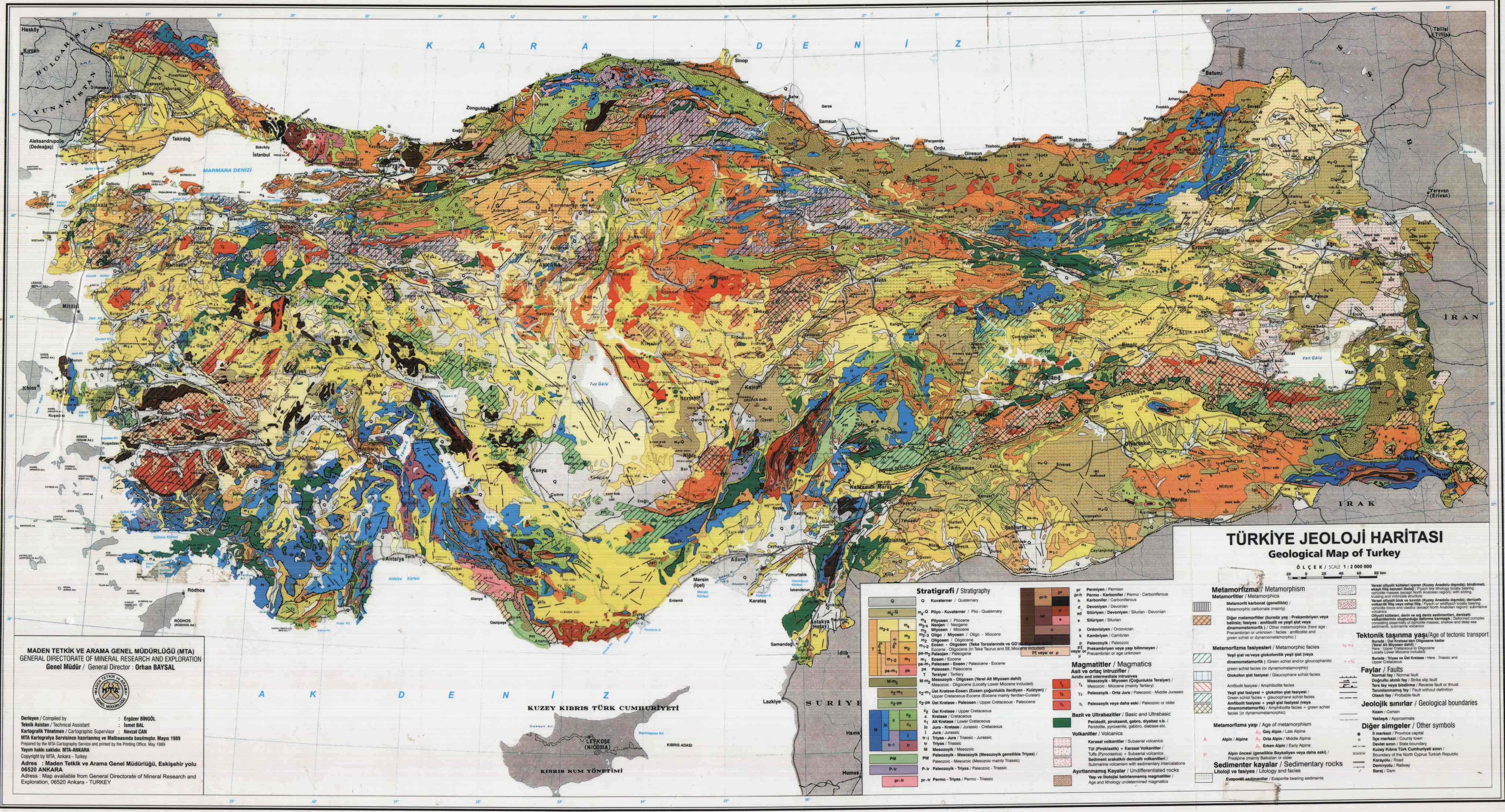
The study area in south-eastern Turkey lies between the Euphrates River (Turkish: Firat) in the west and the Tigris River (Dicle) in the east. Limestone plateau surfaces in the western part of the region range between 500 m and 800 m asl, while they reach 800–1,050 m asl in the eastern part and up to 1,300 m asl near Derik. In between the limestone plateaus lies the shield volcano Karacadag (1,919 m asl); its lava fields extend between 550 m and 850 m asl in the southern area. Towards the south, these plateaus and hills transition into the Mesopotamian Plain (400–600 m asl) (Güldali Reference Güldali1979, Erol Reference Erol1983, Kuzucuoglu et al. Reference Kuzucuoglu, Ciner, Kazanci, Kuzucuoglu, Ciner and Kazanci2019).
The study area extends 380–400 km in the east–west direction and 50–70 km in the north–south direction, covering about 23,000 km2 (Figure 1). This area in south-eastern Turkey is part of south-east Anatolia; this region corresponds to the part of Turkey from which historical breeding sites of Northern Bald Ibis have been recorded (Schenker and Serra Reference Schenker and Serra2022).

Figure 1. Overview of the study area and the main landscape types (modified after Kuzucuoglu Reference Kuzucuoglu, Kuzucuoglu, Ciner and Kazanci2019). The three potential translocation areas are shown with the 20-km study perimeter.
Basic regional information
Before using the main tool, Google Earth Pro 2021 satellite imagery, a preparation phase was necessary to acquire basic knowledge of the regional climate, geology, and landforms and the main types of land use.
Climate
According to the Köppen–Geiger classification, the climate of the study area is a Mediterranean climate type with precipitation in winter and spring and dry, hot summers (Kottek et al. Reference Kottek, Grieser, Beck, Rudolf and Rubel2006, Kuzucuoglu Reference Kuzucuoglu, Kuzucuoglu, Ciner and Kazanci2019). The Birecik site is located in a transition zone to the prevailing hot and dry steppe climate in neighbouring Syria.
In this context, the amount and seasonal distribution of rainfall over the breeding season is of interest. The increasing dryness towards the end of the breeding season in the months from May onwards is likely to affect the availability of invertebrates as prey, as found in the Syrian steppe (Lindsell et al. Reference Lindsell, Adwan and Anderson2011). The average amount of precipitation in the study area during the breeding season from February to June is as follows: 167 mm for Birecik (350 m asl), 236 mm for Derik (780 m asl), 336 mm for Mardin (880 m asl), 315 mm for Yesilli (800 m asl), and 345 mm for Cizre (370 m asl). At all sites, 80–88% of the precipitation was recorded between February and April. In May, monthly precipitation dropped to approximately half that of the preceding months, while June was dry with only 3–4 mm of precipitation; July and August were de facto without rain at these sites (Meteorological Averages 1991–2021, 1999–2019, n.d.).
The average monthly temperature maximum for the hottest month of July is around 38°C in Mardin and Yesilli and around 40°C in Birecik and Cizre, while the average minimum temperature in the coldest month of January is around 1°C in Birecik and around −1°C in Mardin, Yesilli, and Cizre (Meteorological Averages 1991–2021, 1999–2019).
Geology
Essentially, three geological formations prevail in the study area (Geological Map of Turkey 1989, Kuzucuoglu et al. Reference Kuzucuoglu, Ciner, Kazanci, Kuzucuoglu, Ciner and Kazanci2019). A large area is dominated by calcareous sediments, which form plateaus and hilly areas, including a folded limestone formation north-west of Mardin, called Mazlidag. In the central part of the study area, there is a large area of volcanic rocks and lava fields called the Karacadag system. There are also several basin-like plains (ova), partly in tectonic depressions, three of which are located within the study area: Suruç (500–600 m asl), Harran (350–500 m asl), and Dikmen (450–600 m asl).
Geomorphology and relief
In the Gaziantep–Sanliurfa limestone plateau, the Euphrates River and its lateral tributaries have formed gorges and steep rock faces through vertical erosion. In the Mardin–Midyat limestone plateau and hill range, ridges and small valleys occur with hogback crests and escarpments. In the easternmost part of the study area, the Tigris River has shaped a deep canyon valley with rock faces formed by hard strata on the side slopes (Güldali Reference Güldali1979, Erol Reference Erol1983, Kuzucuoglu et al. Reference Kuzucuoglu, Ciner, Kazanci, Kuzucuoglu, Ciner and Kazanci2019).
Throughout the entire south-east Anatolian region, karstic forms with thin and stony soil patches over bare rocks can be found in widespread limestone formations (Nazik et al. Reference Nazik, Poyraz, Karabiyikoglu, Kuzucuoglu, Ciner and Kazanci2019). The extensive Karacadag basaltic shield volcano in the centre of the large study area forms a wide plateau. These areas are located west and south-west of Mardin. The three flat plains mentioned above are filled with alluvial sediments.
Current land use
The three plains provide fertile arable land. The largest of these plains, Harran, is equipped with an extensive irrigation system as a prerequisite for intensive agriculture. The study area is part of the Southeastern Anatolian Project, Güneydogu Anadolu Projesi (GAP) (Toepfer Reference Toepfer1989). In this integrated development project, among other infrastructures, numerous new dams for hydroelectric power generation, as well as large-scale irrigation projects, are either planned or, to a large extent, already realised (GAP 2014).
The southern basaltic flows of the Karacadag volcano are mainly flat and sparsely vegetated, with a coarse surface and minor differences in relief. In small valleys along the drainage system, some small patches of agricultural land exist. The limestone plateau and the gentle hills of the Gaziantep–Sanliurfa plateau east of the Euphrates River are largely free of woody vegetation, whereas small areas of forest occur west of the Euphrates River. The hilly landscape is frequently covered with olive groves and pistachio plantations. Most of the agricultural areas on both sides of the Euphrates River valley are covered with dense rows of olive, pistachio, and fig trees. Occasionally, degraded areas of different sizes lie in between, covered by shallow and stony soils.
The dry steppe landscape of the Mardin–Midyat plateau is partially covered with widely scattered Oak Quercus spp. trees (Kuzucuoglu et al. Reference Kuzucuoglu, Ciner, Kazanci, Kuzucuoglu, Ciner and Kazanci2019). Areas with patches of shrubs and woodlands with Oak, Terebinth Pistacia terebinthus, Prickly Juniper Juniperus oxycedrus, and Jerusalem Thorn Paliurus spina-christi are quite common (Mayer and Aksoy Reference Mayer and Aksoy1986, Yesil et al. Reference Yesil, Celik and Yilmaz2019). Degraded areas with shallow and skeletal soils are used for extensive grazing. In the Mardin province, many fruit trees are cultivated; pistachio, cherry, pomegranate, and olive trees are the most common (Simsek and Gülsoy Reference Simsek and Gülsoy2017).
Satellite imagery
The central and most important tool in analysing the key parameters is the satellite images from the open-source Google Earth Pro 2021. Additionally, terrestrial photographs posted by third parties on Google Earth contributed to the consolidation of the impression gained from the satellite images, although this was only possible in cases where a photograph could be clearly assigned to the landscape viewed in the satellite image. Esri WorldImagery (Reference WorldImagery2022) and OpenTopoMap (2022) were also used to cross-check the results in the three selected areas.
The evaluation of basic information by means of published literature and thematic maps covering the regional geology, landforms, and land use provided some initial indications of potentially suitable and less or non-suitable areas within the large study area. Rock faces and other suitable rock structures with niches and ledges are to be expected in areas with limestone exposed to weathering and fluvial erosion. Thus, the limestone plateaus and hills of Gaziantep–Sanliurfa and Mardin–Midyat, as well as the canyon of the Tigris River, are potentially suitable areas.
Applied key parameters
The three most important habitat requirements of the Northern Bald Ibis can be identified and assessed in the satellite images from Google Earth Pro 2021 using the hierarchy of the three key parameters (Table 1): (1) suitable breeding sites for this colonial nesting species are steep rock faces, inland cliffs, and gorge-like structures with ledges and niches, free from woody plants or other vegetation; the presence of this parameter is a priority prerequisite for the identification of potentially suitable sites; (2) suitable feeding habitat with low and often sparse vegetation, such as extensive and degraded pastures, fallow, and cultivated fields with low vegetation, semiarid steppe, bare ground, and sandy strips; (3) the availability of fresh water in relative proximity to the nesting sites has a positive effect on the breeding success of the Northern Bald Ibis (Smith et al. Reference Smith, Aghnaj, El Bekkay, Oubrou, Ribi, Armesto and Bowden2008); this includes perennial and seasonal watercourses, dams, ponds, and other open water retention structures.
Table 1. Parameters used to select areas with potential sites for a second semi-wild breeding colony of Northern Bald Ibis in south-eastern Turkey.

The Google Earth satellite imagery was searched visually and manually. The resolution corresponds to the zoom function in Google Earth down to the still clearly visible terrain details. In each of the three target areas, a large number of potentially suitable breeding rocks with different exposures and elevations were identified (see Supplementary material S1–S3). It is not an exhaustive selection. Low and/or not very extensive cliffs may have been overlooked.
First, the study area in south-eastern Turkey was scanned for potentially suitable inland cliffs with a size of about 100 m in length and about 10 m or more in height. In the next step, the suitability of foraging habitats within a radius of 20–25 km was roughly analysed. Finally, the presence of temporary or perennial water-bodies within a radius of about 15 km around the potentially suitable nesting cliffs was checked in these areas.
The study area extended eastwards to the Tigris River because there is an absence of inland cliffs, which is a key parameter. East of Birecik there are gentle hills, followed by the Harran Plain with industrial agriculture and the barren basalt areas of the Karacadag shield volcano. Rock structures that are suitable as breeding sites are only found nearly 200 km east of Birecik in the area around Derik in the limestone formations there. These characteristics lead to a focus on suitable areas that extend beyond the documented former breeding range.
Suitable foraging habitats, as described above, are found in the Derik area, eastwards to the Tigris River and southwards in the transitional zone of the foothills to the Mesopotamian Plain.
An additional important reason in favour of a large distance between the Birecik population and a second site are veterinary requirements to prevent the catastrophic impact of diseases (Bowden Reference Bowden2015). Contact between the two vulnerable subpopulations should be avoided to prevent parasite infestation or infection by diseases, e.g. avian influenza.
Furthermore, it must be taken into account that from the flourishing time of the Birecik colony until the middle of the twentieth century, land use in this region has also changed significantly and intensified, including the flooding of the valley floor by large dams on the Euphrates River. This also applies to the densely planted olive groves and pistachio and fig plantations, which are unsuitable as foraging habitat and extend 30–40 km north of Birecik on both sides of the Euphrates River on cultivable land. The rows of these plantations, i.e. their trunks, laid out over extensive areas, are 7–10 m apart, while the individual trees in a row are 5–8 m apart.
Results
Using the described analytical approach and hierarchy of key parameters, three main areas for a second location of a semi-wild breeding colony of Northern Bald Ibis emerged (Table 2): (1) Derik (Mardin province); (2) Yesilli (Mardin province); (3) Yarbasi (Sirnak province).
Table 2. The occurrence of inland cliffs in south-eastern Turkey in the provinces of Mardin (Derik and Yesilli) and Sirnak (Yarbasi).

Key parameter 1: potential breeding sites
Suitable rock structures for this colonial breeding bird species are expected at hogback crests, escarpments, and in the Tigris River canyon (Table 2).
In parts of the Mardin–Midyat limestone plateau, suitable rock structures exist. These hogback crests and escarpments occur west of Mardin, in the area around Derik. These steep slopes are situated between 750 m and 1,300 m asl and are predominantly concentrated within a 10-km radius (Table 3). A second suitable area was found east of Mardin around Yesilli. Here, inland cliffs are located between 500 m and 1,200 m asl with a significant concentration within the 10-km radius (Table 3).
Table 3. Group of potential breeding sites identified with Google Earth Pro 2021 in the areas around Derik, Yesilli, and Yarbasi in south-eastern Turkey. These inland cliffs extend over 100–200 m (short), 200–500 m (medium), and 500–1,000 m (long). The minimum height of the rock formations is approximately 10 m. The altitudes of the cliffs were classified into three categories: 500–750 m asl, 750–1,000 m asl, and 1,000–1,200 m asl. The identified aggregation in the Derik region includes 18 potential sites, nine each at 750–1,000 m asl and 1,000–1,200 m asl. In the Yesilli region, 16 cliffs were identified, four at 500–750 m asl, five at 750–1,000 m asl, and seven at 1,000–1,200 m asl. In the Yarbasi region, a total of seven cliffs were identified, all located at 500–750 m asl. In S1–S3 these cliffs are located in a cut-out from Google Earth Pro 2021.

The third area with potentially suitable breeding sites was located further east in the Sirnak province, near Yarbasi. The canyon-like Tigris River valley, as well as its tributaries west of Cizre, offers numerous potential breeding and roosting sites with rock faces. Potentially suitable nesting sites are located between 500 m and 750 m asl within the 10-km radius (Table 3).
Appendices S1–S3 show the areas around Derik, Yesilli, and Yarbasi, each with a section from Google Earth Pro 2021. The cluster of potential breeding sites are indicated with the abbreviations Der, Yes, and Yar, together with information on altitude (1–3) and the extent of the cliffs (a–f). However, there is no claim to have identified all potential breeding sites.
Key parameter 2: land use and vegetation
Suitable feeding habitats for the Northern Bald Ibis are open landscapes with low and sparse vegetation, dry steppe, extensive pastures, rainfed cultivated land, and fallow (Collar and Stuart Reference Collar and Stuart1985, Bowden et al. Reference Bowden, Smith, El Bekkay, Oubrou, Aghnaj and Jimenez-Armesto2008, Serra et al. Reference Serra, Abdallah and al Qaim2008, Yeniyurt et al. Reference Yeniyurt, Oppel, Isfendiyaroglu, Özkinaci, Erkol and Bowden2017).
Surrounding Derik and Yesilli in the Mardin province, parts of the hilly landscape are covered with dry steppe and some scattered shrubs and trees. These areas are suitable for extensive grazing. Other parts are almost bare of vegetation with stony soils. Around the villages and in the small valleys with arable land, various fruit trees grow. Woodland areas, including afforestation, occur locally in the hilly area. Rainfed agriculture prevails in the areas to the south in the transition zone to the Mesopotamian Plain. However, stony and shallow soils on outcrops, which are suitable for occasional grazing, also occur here.
North of the third site, Yarbasi, in the Sirnak province, the adjacent plateau areas with arable land and pastures are situated 650–800 m asl. The narrow canyon bottom of the Tigris River is located 200–350 m below. The northward-facing slopes of the canyon are often quite densely covered with woody vegetation and therefore are unsuitable as a nest site. This is in contrast to the south-west to south-east-facing slopes, which are almost bare. The gentler slopes are generally used as pastureland. The plain to the south is dominated by rainfed agriculture, although stony and shallow soils on outcrops are likely to be suitable as extensive grazing areas.
Suitability of foraging habitats and their area shares was roughly estimated within a radius of approximately 20 km around the three selected sites (Table 4). Areas with rainfed agriculture and fallow were categorised as moderately suitable; dry steppe and open extensive pastures were categorised as highly suitable. Olive groves, pistachio and fig plantations, woodland, afforestation, and degraded woodland and scrubland were categorised as not suitable. These areas are unsuitable as foraging habitats due to their natural or densely planted woody vegetation. The results based on suitability and area shares lead to the following ranking (Table 4): 1A: Derik area, 1B: Yarbasi area, and 2: Yesilli area.
Table 4. Land use and vegetation within a radius of about 20 km around the villages of Derik, Yesilli, and Yarbasi in south-eastern Turkey. The area percentages were roughly estimated using Google Earth 2021. The suitability of foraging habitats was assessed with three levels: high suitability, moderate suitability, and not suitable. A mosaic distribution of small-scale structures over a relatively limited total area was not considered suitable. Potential foraging areas above 900–1000 m asl were also excluded as unsuitable. N = northern half of the perimeter with radius 20 km; S = southern half of the perimeter with radius 20 km.

Key parameter 3: water-bodies
Another key parameter to consider is the availability of fresh water during the breeding season (Smith et al. Reference Smith, Aghnaj, El Bekkay, Oubrou, Ribi, Armesto and Bowden2008). Water-bodies occur in various forms in the three areas mentioned above (Table 5). In addition to the perennial Tigris River, there are temporary water-bodies fed by winter and spring precipitation. In some cases, widened riverbeds and small dams form local water points. A larger dam is located west and north of Derik, Damluca Baraj Gölü and Kocakent Baraj Gölü, and a smaller one south of Yarbasi near Idil, Dirsekli Göleti.
Table 5. Water-bodies likely to be available in the area around Derik, Yesilli, and Yarbasi during the breeding season according to Google Earth satellite imagery.

Less suitable or unsuitable areas, criteria for exclusion
Suitable breeding cliffs can be found in the Gaziantep–Sanliurfa area, along the Euphrates River and in lateral tributaries, a fact that was also confirmed by historical breeding records (Schenker and Serra Reference Schenker and Serra2022). The vicinity of these potential breeding sites 10–40 km north of the present semi-wild colony at Birecik would make contact and the possible exchange of individuals between the two colonies along the Euphrates valley very likely; however, such an exchange should be avoided to prevent possible disease transmission, e.g. avian influenza (Parameter 5, Table 1). For this reason, the Euphrates River valley and its surroundings were not considered, despite its suitability as a breeding site. Moreover, the gentle hills and flat cultivated fields bordering the Euphrates River valley on both sides are to a large extent not suitable as a foraging habitat. A majority of these surfaces are covered with olive groves and pistachio and fig plantations.
In terms of topography, flat plains with agricultural land do not offer any suitable rock structures for breeding sites. This is also true for extensive lava sheets in the southern part of the Karacadag shield volcano under consideration here.
Intensively farmed areas, along with their corresponding pesticide use, are most likely not suitable as foraging habitats. This applies primarily to the Harran Plain and some smaller areas with industrialised agriculture, e.g. south of Viransehir.
The sparsely vegetated southern lava sheet of the Karacadag volcano and local volcanic rocks, e.g. south-west of Derik or west of Cizre, are difficult to assess for suitability as foraging habitats on the satellite images, although a partially similar situation exists in Morocco at the former breeding site of Foum Kheneg in the Middle Atlas (Rencurel Reference Rencurel1974, AS pers. obs. on-site 2017). Thus, on-site verification is necessary.
Discussion
The proposed potential sites in south-eastern Turkey, in the area around Mardin and west of the town of Cizre, are situated at the fringe of the Anatolian hills and plateaus in the north and the Mesopotamian Plain in the south. The existing mix and mosaic of different potential foraging habitats (i.e. rainfed fields, fallow, extensive grazing areas, and dry steppe) present in this transitional zone are expected to provide sufficient suitable foraging opportunities for Northern Bald Ibis. Furthermore, Northern Bald Ibises are opportunistic in their foraging behaviour and prey on seasonally and locally more abundant large invertebrates and small vertebrates (Hirsch Reference Hirsch1979, Zoufal et al. Reference Zoufal, Fritz, Bichler, Kirbauer, Markut, Meran, Eolf, Boehm, Bowden, Jordan and King2006, Bowden et al. Reference Bowden, Smith, El Bekkay, Oubrou, Aghnaj and Jimenez-Armesto2008, Serra et al. Reference Serra, Abdallah and al Qaim2008, Lindsell et al. Reference Lindsell, Adwan and Anderson2011, Yeniyurt et al. Reference Yeniyurt, Oppel, Isfendiyaroglu, Özkinaci, Erkol and Bowden2017). Several suitable water-bodies exist within a 15–20-km radius of the three sites (Table 5).
Considering published field observations of Northern Bald Ibis foraging areas (Rencurel Reference Rencurel1974, Akçakaya Reference Akçakaya1990, Bowden et al. Reference Bowden, Smith, El Bekkay, Oubrou, Aghnaj and Jimenez-Armesto2008, Yeniyurt et al. Reference Yeniyurt, Oppel, Isfendiyaroglu, Özkinaci, Erkol and Bowden2017, Schenker et al. Reference Schenker, Cahenzli, Gutbrod, Thevenot and Erhardt2020), priority was given to suitable forage habitats within 20 km, although more distant suitable habitats were not excluded. Foraging habitats further than 25 km away are likely to influence breeding success, as nests are left unguarded for longer and thus are more exposed to predation (Serra et al. Reference Serra, Peske, Abdallah, al Qaim and Kanani2009, Lindsell et al. Reference Lindsell, Adwan and Anderson2011) and starvation, as suggested by the deaths of chicks in the nest (Bowden et al. Reference Bowden, Aghnaj, Smith and Ribi2003). In general, distant feeding grounds are associated with relevant additional costs, such as time and flight energy, which may negatively affect breeding success.
For climatic reasons, possible breeding sites below 900–1,000 m asl may be more suitable today. In the long term, considering climate change, potential breeding sites situated higher may become important (Parameter 4, Table 1).
The two first-ranked sites, Derik and Yarbasi, are of similar quality in terms of suitable foraging habitats. In Derik, the landscape sequence and spatial mix of the two categories of suitable foraging habitats are more compact than in the case of Yarbasi. Here, the steep cliffs of the canyon offer various suitable breeding and roosting sites; however, these are often well below the plateau, which may reduce the attractiveness of potential nesting sites. Additionally, this area is close to a border region (Iraq, Syria) where security aspects are of some importance. Yesilli is ranked second. The proportion of potential foraging habitats above 900–1,000 m is relatively high with a low proportion of rainfed agriculture.
The results of the present study provide a useful background for the focused selection of a site by a multidisciplinary team including local experts. However, there are a number of additional features that will need to be considered, e.g. current human activity and disturbance potential especially at the nest sites, existing and potential protected areas, and government infrastructure (i.e. water, electricity, road infrastructure).
This involves a detailed examination of suitability and an assessment of possible risks (Bowden et al. Reference Bowden, Boehm, Lopez, Hatipoglu, Boehm and Bowden2016). Feasibility studies should analyse the current land use and long-term development plans of the areas. In addition, the suitability of potential breeding and roosting sites and their protection against terrestrial predators should be evaluated. Another aspect to be considered concerns uninsulated powerline pylons, existing and planned wind farms, and the potential risk of extensive pesticide use (e.g. desert locusts).
Based on these on-site studies, Derik or Yarbasi may likely be the first priority site. Then, a detailed project description needs to be prepared, including a timetable, budget, location, and construction of infrastructures (i.e. aviary, office, storage room), along with training local staff and monitoring. It will also be crucial to generate interest and goodwill among regional and local authorities and to raise awareness among local communities.
Conclusions
The analytical approach described here using three key parameters, all recognisable on Google Earth satellite images, is a relatively coarse method of analysis but is one that focuses on the critical ecological requirements of the Northern Bald Ibis: breeding site, forage habitat, and water.
In combination with published data and maps on geology, landforms, land use, and other factors, this approach identified potentially suitable translocation sites in a large area using limited resources (Tables 3, 4, and 5). Nevertheless, subsequent more detailed on-site studies are essential. Furthermore, geopolitical and pragmatic constraints may affect and restrict a selection of sites to be examined more closely in a feasibility study. However, these aspects are beyond the scope of this paper.
Conservation translocation beyond the documented former breeding range
The translocation sites in south-eastern Turkey, evaluated using the three key parameters of breeding cliffs, foraging habitats, and water-bodies, are outside the documented former breeding range of Northern Bald Ibis (Schenker and Serra Reference Schenker and Serra2022). The reason is the absence of at least one of the three key parameters in the area closer to the existing semi-wild breeding colony at Birecik on the Euphrates.
The northern Euphrates River valley and its small tributary valleys were not considered despite being suitable nesting sites. In recent years and decades, foraging habitats in the Euphrates River valley have been flooded by dams; in the adjacent agricultural areas, as well as in the gently hilly area, extensive plantations of olives, pistachios, and figs, unsuitable as foraging habitats, cover the agricultural areas. In addition, there is a risk of disease transmission (e.g. avian influenza, parasites) if the second semi-wild breeding colony is too close to Birecik.
A translocation beyond the historical breeding range involves an additional risk, but is a possibility also from the perspective of genetic risk assessment, if there is no risk of hybridisation with other species or subspecies (Weeks et al. Reference Weeks, Sgro, Young, Frankham, Mitchell, Miller and Byrne2011). Furthermore, successful translocations with this constellation have been documented (Miskelly and Powlesland Reference Miskelly and Powlesland2013).
For practical implementation and considering limited resources, a cautious approach including an experimental component is suggested (Seddon et al. Reference Seddon, Armstrong and Maloney2007), including a careful selection of suitable birds (Böhm Reference Böhm2006, Bowden et al. Reference Bowden, Boehm, Lopez, Hatipoglu, Boehm and Bowden2016). However, a discussion of concrete, practical measures at a later stage of a possible establishment of a Northern Bald Ibis population would exceed the scope of this paper.
Overall, the identified potential areas should be compatible with the planned long-term reintroduction and establishment of a wild and migratory population of Northern Bald Ibis in south-eastern Turkey (AEWA 2018, Appendix 4, Result 3.5).
Acknowledgements
Thanks to Martina L. Schenker, Zurich, for map illustration. We also thank Ahmet Kiliç, Dicle University, for information on open-source geodata in Turkey and historical terrestrial photographs from the Birecik region. We appreciate the constructive comments of the Editor on an earlier version of the manuscript. We particularly acknowledge the helpful comments of the two reviewers Chris Bowden and Steffen Oppel on earlier versions of the manuscript.
Supplementary material
The supplementary material for this article can be found at http://doi.org/10.1017/S0959270923000242.


