


Introduction
Desert kites, in a broad sense, comprise long, low stone walls arranged in V- or funnel-shaped ‘arms’ converging into tapering funnel ‘necks’, before sometimes ending on an enclosure known as a ‘head’ or ‘apex’. Located in the arid regions of the Levant/Middle East and Central Asia, these well-attested archaeological features are most often associated with gazelle hunting, although they may also have been used to trap other ungulates or for the management of domesticates (for a synthesis, see Crassard et al. Reference Crassard2015). Desert kites are almost invisible from the ground due both to their large size and the fact that they are constructed using unmodifed local boulders and stones, often in rugged terrain (Arav et al. Reference Arav, Filin, Avner, Bar-Oz, Nachmias and Nadel2014). Consequently, this category of site was first observed in the early twentieth century by pilots flying over the Levant (e.g. Helms & Betts Reference Helms and Betts1987). Where dating has been possible, the ages are mostly within the Holocene Neolithic (Davidovich et al. Reference Davidovich, Goldsmith, Porat and Porat2014).
Until very recently, archaeological records of desert kites were restricted to the Northern Hemisphere. In 2018, however, we announced the discovery of the first two kite-like structures (Keimoes 1 and 2) to be identified in the arid Nama Karoo of South Africa, located just north of the Gariep (Orange River) (van der Walt & Lombard Reference van der Walt and Lombard2018). Environmental specialists noticed these features during an aerial survey, and brought them to the attention of van der Walt, who surveyed and recorded them using traditional, ground-based methods and drone photography as part of the Palaeo-TrACKS project aimed at expanding our understanding of the impact of Stone Age communities on the interior grass/shrublands of South Africa. Keimoes 1 is the smaller of the two sites, with five funnel-shaped features. Keimoes 2 has seven recorded funnels (for descriptions/illustrations, see van der Walt & Lombard Reference van der Walt and Lombard2018).
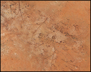
Following the discovery of Keimoes 1 and 2, we scanned the wider region to the north and south of the Gariep for similar sites using Google Earth. During this process, we identified Keimoes 3 (Figure 1), located a few kilometres to the west of the Keimoes 1 and 2 sites. This is the largest of the three kite sites and forms the focus of the present article. Here, we aim to:
1) Refine the relative age of the Keimoes kites. As with most Northern Hemisphere kite sites (Holzer et al. Reference Holzer, Avner, Porat and Horwitz2010; Nadel et al. Reference Nadel, Bar-Oz, Avner, Boaretto and Malkinson2010), the South African sites lack directly associated artefacts or faunal remains.
2) Introduce the use of a combination of orthographic (aerial) photography and aerial lidar scanning data to record and describe Keimoes 3, as traditional survey and recording methods are ineffective for the documentation of kite sites (Arav et al. Reference Arav, Filin, Avner, Bar-Oz, Nachmias and Nadel2014).
3) Examine the micro-topography and interpret the possible function of Keimoes 3, building on research into the strategic and micro-topographic settings of Northern Hemisphere kites (Bar-Oz et al. Reference Bar-Oz, Nadel, Avner and Malkinson2011; Arav et al. Reference Arav, Filin, Avner, Bar-Oz, Nachmias and Nadel2014).

Figure 1. Orthographic/aerial photograph of Keimoes 3 (figure by M. Lombard & M. Caruana).
Relative age of the South African kite sites
A colonial-period origin for the kites can be ruled out, as there are no historical records for the use of kite-like structures by the early European settlers who first arrived in the Keimoes region during the late 1700s. Non-European stone-built structures are, however, common in southern Africa. Most of these features are associated with Iron Age farming communities who entered present-day South Africa from the north-east approximately 1700 years ago (Huffman Reference Huffman2007; Schlebusch et al. Reference Schlebusch2017). The remains of such settlements are widely distributed in areas where suitable arable and pasturelands are available (Figure 2).

Figure 2. Top) map of southern Africa showing the general distribution of Later Stone Age vs Iron Age stone-built sites, and the location of archaeological sites mentioned in the text (partly adapted from Huffman Reference Huffman2007 and Sadr Reference Sadr2012); bottom) dates for Stone Age stone structures from Namibia and South Africa (modelled in OxCal v4.3.2, using the Southern Hemisphere Cal13 calibration curve; Hogg et al. Reference Hogg2013; Bronk Ramsey Reference Bronk Ramsey2017).
There are two regional patterns of stone-walled Iron Age settlement in South Africa: the Central Cattle Pattern, of which the oldest known example dates to between the thirteenth and fifteenth centuries AD (Steyn et al. Reference Steyn, Botha, Vicente, Schlebusch, Whitelaw and Lombard2019), and the Zimbabwe Pattern (see Huffman Reference Huffman2007), which dates to AD 1250, at the Mapungubwe site (Figure 2). Iron Age farmers were dependent on climatic factors (e.g. Maggs Reference Maggs1976). Humphreys (Reference Humphreys1976) used the 254mm and 381mm isohyets and ethnographic data to show that Iron Age stone-walled settlements are confined to eastern regions with higher rainfall, and are absent in northern Nama Karoo (the Bushmanland bioregion), which seldom receives more than 200mm of rain per year. The closest known Iron Age stone-walled structure to Keimoes is approximately 203km to the north-east. Funnel-shaped structures have never been reported in association with agrarian Iron Age sites, and the building techniques used for kite construction are inconsistent with the core-and-rubble technique characteristic of Iron Age settlements (e.g. Walton Reference Walton1958). Rather, construction methods used for the funnels at Keimoes are most consistent with Holocene Later Stone Age stone-built structures mostly dating to less than 2000 years ago (Figure 2). These sites are much smaller than Iron Age sites, sometimes comprising a single circular feature measuring 2–4m in diameter. They are mostly confined to the arid regions of southern Africa (Figure 2; Sadr Reference Sadr2012), and have been associated with both herding and hunter-gatherer groups (Parsons Reference Parsons2008; Sampson Reference Sampson2010). Kinahan (Reference Kinahan1991) suggests that, following the adoption of livestock, some hunter-gatherers abandoned rockshelters in favour of stone-circle settlements (also see Veldman et al. Reference Veldman, Parsons and Lombard2017).
Thus far, no livestock remains have been found in direct association with excavated stone-circle sites (Badenhorst et al. Reference Badenhorst, Veldman and Lombard2016), although they are often associated with herder pottery and sometimes with metal objects (see Table S1 in the online supplementary material (OSM)). The presence of both pottery and metal indicates an age of less than around 2000 years for Stone Age stone-built structures (Lombard et al. Reference Lombard, Wadley, Deacon, Wurz, Parsons, Mohapi, Swart and Mitchell2012). The stone circles at Bloubos 7, dating to cal AD 1450–1670, are the closest to Keimoes 3 in terms of location, and resemble the building methods used for the kites. Farther afield are the oval or circular structures at Jagt Pan 7 dating to cal AD 380–600, and that at Springbokoog 1 has an outlier age estimation of 3520–3090 cal BC. The oldest continuous (non-circular) Stone Age stone walls designed to control livestock are found at Simon se Klip on the west coast, and date to between cal AD 540 and 770. Furthermore, Later Stone Age stone-walled stock enclosures, dating to cal AD 890–1150, are known in the eastern Nama Karoo biome (Figure 2; for dating details and references, see Table S1).
The only previously recorded true funnel-shaped stone structure in the region that the authors are aware of is at Graafwater. Located approximately 90km south-west of Keimoes 3, this structure “may well have been a means of trapping small to medium bovids” (Beaumont et al. Reference Beaumont, Smith, Vogel and Smith1995: 258–59). The age of the Graafwater structure, along with the Keimoes sites, are currently unknown due to a dearth of associated datable material. Figure 2 and Table S1 provide lists of the Namibian and South African Stone Age structures that have been radiocarbon dated with newly calibrated dates published here (Figure 2). Apart from the Springbokoog 1 outlier, all dated Stone Age stone structures in the region are younger than AD 130. We therefore suggest that, in lieu of directly associated dates for the Keimoes kite sites, it is prudent to place their construction and use at some time during the last 2000 years, contemporaneous with other stone structures in the same region that exhibit similar building methods.
The Keimoes 3 kite site
The site is located approximately 24km north-north-west of Keimoes, in a complex geographical region characterised by a range of different geological formations, micro-climates and vegetation/veld types (Figure S1 and Table S2). The kite features on the site were all constructed by organising locally occurring dolerite boulders into funnel-shaped structures. As seen at Keimoes 1 and 2 (van der Walt & Lombard Reference van der Walt and Lombard2018), wall-construction methods differ slightly depending on the location and distance from their final convergence points (or apices). The guiding arms most distant from the apices consist of an alignment of single, large and roughly arranged stones, sometimes incorporating in situ dolerite outcrops/boulders. The arm extremities have no visible vertical organisation, and are approximately 0.30–0.50m high. The walls become slightly higher closer to the apices, are more deliberately organised and, in some instances, show vertical stacking, much of which has now collapsed.
To map the main funnel features at Keimoes 3, we used a geo-rectified LAS (3D point cloud) dataset accurate to 80mm, which was obtained during aerial lidar scanning. The resulting data were analysed in ArcGIS 10.5, in combination with orthographic photography. This approach enables the automatic sorting of features based on their height relative to the ground (Figure 3).

Figure 3. Top and inset) raw LAS point cloud data (middle grey = ground surface; dark grey = low vegetation; light grey = automatically detected stone structures); bottom) orthographic photograph with the layout of the funnel structures highlighted in black. Funnel series 1 consists of funnel structures a–e; funnel series 2 of funnels f–l; and funnel series 3 of funnels m–n (figure by M. Caruana & M. Lombard).
The entire site stretches over a small hill of approximately 130 340m2 and comprises three funnel series. The funnel mouths of series 1 open towards the south-west; those of series 2 open towards the east; and series 3 open northwards. Funnel series 1 and 2 form the main structures of the site. Funnel series 1 consists of five funnels (Figure 3a–e), and funnel series 2 of seven (Figure 3f–l). The total length of funnel series 1 is 316.55m (maximum distance between funnel arms), covering approximately 18 290m2 (perimeter measurement encompassing the structures). Funnel series 2 is 241.64m long, covering around 8795m2 (Figure 3). The individual funnels vary in size, ranging from funnel 1c, which covers approximately 2355m2, with a combined arm length of 242.18m, a funnel length of 108.13m and a funnel mouth that is 67.5 m wide, to funnel 2i that covers only around 267m2. The angles of the funnels vary from 18.3° for funnel 2g to 54.2° for funnel 1e (for morphometric data, see Table 1). The apices of funnels 1a–d and 2g and 2k end in the characteristic roughly circular enclosures or ‘heads’ (now collapsed) averaging approximately 4.5m in diameter (Figure 4). At the apex of funnel 2l, the collapsed ‘head’ is towards the side, instead of at the end of the funnel, with a diameter of 5.44m (Figure 4C). Three funnels (1c, 1e and 2j) have diagonally protruding stone screens on the outside of one of their arms (Figure 4). Funnel series 3 is severely deteriorated and seems to consist of two small funnels (Figure 3). The poor condition and tentative data for the series 3 funnels (see Table 1) precludes further meaningful analysis.
Table 1. Morphometric characteristics of the Keimoes 3 funnels. For each funnel, we measured the combined arm lengths from one mouth extremity to apex to other mouth extremity, and the funnel depths from mid-mouth width to apex.


Figure 4. Top left) plan view of Keimoes 3 with circular heads indicated (dashed lines): A) example of a collapsed circular enclosure at the top of funnel 1c (dashed line) and a protrusion/screen adjacent to a guiding arm (arrows); B) collapsed screen of funnel 2j; C) collapsed head to the side of funnel 2l (dashed line) (figure by M. Caruana & M. Lombard).
Micro-topography and functional interpretation
Keimoes 3 is situated on a small hill approximately 250m east of a dry riverbed. The funnels of the three kite series are all arranged around the rise of the hill, which peaks at approximately 894m asl (Figure 5). The funnel arms were constructed with their mouths facing away from the hilltop, opening towards the surrounding plains and/or occasional water sources, such as the dry riverbed or a large pan located around 1km to the south-west that fills with water following intense thunderstorms (A. Vlok pers. comm.).

Figure 5. Top) geographic positioning of Keimoes 3 in its immediate surrounding landscape; middle) topographic interpretation based on LAS datasets; bottom) hillshade model of the landscape and enlarged hillshade image demonstrating how the funnels are situated around the rise of the hill (white dot on the inset indicates the highest point) (figure by M. Caruana).
The vegetation on the plains directly surrounding Keimoes 3 is a mixture of Kalahari Karroid Shrubland, Gordonia Duneveld and Bushmanland Arid Grassland (Figure S1 and Table S2). Several species of grazing grasses grow here, some of which are high in protein, such as Blue Buffalo Grass (Cenchrus ciliaris). Others, such as Perennial Love Grass (Eragrostis nindensis) and Twabushman Grass (Stipagrostis brevifolia), are drought resistant (Fish et al. Reference Fish, Mashau, Moeaha and Nembudani2015), providing year-round grazing, even through dry periods. Notwithstanding the sparse vegetation, a few shrubs (e.g. Limeum aethiopicum) provide browsing opportunity. The biomass is enriched considerably during periods of good rainfall. Bovids common to the region before large-scale colonial hunting and land regulation/fencing would have included springbok (Antidorcas marsupialis), red hartebeest (Alcelaphus buselaphus), blue wildebeest (Connochaetes taurinus), gemsbok (Oryx gazella) and eland (Tragelaphus oryx), as well as the small grey duiker (Sylvicapra grimmia), klipspringer (Oreotragus oreotragus) and steenbok (Raphicerus campestris) (e.g. du Plessis Reference du Plessis1969). The larger species move in herds of various size depending on season and available biomass, and could have been exploited with the funnels. The small species however, live in territorial reproductive pairs, which would probably make them less suitable for funnel hunting.
The Keimoes kite structures share characteristics with examples from the Negev, Israel, in their size and general layout (van der Walt & Lombard Reference van der Walt and Lombard2018). Bar-Oz et al. (Reference Bar-Oz, Nadel, Avner and Malkinson2011) describe several Negev kites, demonstrating that they were all strategically placed relative to their environmental settings (Table S3) and that the topographic positioning of the kites indicates their use for hunting, particularly as the human-made vertical drops at the apices would cause injury and assist in the slaughter of prey animals. According to their interpretation, kites were usually constructed in natural pastures and along game trails where the animals could be alarmed and driven into the funnels. Funnel apices were often located lower than the funnel necks, preventing the panicking animals from seeing the trap before it was too late. According to Bar-Oz et al. (Reference Bar-Oz, Nadel, Avner and Malkinson2011), this use of macro- and micro-geographical features in kite construction demonstrates that the ancient hunters had a deep understanding of ungulate behaviour within the context of their ecological settings.
The rise of the hill around which Keimoes 3 is constructed is gentle, with no steep slopes. Furthermore, there is no evidence that the enclosures were dug out to create or enhance drops in the landscape. We can therefore rule out the intention to injure animals by falling. Several of the kites’ apices do, however, appear to curve over the hill summit, in what seems to be a deliberate attempt to conceal the enclosures from oncoming herds. To assess this hypothesis, we conducted line-of-site and viewshed analyses, calculating the range of visibility when approaching the funnels. A digital elevation model (DEM) was interpolated using the triangulated irregular network surface algorithm to assess the visibility of the funnels from below the hill. Viewpoints elevated 1m in height (about the eye height of a springbok) were plotted on the DEM approximately 150m away from the two main funnel series (Figure 6: points 1 & 2). We first used the line-of-sight function in ArcMap 10.5 to generate visibility paths from viewpoints extending 300m beyond the funnels. Seven paths were produced spanning 80°, which map the field of visibility for funnel series 1 and 2. The visibility paths were then used to approximate the field of vision from viewpoints 1 and 2 as illustrated in Figure 6: (top), demonstrating how much of the funnel structures would be visible when approaching the hill from a distance of 150m. We also created two line-of-sight profiles bisecting the Keimoes 3 hill to see where these structures lie in relation to gradient (Figure 6: middle). The side of the hill on which funnel series 1 is located has a 1.8 per cent gradient, while the side where funnel series 2 is located has a 2.5 per cent gradient. From these reconstructions, it is apparent that most of the funnel enclosures, or heads, are situated on aspects of the hill that are not visible from 150m away. In addition, as a check, we conducted viewshed analyses from the same points as used for the field-of-vision analysis, which corroborate the interpretation that the structures were strategically located (Figure 6: bottom).

Figure 6. Top left) visibility paths (green) plotted from two interpolated points at 150m; top right) field-of-vision maps approximated from visibility ranges (grey; middle); Keimoes 3 hill profile graphs. Black ovals show the approximate position of funnel structures, and green indicates the visible aspect of the hill, while red is not visible; bottom) viewshed results from the same positions with the white area invisible to approaching herds (figure by M. Caruana & M. Lombard).
Discussion
Our results demonstrate that the builders of the kites used the micro-topography of the site to plan and position their funnels, purposefully ensuring that most of the funnel ends or enclosures were obscured from the view of oncoming herds. Located on the gentler slope, most of the structures within funnel series 1, for example, cannot be seen from 150m away at an eye height of 1m. This contrasts with funnel series 2, which is mostly visible, apart from the apices of some of its funnels.
Such ambush strategies would have provided hunters with the advantage of controlling herd movement, forcing animals from a group formation into a single file through the funnel necks for easy harvesting. The stacked walling of the necks and enclosures concealed and protected the hunters. Carcasses were possibly thrown over the walls into the open areas behind the funnel necks and heads to continue the process of harvesting. Where apices ended in enclosures, it is possible that some animals were kept for later slaughter.
We also recorded the presence of protruding screens placed along the tapering funnel necks (Figure 4B). We argue that these represent another strategic innovation that would have sheltered human lookouts from oncoming herds, while allowing them to alert the hunters positioned further along the funnels. Furthermore, these tactical lookouts could have been instrumental in nudging animals into the narrow necks and/or for closing off the necks to trap the game within. Thus, as with the Negev kites, the Keimoes funnel hunters display a deep understanding of prey behaviour and the local environment. They knew how to exploit, manage and control the various elements by choosing strategic locations in the landscape and altering them with long-term, stone-built structures.
An ethno-historical example of such knowledge is that of /Xam San informants interviewed by Bleek and Lloyd (Reference Bleek and Lloyd1911), who described a trap designed to hunt springbok herds en masse in the Nama Karoo of central South Africa. Rather than build with stone, the trap was constructed by tying ostrich feathers to sticks, placing them in a line with a tight curl at the end (also see Lombard & Badenhorst Reference Lombard and Badenhorst2019). Women would startle the springbok, driving them into the curl, where the hunters waited in ambush. At the end of the eighteenth century, Wikar (Mossop Reference Mossop1935: 49) described the use of funnel-shaped thorny hedges ending in pits for trapping game. These were also located to the south of the Gariep, and were used by San hunter-gatherers. A similar type of trap was recorded by Walker (Reference Walker1991) at Tshwane in east-central Botswana. This trap comprised a U-shaped trench dug into the deep Kalahari sand, thought to have been used by the Basarwa San in the late nineteenth and early twentieth centuries. According to local informants, animals were funnelled by people or by fences built from plant material that no longer survives. To our knowledge, there are no ethno-historical descriptions for the use of funnelled, stone-built animal traps without pitfalls, such as those at Keimoes. This could indicate that by the time Europeans encountered these arid areas north of the Gariep, the kites were no longer in use.
The Keimoes kites attest to sophisticated hunting strategies that were planned, constructed and executed by larger groups of hunters, rather than the individual hunters or small hunting bands often associated with Later Stone Age hunter-gatherers (e.g. Parsons Reference Parsons2015). The kites were probably used to entrap and kill numerous animals within a short time. At the Later Stone Age site of Droëgrond (cal AD 1296–1710), there is evidence for the exploitation of large herds of small- to medium-sized bovids (Smith Reference Smith and Smith1995). This site is located a few kilometres west of the Graafwater funnel site (Andrew Smith pers. comm.), and Beaumont and colleagues (Reference Beaumont, Smith, Vogel and Smith1995: 259) suggest that “a rather specialised hunting association probably evolved in the thirstland areas in southern Africa, as they did with the Barbary sheep, Ammotragus lervia and gazelles in North Africa, and gazelles in the Levant”. Such exploitation implies the presence of relatively large groups of meat consumers, the exchange of game products (meat, hides, fat, marrow, horns) amongst the local groups, and/or the delayed use of animal resources. These scenarios echo di Lernia's (Reference di Lernia2001) suggestion that the wild Barbary sheep of the Libyan Sahara were culturally controlled (penned and fed) in order to mitigate the effects of ‘lean periods’. Although the height of kite arms may seem insufficient for managing or containing most ungulates, gazelle rarely jump over barriers of less than 0.20m during roundups (see Holzer et al. Reference Holzer, Avner, Porat and Horwitz2010). Springbok, the only gazelle species of the southern African arid zones, display similar behaviour in that they do not usually leap over low vertical barriers; once captured, they are easily contained by standard farm fences (Bigalke Reference Bigalke1972). The Keimoes sites could therefore have been used to exploit springbok herds (Lombard & Badenhorst Reference Lombard and Badenhorst2019).
Smith (Reference Smith2011: 836) suggests that ungulate-drive structures, such as kites or funnels, represent communal, landscape-altering endeavours with the purpose of increasing the number and reliability of hunting efforts, and “to increase their share of the annual productivity of the ecosystems they occupy”. Such ungulate-drive infrastructure is represented by enduring installations that require the participation of human game-drivers, hunters and butchers (Smith Reference Smith2013).
Conclusion
Until now, it was questionable whether the ethno-historically recorded traps of the Gariep Valley and other regions in southern Africa, which “rest solely on the movements of hunters and temporary props” (Parsons Reference Parsons2015: 42), could be considered anthropogenic landscape modifications. The South African kite sites, however, present conclusive evidence for such behaviour, for the accompanying ecological knowledge associated with long-lasting structural landscape modifications being handed down through generations of hunters, and for niche construction in an arid landscape (Smith Reference Smith2013). At Keimoes 3, the poor preservation of funnel series 3, compared to funnel series 1 and 2, may indicate multi-generational use of the landscape for funnel hunting. Parsons (Reference Parsons2015: 43) argues that evidence for delayed food use amongst southern African hunter-gatherers is “relatively thin on the ground”. If the Keimoes kites were constructed and controlled by San hunter-gatherers for the mass harvesting of ungulates, as possibly indicated by the ethno-historical records of other trapping strategies ascribed to the San, then these features may represent the first evidence for such behaviour amongst these groups during the final stages of the Later Stone Age in southern Africa. The Keimoes 3 site and work reported on here can now serve as a baseline for future kite-site recording in southern Africa, and as proof of concept for the method in general. Our own future work will expand exploration to the larger archaeological landscape on which the kites are located in the context of a macro-topographic study.
Acknowledgements
The aerial lidar scanning was conducted by Southern Mapping and was funded by an African Origins Platform grant (98815) awarded by the National Research Foundation of South Africa to M. Lombard. We thank Per Ditlef Fredriksen for useful discussion on the application of lidar scanning in a South African context; Emma Loftus for help with the radiocarbon date calibrations; and Ampie Vlok for conversations about the northern Nama Karoo landscape. We also thank the two anonymous reviewers, whose comments improved the manuscript.
Supplementary material
To view supplementary material for this article, please visit https://doi.org/10.15184/aqy.2019.99


 Open access