


Mapping the arctic – an introduction
The exhibition NewArctic recently opened in its third location, at RiddoDuottarMuseat in Karasjok in Northern Norway, en route from one Sámi museum to the next. Initially, a temporary exhibition at the Cultural History Museum in Oslo (2016), NewArctic was developed as part of the Centre for Advanced Studies project Arctic Domestication in the Age of the Anthropocene as an exhibition-based research project in a collaborative endeavour between Sámi and non-Sámi academics and the exhibition architect Åsmund Steinsholm. An initial insight noted by the contributors was the challenge involved in exhibiting “the Arctic,” radically diverse as it is, from an inside and from an outside perspective.
In the Norwegian capital, where the exhibition was first shown, an Arctic without the iconic explorer Roald Amundsen seemed unthinkable. Amundsen in his time acknowledged Inuit expertise and also brought a large Inuit collection to the museum. Despite his interest in local inhabitants and their technology, narratives of his journeys largely emphasised the Arctic as a landscape not yet traversed. From perspectives of those who live in “the Arctic,” the great explorers are not so interesting to exhibit, nor are Amundsen’s journeys so heroic. Rather, they are part of an ongoing process of emptying landscapes of local content that continues to make what they consider their home available to systematic resource exploitation (see also Burnett, Reference Burnett2000; Cronon, Reference Cronon1992; Latour, Reference Latour, Long and Kuklick1986; Sörlin, Reference Sörlin2014; Ween, Reference Ween, Ekerholm, Grandin, Nordlund and Schell2018). In the NewArctic in Oslo, we included Amundsen but countered explorer narratives with visions of the Arctic as seen from the inside: landscapes with embedded memories of past and present appropriation and resistance and, more importantly, as inhabited landscapes, where human and non-human inhabitants otherwise come together.

Fig. 1. Senior Advisor to the Sámi Parliament, Nanni Mari Westerfjeld in front of the map machine at Saemien Sijte in Snåsa.
In the NewArctic, the conundrum of how to exhibit the Arctic both from the inside and the outside, as a collection of sites of ongoing ontological politics, was solved by adding three installations to the displays of Arctic objects. These Arctic objects were also displayed in a way that emphasised the particulars of Arctic multi-species relations and on the specialised technologies that enable Arctic lives. This is, however, not my concern here. Here, I will focus on one of the installations produced, the map machine (Fig. 1). As seen in the picture above, the map machine is a stainless-steel frame holding nine sheets of Plexiglas that can be moved along rails, almost like curtains. The first map, acting as a background for the others, was a basic outline of the Varanger Peninsula without any legend. Other maps, all of the same landscape, fitted on top of the first. Visitors to the exhibition could slide the maps to either superimpose them on top of each other, or move them apart to examine each map separately. Each map bore different kinds of legends: outlines of a national park; or nature protection zones; agricultural land; reindeer migration routes; grazing land; infrastructure, such as electricity and roads; or available mining resources.
Our exhibition team believed that for our audiences, the physical act of juxtaposing the maps and observing the effects of several single-action landscapes superimposed would bring new insights into the goals of mapmakers. Visitors could see with their own eyes the incompatibility of inscribed activities attempted combined in the same landscape. Through the viewers’ personal engagement, the deceptiveness of selective legends and the emptying of landscapes of content became evident. The presence of other maps with other legends also visualised the real life consequences of the actions encouraged by each map on the human and non-human inhabitants in the region.
In this text, I use the map machine as a metaphorical device to reflect upon maps and their relational effects. Maps have always opened the Arctic to exploration. The filmmaker and anthropologist Britt Kramvig’s (2016) film Dreamland (which we also showed in the exhibition) acted in much the same way as the map machine. In the film, the notion of Dreamland is introduced in the voice of the poet Edgar Allan Poe as being “out of space and time” (see also Kaganovsky, McKenzie, & Stenport, Reference Kaganovsky, McKenzie and Westerstahl Stenport2019, p. 325). This quality of being “out of space and time” has always been a feature of maps. In the early maps of the North, such as Olaus Magnus’s map from 1539, this Dreamland was more figurative, artistically inscribed with vicious sea monsters, a land of danger but also tantalising natural resources. Compared with Olaus Magnus’s map, contemporary maps appear less evocative, their legends neutral and objective, seemingly unmediated by interests of individuals or groups: practical legibility, we know, requires cartographic selectivity. Still, these maps open the Northern landscape in similar, if less aesthetically tantalising ways. Selective legends remove contestation, multiplicity and alternative futures, rendering invisible the costs for others (Turnbull, Reference Turnbull2007), enabling new projections and the subsequent emplacement of new meaning (Burnett, Reference Burnett2000; Ryan, Reference Ryan, Tiffin and Lawson1994, p. 69). Selectivity, in other words, is both necessary and a simple means of manipulating geopolitical relations (Harley, Reference Harley, Cosgrove and Daniels1988), and exercising control at a distance (Latour, Reference Latour, Long and Kuklick1986)
This ability of maps to empty landscapes of everything other than particular resources or activities is shared with other forms of inscriptions, such as bureaucratic documents (Latour, Reference Latour, Long and Kuklick1986; Ween, Reference Ween2014). Bureaucratic practices, too, are deceptively selective, and like maps, they produce landscapes “out of space and time” without the complexities of local life. Such inscriptions do have a generative potential, they produce rippling effects, as John Law asserts, “collateral realities.” In Law’s words, these are “through and through political, assembled in a particular moment and occasion” (2009, p. 2).
Despite their efficiency, these selective visions are also inherently fragile. As Asdal (Reference Asdal2014, p. 2262) described, what becomes “the issue” can be radically transformed as it moves from one context to another, in our case, from one government ministry to the next. In this text, I examine how such issues enter and possibly transform a particular cartographic vision or, more plainly, how a landscape dedicated to not one but several endangered species could become a landscape defined by maritime security.
Tana landscapes in bureaucratic practice
Mimicking the work of our map machine, this text introduces the Tana waterways as a series of land–water interfaces that within different bureaucratic procedures are described as occupied by selected groups of human and non-human inhabitants.
Since 2009, I have returned to Tana many times for periods of ethnographic fieldwork. My fieldwork has focused on fishermen living and working on the coast as well as at different locations on the river, on both the Norwegian and the Finnish side. I have focused on the fishermen’s relations with salmon and how these are shaped by regulations and restrictions, and the workings of legal regimes executed by national natural resource management institutions. As part of my ethnographic practice, I have also contributed to reports for the Finnmark Commission regarding coastal Sámi fishing, and I have ethnographically engaged salmon biologists, and likewise participated in negotiations between fishermen and natural resource management institutions. My work generally could be described, with Riles (2001), as within the genre of ethnographies of negotiating practices. Over the years, I have thus followed several bureaucratic processes with a considerable impact on the people living with and along these waterways, processes that also are endangered by the mining landscape I describe here (Ween, Reference Ween, Ellefsen, Larsen and Sollund2012).
The most notable of the existing bureaucratic regulations in Tana is the long-term investment by the Ministry of Climate and Environment in the protection of the endangered wild Tana salmon. The salmon spends its lifetime travelling between the river and the sea. The fjord is the salmon’s final stop before it starts its journey up river. The attraction is the nutrition trickling down from the tundra, which feeds the tiny sand eels and numerous other species of small fish and plankton. These species in turn become food, not only for the salmon but also for trout and goosander and other sea and wetland species.
In the context of the wild salmon, northern rivers and fjords are nationalised (Ween & Swanson, Reference Ween, Swanson, Swanson, Lien and Ween2018) under the category of what the Ministry of Climate and Environment calls National Salmon Rivers and Salmon Fjords. Such a denomination initiates sets of actions, such as the prohibition of salmon farming in the fjord (see Proposition to Parliament, no. 79 (2001–2002) and no. 32 (2006–2007)). It also enables surveillance, the monitoring of salmon stock, calculations of spawning capacity, efforts to regulate and restrict local salmon fishing and, as I will address later, measures to promote tourist fisheries (Ween, Reference Ween, Ellefsen, Larsen and Sollund2012).
Another version of the this land–water interface, which is also in the hands of the Ministry of Climate and Environment, is focused on Tanamunningen, a sandy, wet landscape of lowland and waters in the river delta stretching towards the Sámi community of Lavvonjarg on the opposite bank, which is a protected nature reserve and a Ramsar Wetland Area of International Importance. Nature reserves are the strictest of nature protection categories available. Here protection is key, and human presence and impacts are strictly limited. Tanamunningen is recognised as essential to several endangered species of sea and migratory birds and also attracts other endangered species such as seals, salmon and trout. One might think that in a nature reserve within a listed national salmon fjord, almost all expansive industrial activities would be prohibited, but this is not necessarily the case, as I discuss later.
In yet another version of this land–water interface, the Tanafjord is the end point of the Tana River. The original Deatnu, the Sámi name of the river, simply means “big river,” just as the Finnish name, Teno, and the Norwegian name, Tana (NOU 1997:4). In this landscape, which lies within the Norwegian Sámi core areas, salmon fishing has been an essential part of local lifestyles since time immemorial. Along the river, people fish in different ways, depending on the attributes of the waterways, often combining new and ancient techniques, Coastal Sámi fishermen fish with standing nets; in the lower part of the river, fishermen use drift nets; further up, standing nets or trolling from river boats become more common. All these fisheries are heavily regulated. A shared dedication to fishing as a Sámi way of life unites locals on both sides of the river, but differences in regulations on the Finnish and the Norwegian side also cause division. The Finnish authorities more aggressively reserve the fish for visiting anglers. Such differences in priorities cause strife among local fishermen in the two nations, sparking debate on how exactly locals are supposed to be able to live off the salmon (Ween, Reference Ween, Ellefsen, Larsen and Sollund2012).
On the Norwegian side of the border, people and their traditional lifestyles enjoy some degree of legal protection. The Finnmark Act (2005) constituted a new space, recognising the injustice of the state appropriation of Finnmark. This Act came into being as a result of the Norwegian Sámi rights processes, initiated in the early 1980s with the establishment of a Sámi Rights Commission. After 25 years and several commissions, the Finnmark Act was proposed to Parliament in 2002–2003 (Ot.prp. no. 53 (2002–2003) and finally passed in 2005. The Finnmark Act returned all state land (96% of the county) to an estate established for this purpose, the Finnmark Estate. The population of Finnmark was given the rights to manage their own land, in recognition of Norwegian obligations under international law (ILO 169 on the Rights of Indigenous and Tribal Peoples). The Act, in other words, foregrounded an indigenous landscape and the need for decolonization. However, it also recognised that due to historical migrations, colonization and assimilation processes, the county of Finnmark had become ethnically mixed. Sámi interests therefore had to be balanced against the rights and interests of the other groups, who might not recognise themselves as Sámi but were long-term residents nevertheless (NOU, 1997:4; Ween & Lien, Reference Ween and Lien2012). With the decolonising ambition of the Finnmark Estate came the requirement of new co-management bodies established for local participation in the management of particular local resources; of relevance, here is the Tana River Fisheries Management body (Tana Fiskeforvaltning).
Yet another cartographic vision, presenting a different but partly aligned landscape, foregrounds the small village of Austertana, with less than 200 residents and limited employment opportunities. An open quartzite mine was established here in 1973. The Norwegian industrial giant Elkem took over the mine in 1983. In 2011, they sold the majority of shares to the much bigger Chinese-owned Bluestar (Hovland, Reference Hovland2018). In 2016, Elkem applied to expand the mining site to an area eight times the size of the original. According to the online finance-oriented newspaper Nord24, half the world supply of quartzite is produced at Austertana. Leading up to the national budget negotiations in 2015, Nord24 wrote two feel-good pieces on the mine. One focused on the improvements of workers’ conditions after the Bluestar takeover (Sæbbe, Reference Sæbbe2014a,b). Workers were portrayed reminiscing about the early mining days, when the mine site road was “the most dangerous in the North” (Sæbbe, Reference Sæbbe2014a,b). Nord24 stressed that to Elkem (Bluestar), the workers’ safety was a key concern. All employees interviewed expressed enthusiasm for their workplace. There were new perks: a sauna awaited workers after long hours of operating heavy machinery in icy winds; and every second month, workers enjoyed a free massage. Such benefits improved the quality of life for commuting workers who, in the midst of a 2-week shift, felt the monotony of life in the barracks. The article also acknowledged the simple joys of life in the barracks, such as looking out for the annual return of the oystercatchers in the spring (ibid.). A second article followed up with pictures of happy workers posing next to big machinery or collectively scrutinising samples of quartzite. A long list of products was featured, noting every contemporary necessity that requires quartzite: lipstick, cars, kitchens, stereos, bridges, tires, vitamins, glass, ceramics and fertilisers.
According to the application for the mine’s expansion, the move would extend the longevity of the Elkem site for 30–50 years. The national Sámi news channel (NRK, Sameradioen) revealed that then Mayor of Tana, Frank Martin Ingilæ (of the Labour Party), favoured the expansion. Ingilæ described Elkem as a cornerstone industry for the Austertana community, employing a total of 41 people per year (although not all were local). Ingilæ, however, also expressed concern for the salmon and the endangered species of the Nature Reserve. Helga Pedersen, then deputy leader of the Labour Party and herself a coastal Sámi, from the nearby village of Vestertana, also recommended the mine expansion. She argued that a reliable source of income was paramount for Sámi to be able to live in their communities. The mine, in her words, was needed to enable the survival of Sámi culture (Vuolab & Thrane, Reference Vuolab and Thrane2010).
The mine expansion involved more than the appropriation of land. According to Elkem, the expansion also necessitated improving the ship channel immediately outside the port of Austertana, in the shallow waters between Tanamunningen nature reserve and Lavonjarg in the Tanafjord delta. This is how shipping security became introduced as a new cartographic vision, in the Coastal Administration work to follow up on Elkem’s request to have the ship channel dredged. The Norwegian Coastal Administration is a technical agency under the Norwegian Ministry of Transport and Communications. In this case, this agency’s primary concern was to secure the transport of quartzite from the mining docks. According to Nord24, the shallow ship channel made it impossible for Elkem ships to sail with maximum loads. The company, in other words, could not fully benefit from its proposed expansions without improvements to the ship channel (Sæbbe, Reference Sæbbe2014a,b). Armed with such arguments, Elkem asked the Coastal Administration to subsidise a dredging operation.
In Parliament, the coalition of the Conservative Party and the more right-wing Progress Party responded by prioritising the Tanafjord ship channel on the 2016 national budget allocating NOK 120 million over 2 years. In this, the Proposition to Parliament (1 S (2014–2015)), the clearing of the ship channel was described as an issue of maritime security. When the 2016 national budget was made public, however, the then Mayor of Tana expressed concern. Ingilæ let media know that he feared this would add an element of urgency to the dredging plan, which could stand in the way of a proper environmental assessment (Samuelsen, Reference Samuelsen2015).
Collateral realities
As the reader will already have anticipated, deepening the ship channel could conflict with other cartographic visions of the same landscape. In maps and documents produced by the Coastal Administration, other land–water interfaces were left out. Returning to Asdal’s (Reference Asdal2014) point regarding how issues can be, and regularly are, radically reframed, I will trace how maritime security became a priority at the potential expense of multiple forms of environmental vulnerability that was previously foregrounded in versions of these land–water interfaces. Like these other versions, the landscape addressed by the Coastal Administration’s bureaucratic interventions was produced by legal procedures and decision-making reliant on the circulation of reports, assessments, statistics and policy memos. Some of the documents involved are inherently powerful, such as national budgets, white papers, propositions to Parliament or Norwegian legal texts. As Mayor Ingilæ pointed out, some of these documents also produced significant urgency; on a national budget, funds should be spent within a specific time period. Other documents and reports introduce a generative potential through their circulation, or the circulation of coined entities within them; as issues that require action, such as sustainability, endangered species, spawning capacity measures or profit potential (Latour, Reference Latour, Long and Kuklick1986; Ween, Reference Ween, Ellefsen, Larsen and Sollund2012). Closely associated with these political technologies is the use of numbers, calculations and statistics (Asdal, Reference Asdal2008; Riles, Reference Riles2001; Verran, Reference Verran2010). Numbers and calculations support “common good” arguments and often shift the burden of sacrifice onto minorities, such as Sámi reindeer herders or coastal Sámi communities (Reinert, Reference Reinert2016; Ween, 2009, Reference Ween, Ellefsen, Larsen and Sollund2012).
In the documents produced by the Coastal Administration, shipping security was introduced as a necessity for the survival of a small community. Endangered species were addressed in the assessment as one out of many considerations. With Law (Reference Law2009), I want to argue for the partly accidental nature of the cartographic vision produced in a generic bureaucratic procedure, often by a set of actions that position economic arguments to outweigh environmental arguments. Potentially decisive factors can become marginalised by valuation practices, in cases such as this, initiated by a technical infrastructure-oriented institution. As we will see, shipping security here potentially makes wetlands, salmon, endangered migratory birds, sand dunes and fishermen collateral damage.
Competing spaces – salmon waters
The cartographic vision created by the Coastal Administration is fragile in part because it foregrounds benefits to one small group of inhabitants at the expense of many others. As I have described, some of the inhabitants excluded in these procedures have been prioritised and invested in over substantial time periods, particularly the Atlantic salmon.
For almost 20 years, the Nature Directorate and the Ministry of Climate and Environment have spent large sums on protecting the wild salmon in what these entities describe as the largest Atlantic salmon river in Norway. Local stakeholders have been heavily involved since the introduction of the Finnmark Act (2005) as hearing partners and as representatives, for example, in the process of establishing new local co-management institutions, such as Tana River Fisheries Management.
According to the Ministry, Tana salmon is endangered. The conservation efforts to protect this fish are ongoing and also significantly impact local lives and livelihoods. According to the biologist Morten Falkegård (Reference Falkegård2017), in its most productive years, this river accounted for 20% of the total catch of Atlantic salmon in Europe. A conservation-related understanding of this landscape and its inhabitants was in its time, triggered by yet another Proposition to Parliament. This proposition, written in 2001, produced a significant urgency:
Over the past 10 years, the world’s wild salmon population has been reduced by as much as 75 per cent. The Norwegian wild salmon population has also been dramatically reduced. Since there has been a more dramatic reduction in wild salmon populations elsewhere, Norway has become a focal point for wild salmon as a species. Norway must therefore take on a leading role in the work to protect wild salmon as a resource. It is not only important to save Atlantic salmon as a species. Atlantic wild salmon is also of high importance to the nation. Atlantic salmon represents core national values as well as significant income for marginal areas. It is a genetic resource for the salmon farming industry, a source of recreation and also an important element in Sámi cultures (St.prp. no. 79 (2001-2002), author’s translation) (Ween, Reference Ween, Ellefsen, Larsen and Sollund2012, p. 153).
This official Norwegian report, published by the Ministry of Environment (NOU, 1999:9), described growing international concern over the sustainability of the rapidly expanding industrial Atlantic salmon fisheries at sea, a concern that had begun as early as the 1970s. In 1983, national resolutions and bilateral negotiations led to restrictions on sea fishing and the establishment of the intergovernmental North Atlantic Salmon Conservation Organization (NASCO). The Convention for the Conservation of Salmon in the North Atlantic Ocean, established in 1983, created a large protected zone free of targeted fisheries for Atlantic salmon. Further restrictions would follow. Efforts to further regulate wild salmon fisheries were followed up in the Ministry’s Proposition to Parliament instituting the categories of national salmon rivers and national salmon fjords, encouraging stricter management of these rivers and limiting activities that could endanger the salmon populations in the fjords (see St.prp. no. 79 (2001–2002) and St.prp. no. 32 (2006–2007)).
The aforementioned Proposition to Parliament on the protection of wild salmon recommended restrictions on salmon fisheries. Fisheries should only be allowed for stocks reported to have full reproductive capacity. In the new restrictive regimes introduced, coastal fishermen, particularly in Finnmark, were targeted. Still, the number of days of net fishing allowed per year is regularly reduced (Ween, Reference Ween, Ellefsen, Larsen and Sollund2012). In the Tana waterways, the decline in the number of salmon fished is further employed as evidence of a dwindling salmon population, necessitating further restrictions on local fisheries (Ween, Reference Ween2017).
As I have previously described, within this process, wild salmon became reborn as a creature embedded within an economic rationale (Ween, Reference Ween, Ellefsen, Larsen and Sollund2012). This was introduced in the aforementioned Proposition to Parliament, by way of an argument introducing the economic potential of angling tourism, calculated and juxtaposed to the economic potential of traditional coastal salmon fisheries. While annual profits from angling tourism were estimated (according to tourist organisations) to be as high as NOK 400–500 million and rising, if profits from associated tourism and retail businesses were included, the profits could potentially reach NOK 1.3 billion annually. In comparison, traditional coastal salmon fishing did not seem economically viable. While tourist salmon could be worth as much as NOK 800 per kilo, salmon fished by coastal fishermen was worth a meagre NOK 60 per kilo (Ween, Reference Ween, Ellefsen, Larsen and Sollund2012).
In the time I have worked in Tana, the Ministry of Climate and Environment and its Environmental Agency have set into action several large-scale consultation procedures including local experts and fishermen. For local Sámi fishermen’s organisations and their representatives, the years between 2005 and 2019 have involved endless meetings in these government-instigated processes. There was the working group to establish the new local co-management organisation and the Committee for Regulation of the Coastal Salmon Fisheries (2011), as well as ongoing consultations between fishermen and salmon biologists. The longest lasting of all these processes, including local representatives, was governed jointly by the Norwegian and the Finnish Ministries of Foreign Affairs. Between 1999 and 2017, their negotiations over the salmon fisheries on the border stretch of the river were unsuccessful. Finally, in 2017, a new agreement was reached. To the local fishermen’s despair, this new agreement brought not less but rather further restrictions on local salmon fisheries, at the same time as fishing rights to an entire new category of Finnish anglers were introduced (tourists with holiday homes in the region) (Ween, Reference Ween2017).
The purpose of this long and complicated salmon story is to highlight that for the longest time, the endangered Atlantic salmon was the defining feature of these waters, and that several ministries and agencies in two countries invested huge amounts of time, money and effort in this salmon population and its management. Now, to return to the metaphor of the map machine, I will move this map aside to inspect the mining and shipping security maps.
Minding mining
As this special issue shows, one northern cartographic vision of special interest is the one displaying available mineral resources. Under the current Norwegian government, Finnmark’s mineral resources have been a constant point of contention (as illustrated by Kramvig, this issue). There is, however, a longer history: Finnmark has been a site of resource exploitation for two centuries, beginning with copper and later slate production in Alta in the early 19th century. Copper and gold have been mined, on and off, in Kautokeino and continue to be mined today in the small community of Kvalsund. Following the Finnmark Act (2005), municipal county councils in Sámi core areas succeeded in rejecting applications for fracking and mining explorations. Pressures have, however, intensified, and in recent years, despite local resistance and protests, several mining operations have been approved (see, for example, Reinert, Reference Reinert2016). In a recent political defeat for anti-mining interests, after many rounds of appeal, the government granted the company Nussir licence to mine copper in the small coastal community of Nusfjord. The mine was also permitted to dump toxic mining waste in the fjord (Reinert, Reference Reinert2016).
The Elkem expansion and the plans for the ship channel have been a concern mentioned by my friends and interlocutors in the region, both before and after 2016. I last heard that the County Governor’s office expected to reach a decision in the autumn of 2019. Many inhabitants of the river delta have objected to the plan. From the moment it became a public issue, local fishermen and activists from Lavonjarg, a very small and picturesque coastal Sámi community at the entrance of the ship channel, have actively opposed the dredging.
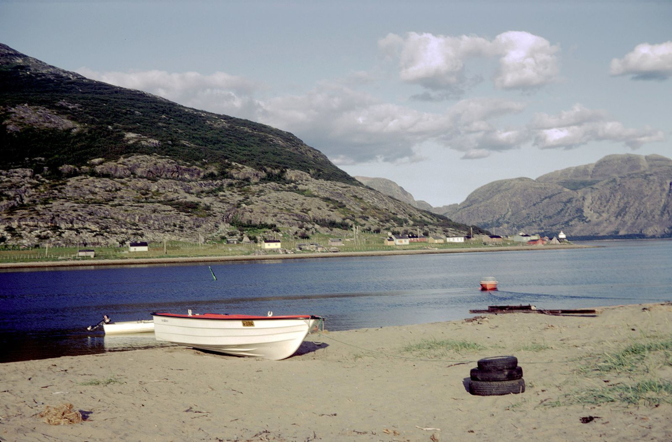
Fig. 2. Lavonjarg and the ship channel. Photo: Øystein Hauge.
When I began writing this article, I returned to conversations I had previously had with Øystein, who is an inhabitant of both Lavonjarg and Austertana (Fig. 2). I knew Øystein as a salmon fisherman, a teacher and an activist for coastal Sámi culture, as well as an experienced member of the local chapter of the international environmental organisation Friends of the Earth. On the phone, he outlined the story of his community’s resistance to Elkem’s mining expansions:
I first became involved in the work to prevent the dredging of the ship channel after an open meeting in 2015. We were told that dredging was necessary because the ship channel had become narrower and shallower. I asked how deep and how wide it was. Elkem’s response was that this was classified information.
The ship channel runs past the Tanamunningen Nature Reserve. Here, the channel is quite shallow. This means that ships cannot be heavier than 6000 tons to expect to get out in all weather, if fully loaded. These conditions have been the same since the mine opened in 1974. Elkem now claims that the sound has become shallower. But the real reason is that they want to be able to use bigger ships, the 8000-ton ships. They use them now, but they cannot fully load them; at the moment they have to sail 1500 tons below capacity. Back when this process was initiated, in 2015, I asked the Coastal Administration if they had depth measurements – if they could actually prove that the channel was filling in. Their answer was that they had measurements from 2011 and that new measurements were due that year, in 2015. It is odd that the Coastal Administration initiated this gigantic procedure without such basic information. Who knows, with the movement of the sand here. We who live here know that the sand moves all the time, depending on weather and water. If measurements were taken in 2015, the area could be deeper again in 2016. I felt as if the Coastal Administration started this potentially very damaging operation on the basis of a rumour.
The Coastal Administration plan is to straighten the ship channel and make it 150 metres wide and 9 metres deep. One can only imagine what effects this will have on the currents, the sandbanks and the wetlands.
Øystein pauses and asks:
What is the problem in not being able to run with maximum loads? And, if this is a problem, do they really need to use the 8000-ton ships? Elkem uses the shipping company Wilhelmsen. They argue that since Wilhelmsen is about to renew their fleet, most of their new ships will be 8000-ton ones. But I checked: there are at least 17 other shipping firms that own 6000-ton ships. Whenever I have argued this, Elkem replies that the new Wilhelmsen ships are better because they have “greener engines.” But, surely, they could put more environmentally friendly engines into older ships too.
Valuating the estuary
So far, the Coastal Administration has produced 12 reports to prepare the way for the dredging operation. Of these, one report is dedicated to environmental consequences. Four reports regard marine mapping, such as water, transport, economic benefits and shipping risk analysis (Kystverket, 2017). The report on the economic consequences of improving the ship channel presents the clearest arguments (Grünfeld, Løge, & Syrstad, Reference Grünfeld, Løge and Syrstad2016). It argues that with the current state of the ship channel, the risk of a ship running aground is estimated at 0.07% annually or, on average, once every 14 years. Dredging is estimated to decrease the annual frequency of ship grounding to 0.04%, in other words, an almost 50% reduction (Grünfeld et al., Reference Grünfeld, Løge and Syrstad2016, p. 30). These calculations of the economic benefits of dredging then follows: A lower probability of grounding also reduces risk of oil spills. Consequently, the savings of potential cleaning costs can be added to the economic benefits of the dredging. Given the area’s status as a nature reserve, the reduced probability of environmental destruction to protected plants and wildlife can further be added to the overall calculated savings. Savings on the potential loss of tourism income following spills within a wildlife reserve can similarly be added. In all, costs of spills should include a loss of income of as much as NOK 3.6 million. This could be added to the economic benefits of dredging (Grünfeld et al., Reference Grünfeld, Løge and Syrstad2016, p. 32). As the reader will have noted, the economic assessment uses the vulnerability of endangered wildlife, as previously proclaimed by the Finnmark chapter of Friends of the Earth and my friend Øystein, as an argument for dredging. Adding savings on maritime security to savings due to the maximisation of transport efficiency enabled by the use of 8000-ton ships, which in itself would save Elkem NOK 485 million. Including savings on potential environmental costs, Elkem would save NOK 500 million over the course of the mine’s lifetime (Grünfeld et al., Reference Grünfeld, Løge and Syrstad2016, p. 35).
Competing spaces – landscapes in movement
A review of newspaper articles from 2015 to 2016, when the mine expansion first became an issue, shows that the story of Elkem as a cornerstone industry becomes destabilised during this period. News coverage from NRK Sameradioen introduced different focuses: Mayor Ingilæ’s emphasis on the Tana River as being one of the most important Atlantic salmon rivers in Europe; the significance of the estuary as home to a variety of endangered species (Samuelsen, Reference Samuelsen2015); and concerns from Sámi in Reindeer Herding District 7 regarding the potential impact of the expansion on their reindeer migration routes (see also Lien, this issue; Måsø, Reference Måsø2014).
The environmental assessment of the proposed dredging operation also introduced another active agent that previously had gone unnoticed. The investigations had included video surveillance of the seabed in the vicinity of the ship channel. Just during the period of this surveillance, the report describes substantial movement in the seabed (Sømme & de Ruiter, Reference Sømme and de Ruiter2015). For people who live here, this was not surprising, As already exemplified by Øystein in this text, locals mentioned the movements of the seabed as an argument against the dredging operation. I recognise these arguments, these movements of sand and water were also a common talking point in the spring. Every year, there were countless stories of how the ice breaks up and thaws before the river starts its furious springtime movement. Rapid floods are unleashed, overflowing lower parts of the riverbed. Fishermen compare past floods and contemporary floods. The lack of steel ice, now that winters are less cold, brings other kinds of floods. Still, large amounts of water race towards the sea. The river is coloured brown by the sediments, and the sediments in turn attract new life to fjord. Even now, with smaller floods, the masses of water move rocks and even entire trees. This movement has positive effects on the river, according to the fishermen; it removes debris from the riverbed and prepares the grounds for new spawning. When the floods abate, fishermen talk about re-familiarising themselves with the landscape. In my hours spent on the river, as part of fishing expeditions, fishermen endlessly point out and describe when and how canyons have been washed out, how sandbanks have been altered and how large rocks have shifted. Fishermen describe how every year deep holes and shallow areas must be mapped anew; sometimes new streams emerge, and old ones could even change direction (Fig. 3).
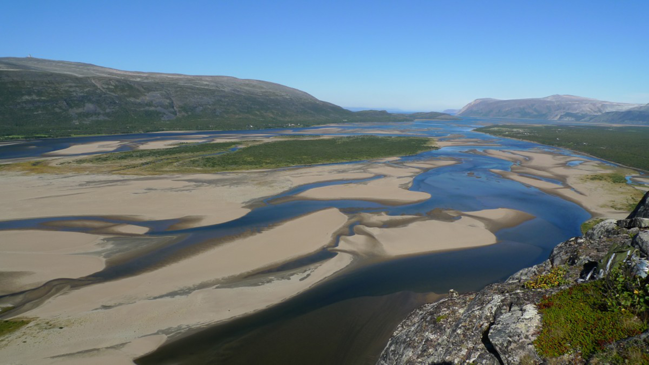
Fig. 3. The lower parts of the Tana River. Photo: Frank Martin Ingilæ.
The locals’ awareness of sand and the seabed have caused them to harbour significant concerns over the proposal to deepen the ship channel. In Øystein’s words:
We who live here know that the sand moves all the time. Remember that time when I met you down at the nature reserve? All that sand, just since that time, it has moved so much. People are worried about erosion. If the channel is deepened, the sand will just slowly pour back; if there is a storm, it could be back in days. I spoke to someone who came from a similar area near Boston, in the US. Where he lived, they had started doing this kind of dredging. Now they have to do it every other year. Will it be the same here? The government pays for dredging now, an operation estimated to cost 120 million. Who will pay when Elkem wants it done again in another two years?
Øystein is not only worried about the constant movement of the seabed. He also wants to draw attention to the amount of material that is proposed to be removed:
It is so hard for people to understand how much mud and sand they want to remove. I tell them, 400,000 cubic metres, that’s 50,000 lorry loads. They say that all this can be safely stored off Stangnes, on the outside of the Varanger Peninsula … It could change the nature of the sandbanks down here. As if it would stay there. The river could change its course. And what will it do with the spawning grounds out there? These sandbanks and everything that lives there are important for the birds in the nature reserve and for the seals. That’s partly what brings them here for their breeding season.
Competing spaces – protecting nature
A different cartographic vision of this land–water interface is detailed in the management plan for the nature reserve at Tanamunningen, across from the small community of Lavonjarg. The environmental assessment of the dredging proposal lists residing endangered species: goosander (Mergus serrator), long-tailed duck, the only living species of its genus, Clangula (Clangula hyemalis), velvet duck (Melanitta fusca), dunlin (Calidris alpina), northern phalarope (Phalaropus lobatus), bean goose (Anser fabalis), white-tailed eagle (Haliaeetus albicilla) and ruff (Philomachus pugnax). Of breeding species, there are temminck (Calidris temminckii), Arctic tern (Sterna paradisae), eider (Somateria mollissima) and Arctic jaeger (Stercorarius parasiticus) (Sømme & de Ruiter, Reference Sømme and de Ruiter2015, Section 5.6.1.). Grey seals (Halichoerus grypus) and harbour seals (Phoca vitulina) also live in the reserve. The environmental assessment also notes that the estuary is the only place in Norway where seals give birth on a sandbank. Locals call the sandbanks in the basin “Kobbsanda” – “seal sand” (Sømme & de Ruiter, Reference Sømme and de Ruiter2015).
While the environmental assessment primarily described species in the immediate area of the ship channel, it does point out that if further areas are involved, such as Stangnesodden, where there are plans to deposit dredging material, further species must be considered. This area is a breeding ground for lumpfish, crab and sand eels (Sømme & de Ruiter, Reference Sømme and de Ruiter2015, Section 5.7). Sand eel is one key species in the environmental assessments that has generally received little attention: it is a small fish of the species Ammodytes marinus, which in recent years has declined significantly in the Far North (Bergstad et al., Reference Bergstad, Johannessen, Anker-Nilssen and Barrett2013). In the nature reserve, sand eels form a substantial part of the diet of local seabirds and wetland bird species. In the fjord, it is also fundamental to the livelihood of trout and salmon (Sømme & de Ruiter, Reference Sømme and de Ruiter2015).
In summary, as small and insignificant as the sand eel may seem, according to the environmental assessment it is a key species in this habitat (Sømme & de Ruiter, Reference Sømme and de Ruiter2015). According to the environmental assessment, since sand eels live in sand, the planned removal of 256,000 tons of sand will lead to the death of extraordinary numbers of the tiny fish. After this initial destruction, there will also be secondary consequences. The area where the removed sediments will likely be deposited is also their spawning ground. The depositing of the sediments will also likely change particle concentration in the water, affecting the plankton on which sand eels feed (Sømme & de Ruiter, Reference Sømme and de Ruiter2015). While dredging in itself involves a dramatic disturbance of existing life and a substantial direct risk to animal life in the fjord, the secondary effects of the depletion of the sand eel population on the larger species inhabiting the area will be equally dramatic (Sømme & de Ruiter, Reference Sømme and de Ruiter2015).
We do not yet know whether the previously ignored sand eel, the sandbanks, the more charismatic salmon or the complex interspecies relations of the wetlands will become the issue(s) that erode(s) the cartographic vision foregrounding maritime security. The Ministry of Climate and Environment may insist on following the precautionary principle that is generally the foundation of environmental policy in all matters regarding such issues as salmon and wetlands, as well as a governing principle in cases with reasonable grounds for concern for potentially deleterious effects on the environment (Ween, Reference Ween, Ellefsen, Larsen and Sollund2012). The dredging operation has yet to be approved by the Finnmark County Governor, but the decision keeps being postponed. The County Governor’s office has emphasised its intent to take the potential environmental consequences seriously. For now, like the map machine, the heterogeneous cartographic visions with possible relevance to this procedure remain open.
Map machines and landscapes in circulation – an extended conclusion
To the Coastal Administration, this area is an infrastructure project. The agency’s mandate is technical in nature: to secure safe travel in Norwegian waters (Kystverket, 2017). Øystein’s story reveals local frustrations with the cartographic vision that emerges in the reports from the Coastal Administration. The agency’s reports, with enclosed maps of the fjord featuring shaded areas marking for reposited materials, give an impression of elements as being mapped and fixed. If so, maybe human and non-human life forms, not to mention their various activities can co-exist? Instead of concluding that the removal and relocation of 300,000 m3 of sand and silt will significantly impact the sand eel and other endangered species, the document asks, could the dredging take place in the winter when the sand eel are not spawning and when there are fewer trout and salmon in the fjord (Kystverket, 2017)? This line of reasoning speaks to the particular “out of space and time” quality of such cartographic visions.
All the cartographic visions I have presented here are part of the same bureaucratic trail, brought together by a formal application to dredge the ship channel. The ship channel is, however, only one element of Elkem’s expansion plans. The territorial expansion of the mine in Austertana is a separate bureaucratic process. This process has also had a considerable effect on public life for about as long as the ship channel issue has. Reframing this land–water interface to take into consideration, the mine expansion on land has a dizzying effect. It brings into view a series of new landscapes and actors, some of which have already briefly been mentioned: Reindeer Herding District 7 and the local population of Austertana. There is also a new mayor of the Tana municipality, Labour representative Helga Pedersen. Last year’s municipal elections manifested strong sentiments both for and against two local land-use development cases. One case involved a proposed windmill park on Rastegaisa, one of Finnmark’s tallest mountains, and also an area of spiritual significance. The other was the case of the Elkem mine expansion. A slim majority elected pro-development Helga Pedersen as mayor; the deputy mayor, however, was elected on an anti-development platform (Vernes, Reference Vernes2019).
The assessments and hearings preparing the Elkem mine expansion case for the municipal county council revealed substantial consequences for Reindeer Herding District 7. Following up on these reports, the Finnmark Estate opposed the expansion in the official hearings (Lindbach & Dahl, Reference Lindbach and Dahl2019). This response again caused others in Austertana to react. These expressed fear of what could be lost if Elkem were to pull out altogether.
I could have included these processes too, to further complicate the many cartographic visions in flux in this text. My primary focus here, however, is not to produce an exhaustive mapping of all possible versions of the land–water interfaces on the Varanger Peninsula. Instead, I aim to highlight those that appear – framed, visualised and prioritised – in a single particular bureaucratic procedure to show how all these visions are put into play by an issue of maritime security, defined as the securing of mining industries and economic development in a small northern community.
As the map machine also illustrates, this landscape could be and is continuously framed and reframed. Regardless of which cartographic vision a bureaucratic procedure brings into focus, other aspects of the same land–water interfaces will be set aside. As this text shows, despite the decolonising ambitions, there is a strong possibility that local inhabitants will be sacrificed. Such reframings could be considered wilful, and undoubtedly, that is often how they are perceived, such as in this specific case, by Sámi salmon fishermen living in Tana. The interests of locals are regularly sacrificed, as this text as exemplified, as economically oriented arguments become more innovative. Regardless of intent, the map machine allows us to dwell on the more or less constant work of such inscriptions, framing and reframing, foregrounding of landscapes and inhabitants and the concomitant erasure of others and the constant effort this involves for people in the North.
Like Kramvig’s Dreamland, to outsiders, the Varanger Peninsula remains “out of space and time.” It is perhaps not surprising that this landscape continues to have new cartographic visions added to the many, and often incommensurable ones, that already exist. Øystein knows how this works, how local landscapes and local perspectives are left out, how new urgencies comes to the fore, how plans and procedures are put forward with no concern for long-term consequences. To Øystein and his community, their culture and environment will surely bear the cost.
I will let Øystein have the last word. At this point in our conversation last year, he was clearly frustrated by the many struggles and the prospects, but at the same time, he was by no means willing to give up. His effort is all for protecting Varanger, Lavonjarg, the coastal Sámi and Austertana as a community:
Remember that it is only Elkem that uses this ship channel. The mining company and its supporters argue that their operation is necessary to maintain the community. Meanwhile, less than half of the staff of 42 are locals. Elkem employees live in barracks on the site. Their work schedule is similar to that of oil workers: ten days on, seven days off. I have a friend who is deeply involved in the fight against them. He has calculated that the municipal county only makes about 600-700,000 in taxes, compensation costs for the land. Over the past 10 years, while Elkem has made a huge profit, the number of inhabitants in Austertana has gone down from 400 to 200. We have a school with five students; we have lost shops and our nursing home. The only thing we get to keep is the dust. The dust from the mining is a constant. It is always on our windows, on our skin and in our breath.


 Open access