Skip to main content Accessibility help
×
Hostname: page-component-8448b6f56d-sxzjt Total loading time: 0 Render date: 2024-04-23T21:06:02.258Z Has data issue: false hasContentIssue false

Bibliography

Published online by Cambridge University Press:  15 January 2021

Sally Bushell
Affiliation:
Lancaster University
Julia S. Carlson
Affiliation:
University of Cincinnati
Damian Walford Davies
Affiliation:
Cardiff University
Get access

Summary

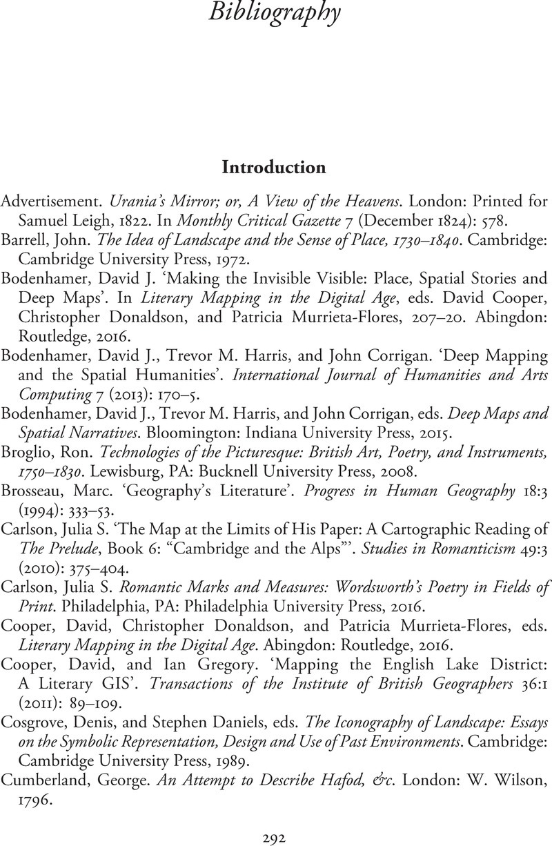
Image of the first page of this content. For PDF version, please use the ‘Save PDF’ preceeding this image.'
Type
Chapter
Information
Romantic Cartographies
Mapping, Literature, Culture, 1789–1832
, pp. 292 - 315
Publisher: Cambridge University Press
Print publication year: 2020

Access options

Get access to the full version of this content by using one of the access options below. (Log in options will check for institutional or personal access. Content may require purchase if you do not have access.)

References

Primary Sources

Advertisement. Urania’s Mirror; or, A View of the Heavens. London: Printed for Samuel Leigh, 1822. In Monthly Critical Gazette 7 (December 1824): 578.Google Scholar
Barrell, John. The Idea of Landscape and the Sense of Place, 1730–1840. Cambridge: Cambridge University Press, 1972.Google Scholar
Bodenhamer, David J.Making the Invisible Visible: Place, Spatial Stories and Deep Maps’. In Literary Mapping in the Digital Age, eds. Cooper, David, Donaldson, Christopher, and Murrieta-Flores, Patricia, 207–20. Abingdon: Routledge, 2016.Google Scholar
Bodenhamer, David J., Harris, Trevor M., and Corrigan, John. ‘Deep Mapping and the Spatial Humanities’. International Journal of Humanities and Arts Computing 7 (2013): 170–5.Google Scholar
Bodenhamer, David J., Harris, Trevor M., and Corrigan, John, eds. Deep Maps and Spatial Narratives. Bloomington: Indiana University Press, 2015.Google Scholar
Broglio, Ron. Technologies of the Picturesque: British Art, Poetry, and Instruments, 1750–1830. Lewisburg, PA: Bucknell University Press, 2008.Google Scholar
Brosseau, Marc.Geography’s Literature’. Progress in Human Geography 18:3 (1994): 333–53.Google Scholar
Carlson, Julia S.The Map at the Limits of His Paper: A Cartographic Reading of The Prelude, Book 6: “Cambridge and the Alps”’. Studies in Romanticism 49:3 (2010): 375404.CrossRefGoogle Scholar
Carlson, Julia S. Romantic Marks and Measures: Wordsworth’s Poetry in Fields of Print. Philadelphia, PA: Philadelphia University Press, 2016.Google Scholar
Cooper, David, Donaldson, Christopher, and Murrieta-Flores, Patricia, eds. Literary Mapping in the Digital Age. Abingdon: Routledge, 2016.CrossRefGoogle Scholar
Cooper, David, and Gregory, Ian. ‘Mapping the English Lake District: A Literary GIS’. Transactions of the Institute of British Geographers 36:1 (2011): 89109.Google Scholar
Cosgrove, Denis, and Daniels, Stephen, eds. The Iconography of Landscape: Essays on the Symbolic Representation, Design and Use of Past Environments. Cambridge: Cambridge University Press, 1989.Google Scholar
Cumberland, George. An Attempt to Describe Hafod, &c. London: W. Wilson, 1796.Google Scholar
Curnow, Wystan.Mapping and the Expanded Field of Contemporary Art’. In Mappings, ed. Cosgrove, Denis, 253–68. London: Reaktion Books, 1999.Google Scholar
Daniels, Stephen. Fields of Vision: Landscape Imagery and National Identity in England and the United States. Cambridge: Polity, 1993.Google Scholar
Dent, Borden D. Cartography: Thematic Map Design, 2nd ed. Atlanta: Georgia State University and Wm C. Brown Publishers, 1985.Google Scholar
Eaves, Morris, Essick, Robert N., and Viscomi, Joseph, eds. ‘Auguries of Innocence’. The Pickering Manuscript: Electronic Edition, The William Blake Archive, object 16. www.blakearchive.org/images/bb126.1.13.ms.100.jpg.Google Scholar
Kanas, Nick. Star Maps: History, Artistry, Cartography. Berlin, Heidelberg, New York, and Chichester: Springer Praxis, 2009.Google Scholar
Hewitt, Rachel.“Eyes to the Blind”: Telescopes, Theodolites and Failing Vision in William Wordsworth’s Landscape Poetry’. Journal of Literature and Science 1:1 (2007): 523.Google Scholar
Hewitt, Rachel. Map of a Nation: A Biography of the Ordnance Survey. London: Granta, 2010.Google Scholar
Hewitt, Rachel.Mapping and Romanticism’. Wordsworth Circle 42:2 (2011): 157–65.Google Scholar
Hingley, P. D.Urania’s Mirror – A 170-Year-Old Mystery Solved’. Journal of the British Astronomical Association 104:5 (1994): 238–40.Google Scholar
Hones, Sheila.Literary Geography: The Novel as Spatial Event’. In Envisioning Landscape, Making Worlds: Geography and the Humanities, eds. Daniels, Stephen, DeLyser, Dydia, Entrikin, J. Nicholas, and Douglas, Richardson, 247–55. Abingdon: Routledge, 2011.Google Scholar
Least Heat-Moon, William. PrairyErth (A Deep Map). Boston, MA: Houghton Mifflin, 1991.Google Scholar
Malkin, Benjamin Heath. A Father’s Memoirs of his Child. London: Longman, Hurst, Rees, and Orme, 1806.Google Scholar
Moretti, Franco. Atlas of the European Novel, 1800–1900. London: Verso, 1998.Google Scholar
Moretti, Franco. Graphs, Maps, Trees: Abstract Models for a Literary Geography. London: Verso, 2005.Google Scholar
‘Qualitative Maps: An Introduction’. Historic Map Collection: Princeton University Library. http://libweb5.princeton.edu/visual_materials/maps/websites/thematic-maps/introduction/introduction.html.Google Scholar
Ridpath, Ian.Alexander Jamieson, Celestial Mapmaker’. Astronomy & Geophysics 54:1 (February 2013): 1.22–1.23.Google Scholar
Roberts, Les, ed. Special Issue: Deep Mapping and Spatial Anthropology. ‘Deep Mapping’. Humanities 5:5 (2016): 17.Google Scholar
Saunders, Angharad.Literary Geography: Re-forging the Connections’. Progress in Human Geography 34:4 (2019): 436–52.Google Scholar
Smith, D. K. The Cartographic Imagination in Early Modern England. Aldershot: Ashgate, 2008.Google Scholar
Tally, Robert T. Review of Franco Moretti. Modern Language Quarterly 68:1 (2007): 132–5.Google Scholar
Thacker, Andrew.The Idea of A Critical Literary Geography’. New Formations: A Journal of Culture/Theory/Politics 57 (2005–6): 5672.Google Scholar
Urania’s Mirror; or, A View of the Heavens. London: G. & W. B. Whittaker, 1824.Google Scholar
Walford Davies, Damian. Cartographies of Culture: New Geographies of Welsh Writing in English. Cardiff: University of Wales Press, 2012.Google Scholar
Wordsworth, William. The Thirteen-Book Prelude, ed. Reed, Mark L.. Ithaca, NY: Cornell University Press, 1991.Google Scholar

Secondary Sources

Alexander, David. Richard Newton and English Caricature in the 1790s. Manchester: The Whitworth Art Gallery and Manchester University Press, 1998.Google Scholar
Alpers, Svetlana. The Art of Describing: Dutch Art in the Seventeenth Century. London: John Murray, 1983.Google Scholar
An Account of the Principal Pleasure Tours In Scotland. Edinburgh: John Thompson, 1821.Google Scholar
Anderson, George, and Anderson, Peter. Guide to the Highlands and Islands of Scotland. London: John Murray, 1834.Google Scholar
Andrew, Graham. A Plan of Part of Hudson’s-bay, and Rivers, Communicating with York Fort and Severn. c. 1774.Google Scholar
Anon. A Plan of Fishguard Bay, Near Which the French Landed 1200 Men (20 March 1797; published by Laurie and Whittle); Llyfrgell Genedlaethol Cymru/National Library of Wales (Map 6466).Google Scholar
Anon. Review of The British Atlas. Eclectic Review 1 (1805): 868–9.Google Scholar
Anon. ‘Welsh Battlefields Historical Research: Carregwastad Point, Fishguard (1797)’. http://battlefields.rcahmw.gov.uk/wp-content/uploads/2017/02/Carregwastad-Point-Fishguard-1797-Border-Archaeology-2009.pdf.Google Scholar
ap Gwilym, H. L. (H. L. Williams). An Authentic Account of the Invasion by the French Troops … on Carrig Gwasted [sic] Point, Near Fishguard, 1797. Haverfordwest: Joseph Potter, 1797.Google Scholar
Arrowsmith, Aaron. Memoir Relative to the Construction of the Map of Scotland. London: W. Savage, 1809.Google Scholar
Ayton, Richard, and Daniell, William. A Voyage Round Great Britain: Undertaken Between the Years 1813 and 1823 … with a Series of Views, 2 vols. London: Tate Gallery and the Scolar Press, 1978.Google Scholar
Baker, James. A Brief Narrative of the French Invasion, Near Fishguard Bay. Worcester: J. Tymbs, 1797.Google Scholar
Banks, Joseph. ‘Observations on Mr Mudge’s Application to Parliament for a Reward for his Time-Keepers’. Royal Society Archive MS: MM/7/100.Google Scholar
Barber, Peter, and Harper, Tom. Magnificent Maps: Power, Propaganda and Art. London: The British Library, 2010.Google Scholar
Barrell, John. English Literature in History 1730–80: An Equal, Wide Survey. London: Hutchinson, 1983.Google Scholar
Beaglehole, J. C., The Life of Captain James Cook. Stanford, CA: Stanford University Press, 1974.Google Scholar
Beaglehole, J. C., ed. The Journals of Captain James Cook on His Voyages of Discovery, 4 vols. Cambridge: For the Hakluyt Society at the University Press, 1968–74.Google Scholar
Beeke, Henry. Observations on the Produce of the Income Tax. London: J. Wright, 1799.Google Scholar
Belyea, Barbara.Amerindian Maps: The Explorer as Translator’. Journal of Historical Geography 18:3 (1992): 267–77.Google Scholar
Belyea, Barbara.Mapping The Marias: The Interface of Native and Scientific Cartographies’. Great Plains Quarterly 17:3/4 (1997): 165–84.Google Scholar
Benedict, Barbara M. Curiosity: A Cultural History of Early Modern Inquiry. Chicago, IL: University of Chicago Press, 2001.Google Scholar
Bernstein, David.Negotiating Nation: Native Participation in the Cartographic Construction of the Trans-Mississippi West’. Environment and Planning A: Economy and Space 48:3 (2016): 626–47.Google Scholar
Bewell, Alan. Natures in Translation: Romanticism and Colonial Natural History. Baltimore, MD: Johns Hopkins University Press, 2017.Google Scholar
Bingley, William. A Tour Round North Wales, During the Summer of 1798, 2 vols. London: E. Williams, 1800.Google Scholar
Binnema, Theodore.How Does a Map Mean? Old Swan’s Map of 1801 and the Blackfoot World’. In From Rupert’s Land to Canada: Essays in Honour of John E. Foster, eds. Binnema, Theodore, Ens, Gerhard, and Macleod, Roderick C., 201–24. Edmonton: University of Alberta Press, 2001.Google Scholar
Bleichmar, Daniela. Visible Empire: Botanical Expeditions and Visual Culture in the Hispanic Enlightenment. Chicago, IL: University of Chicago Press, 2012.Google Scholar
Boswell, James. The Life of Samuel Johnson, 2 vols. London: Charles Dilly, 1791.Google Scholar
Bowles, William Lisle. Sonnets, and Other Poems, 7th ed. London: T. Cadell, 1800.Google Scholar
Brayley, E. W. The Beauties of England and Wales; Or, Delineations Topographical, Historical, and Descriptive, of Each County: Volume 8. London: Vernor, Hood & Sharpe, 1808.Google Scholar
Brayley, E. W. Letter to Mark Noble, 5 November 1816. Bodleian Library, MS. Eng. Misc. d.164, f.47.Google Scholar
Brayley, E. W. Letters to Mark Noble, 1 August 1806–27 December 1808. Bodleian Library, MS. Eng. Misc. d.159.Google Scholar
Brayley, E. W., ed. The Works of the Late Edward Dayes. London: Private publication (Mrs Dayes), 1805.Google Scholar
Brayley, E. W., and Britton, John. The Beauties of England and Wales; Or, Delineations Topographical, Historical, and Descriptive, of Each County: Volume 6. London: Vernor & Hood, 1805.Google Scholar
Brewer, John. The Beauties of England and Wales: Introduction to the Original Delineations, Topographical, Historical and Descriptive. London: John Harris, 1818.Google Scholar
Britton, John. The Autobiography of John Britton, FSA. London: Charles Muskett, 1850.Google Scholar
Britton, John. The Beauties of England and Wales; Or, Delineations Topographical, Historical, and Descriptive of Each County: Volume 9. London: Vernor, Hood & Sharpe, 1807.Google Scholar
Britton, John.Edward Wedlake Brayley, Esq.’. Gentleman’s Magazine 44 (1854): 582–6.Google Scholar
Britton, John. An Essay on Topographical Literature. London: Wiltshire Topographical Society, 1843.Google Scholar
Britton, John. Fine Arts of the English School. London: Longman, 1812.Google Scholar
[Britton, John]. ‘The Late Samuel Prout’. The Builder 10 (1852): 339–40.Google Scholar
Broglio, Ron.Mapping British Earth and Sky’. Wordsworth Circle 33:2 (2002): 70–7.Google Scholar
Brown, John. A Description of the Lake at Keswick. Kendal: W. Pennington, 1771.Google Scholar
[Brydges, Samuel]. ‘Preface’. The Topographer 1 (1789): iviii.Google Scholar
Budgen, Thomas. ‘Exeter’, Ordnance Surveyors’ Drawings. British Library, OSD 40 (1801).Google Scholar
Burney, Frances. Cecilia; or, Memoirs of an Heiress, 3 vols. London: T. Cadell, 1782.Google Scholar
Carlson, Julia S. Romantic Marks and Measures: Wordsworth’s Poetry in Fields of Print. Philadelphia, PA: University of Philadelphia Press, 2016.Google Scholar
Carlson, Julia S.Topographical Measures: Wordsworth’s and Crosthwaite’s Lines on the Lake District’. Romanticism 16.1 (2010): 7293.Google Scholar
Carradice, Phil. The Last Invasion: The Story of the French Landing in Wales. Griffithstown, Wales: Village Publishing, 1992.Google Scholar
Chubb, Thomas. The Printed Maps in the Atlases of Great Britain and Ireland. London: The Homeland Association, 1927.Google Scholar
Close, Charles. The Early Years of the Ordnance Survey. Newton Abbot: David & Charles, 1969 [1926].Google Scholar
Coleridge, Samuel Taylor. Fears in Solitude … To Which Are Added, France, An Ode; and Frost at Midnight. London: J. Johnson, 1798.Google Scholar
Compton, Thomas. The North Cambrian Mountains, or a Tour Through North Wales, Describing the Scenery and General Characters of that Romantic Country, and Embellished with a Series of Highly-Finished Coloured Views, Engraved from Original Drawings. London: Thomas Compton, 1817.Google Scholar
Cookson, J. E.The English Volunteer Movement of the French Wars, 1793–1815: Some Contexts’. Historical Journal 32:4 (1989): 867–91.Google Scholar
Cradock, Joseph. Letters from Snowdon, Descriptive of a Tour through the Northern Countries of Wales. London: J. Ridley, 1770.Google Scholar
Daniels, Stephen.Mapping the Metropolis in an Age of Reform: John Britton’s London Topography, 1820–1840’. Journal of Historical Geography 56 (2017): 6182.Google Scholar
Daniels, Stephen, and Elliott, Paul. ‘“Outline Maps of Knowledge”: John Aikin’s Geographical Imagination’. Religious Dissent and the Aikin-Barbauld Circle, 1740–1860, eds. James, Felicity and Inkster, Ian, 94125. Cambridge: Cambridge University Press, 2010.Google Scholar
Darwin, Erasmus. The Botanic Garden. London: Joseph Johnson, 1799.Google Scholar
Daston, Lorraine, and Galison, Peter. Objectivity. New York: Zone Books, 2010.Google Scholar
Daston, Lorraine, and Park, Katharine. Wonders and the Order of Nature. New York: Zone Books, 1998.Google Scholar
Davidoff, Leonore, and Hall, Catherine. Family Fortunes: Men and Women of the English Middle Class, 1780–1850. London: Hutchinson, 1987.Google Scholar
Davies, Hywel M.Terror, Treason and Tourism: The French in Pembrokeshire, 1797’. ‘Footsteps of Liberty and Revolt’: Essays on Wales and the French Revolution, eds. Constantine, Mary-Ann and Johnston, Dafydd, 247–70. Cardiff: University of Wales Press, 2013.Google Scholar
Dawson, Joan. The Mapmaker’s Eye: Nova Scotia Through Early Maps. Halifax: Nimbus Publishing and the Nova Scotia Museum, 1988.Google Scholar
Dearden, William, ed. Poems by John Nicholson, the Airedale Poet. London: W. H. Young, 1859.Google Scholar
Delano-Smith, Catherine, and J. P. Kain, Roger. English Maps: A History. London: The British Museum, 1999.Google Scholar
Della Dora, Veronica.Performative Atlases: Memory, Materiality and (Co)authorship’. Cartographica 44:4 (2009): 241–56.Google Scholar
Dodsley, Robert.Agriculture: A Poem’. Trifles. London: J. Dodsley, 1777.Google Scholar
Donald, Diana. The Age of Caricature: Satirical Prints in the Age of George III. New Haven, CT: Yale University Press, 1996.Google Scholar
Douglas, Starr.Dr John Fothergill: Significant Donor’. William Hunter’s World: The Art and Science of Eighteenth-Century Collecting, eds. Hancock, E. Geoffrey, Pearce, Nick, and Campbell, Mungo, 165–75. Dorchester: Ashgate, 2015.Google Scholar
Dorrian, Mark.The Aerial View: Notes for a Cultural History’. Strates 13 (2007): 113.Google Scholar
Edgeworth, Maria. Tales of Fashionable Life, 3 vols. London: Joseph Johnson, 1809.Google Scholar
Edwards, George. A Natural History of Uncommon Birds … Containing the Figures of Sixty Birds and two Quadrupeds, 4 vols. London: Printed for the author, 1743–51.Google Scholar
Evans, John, and Britton, John. The Beauties of England and Wales; Or, Delineations Topographical, Historical, and Descriptive, of Each County: Volume 11. London: Vernor, Hood & Sharpe, 1810.Google Scholar
Faden, William. Catalogue of Geographical Works Published by William Faden. London: Faden, 1822.Google Scholar
Farmer, Jared. On Zion’s Mount: Mormons, Indians, and the American Landscape. New York: Cambridge University Press, 2002.Google Scholar
Flint, Stamford Raffles. Mudge Memoirs: Being a Record of Zachariah Mudge, and Some Members of his Family. Truro: Netherton and Worth, 1883.Google Scholar
Franklin, Alexandra.John Bull in a Dream: Fear and Fantasy in the Visual Satires of 1803’. Resisting Napoleon: The British Response to the Threat of Invasion, 1797–1815, ed. Philp, Mark, 125–39. Aldershot: Ashgate, 2006.Google Scholar
Franklin, Alexandra, and Philp, Mark. Napoleon and the Invasion of Britain. Oxford: The Bodleian Library, 2003.Google Scholar
Friel, Brian. Translations. London: Faber, 1981.Google Scholar
Gascoigne, John. Science in the Service of Empire: Joseph Banks, The British State and The Uses of Science in the Age of Revolution. Cambridge: Cambridge University Press, 1998.Google Scholar
George, M. Dorothy. Catalogue of Political and Personal Satires Preserved in the Department of Prints and Drawings in the British Museum, Vol VI, 1784–1792. London: Oxford University Press, 1938.Google Scholar
George, M. Dorothy. Catalogue of Political and Personal Satires Preserved in the Department of Prints and Drawings in the British Museum, Vol VII, 1793–1800. London: Oxford University Press, 1942.Google Scholar
George, Wilma. Animals and Maps. Berkeley: University of California Press, 1969.Google Scholar
Gittings, Robert, ed. Letters of John Keats: A New Selection. Oxford: Oxford University Press, 1970.Google Scholar
Goffart, Walter. Historical Atlases: The First Three Hundred Years, 1570–1870. Chicago, IL: University of Chicago Press, 2003.Google Scholar
Goodwin, Gordon. ‘Mark Noble (1754–1827)’. Oxford Dictionary of National Biography. www.oxforddnb.com/view/article/20221.Google Scholar
Graham, Andrew.Andrew Graham’s Bird Observations Written at Severn, 1768’. Manuscript E.2/5, Hudson’s Bay Company Archives, Provincial Archives of Manitoba, Supplementary Document #1 to Eighteenth-Century Naturalists of Hudson Bay, eds. Stuart Houston, C, Ball, Tim, and Houston, Mary. Montreal, QC: McGill-Queen’s University Press, 2003.Google Scholar
Grainger, Margaret, ed. The Natural History Prose Writings of John Clare. Oxford: Clarendon Press, 1983.Google Scholar
Graves, Robert. Collected Poems. New York: Oxford University Press, 1975.Google Scholar
Green, William. The Tourist’s New Guide, Containing a Description of the Lakes, 2 vols. Kendal: R. Lough, 1819.Google Scholar
Griggs, Earl Leslie, ed. Collected Letters of Samuel Taylor Coleridge, 6 vols. Oxford: Clarendon Press, 1957–71.Google Scholar
Hacking, Ian. The Taming of Chance. Cambridge: Cambridge University Press, 1990.Google Scholar
Hansen, Lars, ed. The Linnaeus Apostles: Global Science and Adventure, 8 vols. London: I. K. Foundation, 2010.Google Scholar
Harley, J. Brian.Deconstructing the Map’. Writing Worlds: Discourse, Text and Metaphor, eds. Barnes, T. J. and Duncan, J. J., 231–47. London: Routledge, 1992.Google Scholar
Harley, J. Brian, et al. The Old Series Ordnance Survey Maps of England and Wales, Vol 6: Wales. Lympne Castle: Harry Margars, 1992.Google Scholar
Harley, J. Brian, and O’Donoghue, Yolande, eds. The Old Series Ordnance Survey Maps of England and Wales, 8 vols. Lympne Castle, Kent: Harry Margary, 1975–92.Google Scholar
Harvey, P. D. A. The History of Topographical Maps: Symbols, Pictures and Surveys. London: Thames and Hudson, 1980.Google Scholar
Harrington, James. The Common-Wealth of Oceana. London: J. Streater, 1656.Google Scholar
Harris, Moses. A Plan of the Harbour of Chebucto and Town of Halifax. London: Edward Cave, 1750.Google Scholar
Haywood, Ian.“The Dark Sketches of a Revolution”: Gillray, the Anti-Jacobin Review, and the Aesthetics of Conspiracy in the 1790s’. European Romantic Review 22:4 (2011): 431–51.Google Scholar
Helgerson, Richard.The Land Speaks: Cartography, Chorography and Subversion in Renaissance England’. Representations 16 (1986): 5085.Google Scholar
Hewitt, Rachel. Map of a Nation: A Biography of the Ordnance Survey. London: Granta, 2011.Google Scholar
Hewitt, Rachel.Mapping and Romanticism’. Wordsworth Circle 42:2 (2011): 157–65.Google Scholar
Hill, Arthur. Plans for the Government and Liberal Instruction of Boys. London: G. and W. B. Whittaker, 1822.Google Scholar
Hill, Draper. Mr Gillray. The Caricaturist. London: Phaidon, 1965.Google Scholar
Howse, Derek. Nevil Maskelyne: The Seaman’s Astronomer. Cambridge: Cambridge University Press, 1989.Google Scholar
Hughes, John. Poems on Several Occasions, 2 vols. London: J. Tonson and J. Watts, 1735.Google Scholar
Hutchins, Thomas.Thomas Hutchins’ Manuscript Accompanying Bird and Mammal Specimens Submitted to England from York Factory, 28 August 1772’. Property of the Royal Society of London, England, Supplementary Document #2 to Eighteenth-Century Naturalists of Hudson Bay, eds. Stuart Houston, C, Ball, Tim, and Houston, Mary. Montreal, QC: McGill-Queen’s University Press, 2003.Google Scholar
Hutton, William. Remarks Upon North Wales. Birmingham: Knott and Lloyd, 1803.Google Scholar
Hyde, Ralph.Thomas Hornor: Pictural Land Surveyor’. Imago Mundi 29:1 (1977): 2334.Google Scholar
Jefferys, Thomas. A Map of the South Part of Nova Scotia and Its Fishing Banks. London: T. Jefferys, 1750.Google Scholar
Jones, Ffion Mair.“The Silly Expressions of French Revolution … ”: The Experience of the Dissenting Community in South-West Wales, 1797’. In Experiencing the French Revolution, ed. Andrews, David, 245–62. Oxford: Voltaire Foundation, 2013.Google Scholar
Jones, Ffion Mair, ed. Welsh Ballads of the French Revolution, 1793–1815. Cardiff: University of Wales Press, 2012.Google Scholar
Jones, T. E. A Descriptive Account of the Literary Works of John Britton, FSA. London: For Subscribers to the Testimonial, 1849.Google Scholar
Kennedy, A. J. ‘British Topographical Print Series in Their Social and Economic Context, c.1720–c.1840’. Unpublished PhD thesis. Courtauld Institute, University of London, 1998.Google Scholar
King, William. The Toast. An Heroick Poem. London: 1747.Google Scholar
Knowles, John, ed. The Life and Writings of Henry Fuseli, 3 vols. London: Henry Colburn and Richard Bentley, 1831.Google Scholar
Knox, Thomas. Some Account of the Proceedings that Took Place on the Landing of the French Near Fishguard, in Pembrokeshire … And of the Inquiry Afterwards Had Into Lieut. Col. Knox’s Conduct. London: A. Wilson, 1800.Google Scholar
‘Legal Papers Regarding Case of Hugh Debbeig vs Lord Howe’, National Archives, TS 11/944/3436, f. 1, 5 February 1782.Google Scholar
Lennox, Jeffers. Homelands and Empires: Indigenous Spaces, Imperial Fictions, and Competition. Toronto: University of Toronto Press, 2017.Google Scholar
Leslie, Charles Robert. Life and Times of Sir Joshua Reynolds, 2 vols. London: John Murray, 1865.Google Scholar
Lewis, Kathleen. In the Steps of St Rhian: A History of the Church and Parish of Llanrhian (1962). www.northdewislandchurches.org.uk/wp-content/uploads/2015/06/In-the-Steps-of-St-Rhian.pdf.Google Scholar
Linnaeus, Carl. Linnaeus’ Philosophia Botanica, trans. Stephen Freer. Oxford: Oxford University Press, 2003.Google Scholar
Linnaeus, Carl. Systema Naturae, 1735. Facsimile of the First Edition, ed. and trans. Engel-Ledeboer, M. S. J. and Engle, H. Nieuwkoop: B. de Graaf, 1964.Google Scholar
Löffler, Marion, ed., with Welsh-to-English translation by Bethan Mair Jenkins. Political Pamphlets and Sermons from Wales, 1790–1806. Cardiff: University of Wales Press, 2014.Google Scholar
Löffler, Marion, ed. Welsh Responses to the French Revolution: Press and Public Discourse. Cardiff: University of Cardiff Press, 2012.Google Scholar
Lord, Peter. Words with Pictures: Welsh Images and Images of Wales in the Popular Press, 1640–1860. Aberystwyth: Planet Books, 1995.Google Scholar
Lysaght, A. M. Joseph Banks in Newfoundland and Labrador, 1766: His Diary, Manuscripts and Collections. Berkeley: University of California Press, 1971.Google Scholar
MacDiarmid, Hugh. Complete Poems: Volume I, eds. Grieve, M and Aitken, W. R.. Manchester: Carcanet, 1993.Google Scholar
MacDiarmid, Hugh. Complete Poems: Volume II, eds. Grieve, M and Aitken, W. R.. Manchester: Carcanet, 1994.Google Scholar
Macnair, Andrew, and Williamson, Tom. William Faden and Eighteenth-Century Landscape. Oxford: Wingatherer, 2010.Google Scholar
Manley, K. A. ‘Sir Samuel Egerton Brydges (1762–1837)’. Oxford Dictionary of National Biography. www.oxforddnb.com/view/article/3809.Google Scholar
Manners, John Henry (5th Duke of Rutland). Journal of a Tour through North and South Wales, The Isle of Man, &c. London: J. Triphook, 1805.Google Scholar
Mathias, Thomas James. The Shade of Alexander Pope on the Banks of the Thames. London: T. Becket, 1799.Google Scholar
Moll, Herman. A New and Exact Map of the Dominions of the King of Great Britain on ye Continent of North America. 1715.Google Scholar
Moritz, Charles P. Travels, Chiefly on Foot, through Several Parts of England, in 1782. London: G. G. and J. Robinson, 1795.Google Scholar
Morrison, Walter K.The Porcupine Map’. ACML Bulletin 62 (March 1987): 18.Google Scholar
Mudge, Thomas. A Description with Plates, of the Time-Keeper Invented by the Late Mr Thomas Mudge. London: Printed for the author, and sold by Mess. Payne, Cadell and Davies, Rivingtons, Dilly, and Richardson, 1799.Google Scholar
Mudge, Thomas. Documents. Royal Society, MM/7/91, MM/7/94, MM/7/100, MM/7/114, and MM/7/117–19.Google Scholar
Mudge, William.An Account of the Measurement of an Arc of the Meridian, Extending from Dunnose in the Isle of Wight … to Clifton in Yorkshire’. Philosophical Transactions 93 (1803): 383508.Google Scholar
Mudge, William.An Account of the Trigonometrical Survey, Carried on in the Years 1797, 1798, and 1799’. Philosophical Transactions 90 (1800): 539728.Google Scholar
Mudge, William, and Dalby, Isaac. An Account of the Operations Carried on for Accomplishing a Trigonometrical Survey of England and Wales; From the Commencement in the Year 1784, to the End of the Year 1796. London: Bulmer and Faden, 1799.Google Scholar
Mudge, William, Williams, Edward, and Dalby, Isaac. ‘An Account of the Trigonometrical Survey, Carried on in the Years 1791, 1792, 1793, and 1794’. Philosophical Transactions 85 (1795): 414591Google Scholar
Mudge, William, Williams, Edward, and Dalby, Isaac. ‘An Account of the Trigonometrical Survey, Carried on in the Years 1795 and 1796’. Philosophical Transactions 87 (1797): 432541.Google Scholar
Mudge, Zachariah. A Sermon on Liberty. London: F. Knight, 1790.Google Scholar
Nightingale, Joseph. English Topography; Or, A Series of Historical and Statistical Descriptions of the Several Counties of England and Wales. London: Baldwin, Cradock & Joy, 1816.Google Scholar
O’Brien, Sean. Cousin Coat: Selected Poems, 1976–2001. London: Picador, 2001.Google Scholar
Ordnance Survey. ‘Old Series’ map of Pembrokeshire (1819). Sheet 40.Google Scholar
Out-letters from Master-General, Board of Ordnance, and Commander in Chief, National Archives, WO 46/22, 1791–2.Google Scholar
Otto, Peter. Multiplying Worlds: Romanticism, Modernity, and the Emergence of Virtual Reality. Oxford: Oxford University Press, 2011.Google Scholar
Paterson, Daniel. A New and Accurate Description of the Roads in England and Wales, and Part of the Roads of Scotland. London: Longman, Rees, Faden, 1803.Google Scholar
Paulson, Ronald. Representations of Revolution (1789–1820). New Haven, CT: Yale University Press, 1983.Google Scholar
Pennant, Thomas. A Tour in Wales, MDCCLXXIII, 2 vols. London: Henry Hughes, 1778 and 1781.Google Scholar
Philp, Mark.Introduction: The British Response to the Threat of Invasion, 1797–1815’. Resisting Napoleon: The British Response to the Threat of Invasion, 1797–1815, ed. Philp, Mark, 117. Aldershot: Ashgate, 2006.Google Scholar
Pickles, John.Texts, Hermeneutics and Propaganda Maps’. Writing Worlds: Discourse, Text and Metaphor, eds. Barnes, T. J. and Duncan, J. J., 193230. London: Routledge, 1992.Google Scholar
Pindar, Peter [John Wolcot]. Peter’s Prophecy; Or, the President and Poet; Or, an Important Epistle to Sir J. Banks, On the Approaching Election of a President of the Royal Society, 4th ed. London: G. Kearsley, 1788.Google Scholar
Portlock, Joseph. Memoir of the Life of Major-General Colby. London: Seeley, Jackson & Halliday, 1869.Google Scholar
Propert, Thomas. A Plan of that Part of the County of Pembroke called Pen-Caer and the Sea Coast Adjacent, where between 1200 and 1400 French Troops under the Command of General Tate, made a Descent on a Point of Land called Garn or Cerrig Gwastad on the 22nd Day of Febry 1797 (11 February 1798). Llyfrgell Genedlaethol Cymru/National Library of Wales (Map 10823).Google Scholar
Quinault, Roland.The French Invasion of Pembrokeshire in 1797: A Bicentennial Assessment’. Welsh History Review/Cylchgrawn Hanes Cymru 19:4 (1999): 618–42.Google Scholar
Ramsey, Neil.Exhibiting Discipline: Military Science and the Naval Military Library and Museum’. Tracing War in British Enlightenment and Romantic Culture, eds. Ramsey, Neil and Russell, Gillian. Basingstoke: Palgrave, 2015: 113131.Google Scholar
Ramsey, Neil, and Russell, Gillian. ‘Introduction: Tracing War in Enlightenment and Romantic Culture’. In Tracing War in British Enlightenment and Romantic Culture, eds. Ramsey, Neil and Russell, Gillian, 116. Basingstoke: Palgrave, 2015.Google Scholar
Reynolds, Joshua. The Works of Sir Joshua Reynolds, 3 vols. London: Cadell & Davies, 1798.Google Scholar
Reynolds, Thomas Vincent. ‘Queries Humbly Submitted to General the Duke of Richmond Relative to the Compilation of a Military Map of the Southern District’. National Archives, OS 3/5.Google Scholar
Richardson, John. Fauna Boreali-Americana; Or, The Zoology of the Northern Parts of British America: Containing Descriptions of the Objects of Natural History Collected on the Late Northern Land Expeditions, under Command of Captain Sir John Franklin, 4 vols. London: John Murray, 1829–37.Google Scholar
Roper, John, directed by E. W. Brayley. ‘Index Map and Title Page’. In The British Atlas: Comprising a Complete Set of County Maps, of England and Wales; With a General Map of Navigable Rivers and Canals; and Plans of Cities and Principal Towns. London: Vernor, Hood & Sharpe, 1810.Google Scholar
Roper, John, after George Cole, directed by E. W. Brayley. ‘Hereford’. In The British Atlas: Comprising a Complete Set of County Maps, of England and Wales; With a General Map of Navigable Rivers and Canals; and Plans of Cities and Principal Towns. London: Vernor, Hood & Sharpe, 1810.Google Scholar
Roper, John, after George Cole, directed by E. W. Brayley. ‘Kent’. In The British Atlas: Comprising a Complete Set of County Maps, of England and Wales; With a General Map of Navigable Rivers and Canals; and Plans of Cities and Principal Towns. London: Vernor, Hood & Sharpe, 1810.Google Scholar
Roper, John, from a survey by Richard Thornton, directed by John Britton. ‘Manchester and Salford’. In The British Atlas: Comprising a Complete Set of County Maps, of England and Wales; With a General Map of Navigable Rivers and Canals; and Plans of Cities and Principal Towns. London: Vernor, Hood & Sharpe, 1810.Google Scholar
Rose, Richard.The French at Fishguard: Fact, Fiction and Folklore’. Transactions of the Honourable Society of Cymmrodorion N.S. 9 (2003): 74105.Google Scholar
Roy, William.An Account of the Trigonometrical Operation, Whereby the Distance Between the Meridians of the Royal Observatories of Greenwich and Paris has been Determined’. Philosophical Transactions of the Royal Society 80 (1790): 111614.Google Scholar
Roy, William. The Military Antiquities of the Romans in North Britain. London: Society of Antiquaries, 1793.Google Scholar
Ruggles, Richard I. A Country So Interesting: The Hudson’s Bay Company and Two Centuries of Mapping, 1670–1870. Montreal, QC: McGill-Queen’s University Press, 1991.Google Scholar
Salmon, David.The French Invasion of Pembrokeshire in 1797: Official Documents, Contemporary Letters and Early Narratives’. West Wales Historical Records 14 (1929): 127207.Google Scholar
Salmon, David.Histories of the French Invasion of Pembrokeshire’. Cylchgrawn y Gymdeithas Lyfryddol Gymreig/Journal of the Welsh Bibliographical Society 5:1 (1937): 41–8.Google Scholar
Salmon, David.A Sequel to the French Invasion of Pembrokeshire’. Y Cymmrodor 43 (1932): 6292.Google Scholar
Scott, Walter. Guy Mannering; or, the Astrologer, 3 vols. Edinburgh: James Ballantyne, 1815.Google Scholar
Seccombe, Thomas, and Penney, David. ‘Thomas Mudge (1715/16–1794)’. Oxford Dictionary of National Biography. www.oxforddnb.com/view/article/19486.Google Scholar
Seward, Anna. The Poetical Works of Anna Seward, With Extracts from H er Correspondence, ed. Scott, Walter. Edinburgh: J. Ballantyne and Co., 1810.Google Scholar
Sinclair, John. The Statistical Account of Scotland. Drawn up from the Communications of the Ministers of Different Parishes, 21 vols. Edinburgh: William Creech, 1791–9.Google Scholar
Smiles, Sam. Eye Witness: Artists and Visual Documentation in Britain, 1770–1830. Aldershot: Ashgate, 2000.Google Scholar
Smith, David. Antique Maps of the British Isles. London: Batsford, 1982.Google Scholar
Smith, D. K. The Cartographic Imagination in Early Modern England: Re-writing the World in Marlowe, Spenser, Raleigh and Marvell. Aldershot: Ashgate, 2008.Google Scholar
Smith, James Edward, ed. A Selection of the Correspondence of Linnaeus, and Other Naturalists, 2 vols. London: Longman, Hurst, Rees, Orme, and Brown, 1821.Google Scholar
Smyth, William J. Map-Making, Landscapes and Memory: A Geography of Colonial and Early Modern Ireland. Cork: Cork University Press, 2006.Google Scholar
Sobel, Dava. Longitude: The True Story of a Lone Genius Who Solved the Greatest Scientific Problem of His Time. London: Fourth Estate, 1996.Google Scholar
Sorrenson, Richard.The Ship as a Scientific Instrument in the Eighteenth Century’. Osiris 11 (1996): 221–36.Google Scholar
Stevenson, Anne. Collected Poems of Anne Stevenson, 1955–95. Oxford: Oxford University Press, 1996.Google Scholar
Stewart, Dugald. Elements of the Philosophy of the Human Mind, 3 vols. Edinburgh: Ramsay, 1792–1827.Google Scholar
Stuart Jones, E. H. The Last Invasion of Britain. Cardiff: University of Wales Press, 1950.Google Scholar
Surveyor-General’s Minutes. National Archives, WO 47/118, 12 July 1791.Google Scholar
Tardieu, P. F., after J. Enouy. Carte des Descentes Faites en Angleterre et en Irlande (1798).Google Scholar
Thomas, J. E. Britain’s Last Invasion: Fishguard, 1797. Stroud: Tempus, 2007.Google Scholar
Thomson, James. The Works of James Thomson, 4 vols. London: A. Millar, 1757.Google Scholar
Thornton, Thomas F.Anthropological Studies of Native American Place Naming’. American Indian Quarterly 21:2 (1997): 209–28.Google Scholar
Van Luijk, Ruben B.Maps of Battles, Battle of Maps: News Cartography of the Battle at Neerwinden, Flanders, 1693’. Imago Mundi 60:2 (2008): 211–20.Google Scholar
Vanek, Morgan.The Politics of the Weather: The Hudson’s Bay Company and the Dobbs Affair’. Journal for Eighteenth-Century Studies 38:3 (2015): 395411.Google Scholar
Verne, Jules. Meridiana: The Adventures of Three Englishmen and Three Russians in South Africa. New York: Scribner, Armstrong & Co., 1874.Google Scholar
Walker, Carol Kyros. Walking North with Keats. New Haven, CT: Yale University Press, 1992.Google Scholar
West, Shearer.Wilkes’s Squint: Synecdochic Physiognomy and Political Identity in Eighteenth-Century Print Culture’. Eighteenth-Century Studies 33:1 (1999): 6584.Google Scholar
West, Thomas. A Guide to the Lakes, 4th ed. London: Richardson, Robson and Pennington, 1789.Google Scholar
Widmalm, Sven.Accuracy, Rhetoric, and Technology: The Paris–Greenwich Triangulation, 1784–1788’. The Quantifying Spirit in the Eighteenth Century, eds. Frängsmyr, T, Heilbron, J. L., and Rider, Robin E., 179206. Berkeley: University of California Press, 1990.Google Scholar
Whitaker, Katie.The Culture of Curiosity’. In Cultures of Natural History, eds. Jardine, N, Secord, J. A., and Spary, E. C., 7590. Cambridge: Cambridge University Press, 1996.Google Scholar
Williams, Glyndwr, ed. Andrew Graham’s Observations on Hudson’s Bay 1767–1791. London: The Hudson’s Bay Record Society, 1969.Google Scholar
Williams, Glyndwr.Andrew Graham and Thomas Hutchings: Collaboration and Plagiarism in 18th-Century Natural History’. The Beaver 308:4 (1978): 414.Google Scholar
Wilson, Kathleen. The Island Race: Englishness, Empire and Gender in the Eighteenth Century. London and New York: Routledge, 2003.Google Scholar
Withers, Charles W. J.Authorizing Landscape: “Authority”, Naming and the Ordnance Survey’s Mapping of the Scottish Highlands in the Nineteenth Century’. Journal of Historical Geography 26:4 (2000): 532–54.Google Scholar
Wordsworth, William. Guide to the Lakes, ed. de Selincourt, Ernest. Oxford: Oxford University Press, 1977.Google Scholar
Abrams, M. H. Natural Supernaturalism: Tradition and Revolution in Romantic Literature. New York: Norton, 1973.Google Scholar
Alston, John. Letter to John Russell, 15 August 1839. National Archives, HO 102/47, MPI 1/63.Google Scholar
Alston, John. Statements of the Education, Employments, and Internal Arrangements, Adopted at the Asylum for the Blind, Glasgow. Glasgow: Printed by George Brookman, 1839.Google Scholar
Baugh, Daniel. The Global Seven Years War, 1754–1763: Britain and France in a Great Power Contest. Harlow: Longman, 2011.Google Scholar
Belzoni, Giovanni. Narrative of the Operations and Recent Discoveries within the Pyramids, Temples, Tombs and Excavations of Egypt and Nubia. London: John Murray, 1820.Google Scholar
Blacklock, Thomas. Poems by the Late Reverend Dr. Thomas Blacklock; Together with An Essay on the Education of the Blind. Edinburgh: Alexander Chapman and Company, 1793.Google Scholar
Blind’. In Encyclopaedia Britannica; Or, A Dictionary of Arts, Sciences, and Miscellaneous Literature, vol. 3, 3rd edn., eds. Macfarquhar, Colin and Gleig, George, illus. Andrew Bell, 298. Edinburgh: Printed for A. Bell and C. Macfarquhar, 1797.Google Scholar
Branch, Jordan. The Cartographic State: Maps, Territory and the Origins of Sovereignty. Cambridge: Cambridge University Press, 2013.Google Scholar
Bowden, John E. The Life and Letters of Frederick William Faber, D.d. London: J. Murphy, 1869.Google Scholar
Bowdler, Henrietta Maria, ed. Fragments in prose and verse: by Miss Elizabeth Smith. With Some Account of Her Life and Character. Bath: Printed by Richard Cruttwell, 1809.Google Scholar
Bowles’s Geographical Game of the World: In a New Complete and Elegant Tour Through Known Parts Thereof, Laid Down on Mercator’s Projection. London: Printed for the proprietors Bowles & Carver, No. 69 St. Paul’s Church Yard, 1797.Google Scholar
‘British Isles’. Two duplicates of an embossed tactile map printed at the Asylum for the Blind, Glasgow. National Archives MPI 1/63.Google Scholar
‘British Geographical Game’, The Literary Chronicle (Dec. 1827): 824–5.Google Scholar
The British Tourist: A New Game. London: E. Wallis, 1820.Google Scholar
Broglio, Ron. Technologies of the Picturesque: British Art, Poetry, and Instruments, 1750–1830. Lewisburg, PA: Bucknell University Press, 2008.Google Scholar
Caeton, D. A.“Veux-tu regarder, bourreau!”: The Somanormative Dimensions of the Diderotian Citoyen’. Journal of Literary & Cultural Disability Studies 4.1 (2010): 7388.Google Scholar
Caillois, Roger. Man, Play, and Games. New York: Free Press of Glencoe, 1961.Google Scholar
Carlson, Julia S. Romantic Marks and Measures: Wordsworth’s Poetry in Fields of Print. Philadelphia: University of Pennsylvania Press, 2016.Google Scholar
Carlson, Julia S.Tangible Burns’. In The Unfinished Book, eds. Gillespie, Alexandra and Lynch, Deidre, 121–35. Oxford: Oxford University Press, 2020.Google Scholar
Carroll, Siobhan. An Empire of Air and Water: Uncolonizable Space in the British Imagination, 1750–1850. Philadelphia: University of Pennsylvania Press, 2015.Google Scholar
Clarke, Norma.“The Cursed Barbauld Crew”: Women Writers and Writing for Children in the Late Eighteenth Century’. In Opening the Nursery Door: Reading, Writing and Childhood, 1600–1900, eds. Hilton, Mary, Styles, Morag, and Watson, Victor, 91104. London and New York: Routledge, 1997.Google Scholar
Coleridge, Samuel Taylor. Biographia Literaria, ed. Roberts, Adam. Edinburgh: Edinburgh University Press, 2015.Google Scholar
Coleridge, Sara. Memoir and Letters of Sara Coleridge, vol. 1, ed. Coleridge, Edith. London: Henry S. King, 1873.Google Scholar
Cowper, William. The Task. The Task and Selected Other Poems, ed. Sambrook, James. London, Longman, 1994.Google Scholar
Degenaar, Marjolein, and Lokhorst, Gert-Jan. ‘Molyneux’s Problem’. The Stanford Encyclopedia of Philosophy (Winter 2017), ed. Edward N. Zalta. https://plato.stanford.edu/archives/win2017/entries/molyneux-problem/.Google Scholar
Diderot, Denis. Diderot’s Early Philosophical Works, trans. and ed. Jourdain, Margaret. Chicago and London: Open Court, 1916.Google Scholar
Diderot, Denis. Letter on the Blind for the Use of Those Who Can See, trans. Kate E. Tunstall. In Tunstall, Blindness and Enlightenment: An Essay (New York: Continuum, 2011).Google Scholar
Edney, Matthew.British Military Education, Mapmaking, and Military “Map-mindedness” in the Later Enlightenment’. Cartographic Journal 31.1 (1994): 1420.Google Scholar
Edney, Matthew. Mapping an Empire: The Geographical Construction of British India, 1765–1843. Chicago, IL: University of Chicago Press, 1990.Google Scholar
Edney, Matthew.The Irony of Imperial Mapping’. In The Imperial Map: Cartography and the Mastery of Empire, ed. Akermen, James R., 1146. Chicago, IL: University of Chicago Press, 2009.Google Scholar
Farrell, Gabriel. The Story of Blindness. Cambridge, MA: Harvard University Press, 1956.Google Scholar
Fleet, Christopher, and Charles, W. J. Withers. ‘A Scottish Paper Landscape’. National Library of Scotland. https://maps.nls.uk/os/6inch/os_info1.html.Google Scholar
Friel, Brian. Translations. London: Faber and Faber, 1981.Google Scholar
Galileo, Galilei. Discoveries and Opinions of Galileo: Including the Starry Messenger (1610), Letter to the Grand Duchess Christina (1615), and Excerpts from Letters on Sunspots (1613), The Assayer (1623), trans. Drake Stillman. New York: Anchor Books, 1990.Google Scholar
Gall, James. An Account of the Recent Discoveries Which Have Been Made for Facilitating the Education of the Blind, with Specimens of the Books, Maps, Pictures, &c. for their Use. Edinburgh: James Gall, 1837.Google Scholar
Gall, James. A Historical Sketch of the Origin and Progress of Literature for the Blind: And Practical Hints and Recommendations as to their Education. Edinburgh: James Gall, 1834.Google Scholar
Gual, Jaume.Three-Dimensional Tactile Symbols Produced by 3D Printing: Improving the Process of Memorizing a Tactile Map Key’. British Journal of Visual Impairment 32.3 (2014): 263–78.Google Scholar
Guillié, Sébastien. An Essay on the Instruction and Amusements of the Blind. London: Printed for Richard Philips, 1819. Reprinted London: Sampson Low, Marston, and Company, 1894.Google Scholar
Hack, Maria. Winter Evenings; or Tales of Travellers. London: Darton, Harvey and Darton, 1818.Google Scholar
Haguet, Lucile.J-B d’Anville as Armchair Mapmaker’. Imago Mundi 62 (2011): 88105.Google Scholar
Hannas, Linda. The English Jigsaw Puzzle, 1760–1890: With a Descriptive Check-List of Puzzles in the Museums of Great Britain and the Author’s Collection. London: Wayland, 1972.Google Scholar
Harley, J. B. The New Nature of Maps: Essays in the History of Cartography, ed. Laxton, Paul. Baltimore, MD: Johns Hopkins University Press, 2001.Google Scholar
Hartman, Geoffrey H. Wordsworth’s Poetry, 1787–1814. New Haven, CT: Yale University Press, 1971.Google Scholar
Haüy, Valentin.Bienfaisance. Aux Auteurs du Journal’. Journal de Paris 274 (18 September 1784): 1158–9.Google Scholar
Hayhoe, Simon. Blind Visitor Experiences at Art Museums. Lanham, MD: Rowman & Littlefield, 2017.Google Scholar
Hewitt, Rachel. Map of a Nation: A Biography of the Ordnance Survey. London: Granta, 2010.Google Scholar
Jacob, Christian. The Sovereign Map: Theoretical Approaches in Cartography Throughout History, trans. Tom Conley, ed. Dahl, Edward H.. Chicago, IL: University of Chicago Press, 2006.Google Scholar
Jacobus, Mary. Romanticism, Writing and Sexual Difference: Essays on The Prelude. Oxford and New York: Clarendon Press, 1989.Google Scholar
Jay, Martin. Downcast Eyes: The Denigration of Vision in Twentieth-Century French Thought. Berkeley: University of California Press, 1993.Google Scholar
Jefferys, Thomas. The Conduct of the French, with Regard to Nova Scotia. London: T. Jefferys, 1754.Google Scholar
Jefferys, Thomas. The Royal Geographical Pastime: Exhibiting a Complete Tour Round the World, by T. Jefferys. London: Thos. Jefferys at the Corner of St. Martins Lane, 1768.Google Scholar
Johnston, David. The Uncomfortable Situation of the Blind, with the Means of Relief, Represented in a Sermon, Preached in the Tron Church, Edinburgh, on Tuesday May 15. 1793. Edinburgh: Printed for the Society for the Relief of the Indigent Blind, 1793.Google Scholar
Johnston, Kenneth R. The Hidden Wordsworth: Poet, Lover, Rebel, Spy. New York: Norton, 1998.Google Scholar
Kaiser, Matthew. The World in Play: Portraits of a Victorian Concept. Stanford, CA: Stanford University Press, 2012.Google Scholar
Lacaille, Nicholas-Louis de. Leçons élémentaires de Mathématiques (1741).Google Scholar
Lajer-Burchrarth, Ewa. The Painter’s Touch: Boucher, Chardin, Fragonard. Princeton, NJ: Princeton University Press, 2018.Google Scholar
Leslie, Camilo Arturo.Territoriality, Map-Mindedness, and the Politics of Place’. Theory and Society 45 (2016): 169201.Google Scholar
Locke, John. Some Thoughts Concerning Education. London: Printed for a Society of Stationers, and sold by J. Baker at the Black Boy in Pater-Noster-Row, 1710.Google Scholar
Mandelbrot, Benoit B. The Fractal Geometry of Nature, updated and augmented ed. New York: W. H. Freeman, 1983.Google Scholar
Mandelbrot, Benoit B. The Fractalist: Memoir of a Scientific Maverick. New York: Pantheon Books, 2012.Google Scholar
Mandelbrot, Benoit B. ‘Fractals and the Art of Roughness’. TED, 2010. www.ted.com/talks/benoit_mandelbrot_fractals_the_art_of_roughness.Google Scholar
Mandelbrot, Benoit B.How Long Is the Coast of Britain? Statistical Self-Similarity and Fractional Dimension’. Science 156.3775 (1967): 636–8.Google Scholar
Norcia, Megan. X Marks the Spot: Women Writers Map the Empire for British Children, 1790–1895. Athens: Ohio University Press, 2010.Google Scholar
Owen, Tim, and Pillbeam, Elaine. Ordnance Survey: Map Makers to Britain Since 1791. Southampton: Ordnance Survey, 1992.Google Scholar
Packham, Catherine.Disability and Sympathetic Sociability in Enlightenment Scotland: The Case of Thomas Blacklock’. British Journal for Eighteenth-Century Studies 30 (2007): 423–38.Google Scholar
Panorama of Europe. A New Game. London and Sidmouth: J & E. Wallis, 1815.Google Scholar
Pasanek, Brian, and Wellmon, Chad. ‘The Enlightenment Index’. Eighteenth-Century Theory and Interpretation 56:3 (2015): 357–80.Google Scholar
Paterson, Mark. The Senses of Touch: Haptics, Affects and Technologies. London: Bloomsbury, 2007.Google Scholar
Paulson, William R. Enlightenment, Romanticism, and the Blind in France. Princeton, NJ: Princeton University Press, 1987.Google Scholar
Pedley, Mary. The Commerce of Cartography: Making and Marketing Maps in Eighteenth-Century France and England. Chicago, IL: University of Chicago Press, 2005.Google Scholar
Poincaré, Henri. Science et Méthode. Paris: Flammarion, 1947.Google Scholar
Poincaré, Henri, and Halstead, George Bruce. The Foundations of Science: Science and Hypothesis, The Value of Science, Science and Method. Garrison, NY: The Science Press, 1913.Google Scholar
Pratt, Mary Louise. Imperial Eyes: Travel and Transculturation. London: Routledge, 1992.Google Scholar
Proceedings of the Society for the Encouragement of the Useful Arts in Scotland’. Edinburgh New Philosophical Journal 20 (October 1835–April 1836).Google Scholar
Rankin, William. After the Map: Cartography, Navigation, and the Transformation of Territory in the Twentieth Century. Chicago, IL: University of Chicago Press, 2016.Google Scholar
Richardson, Lewis Fry. Statistics of Deadly Quarrels. Pittsburgh, PA: Boxwood Press, 1960.Google Scholar
Richardson, Lewis Fry. Weather Prediction by Numerical Process. Cambridge: Cambridge University Press, 1922.Google Scholar
Riskin, Jessica. Science in the Age of Sensibility: The Sentimental Empiricists of the French Enlightenment. Chicago, IL: University of Chicago Press, 2002.Google Scholar
Sala, George Augustus. Under the Sun; Essays Written Mainly in Hot Countries. London: Robson & Sons, 1872.Google Scholar
Scott, Walter. Waverley, ed. Lamont, Claire. Oxford: Oxford University Press, 2008.Google Scholar
Seymour, W. A., ed. A History of the Ordnance Survey. Folkestone, Kent: Dawson, 1980.Google Scholar
Smith, Johanna M.Constructing the Nation: Eighteenth-Century Geographies for Children’. Mosaic 34:2 (2001): 133–48.Google Scholar
St Clair, William. The Reading Nation in the Romantic Period. Cambridge: Cambridge University Press, 2004.Google Scholar
Tilley, Heather. Blindness and Writing: From Wordsworth to Gissing. Cambridge: Cambridge University Press, 2017.Google Scholar
Tunstall, Kate E. Blindness and Enlightenment: An Essay. New York: Continuum, 2011.Google Scholar
Uttal, David H.Seeing the Big Picture: Map Use and the Development of Spatial Cognition’. Developmental Science 3:3 (2000): 247–86.Google Scholar
Uttal, David H.Spatial Symbols and Spatial Thought: Cross-Cultural, Developmental, and Historical Perspectives on the Relation between Map Use and Spatial Cognition’. In Symbol Use and Symbolic Representation: Developmental and Comparative Perspectives, ed. Namy, L, 323. Mahwah: Erlbaum, 2005.Google Scholar
Variétés. Aux Auteurs du Journal’. Journal de Paris 115 (24 April 1784): 504.Google Scholar
Variétés. Institut des Aveugles. Aux Rédacteurs du Journal’. Journal de Paris 338 (26 August 1805): 2376.Google Scholar
Wallis, John, with Archibald McIntyre (engraver). Wallis’s New Map of Europe Divided into Its Empires Kingdoms &c: From the Latest Astronomical Observations. London: John Wallis, 1814.Google Scholar
Wallis’s Locomotive Game of Railroad Adventure. London: Edward Wallis, 1835.Google Scholar
Wallis’s New Geographical Game Exhibiting a Complete Tour through Scotland and the Western Isles. London: John Wallis and Elizabeth Newbery, 1792.Google Scholar
Wallis’s Tour of Europe: A New Geographical Pastime. London: John Wallis, 16, Ludgate St, 1794.Google Scholar
Walker’s New Geographical Game Exhibiting a Tour through Europe. London: W. & T. Darton, 1810.Google Scholar
Weimer, David.A Touch of the Sighted World: Tactile Maps in the Early Nineteenth Century’. Winterthur Portfolio 51 (Summer/Autumn 2017): 135–58.Google Scholar
Weygand, Zina. The Blind in French Society, from the Middle Ages to the Century of Louis Braille, trans. Emily-Jane Cohen. Stanford, CA: Stanford University Press, 2009.Google Scholar
Wilner, Joshua.“Self-Displacing Vision”: Snowdon and the Dialectic of the Senses’. Wordsworth Circle XXVIII:1 (2006): 2733.Google Scholar
Wilson, E. F. Missionary Works Among the Ojebway Indians. London: SPCK, 1886.Google Scholar
Wilson, Sarah Atkins. Botanical Rambles. London: Baldwin, Cradock and Joy, 1822.Google Scholar
Wilson, Sarah Atkins. An Evening in Autumn; or, The Useful Amusement. London: Harvey and Darton, 1821.Google Scholar
Wilson, Sarah Atkins. The Fruits of Enterprise Exhibited in the Travels of Belzoni. London: John Harris, 1821.Google Scholar
Wilson, Sarah Atkins. Grove Cottage. London: Harris and Sons, 1823.Google Scholar
Wilson, Sarah Atkins. The India Cabinet Opened. London: Harris and Son, 1821.Google Scholar
Wilson, Sarah Atkins. Real Stories, Taken from the Lives of Various Travellers. London: Harvey and Darton, 1827.Google Scholar
Wordsworth, William. The Excursion, eds. Bushell, Sally, Butler, James A., Jaye, Michael C., and Garcia, David. Ithaca, NY: Cornell University Press, 2007.Google Scholar
Wordsworth, William. The Five-Book Prelude, ed. Wu, Duncan. Oxford: Blackwell, 1997.Google Scholar
Wordsworth, William. The Thirteen-Book Prelude, ed. Reed, Mark L.. Ithaca, NY: Cornell University Press, 1991.Google Scholar
Venn, H. Sermons Preached on the Occasion of the Death of Mrs Wilson. London: Seeley, 1863.Google Scholar
Adams, Richard. The Plague Dogs. London: Allen Lane, 1978.Google Scholar
Bakhtin, Mikhail.Forms of Time and Chronotope in the Novel’. In The Dialogic Imagination: Four Essays by M. M. Bakhtin, ed. Holquist, Michael, trans. Caryl Emerson and Michael Holquist, 184258. Austin: University of Texas Press, 1982.Google Scholar
Barfield, Steven, ed. ‘Psychogeography: Will Self and Iain Sinclair in Conversation with Kevin Jackson’. Literary London: Interdisciplinary Studies in the Representation of London 6.1 (2008): 141.Google Scholar
Barrell, John.The Sense of Place in the Poetry of John Clare’. In The Idea of Landscape and the Sense of Place, 1730–1840, 98187. Cambridge: Cambridge University Press, 1972.Google Scholar
Besson, Jean. Transformations of Freedom in the Land of the Maroons: Creolization in the Cockpits, Jamaica. Kingston, JA: Ian Randle, 2015.Google Scholar
Biggs, Iain.“Deep Mapping”: A Brief Introduction’. In Mapping Spectral Traces, ed. Till, K. E., 58. Blacksburg: Virginia Tech College, 2010.Google Scholar
Biggs, Iain.The Spaces of “Deep Mapping”: A Partial Account’. Journal of Arts and Communities 2 (2011): 525.Google Scholar
Blythe, Ronald.Solvitur Ambulando: John Clare and Footpath Walking’. John Clare Society Journal 14 (1995): 1727.Google Scholar
Bate, Jonathan.The Flitting’. In John Clare: A Biography, 387401. London: Picador, 2003.Google Scholar
Borodale, Sean. ‘Walking to Paradise’, Maps 01–12. Grasmere, The Wordsworth Trust, 2011.R1.14.1–2011.R1.14.12.Google Scholar
Borodale, Sean.Walking to Paradise.’ In Walking to Paradise, ed. Borodale, Sean et al., 1415. Grasmere: The Wordsworth Trust, 1999.Google Scholar
Campbell, Mavis. The Maroons of Jamaica, 1655–1796: A History of Resistance, Collaboration, and Betrayal. South Hadley, MA: Bergin & Garvey, 1988.Google Scholar
Campbell, Mavis. Nova Scotia and the Fighting Maroons: A Documentary History. Williamsburg, VA: Department of Anthropology, College of William and Mary, 1990.Google Scholar
Carey, Bev. The Maroon Story: The Authentic and Original History of the Maroons in the History of Jamaica, 1490–1880. Gordon Town, Jamaica: Agouti Press, 1997.Google Scholar
Carlson, Julia S.Topographical Measures: Wordsworth’s and Crosthwaite’s Lines on the Lake District’. Romanticism 16 (2010): 7293.Google Scholar
Chopra, Ruma. Almost Home: Maroons between Slavery and Freedom in Jamaica, Nova Scotia, and Sierra Leone. New Haven: Yale University Press, 2018.Google Scholar
Clare, John. John Clare By Himself, eds. Robinson, Eric and Powell, David. Manchester: Carcanet, 1996.Google Scholar
Clare, John. John Clare: Poems of the Middle Period 1822–1837. Vol. IV, eds. Robinson, Eric, Powell, David and Dawson, P. M. S.. Oxford: Clarendon Press, 1998.Google Scholar
Coleridge, Rev. Gerard Hartley Buchanan.Samuel Taylor Coleridge Discovers the Lake County’. In Wordsworth and Coleridge: Studies in Honor of George McLean Harper, ed. Griggs, Earl Leslie, 135–65. Princeton, NJ: Princeton University Press, 1939.Google Scholar
Coleridge, Samuel Taylor. Collected Letters of Samuel Taylor Coleridge: Volume I 1785–1800, ed. Griggs, Earl Leslie. Oxford: Clarendon Press, 1956.Google Scholar
Coleridge, Samuel Taylor. Collected Letters of Samuel Taylor Coleridge: Volume II 1801–1806, ed. Griggs, Earl Leslie. Oxford: Clarendon Press, 1956.Google Scholar
Coleridge, Samuel Taylor. The Notebooks of Samuel Taylor Coleridge: Volume 1, 1794–1804, ed. Coburn, Kathleen. Abingdon: Routledge & Kegan Paul, 1957.Google Scholar
Cooper, David, and Roberts, Les. ‘Walking, Witnessing, Mapping: An Interview with Iain Sinclair’. Mapping Cultures: Place Practice Performance, ed. Roberts, Les. London: Palgrave Macmillan, 2012: 85100.Google Scholar
Corbin, Alan. Village Bells: Sound and Meaning in the Nineteenth Century French Countryside, trans. Martin Thom. London: Papermac, 1999.Google Scholar
Cosgrove, Denis.Cultural Cartography: Maps and Mapping in Cultural Geography’. Annales de Géographie 2 (2008): 159–78.Google Scholar
Dallas, R. C. The History of the Maroons, 2 vols. London: Longman and Rees, 1803.Google Scholar
Davies, Hunter. Wainwright: The Biography. London: Orion, 1998.Google Scholar
Denil, Mark.Cartographic Design: Rhetoric and Persuasion’. Cartographic Perspectives 45 (2003): 867.Google Scholar
Dodge, Martin, et al.Mapping Modes, Methods and Moments: A Manifesto for Map Studies’. Rethinking Maps: New Frontiers in Cartographic Theory. London: Routledge, 2009: 220–43.Google Scholar
Edensor, Tim.Walking in Rhythms: Place, Regulation, Style and the Flow of Experience’. Visual Studies 25 (2010): 6979.Google Scholar
Edney, Matthew H. Mapping an Empire: The Geographical Construction of British India, 1765–1843. Chicago, IL: University of Chicago Press, 1997.Google Scholar
Edwards, Bryan. The History, Civil and Commercial, of the British Colonies in the West Indies. London: Stockdale, 1801.Google Scholar
Edwards, Bryan. The Proceedings of the Governor and Assembly of Jamaica in Regard to the Maroon Negroes. London: Stockdale, 1796.Google Scholar
Edwards, Jess. ‘Study, Marketplace and Labyrinth: Geometry as Rhetoric’. New Formations (2006): 126144.Google Scholar
Fielding, Penny. Scotland and the Fictions of Geography: North Britain 1760–1830. Cambridge: Cambridge University Press, 2008.Google Scholar
Fulford, Tim. The Late Poetry of the Lake Poets: Romanticism Revised. Cambridge: Cambridge University Press, 2013.Google Scholar
Gambles, Robert. Man in Lakeland: 2,000 Years of Human Settlement. Clapham: Dalesman, 1975.Google Scholar
Grant, John N. The Maroons in Nova Scotia. Halifax: Formac, 2002.Google Scholar
Griffin, A. H. A Lakeland Notebook. London: Robert Hale, 1975.Google Scholar
Guyer, Sara.The Poetics of Homelessness’. In Reading with John Clare: Biopoetics, Sovereignty, Romanticism, 78100. New York: Fordham University Press, 2015.Google Scholar
Haft, Adele J.Poems Shaped Like Maps: (Di)Versifying the Teaching of Geography, II.’ Cartographic Perspectives 36 (2000): 6691.Google Scholar
Harley, J. B.Deconstructing the Map’. Cartographica 26.2 (1989): 120.Google Scholar
Harley, J. B.Maps, Knowledge and Power’. The Iconography of Landscape: Essays in the Symbolic Representation, Design and Use of Past Environments, eds Cosgrove, D and Daniels, S, 277312. Cambridge: Cambridge University Press, 1988.Google Scholar
Harley, J. B.Power and Legitimation in the English Geographical Atlases of the Eighteenth-Century’. In The New Nature of Maps: Essays in the History of Cartography, ed. Laxton, Paul, intro. Andrews, J. H., 110–47. Baltimore, MD: Johns Hopkins University Press, 2001.Google Scholar
Harley, J. B.Texts and Contexts in the Interpretation of Early Maps’. In The New Nature of Maps: Essays in the History of Cartography, ed. Laxton, Paul, intro. Andrews, J. H., 3449. Baltimore, MD: Johns Hopkins University Press, 2001.Google Scholar
Hardt, Michael, and Negri, Antonio. Declaration. Argo Navis Author Services, 2012.Google Scholar
Harris, T. M., Corrigan, J, and Bodenhamer, D. J.. ‘Conclusion: Engaging Deep Maps’. In Deep Maps and Spatial Narratives, eds. Bodenhamer, D. J., Corrigan, J, and Harris, T. M., 223–33. Bloomington: Indiana University Press, 2015.Google Scholar
Hart, Richard. Blacks in Rebellion: Slaves who Abolished Slavery. Kingston, Jamaica: University of the West Indies Press, 1980.Google Scholar
Heidegger, Martin. Poetry, Language, Thought, trans. Albert Hofstadter. New York: Harper & Row, 1971.Google Scholar
Hones, Sheila.Literary Geography: The Novel as a Spatial Event’. In Envisioning Landscapes, Making Worlds: Geography and the Humanities, eds. Daniels, Stephen et al., 247–55. London: Routledge, 2011.Google Scholar
Hudson, Martyn.Archive, Sound and Landscape in Richard Skelton’s Landings Sequence’. Landscapes 16 (2015): 6378.Google Scholar
Ingold, Tim. The Perception of the Environment: Essays of Livelihood, Dwelling, and Skill. London: Routledge, 2000.Google Scholar
Ingold, Tim.The Temporality of Landscape’. World Archaeology 25 (1993): 152–74.Google Scholar
Jeffrey, Francis.The Lay of the Last Minstrel: A Poem. By Walter Scott, Esquire’. Edinburgh Review 5 (1805): 120.Google Scholar
Kelly, Stuart. ‘Show Me the Way to Tillietudlem’. Five Imaginary Scottish Places, BBC Radio 3 (1 June 2015). www.bbc.co.uk/programmes/b05xqtp0 (accessed 31 July 2017).Google Scholar
Kopytoff, Barbara Klamon.Colonial Treaty as Sacred Charter of the Jamaican Maroons’. Ethnohistory 21.1 (1979): 4564.Google Scholar
Kövesi, Simon. John Clare: Nature, Criticism and History. London: Palgrave Macmillan, 2017.Google Scholar
Laws of Jamaica, 1792–1799. St. Jago de la Vega, Jamaica: Alexander Aikman, 1799.Google Scholar
Lindsay, Alexander Crawford. Lives of the Lindsays; Or, a Memoir of the Houses of Crawford and Balcarres, 3 vols. London: John Murray, 1849.Google Scholar
Linebaugh, Peter. The Magna Carta Manifesto: On Liberties and Commons for All. Berkeley: University of California Press, 2009.Google Scholar
Lockhart, J. G. Memoirs of the Life of Sir Walter Scott, 7 vols. Edinburgh: Robert Caddell, 1837.Google Scholar
Lockhart’s Life of Sir Walter Scott’. Tait’s Edinburgh Magazine 4 (1837): 205–20.Google Scholar
Long, Edward. The History of Jamaica, 3 vols. London: T. Lowndes, 1774.Google Scholar
The Journals of the Assembly of Jamaica. St. Jago de la Vega, Jamaica: Alexander Aikman, 1758.Google Scholar
Macfarlane, Robert. ‘Extreme Styles of Hunting’. Guardian Review, 21 May 2005: 35.Google Scholar
Macfarlane, Robert. ‘Generation Anthropocene: How Humans Have Altered the Planet For Ever’. Guardian, 1 April 2016.Google Scholar
Macfarlane, Robert. Landmarks. London: Hamish Hamilton, 2015.Google Scholar
McEwan, Ian. Amsterdam. London: Jonathan Cape, 1998.Google Scholar
McKay, Carol.Richard Skelton’. In Wordsworth and Bashō: Walking Poets, 128. Sunderland: Art Editions North, 2014.Google Scholar
McRae, Lucy.Local Explanations: Editing a Sense of Place in Walter Scott’s Minstrelsy of the Scottish Border’. Forum 3 (2014): 112.Google Scholar
McRae, Lucy. ‘Walter Scott’s Minstrelsy of the Scottish Border and the Dynamics of Cultural Memory’. Unpublished Ph.D. thesis. University of Edinburgh, 2014.Google Scholar
Marchitello, Howard. Narrative and Meaning in Early Modern England: Browne’s Skull and Other Histories. Cambridge: Cambridge University Press, 1997.Google Scholar
‘Maroon Town in the Parish of St. James Jamaica, with a representation of the attack in the Road leading to the Town in which Col Sanford & other respectable Gentlemen were unfortunately killed. Aug. 1795’. National Library of Jamaica. P/240/XIII.Google Scholar
Milton, John. Paradise Lost, eds. Orgel, Stephen and Jonathan, Goldberg. Oxford: Oxford University Press, 2008.Google Scholar
Modiano, Raimonda.Blood Sacrifice, Gift Economy and the Edenic World: Wordsworth’s “Home at Grasmere”’. Studies in Romanticism 32 (1993): 481521.Google Scholar
Monmonier, Mark. Mapping It Out: Expository Cartography for the Humanities and Social Sciences. Chicago, IL: University of Chicago Press, 1993.Google Scholar
Moretti, Franco. Graphs, Maps, Trees: Abstract Models for a Literary History. London: Verso, 2005.Google Scholar
Morley, E. J., ed. Blake, Coleridge, Wordsworth, Lamb, etc. Being Selections from the Remains of Henry Crabb Robinson. Manchester: Manchester University Press, 1922.Google Scholar
Morley, Simon. Writing on the Wall: Word and Image in Modern Art. London: Thames and Hudson, 2003.Google Scholar
Nichol, bp. Man in Lakeland. Toronto: Weed/Flower Press, 1978.Google Scholar
Nicholson, Norman. Collected Poems, ed. Curry, Neil. London: Faber & Faber, 1994.Google Scholar
Nora, Pierre.Between Memory and History: Les Lieux de Memoire’. Representations 26 (Spring 1989): 724.Google Scholar
Nora, Pierre.General Introduction’. Rethinking France: Les Lieux de Mémoire, Vol. 1, The State, trans. Mary Trouille, 721. Chicago, IL: University of Chicago Press, 2010.Google Scholar
Nora, Pierre.Introduction’. Rethinking France: Les Lieux de Mémoire, Vol. 4, Histories and Memories, trans. David P. Jordan, 714. Chicago, IL: University of Chicago Press, 2010.Google Scholar
Palmer, Clare, and Brady, Emily.Landscape and Value in the Work of Alfred Wainwright (1907–1991)’. Landscape Research 32.4 (2007): 397421.Google Scholar
Pearson, Mike, and Michael, Shanks. Theatre/Archaeology. London: Routledge, 2001.Google Scholar
Rainsford, Marcus. An Historical Account of the Black Empire of Hayti. London: James Cundee, 1805.Google Scholar
Richardson, Autumn, and Skelton, Richard. Memorious Earth: A Longitudinal Study. Cumbria: Corbel Stone Press, 2015.Google Scholar
Roberts, Les.Deep Mapping and Spatial Anthropology’. Deep Mapping, ed. Roberts, Les, viixv. Basel: MDPI, 2016.Google Scholar
Rodaway, Paul. Sensuous Geographies: Body, Sense and Place. London: Routledge, 1994.Google Scholar
Rohl, Darrell. J.The Chorographical Tradition and Seventeenth- and Eighteenth-Century Scottish Antiquaries’. Journal of Art Historiography 5 (2011): 118.Google Scholar
Rylance, Rick.Three North Pennine Journeys in the 1930s: Auden, Trevelyan and Wainwright’. Critical Survey 10.3 (1998): 8394.Google Scholar
St. James. 184A. National Library of Jamaica. Cadastral Maps and Plans.Google Scholar
St. James 184B. National Library of Jamaica. Cadastral Maps and Plans.Google Scholar
St. James 434. National Library of Jamaica. Cadastral Maps and Plans.Google Scholar
Scott, Walter. The Border Antiquities of England and Scotland, 2 vols. London: Longman & Co., 1814.Google Scholar
Scott, Walter.Essay on Romance’. In The Miscellaneous Prose Works of Sir Walter Scott, Bart, 1834–1836: Vol. VI, 127216. Edinburgh: Robert Caddell, 1834–6.Google Scholar
Scott, Walter. The Lay of the Last Minstrel: A Poem. London: Longman & Co., 1805.Google Scholar
Scott, Walter. The Letters of Sir Walter Scott, 12 vols., ed. Grierson, H. J. C.. London: Constable & Co., 1832–6.Google Scholar
Scott, Walter. Minstrelsy of the Scottish Border, 3 vols. Kelso: James Ballantyne, 1802–3.Google Scholar
Scott, Walter. The Poetical Works of Sir Walter Scott, Baronet, 11 vols. Edinburgh: Caddell & Co., 1830.Google Scholar
Shanks, Michael. The Archaeological Imagination. Abingdon: Routledge, 2016.Google Scholar
Shanks, Michael, and Christopher, Witmore.Echoes of the Past: Chorography and Topography in Antiquarian Engagements with Place’. Performance Research 15 (2010): 97106.Google Scholar
Sinclair, Iain. Edge of the Orison: In the Traces of John Clare’s ‘Journey out of Essex’. London: Hamish Hamilton, 2005.Google Scholar
Sinclair, Iain. London Orbital. London: Penguin, 2003.Google Scholar
Sinclair, Iain. Lud Heat: A Book of the Dead Hamlets. London: Albion Village Press, 1975.Google Scholar
Skelton, Richard. Beyond the Fell Wall. Fratrum Toller: Little Toller, 2015.Google Scholar
Skelton, Richard. Landings, 5th ed. Cumbria: Corbel Stone Press, 2015.Google Scholar
Skelton, Richard. Limnology. Cumbria: Corbel Stone Press, 2012.Google Scholar
Stafford, Fiona. Local Attachments: The Province of Poetry. Oxford: Oxford University Press, 2010.Google Scholar
Sutherland, John. The Life of Sir Walter Scott: A Critical Biography. Oxford: Blackwell Publishers, 1995.Google Scholar
Sweet, Rosemary. Antiquaries: The Discovery of the Past in Eighteenth-Century Britain. London: Hambledon and London, 2004.Google Scholar
United Nations. United Nations Declaration of the Rights of Indigenous Peoples. New York: United Nations, 2008.Google Scholar
Votes of the Honourable Assembly of Jamaica, 1791–92. St. Jago de la Vega, Jamaica: Alexander Aikman, 1792.Google Scholar
Votes of the House of the Honourable Assembly of Jamaica, 1841–42. St. Jago de la Vega, Jamaica: Alexander Aikman, 1842.Google Scholar
Wainwright, A. Ex-Fellwanderer: A Thanksgiving. Kendal: Westmorland Gazette, 1987.Google Scholar
Wainwright, A. Fellwanderer: The Story behind the Guidebooks. Kendal: Westmorland Gazette, 1966.Google Scholar
Wainwright, A. Memoirs of a Fellwanderer. London: Frances Lincoln, 2003.Google Scholar
Wainwright, A. The Wainwright Letters, ed. Davies, Hunter. London: Frances Lincoln, 2011.Google Scholar
Walford Davies, Damian. Cartographies of Culture: New Geographies of Welsh Writing in English. Cardiff: University of Wales Press, 2012.Google Scholar
Wilson, Kathleen.The Performance of Freedom: Maroons and the Colonial Order in Eighteenth-Century Jamaica and the Atlantic Sound’. William and Mary Quarterly 66:1 (2009): 4586.Google Scholar
Wood, Denis, Fels, John, and Krygier, John. Rethinking the Power of Maps. New York: Guilford, 2010.Google Scholar
Wordsworth, William. The Prelude 1799, 1805, 1850, eds. Wordsworth, Jonathan, Abrams, M. H, and Gill, Stephen. New York: Norton, 1979.Google Scholar
Wordsworth, William. William Wordsworth, ed. Gill, Stephen. Oxford: Oxford University Press, 1984.Google Scholar
Wordsworth, William. Wordsworth: Poetical Works, ed. Hutchinson, Thomas, rev. Ernest de Selincourt. Oxford: Oxford University Press, 1969.Google Scholar
Zips, Werner. Black Rebels: African Freedom Fighters in Jamaica, trans. Shelley L. Frisch. Kingston, Jamaica: Ian Randal, 1999.Google Scholar

Save book to Kindle

To save this book to your Kindle, first ensure coreplatform@cambridge.org is added to your Approved Personal Document E-mail List under your Personal Document Settings on the Manage Your Content and Devices page of your Amazon account. Then enter the ‘name’ part of your Kindle email address below. Find out more about saving to your Kindle.

Note you can select to save to either the @free.kindle.com or @kindle.com variations. ‘@free.kindle.com’ emails are free but can only be saved to your device when it is connected to wi-fi. ‘@kindle.com’ emails can be delivered even when you are not connected to wi-fi, but note that service fees apply.

Find out more about the Kindle Personal Document Service.

Available formats
×

Save book to Dropbox

To save content items to your account, please confirm that you agree to abide by our usage policies. If this is the first time you use this feature, you will be asked to authorise Cambridge Core to connect with your account. Find out more about saving content to Dropbox.

Available formats
×

Save book to Google Drive

To save content items to your account, please confirm that you agree to abide by our usage policies. If this is the first time you use this feature, you will be asked to authorise Cambridge Core to connect with your account. Find out more about saving content to Google Drive.

Available formats
×