Skip to main content Accessibility help
×
Hostname: page-component-8448b6f56d-mp689 Total loading time: 0 Render date: 2024-04-18T21:23:19.467Z Has data issue: false hasContentIssue false

6 - Exploration and Discovery

Published online by Cambridge University Press:  30 August 2017

Markus Gräfe
Affiliation:
Emirates Global Aluminium (EGA)
Craig Klauber
Affiliation:
Curtin University of Technology, Perth
Angus J. McFarlane
Affiliation:
Commonwealth Scientific and Industrial Research Organisation, Canberra
David J. Robinson
Affiliation:
Commonwealth Scientific and Industrial Research Organisation, Canberra
Get access

Summary

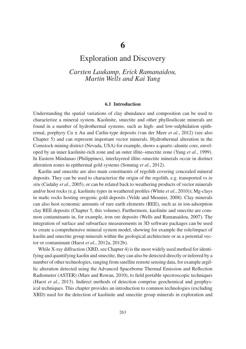
Image of the first page of this content. For PDF version, please use the ‘Save PDF’ preceeding this image.'
Type
Chapter
Information
Publisher: Cambridge University Press
Print publication year: 2017

Access options

Get access to the full version of this content by using one of the access options below. (Log in options will check for institutional or personal access. Content may require purchase if you do not have access.)

References

Abrams, M. J., Ashley, R. P., Rowan, L. C., Goetz, A. F. H. & Kahle, A. B. 1977. Mapping of hydrothermal alteration in the Cuprite mining district, Nevada, using aircraft scanner images for the spectral region 0.46 to 2.36 µm. Geology, 5 (12), 713718.Google Scholar
Amonette, J. E. & Zelazny, L. W. 1994. Quantitative Methods in Soil Mineralogy. Madison, WI: Soil Science Society of America.CrossRefGoogle Scholar
Anand, R. R. & Paine, M. 2002. Regolith geology of the Yilgarn Craton, Western Australia: Implications for exploration. Australian Journal of Earth Sciences, 49 (1), 3162.CrossRefGoogle Scholar
Anand, R. R. & Robertson, I. D. M. 2012. The role of mineralogy and geochemistry in forming anomalies on interfaces and in areas of deep basin cover: Implications for exploration. Geochemistry: Exploration, Environment, Analysis, 12 (1), 4566.Google Scholar
Anand, R. R. 2005. Weathering history, landscape evolution and implications for exploration. In: Anand, R. R. & De Broekert, P. (eds) Regolith Landscape Evolution Across Australia: A Compilation of Regolith Landscape Case Studies with Regolith Landscape Evolution Models. Perth: CRC LEME.Google Scholar
Bettinelli, M., Beone, G. M., Spezia, S. & Baffi, C. 2000. Determination of heavy metals in soils and sediments by microwave-assisted digestion and inductively coupled plasma optical emission spectrometry analysis. Analytica Chimica Acta, 424 (2), 289296.Google Scholar
Bird, M. I. & Chivas, A. R. 1988. Oxygen isotope dating of the Australian regolith. Nature, 331 (6190), 513516.Google Scholar
Bird, M. I. & Chivas, A. R. 1989. Stable-isotope geochronology of the Australian regolith. Geochimica et Cosmochimica Acta, 53 (12), 32393256.CrossRefGoogle Scholar
Bird, M. I. & Chivas, A. R. 1993. Geomorphic and palaeoclimatic implications of an oxygen-isotope chronology for Australian deeply weathered profiles. Australian Journal of Earth Sciences, 40 (4), 345358.Google Scholar
Bishop, J., Lane, M., Dyar, M. & Brown, A. 2008. Reflectance and emission spectroscopy study of four groups of phyllosilicates: Smectites, kaolinite-serpentines, chlorites and micas. Clay Minerals, 43 (1), 3554.CrossRefGoogle Scholar
Bohor, B. F. & Hughes, R. E. 1971. Scanning electron microscopy of clays and clay minerals. Clays and Clay Minerals, 19 (1), 4954.Google Scholar
Borsaru, M., Rojc, A., Ronaszeki, J. & Smith, C. 2002. The determination of Fe, Si and Al content in iron ore blastholes by nuclear logging. In: Ausimm, T. (ed.) Iron Ore Conference 2002. Perth: The Australasian Institute of Mining and Metallurgy, 171176.Google Scholar
Burger, P. A. 1996. Origins and characteristics of lateritic nickel deposits. In: Ausimm, T. (ed.) Nickel ‘96, Mineral to Market, 27–29 November. Kalgoorlie, WA: The Australasian Institute of Mining and Metallurgy, 179183.Google Scholar
Burnham, G. F. & Hawke, P. J. 2003. Smart solution to a sticky problem: In-mine clay mapping using high-resolution geophysics. The Australian Society of Exploration Geophysicists’ Extended Abstracts, 2003 (2), 15.CrossRefGoogle Scholar
Butt, C. R. M., Lintern, M. J. & Anand, R. R. 2000. Evolution of regoliths and landscapes in deeply weathered terrain: Implications for geochemical exploration. Ore Geology Reviews, 16 (3–4), 167183.CrossRefGoogle Scholar
Cameron, E. M., Hamilton, S. M., Leybourne, M. I., Hall, G. E. M. & McClenaghan, M. B. 2004. Finding deeply buried deposits using geochemistry. Geochemistry: Exploration, Environment, Analysis, 4 (1), 732.Google Scholar
Cariati, F., Erre, L., Micera, G., Piu, P. & Gessa, C. 1983. Effects of layer charge on the near-infrared spectra of water molecules in smectites and vermiculites. Clays and Clay Minerals, 31 (6), 447449.CrossRefGoogle Scholar
Chabrillat, S., Goetz, A. F. H., Krosley, L. & Olsen, H. W. 2002. Use of hyperspectral images in the identification and mapping of expansive clay soils and the role of spatial resolution. Remote Sensing of Environment, 82 (2), 431445.Google Scholar
Chang, Z. & Yang, Z. 2012. Evaluation of inter-instrument variations among short wavelength infrared (SWIR) devices Economic Geology, 107 (7), 14791488.Google Scholar
Chivas, A. R. 1993. Palaeoclimate from Gondwanaland clays. In: Churchman, G. J., Fitzpatrick, R. W. & Eggleton, R. A. (eds) 10th International Clay Conference: Clays Controlling the Environment, July 18–23, 1993. Adelaide: CSIRO Publishing, 333338.Google Scholar
Churchman, G. J. & Gilkes, R. J. 1989. Recognition of intermediates in the possible transformation of halloysite to kaolinite in weathering profiles. Clay Minerals, 24 (4), 579590.Google Scholar
Clark, R. N. 1999. Spectroscopy of rocks and minerals, and principles of spectroscopy. In: Rencz, A. (ed.) Manual of Remote Sensing. New York: Wiley & Sons.Google Scholar
Clauer, N. & Chaudhuri, S. 1995. Clays in Crustal Environments: Isotope Dating and Tracing. Berlin: Springer-Verlag.CrossRefGoogle Scholar
Clauer, N. & Chaudhuri, S. 2001. Extracting K–Ar ages from shales: The analytical evidence. Clay Minerals, 36 (2), 227235.CrossRefGoogle Scholar
Clauer, N., Muller, J. P. & O’Neil, J. R. 1989. Oxygen isotope signature of several generations of kaolinite in a laterite: Geochemical implications. In: Farmer, V. C. & Tardy, Y. (eds) 9th International Clay Conference: Clay–Organic Interactions Clay Minerals In Soils, August 28–September 2, 1989. Strasbourg: Université Louis Pasteur, Centre National de la Recherche Scientifique, 1.Google Scholar
Clauer, N., Środoń, J., Francu, J. & Šucha, V. 1997. K–Ar dating of illite fundamental particles separated from illite–smectite. Clay Minerals, 32 (2), 181196.Google Scholar
Clayton, T. & Pearce, R. B. 2007. Rapid chemical analysis of the <2 μm clay fraction using an SEM/EDS technique. Clay Minerals, 42 (4), 549562.CrossRefGoogle Scholar
Cocks, T., Jenssen, R., Stewart, A., Wilson, I. & Shields, T. 1998. The Hymap Airborne Hyperspectral Sensor: The system, calibration and performance. In: 1st EARSEL Workshop on Imaging Spectroscopy, October 1998. Zurich, Switzerland: EARSEL, 7.Google Scholar
Cohen, D. R., Shen, X. C., Dunlop, A. C. & Rutherford, N. F. 1998. A comparison of selective extraction soil geochemistry and biogeochemistry in the Cobar area, New South Wales. Journal of Geochemical Exploration, 61 (1–3), 173189.CrossRefGoogle Scholar
Cohen, D. R., Kelley, D. L., Anand, R. & Coker, W. B. 2010. Major advances in exploration geochemistry, 1998–2007. Geochemistry: Exploration, Environment, Analysis, 10 (1), 316.Google Scholar
Cook, S. E., Corner, R. J., Groves, P. R. & Grealish, G. J. 1996. Use of airborne gamma radiometric data for soil mapping. Soil Research, 34 (1), 183194.Google Scholar
Cooke, D. R., Hollings, P. & Walshe, J. L. 2005. Giant porphyry deposits: Characteristics, distribution, and tectonic controls. Economic Geology, 100 (5), 801818.CrossRefGoogle Scholar
Coulter, D., Hauff, P. L. & Kerby, W. L. 2007. Airborne hyperspectral remote sensing. In: Milkereit, B. (ed.) Exploration 07: Fifth Decennial International Conference in Mineral Exploration, 9–12 September, 2007. Toronto, ON: Decennial Mineral Exploration Conferences, 357378.Google Scholar
Craig, M. A. & Anand, R. R. 1993. Kalgoorlie-Kurnalpi Regolith-Landform Map, 1:250,000 Special edition. Adelaide: Australian Geological Survey Organisation.Google Scholar
Crosta, A. P., Sabine, C. & Taranik, J. V. 1998. Hydrothermal alteration mapping at Bodie, California, using AVIRIS hyperspectral data. Remote Sensing of Environment, 65 (3), 309319.CrossRefGoogle Scholar
Crowley, J. K. & Hook, S. J. 1996. Mapping playa evaporite minerals and associated sediments in Death Valley, California, with multispectral thermal infrared images. Journal of Geophysical Research: Solid Earth, 101 (B1), 643660.Google Scholar
Crowley, J. K. & Vergo, N. 1988. Near-infrared reflectance spectra of mixtures of kaolin group minerals: Use in clay studies. Clays and Clay Minerals, 36 (4), 310316.Google Scholar
Crowley, J. K., Brickey, D. W. & Rowan, L. C. 1989. Airborne imaging spectrometer data of the Ruby Mountains, Montana: Mineral discrimination using relative absorption band-depth images. Remote Sensing of Environment, 29 (2), 121134.CrossRefGoogle Scholar
Cudahy, T. 1997. PIMA-II Spectral Characteristics of Natural Kaolins – AMIRA Project P435. North Ryde, NSW: CSIRO.Google Scholar
Cudahy, T. J., Caccetta, M., Cornelius, A., et al. 2005. Regolith, Geology and Alteration Mineral Maps from New Generation Airborne and Satellite Remote Sensing Technologies. Perth: CSIRO Minerals Exploration.Google Scholar
Cudahy, T., Jones, M., Thomas, M., et al. 2008. Next Generation Mineral Mapping: Queensland Airborne HyMap and Satellite ASTER Surveys 2006–2008. North Ryde, NSW: CSIRO.Google Scholar
Cudahy, T., Hewson, R., Caccetta, M., et al. 2009. Drill core logging of plagioclase feldspar composition and other minerals associated with Archean gold mineralization at Kambalda, Western Australia, using a bidirectional thermal infrared reflectance system. In: Bedell, R., Crósta, A. P. & Grunsky, E. (eds) Reviews in Economic Geology. Littleton, CO: Society of Economic Geologists, Inc.Google Scholar
Cudahy, T., Caccetta, M., Hewson, R., et al. 2012. Satellite ASTER Geoscience Map of Australia. v1. CSIRO.Google Scholar
Cudahy, T., Caccetta, M., Thomas, M., et al. (2016): Satellite-derived mineral mapping and monitoring of weathering, deposition and erosion. Nature Scientific Reports. DOI: 10.1038/srep23702Google Scholar
Davis, J. L. & Annan, A. P. 1989. Ground-penetrating radar for high-resolution mapping of soils and rock stratigraphy Geophysical Prospecting, 37 (5), 531551.CrossRefGoogle Scholar
Delineau, T., Allard, T., Muller, J. P., et al. 1994. FTIR reflectance vs. EPR studies of structural iron in kaolinites. Clays & Clay Minerals, 42 (3), 308320.Google Scholar
Dickson, B. L. & Scott, K. M. 1997. Interpretation of aerial gamma-ray surveys: Adding the geochemical factors. AGSO Journal of Australian Geology and Geophysics, 17 (2), 187200.Google Scholar
Ducart, D. F., Crosta, A. P., Souza Filho, C. R. & Coniglio, J. 2006. Alteration mineralogy at the Cerro la Mina epithermal prospect, Patagonia, Argentina: Field mapping, short-wave infrared spectroscopy, and ASTER images. Economic Geology, 101 (5), 981996.Google Scholar
Elias, M., Donaldson, M. J. & Giorgetta, N. 1981. Geology, mineralogy, and chemistry of lateritic nickel–cobalt deposits near Kalgoorlie, Western Australia. Economic Geology, 76, 17751783.Google Scholar
Emerson, D. W. & Yang, Y. P. 1997. Effects of water salinity and saturation on the electrical resistivity of clays. In: 1997 Conference Handbook: ASEG 12th International Conference and Exhibition. Sydney: Australian Society of Exploration Geophysicist, 1924.Google Scholar
Ferbey, T. 2010. Geochemistry of the Nadina River Map Area (093E/15), West-Central British Columbia. Vancouver: BC Ministry of Energy Mines and Petroleum Resources.Google Scholar
Fisher, L., Gazley, M. F., Baensch, A., et al. 2014. Resolution of geochemical and lithostatigraphic complexity: A workflow for application of portable X-ray fluorescence to mineral exploration. Geochemistry: Exploration, Environment, Analysis, 14 (2), 149159.Google Scholar
Flehmig, W. & Kurze, R. 1973. Die quantitative infrarotspektroskopische Phasenanalyse von Mineralmengen. Neues Jahrbuch Mineralogischer Abhandlungen, 119 (1), 101102.Google Scholar
Frost, R. & Johansson, U. 1998. Combination bands in the infrared spectroscopy of kaolins: A drift spectroscopic study. Clays and Clay Minerals, 46 (4), 466477.Google Scholar
Gaudin, A., Deacrreau, A., Noack, Y. & Grauby, O. 2005. Clay mineralogy of the nickel laterite ore developed from serpentinised peridotites at Murrin Murrin, Western Australia. Australian Journal of Earth Sciences, 52 (2), 231241.Google Scholar
Gersman, R., Ben-Dor, E., Beyth, M., et al. 2008. Mapping of hydrothermally altered rocks by the EO-1 Hyperion sensor, Northern Danakil Depression, Eritrea. International Journal of Remote Sensing, 29 (13), 39113936.Google Scholar
Giral, S., Savin, S. M., Girard, J.-P. & Nahon, D. B. 1993a. The oxygen isotope geochemistry of kaolinites from lateritic profiles: Implications for pedology and paleoclimatology. Chemical Geology, 197 (3–4), 237240.Google Scholar
Giral, S., Savin, S. M., Girard, J.-P. & Nahon, D. B. 1993b. Oxygen isotope geochemistry of kaolinites from two lateritic profiles: Implications for pedology and paleoclimatology. In: Churchman, G. J., Fitzpatrick, R. W. & Eggleton, R. A. (eds) 10th International Clay Conference: Clays controlling the environment, 18–23 July, 1993. Adelaide: CSIRO Publishing, 65.Google Scholar
Gray, D. J., Wildman, J. E. & Longman, G. D. 1999. Selective and partial extraction analyses of transported overburden for gold exploration in the Yilgarn Craton, Western Australia. Journal of Geochemical Exploration, 67 (1–3), 5166.Google Scholar
Grunsky, E. C. 2010. The interpretation of geochemical survey data. Geochemistry: Exploration, Environment, Analysis, 10 (1), 2774.Google Scholar
Guanter, L., Kaufmann, H., Segl, K., et al. 2015. The environmental mapping and analysis program (ENMAP) spaceborne imaging spectroscopy mission for earth observation. Remote Sensing, 7 (7), 88308857.Google Scholar
Haest, M., Cudahy, T., Laukamp, C. & Gregory, S. 2012a. Quantitative mineralogy from infrared spectroscopic data: I. Validation of mineral abundance and composition scripts at the Rocklea channel iron deposit in Western Australia. Economic Geology, 107 (2), 209228.CrossRefGoogle Scholar
Haest, M., Cudahy, T., Laukamp, C. & Gregory, S. 2012b. Quantitative mineralogy from infrared spectroscopic data: II. Three-dimensional mineralogical characterization of the Rocklea channel iron deposit, Western Australia. Economic Geology, 107 (2), 229249.Google Scholar
Haest, M., Cudahy, T., Rodger, A., et al. 2013. Unmixing the effects of vegetation in airborne hyperspectral mineral maps over the Rocklea Dome iron-rich palaeochannel system (Western Australia). Remote Sensing of Environment, 129, 1731.CrossRefGoogle Scholar
Hamilton, S. M. 1998. Electrochemical mass-transport in overburden: A new model to account for the formation of selective leach geochemical anomalies in glacial terrain. Journal of Geochemical Exploration, 63 (3), 155172.CrossRefGoogle Scholar
Hamilton, V. E. & Christensen, P. R. 2000. Determining the modal mineralogy of mafic and ultramafic igneous rocks using thermal emission spectroscopy. Journal of Geophysical Research, 105 (E4), 97179733.CrossRefGoogle Scholar
Hedenquist, J. W., Arribas, A. & Reynolds, T. J. 1998. Evolution of an intrusion-centered hydrothermal system: Far Southeast-Lepanto porphyry and epithermal Cu–Au deposits, Philippines. Economic Geology, 93 (4), 373404.Google Scholar
Hesselbo, S. P. 1996. Spectral gamma-ray logs in relation to clay mineralogy and sequence stratigraphy, Cenozoic of the Atlantic margin, offshore New Jersey. In: Mountain, G. S., Miller, K. G., Blum, P., Poag, C. W. & Twichell, D. C. (eds) Proceedings of the Ocean Drilling Program, Scientific Results, 150: New Jersey Continental Slope and Rise. College Station, TX: Ocean Drilling Program, Texas A&M University, The National Science Foundation, Joint Oceanographic Institutions, Inc., 411422.Google Scholar
Hewson, R. & Cudahy, T. 2011. Issues affecting geological mapping with ASTER data: A case study of the Mt Fitton Area, South Australia. In: Ramachandran, B., Justice, C. O. & Abrams, M. J. (eds) Land Remote Sensing and Global Environmental Change. New York: Springer.Google Scholar
Hewson, R. D., Cudahy, T. J., Mizuhiko, S., Ueda, K. & Mauger, A. J. 2005. Seamless geological map generation using ASTER in the Broken Hill-Curnamona province of Australia. Remote Sensing of Environment, 99 (1–2), 159172.Google Scholar
Hunt, G. R. & Salisbury, J. W. 1970. Visible and infrared spectra of minerals and rocks: I. Silicate minerals. Modern Geology, 1, 283300.Google Scholar
IAEA. 2003. Guidelines for radioelement mapping using gamma ray spectrometry data. Technical Document No. 1363.Google Scholar
Inoue, A. 1995. Formation of clay minerals in hydrothermal environments. In: Velde, B. (ed.) Origin and Mineralogy of Clays. Berlin: Springer.Google Scholar
King, P. L., Ramsey, M. S., McMillan, P. F. & Swayze, G. 2004. Laboratory Fourier transform infrared spectroscopy methods for geologic samples. In: King, P. L., Ramsey, M. S. & Swayze, G. A. (eds) Infrared Spectroscopy in Geochemistry, Exploration Geochemistry, and Remote Sensing. Québec: Mineralogical Association of Canada.Google Scholar
Kogel, J. E. & Lewis, S. A. 2001. Baseline studies of the clay minerals society source clays: Chemical analysis by inductively coupled plasma-mass spectroscopy (ICP-MS). Clays and Clay Minerals, 49 (5), 387392.Google Scholar
Kruse, F. A. 1988. Use of airborne imaging spectrometer data to map minerals associated with hydrothermally altered rocks in the northern grapevine mountains, Nevada, and California. Remote Sensing of Environment, 24 (1), 3151.Google Scholar
Kruse, F. A., Lefkoff, A. B., Boardman, J. W., et al. 1993. The spectral image processing system (SIPS): Interactive visualization and analysis of imaging spectrometer data. Remote Sensing of Environment, 44 (2–3), 145163.Google Scholar
Kruse, F. A., Boardman, J. W. & Huntington, J. F. 2002. Comparison of EO-1 Hyperion and airborne hyperspectral remote sensing data for geologic applications. In: Woerner, D. F. (ed.) Aerospace Conference Proceedings. Big Sky, MO: Institute of Electrical and Electronics Engineers, Inc., 15011513.Google Scholar
Laukamp, C., Cudahy, T., Cleverley, J. S., Oliver, N. H. S. & Hewson, R. 2011a. Airborne hyperspectral imaging of hydrothermal alteration zones in granitoids of the Eastern Fold Belt, Mount Isa Inlier, Australia. Geochemistry: Exploration, Environment, Analysis, 11 (1), 324.Google Scholar
Laukamp, C., Cudahy, T., Thomas, M., et al. 2011b. Hydrothermal mineral alteration patterns in the Mount Isa Inlier revealed by airborne hyperspectral data. Australian Journal of Earth Sciences, 58 (8), 917936.Google Scholar
Laukamp, C., Termin, K. A., Pejcic, B., Haest, M. & Cudahy, T. 2012. Vibrational spectroscopy of calcic amphiboles: Applications for exploration and mining. European Journal of Mineralogy, 24 (5), 863878.CrossRefGoogle Scholar
Laukamp, C., Salama, W. & González-Álvarez, I. 2015. Proximal and remote spectroscopic characterisation of regolith in the Albany-Fraser Orogen (Western Australia). Ore Geology Reviews, 73 (3), 540554.Google Scholar
Lawrence, J. R. & Meaux, J. R. 1993. The stable isotopic composition of ancient kaolinites of North America. In: Swart, P. K., Lohmann, K. C., Mckenzie, J. & Savin, S. (eds) Climate Change in Continental Isotopic Records. Washington, DC: Wiley & Sons.Google Scholar
Lee, C. M., Cable, M. L., Hook, S. J., et al. 2015. An introduction to the NASA Hyperspectral InfraRed Imager (HyspIRI) mission and preparatory activities. Remote Sensing of Environment, 167, 619.Google Scholar
Loizeau, D., Mangold, N., Poulet, F., et al. 2007. Phyllosilicates in the Mawrth Vallis region of Mars. Journal of Geophysical Research: Planets, 112 (E08S08), 21562202.Google Scholar
Macnae, J. C. 2007. Developments in broadband airborne electromagnetics in the past decade. In: Milkereit, B. (ed.) Exploration 07: Fifth Decennial International Conference on Mineral Exploration. Toronto: Prospectors and Developers Association of Canada, 387398.Google Scholar
Madejova, J. & Komadel, P. 2001. Baseline studies of the Clay Minerals Society source clays: Infrared methods. Clays and Clay Minerals, 49 (5), 410432.CrossRefGoogle Scholar
Mann, A. W., Birrell, R. D., Fedikow, M. A. F. & de Souza, H. A. F. 2005. Vertical ionic migration: Mechanisms, soil anomalies, and sampling depth for mineral exploration. Geochemistry: Exploration, Environment, Analysis, 5 (3), 201210.Google Scholar
Mars, J. C. & Rowan, L. C. 2010. Spectral assessment of new ASTER SWIR surface reflectance data products for spectroscopic mapping of rocks and minerals. Remote Sensing of Environment, 114 (9), 20112025.Google Scholar
Martinez-Alonso, S., Rustad, J. & Goetz, A. 2002. Ab initio quantum mechanical modeling of infrared vibrational frequencies of the OH group in dioctahedral phyllosilicates. Part I: Methods, results and comparison to experimental data. American Mineralogist, 87 (8–9), 12151223.CrossRefGoogle Scholar
McCann, D. M. & Forster, A. 1990. Reconnaissance geophysical methods in landslide investigations. Engineering Geology, 29 (1), 5978.Google Scholar
McNeill, J. D. 1980. Electromagnetic Terrain Conductivity Measurement at Low Induction Numbers. Mississauga, ON: Geonics Limited.Google Scholar
Mermut, A. R. & Canot, A. F. 2001. Baseline studies of the Clay Minerals Society source clays: Chemical analyses of major elements. Clays and Clay Minerals, 49 (5), 381386.CrossRefGoogle Scholar
Meunier, A. 2005. Clays. Berlin: Springer.Google Scholar
Mokhtari, A. R., Cohen, D. R. & Gatehouse, S. G. 2009. Geochemical effects of deeply buried Cu–Au mineralization on transported regolith in an arid terrain. Geochemistry: Exploration, Environment, Analysis, 9 (3), 227236.Google Scholar
Moore, D. M. & Reynolds, R. C. J. 1997. X-ray Diffraction and the Identification and Analysis of Clay Minerals. Oxford: Oxford University Press.Google Scholar
Munday, T. 2008. Regolith geophysics. In: Scott, K. & Pain, C. (eds) Regolith Science.Berlin: Springer.Google Scholar
Munday, T. J., Macnae, J., Bishop, J. & Sattel, D. 2001. A geological interpretation of observed electrical structures in the regolith: Lawlers, Western Australia. Exploration Geophysics, 32 (1), 3647.Google Scholar
Ninomiya, Y., Fu, B. & Cudahy, T. J. 2005. Detecting lithology with Advanced Spaceborne Thermal Emission and Reflection Radiometer (ASTER) multispectral thermal infrared ‘radiance-at-sensor’ data. Remote Sensing of Environment, 99 (1–2), 127139.Google Scholar
Noble, R. R. P. & Stanley, C. R. 2009. Traditional and novel geochemical extractions applied to a Cu–Zn soil anomaly: A quantitative comparison of exploration accuracy and precision. Geochemistry: Exploration, Environment, Analysis, 9 (2), 159172.Google Scholar
Paquet, H., Colin, F., Duplay, J., Nahon, K. & Millot, G. 1987. Ni, Mn, Zn, Cr-smectites, early and effective traps for transition elements in supergene ore deposits. In: Rodrigez-Clemente, R. & Tardy, Y. (eds) Geochemistry and Mineral Formation in the Earth Surface. Madrid: Centre National de la Récherche Scientifique.Google Scholar
Patterson, J. H. 1993. A review of the effects of minerals in processing of Australian oil shales. Fuel, 73 (3), 321327.Google Scholar
Patterson, J. H. & Henstridge, D. A. 1990. Comparison of the mineralogy and geochemistry of the Kerosene Creek Member, Rundle and Stuart oil shale deposits, Queensland, Australia. Chemical Geology, 82, 319339.Google Scholar
Perry, S. L. 2004. Review of airborne and orbiting remote sensing systems applied to worldwide mineral exploration: Case histories focussed on infrared spectroscopy. In: King, P. L., Ramsey, M., Swayze, G. A. (ed.) Infrared Spectroscopy in Geochemistry, Exploration Geochemistry, and Remote Sensing. London, ON: Mineralogical Association of Canada.Google Scholar
Pevear, D. R. 1999. Illite and hydrocarbon exploration. Proceedings of the National Academy of Science USA, 96, 34403446.Google Scholar
Pillans, B. 1998. Regolith Dating Methods: A Guide to Numerical Dating Techniques. Millaa Millaa: Cooperative Research Centre for Landscape Evolution and Mineral Exploration (CRCLEME).Google Scholar
Pillans, B. & Bourman, R. 1996. The Brunhes/Matuyama polarity transition (0.78 Ma) as a chronostratigraphic marker in Australian regolith studies. AGSO Journal of Australian Geology and Geophysics, 16 (3), 289294.Google Scholar
Pollastro, R. M. 1993. Considerations and applications of the illite/smectite geothermometer in hydrocarbon-bearing rocks of Miocene to Mississippian age. Clays and Clay Minerals, 41 (2), 119.Google Scholar
Post, J. L. & Noble, P. N. 1993. The near-infrared combination band frequencies of dioctahedral smectites, micas, and illites. Clays and Clay Minerals, 41 (6), 639644.Google Scholar
Poulet, F., Bibring, J. P., Mustard, J. F., et al. 2005. Phyllosilicates on Mars and implications for early Martian climate. Nature, 438 (7068), 623627.Google Scholar
Richter, N., Staenz, K. & Kaufmann, H. 2008. Spectral unmixing of airborne hyperspectral data for baseline mapping of mine tailings areas. International Journal of Remote Sensing, 29 (13), 39373956.Google Scholar
Ricordel-Prognon, C., Lagroix, F., Moreau, M.-G. & Thiry, M. 2010. Lateritic paleoweathering profiles in French Massif Central: Paleomagnetic datings. Journal of Geophysical Research, 115 (B10104), 19.Google Scholar
Robb, L. 2005. Introduction to Ore-Forming Processes. Oxford: Blackwell Publishing.Google Scholar
Roberts, D. A., Smith, M. O. & Adams, J. B. 1993. Green vegetation, nonphotosynthetic vegetation, and soils in AVIRIS data. Remote Sensing of Environment, 44 (2–3), 255269.Google Scholar
Robertson, I. D. M. 2001. Geochemical exploration around the Harmony gold deposit, Peak Hill, Western Australia. Geochemistry: Exploration, Environment, Analysis, 1 (3), 277288.Google Scholar
Rodger, A. & Cudahy, T. 2009. Vegetation corrected continuum depths at 2.20 µm: An approach for hyperspectral sensors. Remote Sensing of Environment, 113 (10), 22432257.Google Scholar
Rodriguez, J. M., Ustin, S. L. & Riaño, D. 2011. Contributions of imaging spectroscopy to improve estimates of evapotranspiration. Hydrological Processes, 25 (26), 40694081.Google Scholar
Rowan, L. C. & Mars, J. C. 2003. Lithologic mapping in the Mountain Pass, California area using Advanced Spaceborne Thermal Emission and Reflection Radiometer (ASTER) data. Remote Sensing of Environment, 84 (3), 350366.CrossRefGoogle Scholar
Rowan, L. C., Hook, S. J., Abrams, M. J. & Mars, J. C. 2003. Mapping hydrothermally altered rocks at Cuprite, Nevada, using the Advanced Spaceborne Thermal Emission and Reflection Radiometer (ASTER), a new satellite-imaging system. Economic Geology, 98 (5), 10191027.CrossRefGoogle Scholar
Savin, S. M. & Hsieh, J. C. C. 1998. The hydrogen and oxygen isotope geochemistry of pedogenic clay minerals: Principals and theoretical background. Geoderma, 82 (1–3), 227253.CrossRefGoogle Scholar
Schlumberger. 1989. Log Interpretation Principles/Applications. Sugarland, TX: Schlumberger.Google Scholar
Schmidt, P. W. & Ollier, C. D. 1988. Palaeomagnetic dating of late Cretaceous to early Tertiary weathering in New England, NSW, Australia. Earth-Science Reviews, 25 (5–6), 363371.Google Scholar
Schmidt, P. W., Prasad, V. & Ramam, P. K. 1983. Magnetic ages of some Indian laterites. Palaeogeography, Palaeoclimatology, Palaeoecology, 44 (3–4), 185202.Google Scholar
Scott, K. 2008. Appendix 2: Regolith geochemistry of elements. In: Scott, K. & Pain, C. (eds) Regolith Science. Berlin: Springer.Google Scholar
Short, N. M. 1982. The Landsat Tutorial Workbook: Basics of Satellite Remote Sensing. Washington, DC: NASA.Google Scholar
Simmons, S. F., White, N. C. & John, D. A. 2005. Geological characteristics of epithermal precious and base metal deposits. Economic Geology, 100th Anniversary (3), 485522.Google Scholar
Sonibare, O. O., Jacob, D. E., Ward, C. R. & Foley, S. F. 2011. Mineral and trace element composition of the Lokpanta oil shales in the Lower Benue Trough, Nigeria. Fuel, 90, 28432849.Google Scholar
Sonntag, I., Laukamp, C. & Hagemann, S. G. 2012. Low potassium hydrothermal alteration in low sulfidation epithermal systems as detected by IRS and XRD: An example from the Co–O mine, Eastern Mindanao, Philippines. Ore Geology Reviews, 45, 4760.Google Scholar
Środoń, J. 1999. Nature of mixed-layer clays and mechanisms of their formation and alteration. Annual Reviews of Earth Planetary Science, 27, 1953.Google Scholar
Środoń, J. 2002. Quantitative mineralogy of sedimentary rocks with emphasis on clays and with applications to K–Ar dating. Mineralogical Magazine, 66 (5), 677687.Google Scholar
Środoń, J., Clauer, N. & Eberl, D. D. D. 2002. Interpretation of K–Ar dates of illitic clays from sedimentary rocks aided by modeling. American Mineralogist, 87 (11–12), 15281535.Google Scholar
Stern, L. A., Chamberlain, C. P., Reynolds, R. C. & Johnson, G. D. 1997. Oxygen isotope evidence of climate change from pedogenic clay minerals in the Himalayan molasse. Geochimica et Cosmochimica Acta, 61 (4), 731744.Google Scholar
Telford, W. M., Geldhart, L. P. & Sheriff, R. E. 1990. Applied Geophysics. Cambridge: Cambridge University Press.Google Scholar
Thompson, A. J. B., Hauff, P. L. & Robitaille, A. J. 1999. Alteration mapping in exploration: Application of Short-Wave Infrared (SWIR) Spectroscopy. SEG Newsletter, 39 (1), 1627.Google Scholar
Thomson, S., Fountain, D. & Watts, T. 2007. Airborne geophysics: Evolution and revolution. In: Milkereit, B. (ed.) Fifth Decennial International Conference on Mineral Exploration. Toronto: Prospectors and Developers Association of Canada, 1937.Google Scholar
Tosdal, R. M., Dilles, J. H. & Cooke, D. R. 2009. From source to sinks in auriferous magmatic-hydrothermal porphyry and epithermal deposits. Elements, 5 (5), 289295.Google Scholar
van der Meer, F. D., van der Werff, H. M. A., van Ruitenbeek, F. J. A., et al. 2012. Multi- and hyperspectral geologic remote sensing: A review. International Journal of Applied Earth Observation and Geoinformation, 13 (1), 112128.Google Scholar
Vane, G., Green, R. O., Chrien, T. G., et al. 1993. The airborne visible/infrared imaging spectrometer (AVIRIS). Remote Sensing of Environment, 44 (2–3), 127143.Google Scholar
Vaughan, R. G., Calvin, W. M. & Taranik, J. V. 2003. SEBASS hyperspectral thermal infrared data: Surface emissivity measurement and mineral mapping. Remote Sensing of Environment, 85 (1), 4863.Google Scholar
Velde, B. B. & Meunier, A. 2008. The Origin of Clay Minerals in Soils and Weathered Rocks. Berlin: Springer.Google Scholar
Wells, M. & Ramanaidou, E. 2007. Clay quantification of channel iron deposits (CID), Pilbara, Western Australia. In: Ausimm, T. (ed.) Iron Ore Conference 2007. Perth: The Australasian Institute of Mining and Metallurgy, 203207.Google Scholar
White, A. J. R., Robb, V. M., Robb, L. J. & Waters, D. J. 2010. Portable infrared spectroscopy as a tool for the exploration of gold deposits in tropical terrains: A case study at the Damang Deposit, Ghana. Economic Geology, 15, 6784.Google Scholar
Wilford, J. R., Bierwirth, P. N. & Craig, M. A. 1997. Application of airborne gamma-ray spectrometry in soil/regolith mapping and applied geomorphology. AGSO Journal of Australian Geology and Geophysics, 17 (2), 201216.Google Scholar
Wilson, P. N. & Parry, W. T. 1995. Characterization and dating of argillic alteration in the Mercur gold district, Utah. Economic Geology, 90 (5), 11971216.Google Scholar
Witt, W. K., Hagemann, S. G., Ojala, J., et al. 2013. Multiple methods for regional- to mine-scale targeting, Pataz gold field, northern Peru. Australian Journal of Earth Sciences, 61 (1), 4358.Google Scholar
WoldeGabriel, G. & Goff, F. 1989. Temporal relations of volcanism and hydrothermal systems in two areas of the Jemez volcanic field, New Mexico. Geology, 17 (11), 986989.Google Scholar
Woodcock, R., Simons, B., Duclaux, G. & Cox, S. 2010. AuScope’s use of standards to deliver earth resource data In: Malamud, B. D. (ed.) European Geosciences Union General Assembly 2010, 2–7 May, 2010. Vienna: Copernicus, 1556.Google Scholar
Yamaguchi, Y., Fujisada, H., Kudoh, M., et al. 1999. ASTER instrument characterization and operation scenario. Advances in Space Research, 23 (8), 14151424.CrossRefGoogle Scholar
Yang, K., Huntington, J. F., Boardman, J. W. & Mason, P. 1999. Mapping hydrothermal alteration in the Comstock mining district, Nevada, using simulated satellite-borne hyperspectral data. Australian Journal of Earth Sciences, 46 (6), 915922.Google Scholar
Yang, K., Lian, C., Huntington, J. F., Peng, Q. & Wang, Q. 2005. Infrared spectral reflectance characterization of the hydrothermal alteration at the Tuwu Cu–Au deposit, Xinjiang, China. Mineralium Deposita, 40 (3), 324336.Google Scholar
Yang, K., Huntington, J. F., Gemmell, J. B. & Scott, K. M. 2011. Variations in composition and abundance of white mica in the hydrothermal alteration system at Hellyer, Tasmania, as revealed by infrared reflectance spectroscopy. Journal of Geochemical Exploration, 108 (2), 143156.Google Scholar
Zhang, G., Wasyliuk, K. & Pan, Y. 2001. The characterization and quantitative analysis of clay minerals in the Athabasca Basin, Saskatchewan: Applications of shortwave infrared reflectance. The Canadian Mineralogist, 39 (5), 13471363.Google Scholar

Save book to Kindle

To save this book to your Kindle, first ensure coreplatform@cambridge.org is added to your Approved Personal Document E-mail List under your Personal Document Settings on the Manage Your Content and Devices page of your Amazon account. Then enter the ‘name’ part of your Kindle email address below. Find out more about saving to your Kindle.

Note you can select to save to either the @free.kindle.com or @kindle.com variations. ‘@free.kindle.com’ emails are free but can only be saved to your device when it is connected to wi-fi. ‘@kindle.com’ emails can be delivered even when you are not connected to wi-fi, but note that service fees apply.

Find out more about the Kindle Personal Document Service.

Available formats
×

Save book to Dropbox

To save content items to your account, please confirm that you agree to abide by our usage policies. If this is the first time you use this feature, you will be asked to authorise Cambridge Core to connect with your account. Find out more about saving content to Dropbox.

Available formats
×

Save book to Google Drive

To save content items to your account, please confirm that you agree to abide by our usage policies. If this is the first time you use this feature, you will be asked to authorise Cambridge Core to connect with your account. Find out more about saving content to Google Drive.

Available formats
×